

CoastalWx
-
Posts
176,151 -
Joined
-
Last visited
Content Type
Profiles
Blogs
Forums
American Weather
Media Demo
Store
Gallery
Everything posted by CoastalWx
-
Looks like status quo.
-
That's a good visual. Typically when that gets towards and north of Hudson Bay...we have more potential.
-
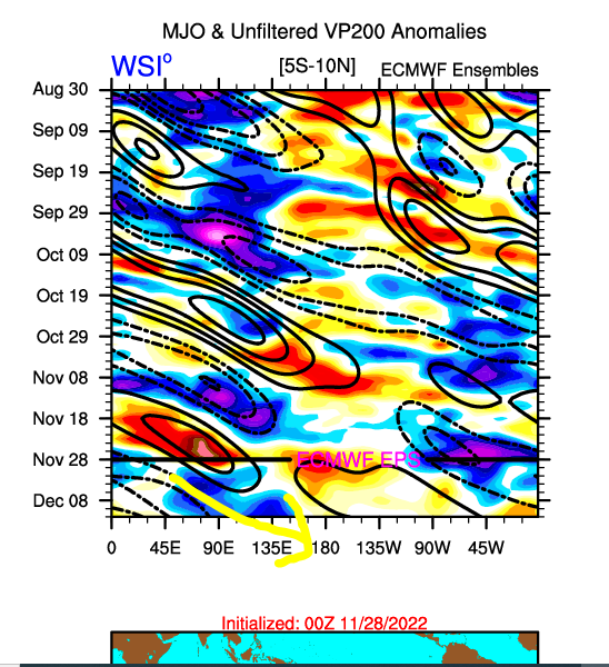
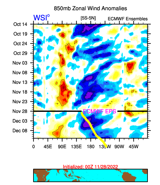
Something else that may give the Pacific a boost later on December. The MJO can be voodoo many times, but these to me...are good signals. Looks like some forcing gets past 135E later this month..but to boost that...the 850 easterly anomalies also move towards the east. The convergence area also shifts east which will aid in the MJO forcing also perhaps shifting east. If we were to have easterly anomalies across the basin and the IO blow up with tropical convection I would be more concerned...but this looks like a good thing to me anyways.
-
BDL was 55. Same here. Looks like someone farted on the HFD ASOS.
-
Yeah I think the chances come after it peaks in terms of SD anomalies.
-
I could see it being cold and dry for a bit until after the 12th or so before any real storm chances occur. The thing on the 7th-8th may be wintry up north with a mixed bag. I don’t see any real issues. You can’t really pin point deterministic things like snow opportunities. It’s a look that could deliver some chances. I don’t know how much more you can say with any confidence. We’ll blame Ray if nothing happens by a Christmas.
-
Lots of mushrooms being ingested.
-
Looks like he was locking in the euro op?
-
No 2015.
-
How were those record highs today?
-
Yep. Winterize a bit more and do some outdoor lights etc.
-
Should be mild and dry tomorrow. Yep. We end Mowvember on a high note.
-
I think for SNE any legit winter threat is closer to the 10th. Maybe some sort of mixed event prior? Just speculation.
-
Well we would have had it in 2020 if it was a day earlier lol.
-
50s for Christmas then?
-
Wednesday looks like peak torch with temps in 60s in spots.
-
It is under 10 days. If you’re looking for actual snow threats, that’s TBD as it’s impossible to see confidently this far out.
-
IMO I kind of want it pushed back a bit towards better climo.
-
My guess is we may see some sort of a reload in January? Might be more EPO driven and not a -NAO.
-
Weeklies aren’t giving much insights as they seem to break it down before it even happens lol. On the other hand those blocking patterns usually last over two weeks when it’s a big, stable feature. There is also a lot of other factors that go into sustaining a pattern like MJO etc. During 2015 the forcing allowed our epic pattern to hang around for like 6-7 weeks.
-
He’s a very disturbed individual.
-
Never. It’s a jinx.
-
Beer, edibles, meth, Molly.
-
I sometimes wonder if this forum is on another planet.
-
Post 12/5. In between 12/5 and 12/10. The one after 12/5 maybe is a SWFE for you perhaps. Until then it’s warm/wet/cold. Enjoy.


