
Sey-Mour Snow
-
Posts
6,995 -
Joined
-
Last visited
Content Type
Profiles
Blogs
Forums
American Weather
Media Demo
Store
Gallery
Everything posted by Sey-Mour Snow
-
 Looks like we will See More Rain. Severe threat increasing locally too as heating builds ..
 -
Saturday, July 18, 2026 Thunderstorm/Severe Weather Potential
Sey-Mour Snow replied to weatherwiz's topic in New England
Ya there was a long swath of 3-6” in southern CT. -
Saturday, July 18, 2026 Thunderstorm/Severe Weather Potential
Sey-Mour Snow replied to weatherwiz's topic in New England
A lot of rain after those reports. Had 1.3” as of 9:30 ended up with 3.03” -
Saturday, July 18, 2026 Thunderstorm/Severe Weather Potential
Sey-Mour Snow replied to weatherwiz's topic in New England
You know it -
was wild out pink/red at 5am as sun came up, and the thick of it is still SW of us
-
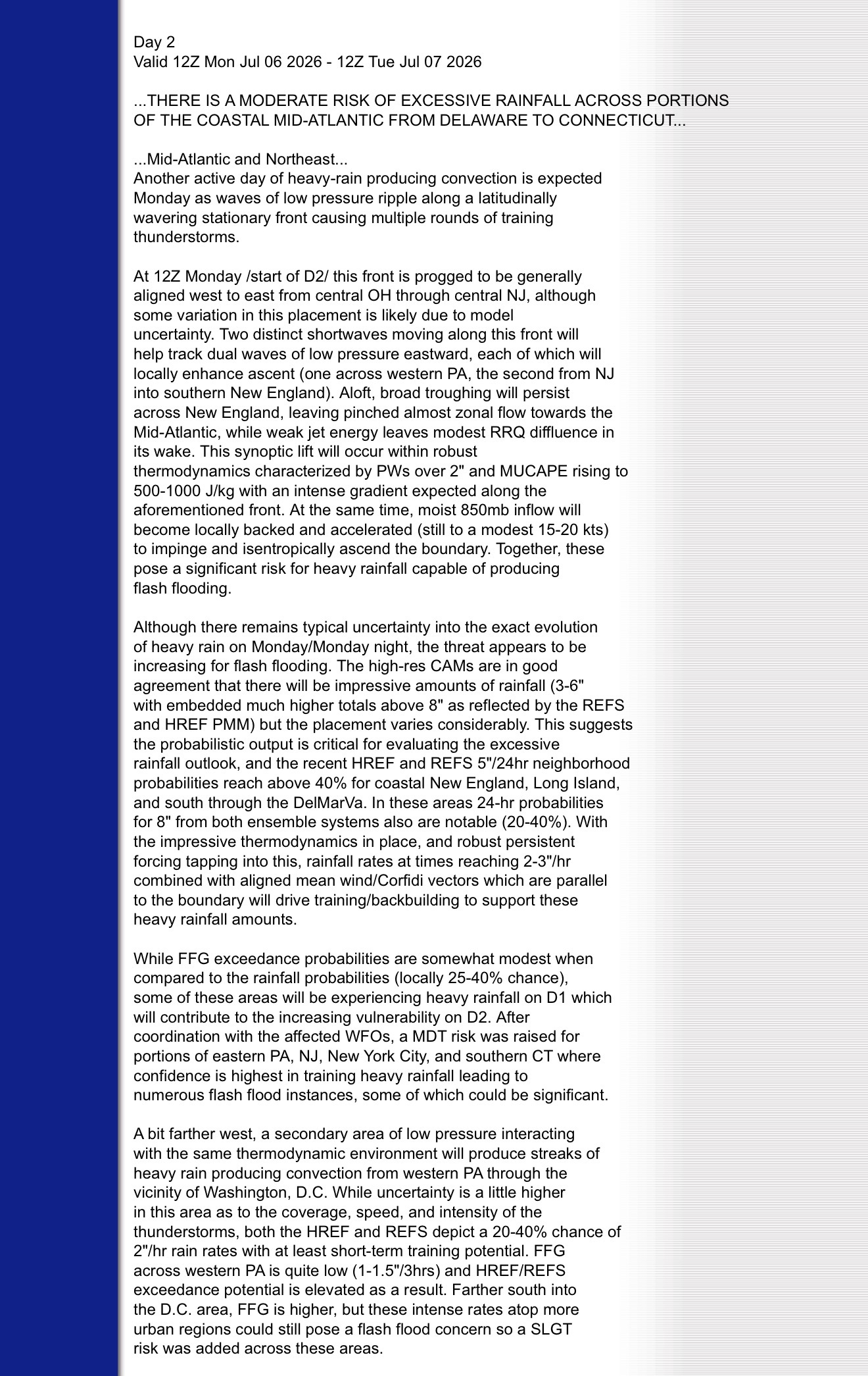
Hoisting the Sultan Signal: Heavy Rain Event July 5-7
Sey-Mour Snow replied to WxWatcher007's topic in New England
4.41” yesterday -
Hoisting the Sultan Signal: Heavy Rain Event July 5-7
Sey-Mour Snow replied to WxWatcher007's topic in New England
Looks like SECT will clean up this evening with heavier rates and have some flash flooding issues. Starting to get a good bit of ponding and runoff here but no torrential rain yet will help prevent any flash flooding. Although we are now up to 6” of rain on the month and 8” in 10 days so the ground can’t handle much more. -
Hoisting the Sultan Signal: Heavy Rain Event July 5-7
Sey-Mour Snow replied to WxWatcher007's topic in New England
Heaviest rain of the day 3.25” -
Hoisting the Sultan Signal: Heavy Rain Event July 5-7
Sey-Mour Snow replied to WxWatcher007's topic in New England
No doubt boring but beneficial yes -
Hoisting the Sultan Signal: Heavy Rain Event July 5-7
Sey-Mour Snow replied to WxWatcher007's topic in New England
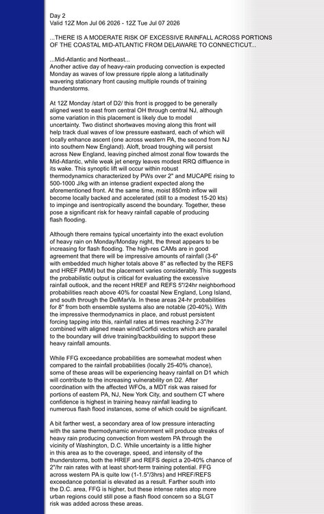
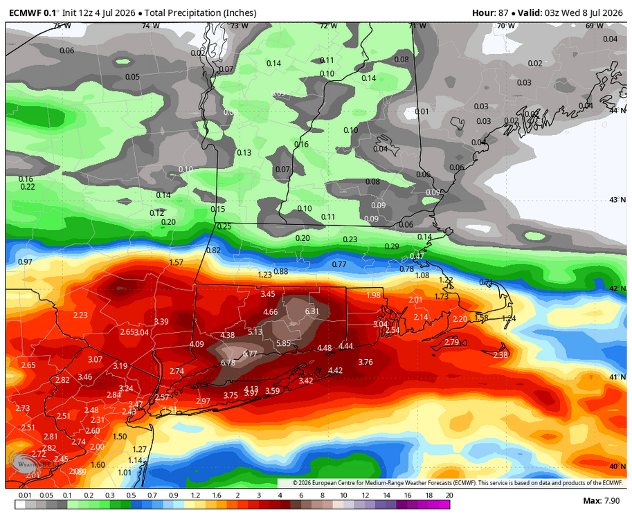
Still a while to go, should be a widespread 2-5” across the state with isolated higher amounts. Already at 2” here just from today -
Hoisting the Sultan Signal: Heavy Rain Event July 5-7
Sey-Mour Snow replied to WxWatcher007's topic in New England
-
Solid rain producer another inch can't tell if there was any damage locally.. 4"of rain in the past 2 weeks..
-
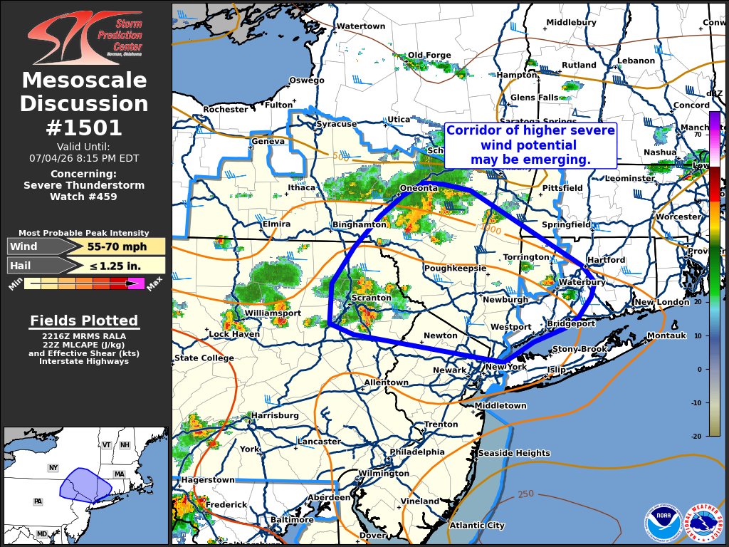
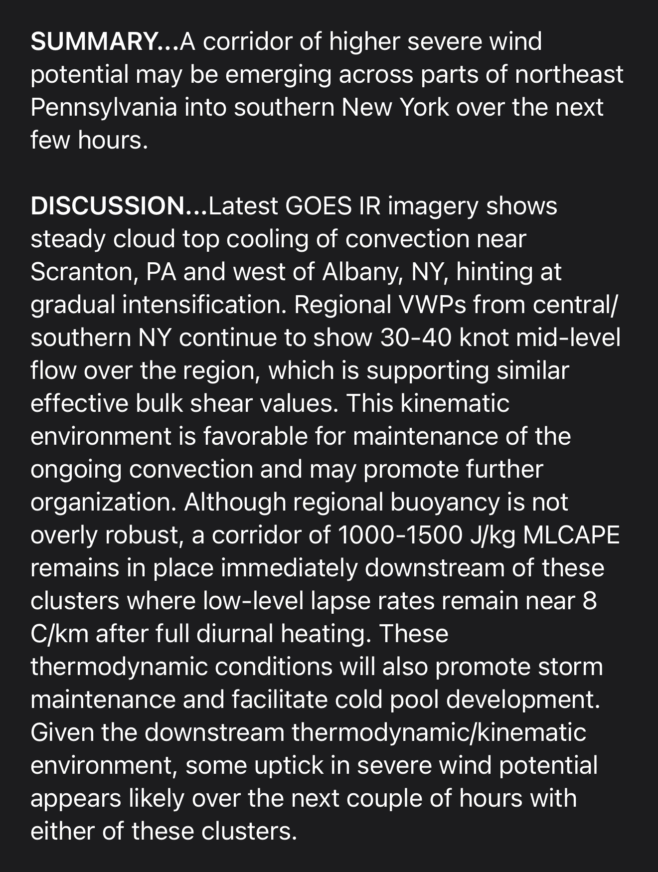
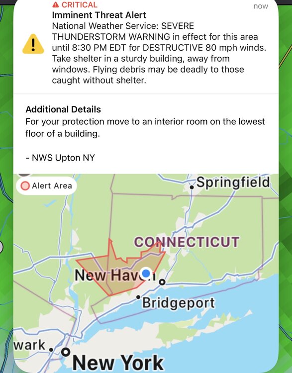
Monroe getting rocked with the worst of the wind. Just average here so far
-
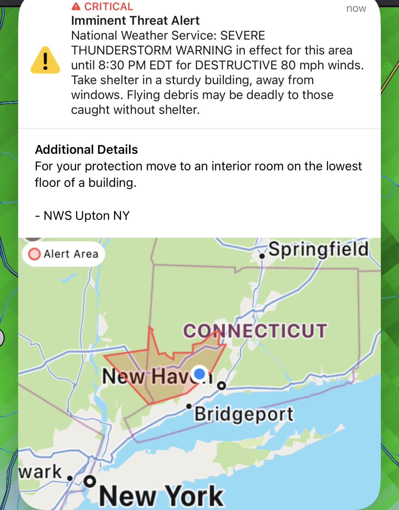
Never had this before! All our devices are going wild! Emergency alerts!
-
Storm is trying to build into your good
-
Seymour Rain
-
Saw a 103 in Medford Mass in the nws obs.. 101 here in Seymour at lower elevation
-
https://x.com/burgwx/status/2072714292655194125?s=46 cool stat above temp of 96 before noon in KNYC
-
84/79 already
-
Solid inch so far
-
Also not sure if it was talked about but the GFS was all over this mid to late week heat wave while the EURO had no interest in it. Another impressive mid to long range win for the GFS.
-
I more have a problem with this paragraph. “The US will endure one of its most expansive heatwaves in history this week. Then another long lasting record breaking heat dome will plague #Europe again, back to back on its worst #heatwave in its history!” Every anomalous outbreak doesn’t have to be dubbed “worst in history” . As you stated earlier there have been higher temperatures recorded much more humid air masses and more dangerous/long lasting heat waves. Let’s see where this one ranks when all is said and done. Now if we actually hit 100-104 over a large number of climo sites plus humidity that’s a different ball game. However it seems like we do 95-99 for a week stretch every year.
-
Puerto Rico
-
Will be in the Caribbean next week can’t wait. Although I’m enjoying the fresh air today.