Sey-Mour Snow
-
Posts
6,889 -
Joined
-
Last visited
Content Type
Profiles
Blogs
Forums
American Weather
Media Demo
Store
Gallery
Everything posted by Sey-Mour Snow
-
I think bc it's like our only team that matters bc we don't have a professional team.
-
You would if you lived in CT, it's the only championships I've seen since 2000 besides 1 Yankees Ship. Knicks and Jets will never get one..
-
Donuts?
-
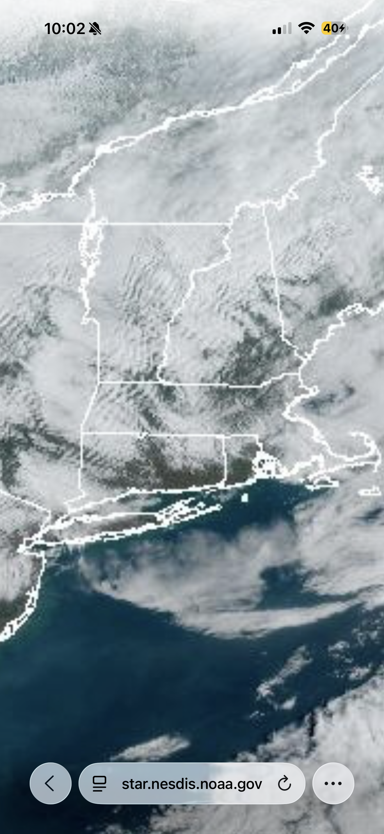
Is that ct or vt?
-
Stop it / that would be horrible
-
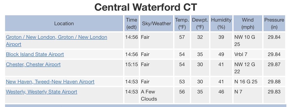
Just got to Mohegan for the weekend overperformer today, truck says 60 - mostly sunny, enjoy the warmth while we have it!
-
Meh give time, it’s nice in a lot of SNE. 48-51 around here partly cloudy, perfect late March weekend morning . I think you said this weekend was crap a few days ago, can’t really ask for much nicer weather here at least today except 10-15 degrees warmer.
-
Should be a decent three days today through sunday in SNE at least 48-58 with sun 65% of the time.. Then we go back to cold
-
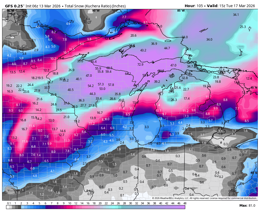
Sunday is on life support , getting close to a snowstorm for CNE
-
3.04 in the gauge , winds cranked for an hour at least , no big damage but a ton branches down roads are littered with debris
-
Closing in on an inch.
-
Ya just posted about it on the socials 3-4”+ possible
-
2 storms .. totals .. What

-
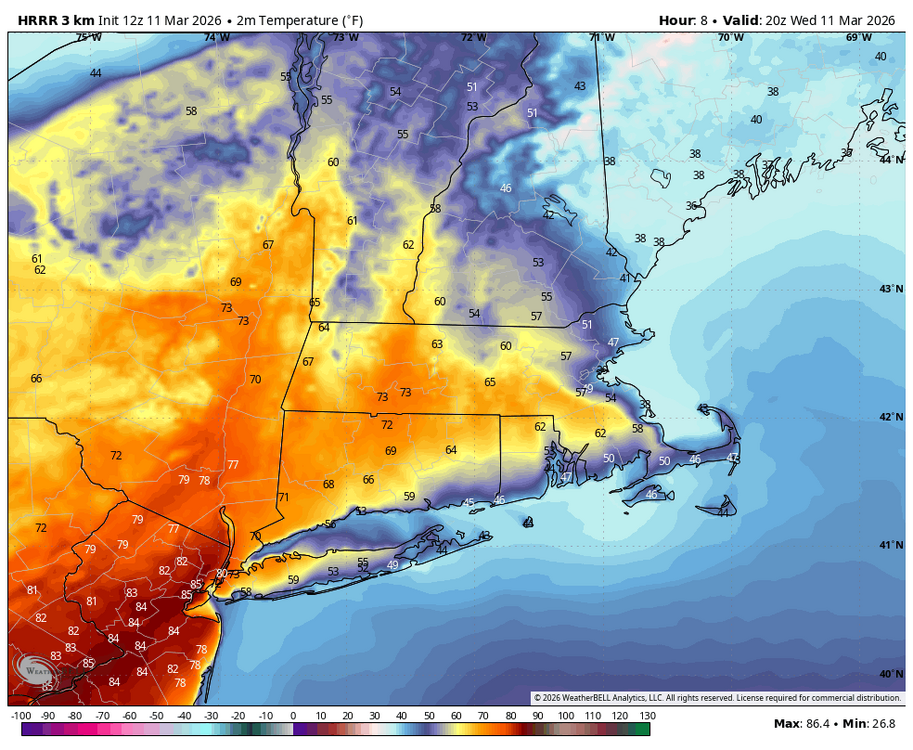
Already near 70 there with a warm surge moving in we shall see. I’m 61 here + 4 from yesterday
-
Euro had some runs inside day 4 with a 962 just SE of the benchmark giving 1-2' of snow to ENE

-
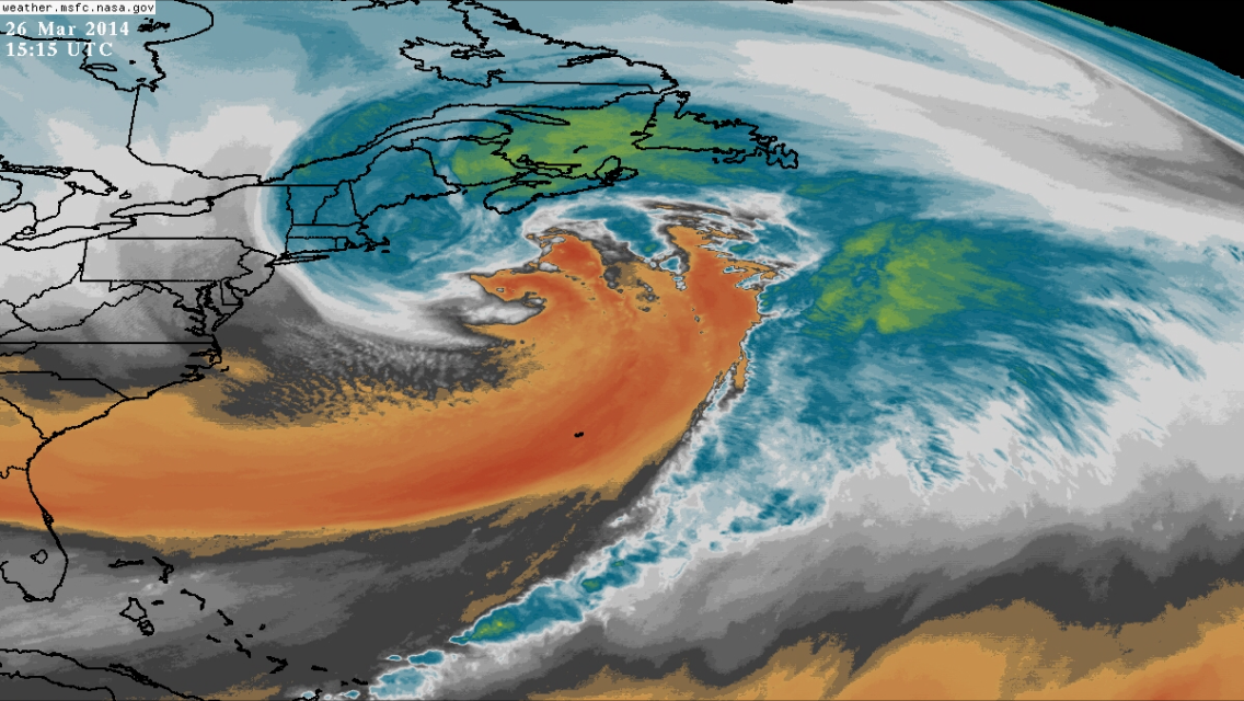
ya 3/20 still has hope it's 9 days out.. Remember the mega blizzard that hit the cape and especially Nova Scotia around 3/20/14?
-
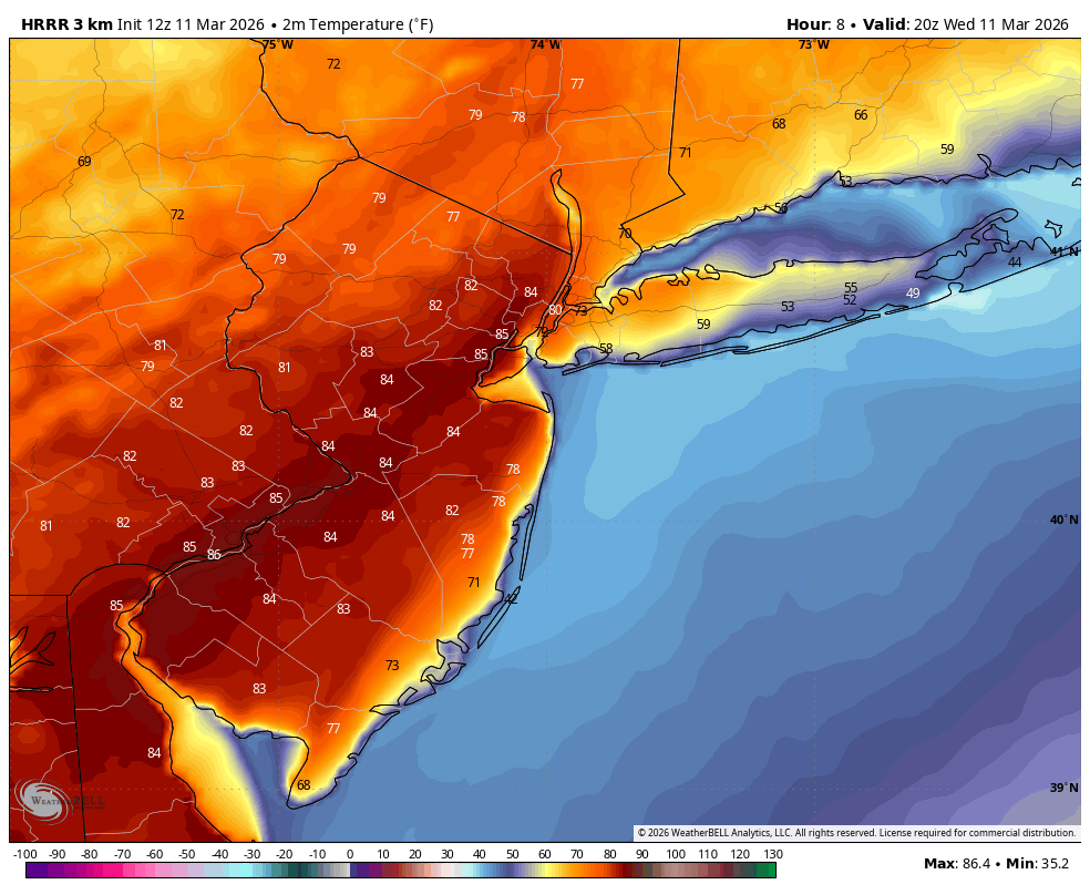
Wild in nyc metro , upper 80s ?

-
I’m already up 11 from yesterday at 9am
-
LOL GFS is 3-6" of snow on the grass for DC..
-
He might hit 70.. looks like 80s for NJ
-
Snowfall wise for me A-. Overall winter A+ pack, cold, no rain, plenty of snow .
-
74 perfect day
-
70 for a high not bad
-
NERDS
-
Torch today going to hit 70+ easily if we don’t seabreeze.. 66 already here.