Sey-Mour Snow
-
Posts
6,904 -
Joined
-
Last visited
Content Type
Profiles
Blogs
Forums
American Weather
Media Demo
Store
Gallery
Everything posted by Sey-Mour Snow
-
We will break it soon with a land falling January Hurricane. Or training severe storms. I’m sure Tip can muster up something for us.
-
Ya makes sense.
-
33/34” isn’t bad for Long Island. More than a lot of immediate ct shore
-
Thinking lower end of this will verify. If the lower end does verify 99% of CTs population will endure their least snowy January ever. Congrats. Kinda excited for MJO and Brooklyn on their potential for a record in futility if they don’t get .1” tomorrow. We rat on! Enjoy up North!
-
4 of last 5 Januarys here have had 4” or less.
-
Wild January stats from my weather station. The coldest high temperature was 34 degrees this month. A whopping 17/24 days had a high of 40+ and only 7/24 days made it into the 20s at night. 5.78” of rain .4” of snow.
-
.3” 3.4” on the season.
-
We pray for that outcome verbatim
-
 .3 in the books just a little coating on the grass. But it snowed for about 6 hours. Hopefully we can get our first plowable of the season Wednesday.
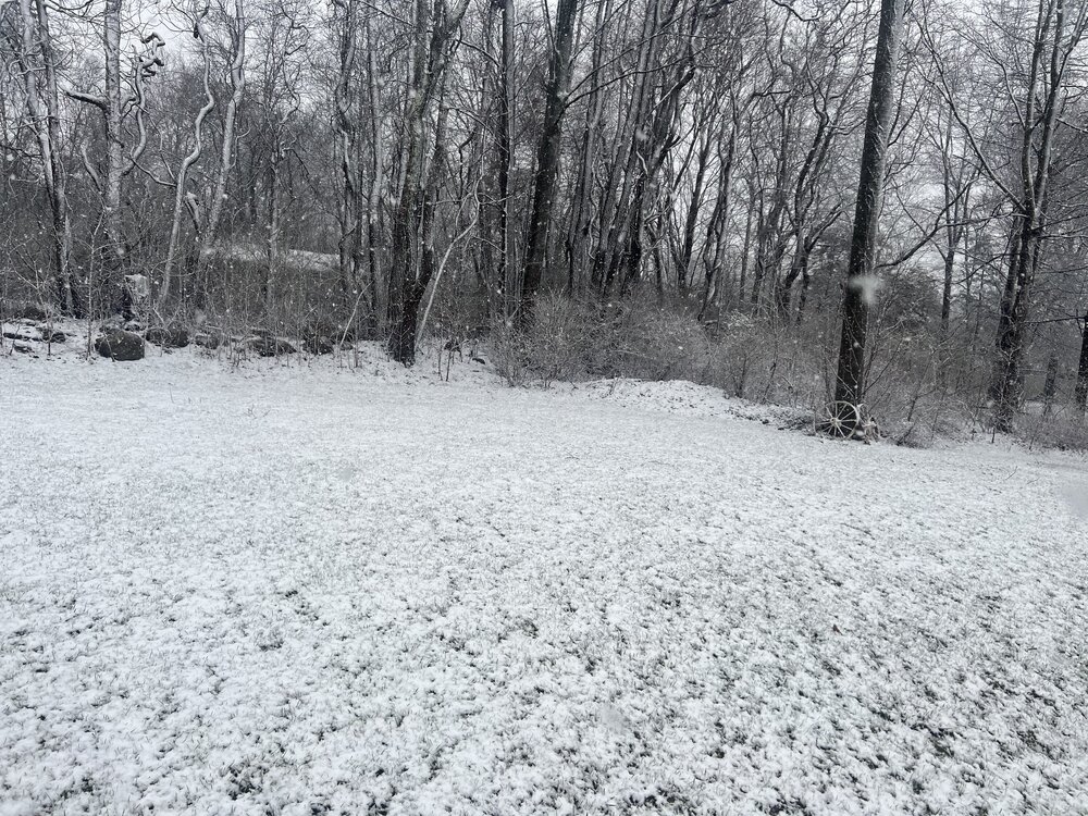
-
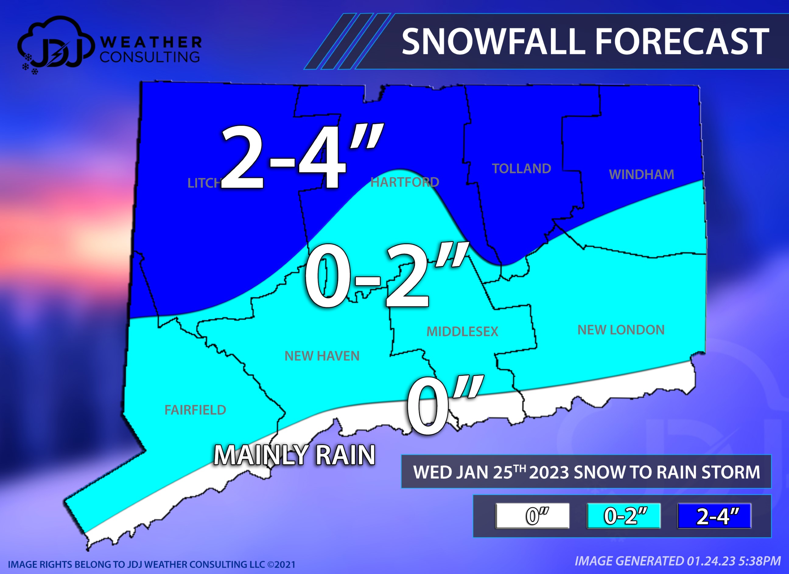
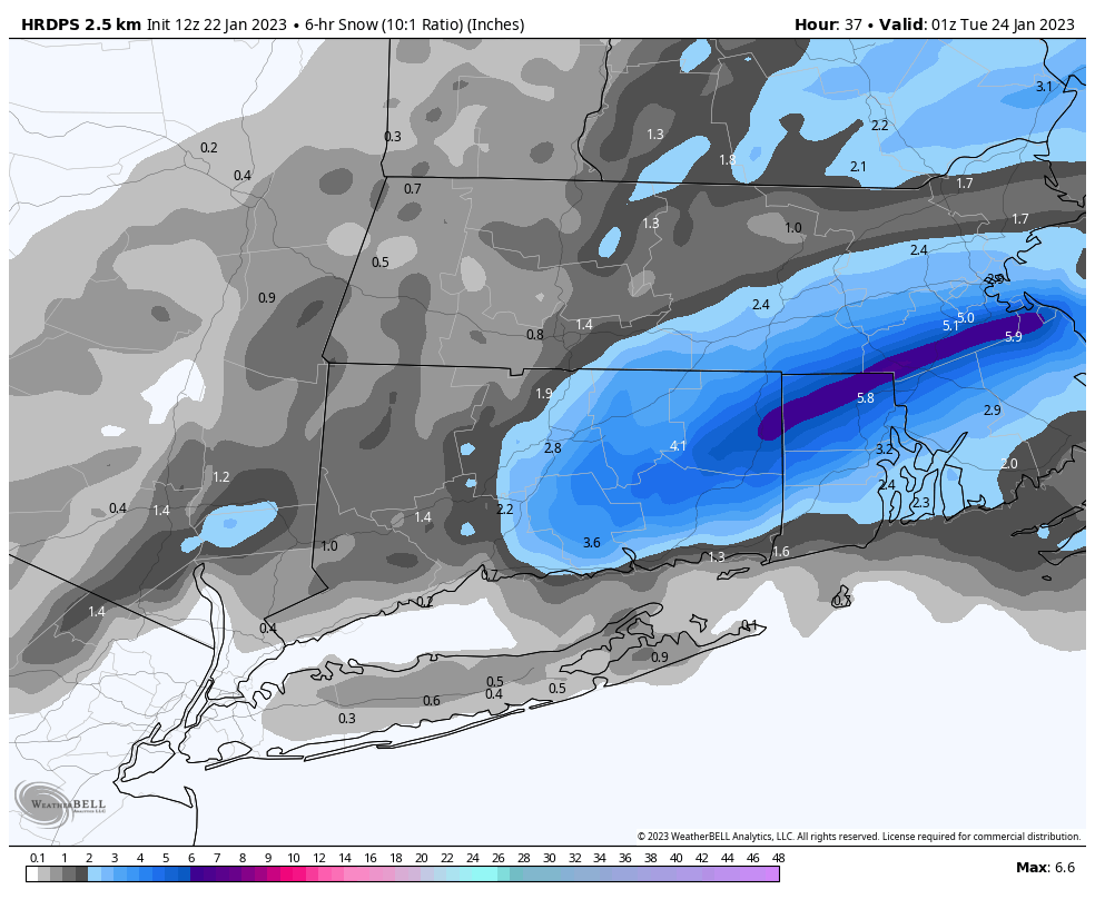
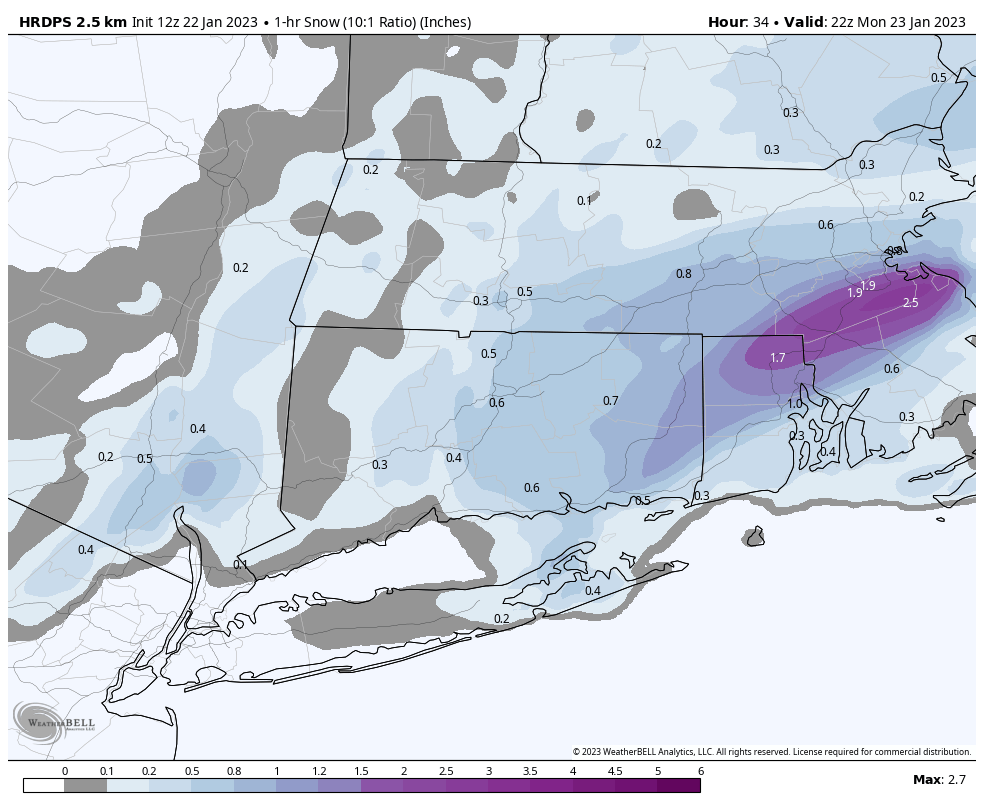
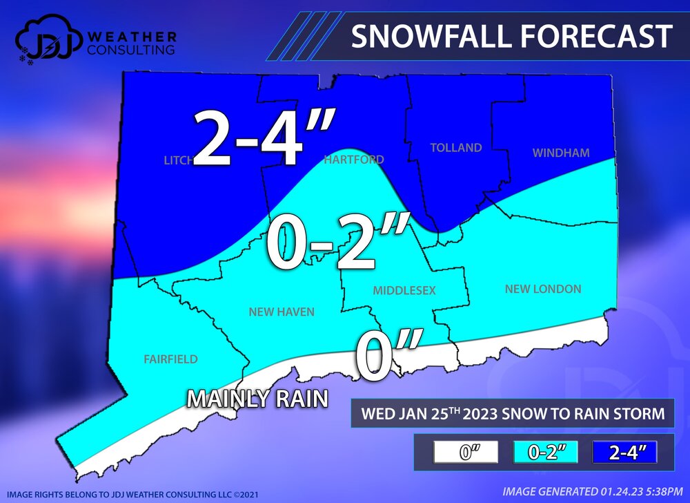
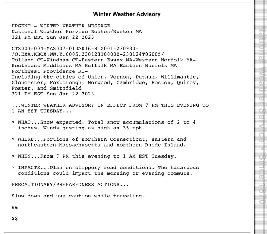
It’s Wednesday 10am to 10pm throughout the state. Looking like 2-5” for most if not all of the state. then rain but temps shouldn’t rise above 39.. edit euro has gotten much warmer last few runs so it does spike to 50 for a few hours across 75% of the state.
-
Damn!
-
Not even a flake 2 miles away at 300’ .. my house 600’ 33.3 grass just starting to get covered.
-
Jelly. Temp dropped quick now 34.9. If we can cover grass that’s a win in my book and would be the first accumulation of the month.
-
Temp 36.7 fully snow now. Won’t stick for a while though
-
It’s happening here too! ground covered quickly with more rain!!! 37*
-
Hoping this continues to strengthen and blossom. Looks good early on

-
Flipping to heavy snow on central pa/nj border temp of 35. Encouraging
-
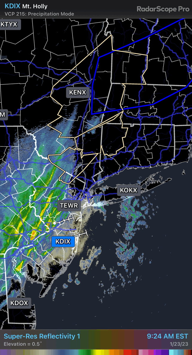
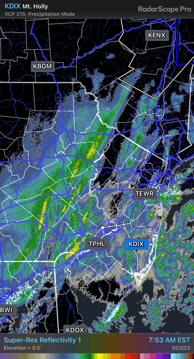
Mount holly radar does look interesting already, or am I hallucinating. Could see that developing into a very solid “krafty ending” by the time it gets to New England

-
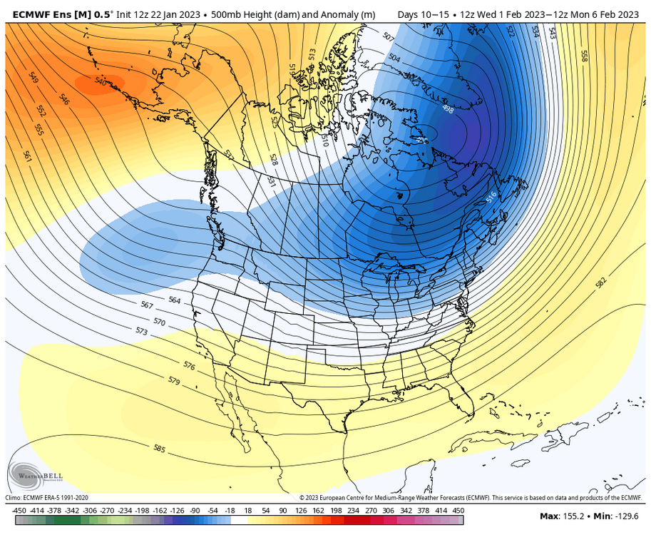
Shhhh Don’t say that I got roasted for that yesterday. But seriously I think it ends up being feb 1 to feb 10 for larger window of opportunity with a very favorable 4-5 day period somewhere in there..
-
You look good for 1-4”. 1” screw zone, or 4” with some nice banding. Still 37 here no chance for anything more than a coating.
-
Congrats kevin and ginxy
-
That’s my 5 day window, and hopefully more after that. Looks solid for now!
-
That’s a pretty solid summary of my day actually. We get a good CT snowstorm in early February and we are naming it the runnawaywolf storm. Until then I’m cautious.
-
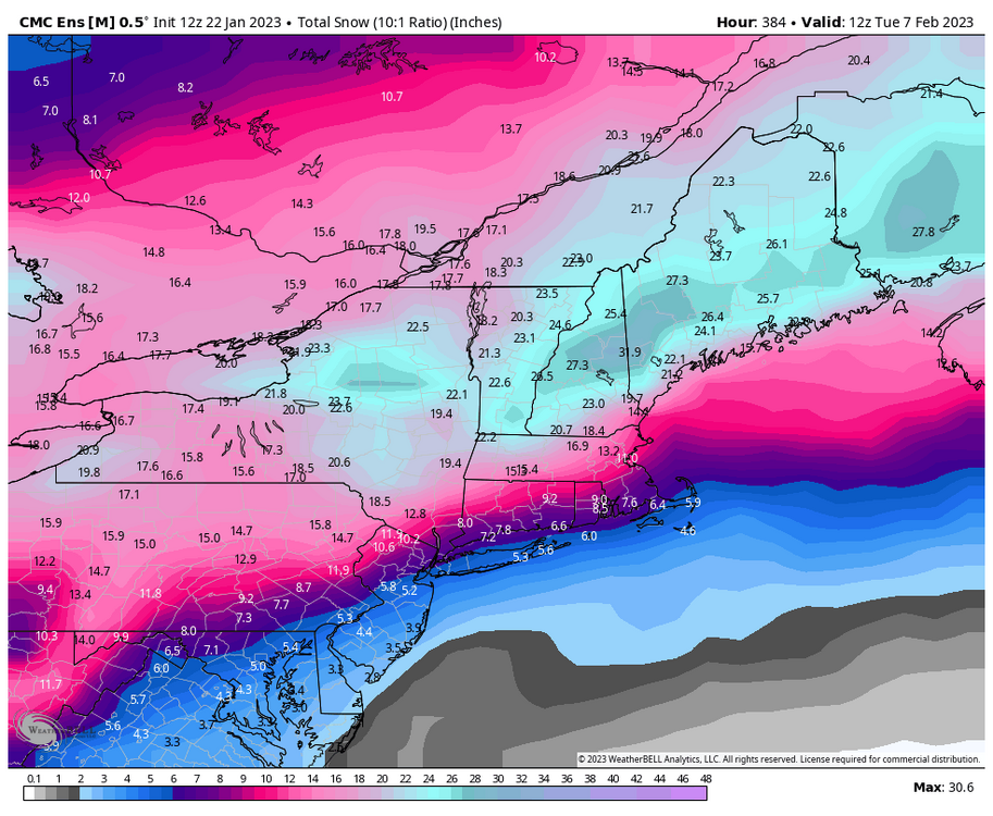
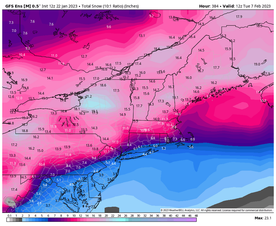
A positive post for wolfman. A very snowy geps and GEFS in the 7-15 for a change. About half of this comes after Wednesday. So there’s more chances..
-
Ginx and Scott ran the herpes out of their basement this morning?? That would be quite the happy ending 1-2” per hour for a few hours to end things tomororw.