

Sey-Mour Snow
-
Posts
4,048 -
Joined
-
Last visited
Content Type
Profiles
Blogs
Forums
American Weather
Media Demo
Store
Gallery
Posts posted by Sey-Mour Snow
-
-
5 minutes ago, WinterWolf said:
Weenies bickering about Suppression and how long any flip can last, and we don’t even know if a concerted flip will even happen yet.
Plus Things seem to trend north most times anyways, so suppression is the last thing I’d be worried about at this stage here in SNE/CNE.
Exactly plus with that subtropical moisture feed I think we will be fine.
-
 2
2
-
-
1 hour ago, brooklynwx99 said:
I think that this pattern allows for a true high-end event later in the month, generally from a potent southern stream vort traveling underneath the vort and phasing, but yeah, you can get clipper or Miller Bs from the AK ridge. I would say that this probably favors SNE rather than NNE for sure, as there can be some suppression depending on how strong the blocking and associated 50/50 ULL get. I'd feel a lot better in Danbury than Nashua
RAY : “He said Nashua and suppression”

-
 7
7
-
-
3 minutes ago, AstronomyEnjoyer said:
Nah, not the same person.
Impressive, family?
-
5 minutes ago, CoastalWx said:
Anheuser enjoyer and moonshine productions love that.
I’m thinking they may be the same person? Kinda odd to have two people so similar in posting style to just randomly pop up and start mass posting
-
5
-
-
14 minutes ago, CoastalWx said:
Let’s get PD III
Cosgrove already alerting the masses for PD3 .. but seriously things do look very favorable for something big in that time period… lets hope it’s a uniform snowfall for all .
-
2
-
-
3 minutes ago, Torch Tiger said:
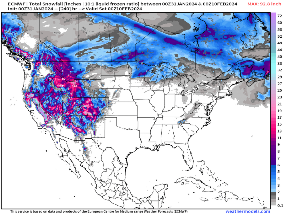
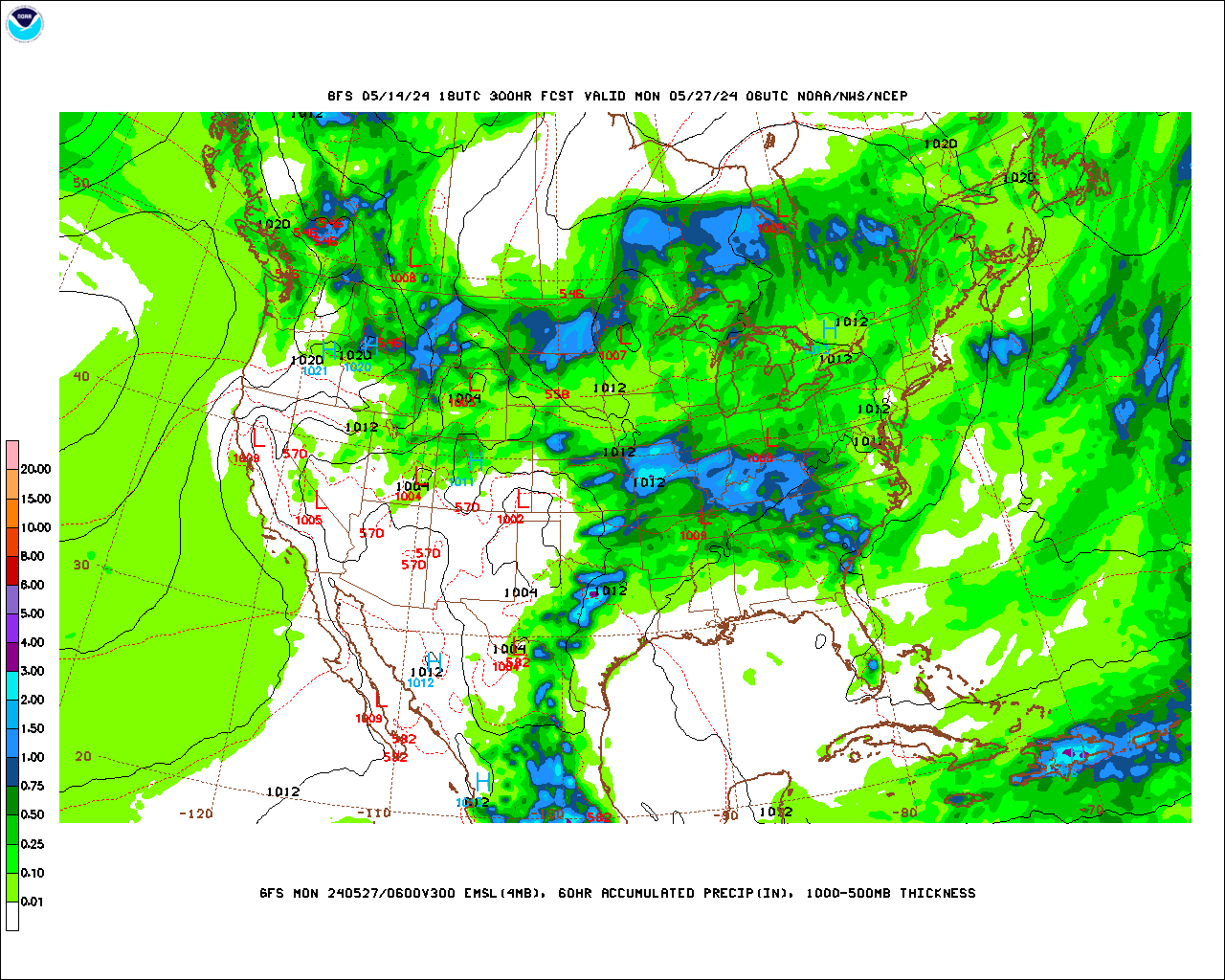
Just for chuckles I'm looking at the relatively useless 18z gfs more closely. coarse-grid gfs total qpf is roughly 1-1.5" for that system here
This is all snow, though? And how readily would it accumulate? Ahhh entirely pointless but hopefully there's a decent storm!
.thumb.png.b27c98598b8c58b8bddf495ae82e75a6.png)
Well ya not the greatest set up with that low in Canada on that 18z run . 60 more gfs cycles to lock it in. I’m sure we will get a few warmer runs and a few SECS runs
-
2
-
-
4 minutes ago, Torch Tiger said:
It's amazing how bad even mets can be at reading a map. Seymour, were you were looking at the Kuchie Ku weenie algorithm?
No, I'm using a site you actually pay for..
-
2
-
-
31 minutes ago, Torch Tiger said:


LMAO that is one of your worst posts ever. You have been better lately.. You literally picked the only bad frame that storms gives your area 6" + and CNE 12-18" of clown snow..
-
1 minute ago, ORH_wxman said:
Pattern mid-month still looks excellent. But it’s pretty much snoozefest for 10 days before that…only question is whether we can sneak a 60F nape tanner or two in there at the end of next week/weekend.
But the pattern beyond that is still about as good as you could draw it up.
especially love that EPS look tremendous blocking in the Arctic. Things really start shuffling by day 8-9.. And that pattern starts locking in by day 10-12.. We should be tracking a region-wide plowable event by sometime next week hopefully some 60s too while we track..
-
2
-
-
10 minutes ago, jbenedet said:
Did you say geese?
Noticed them the past week in the elementary school playground dozens of them.
-
1
-
-
4 minutes ago, FXWX said:
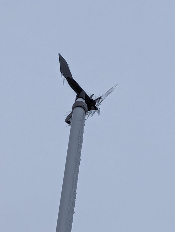
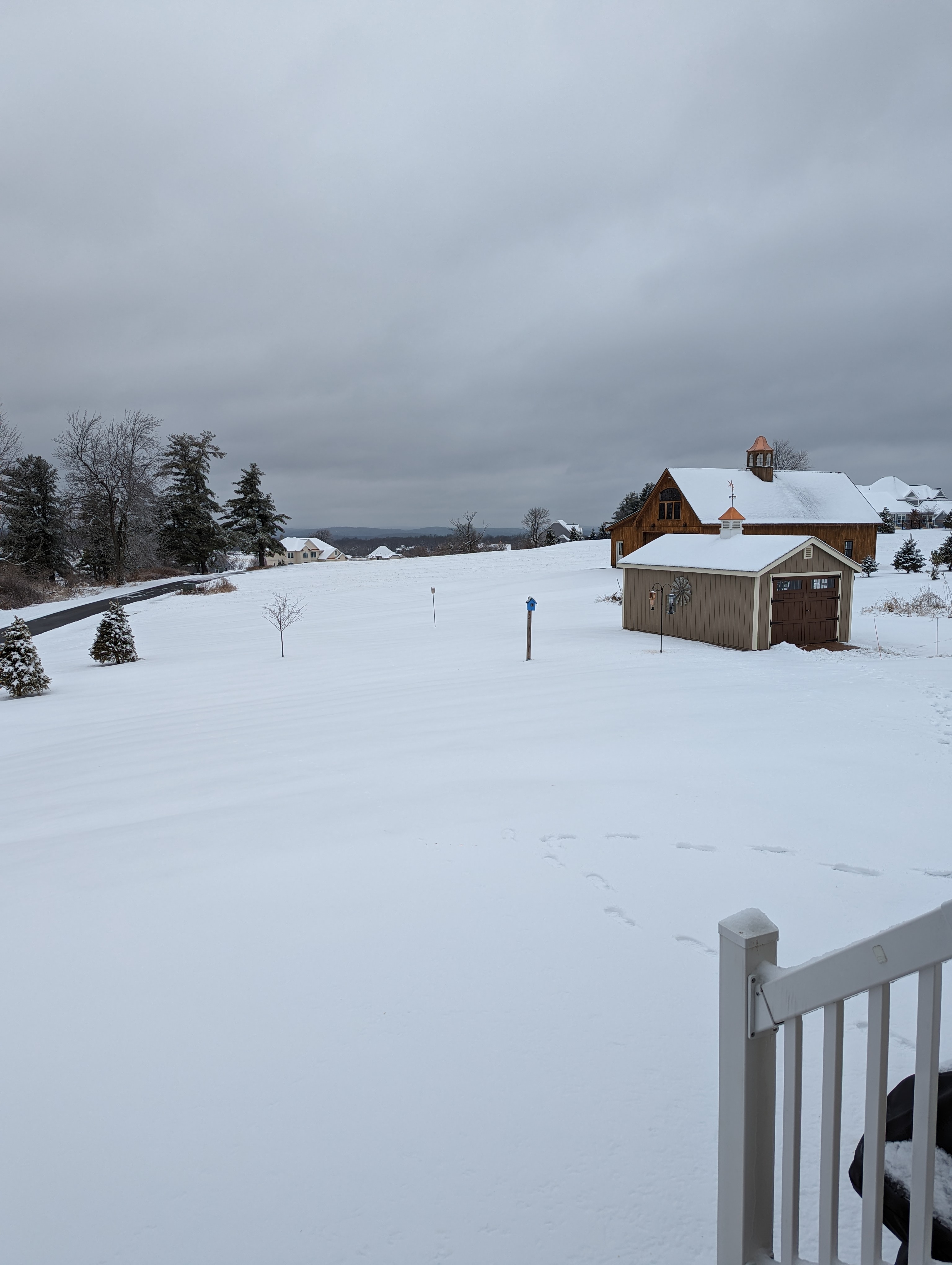
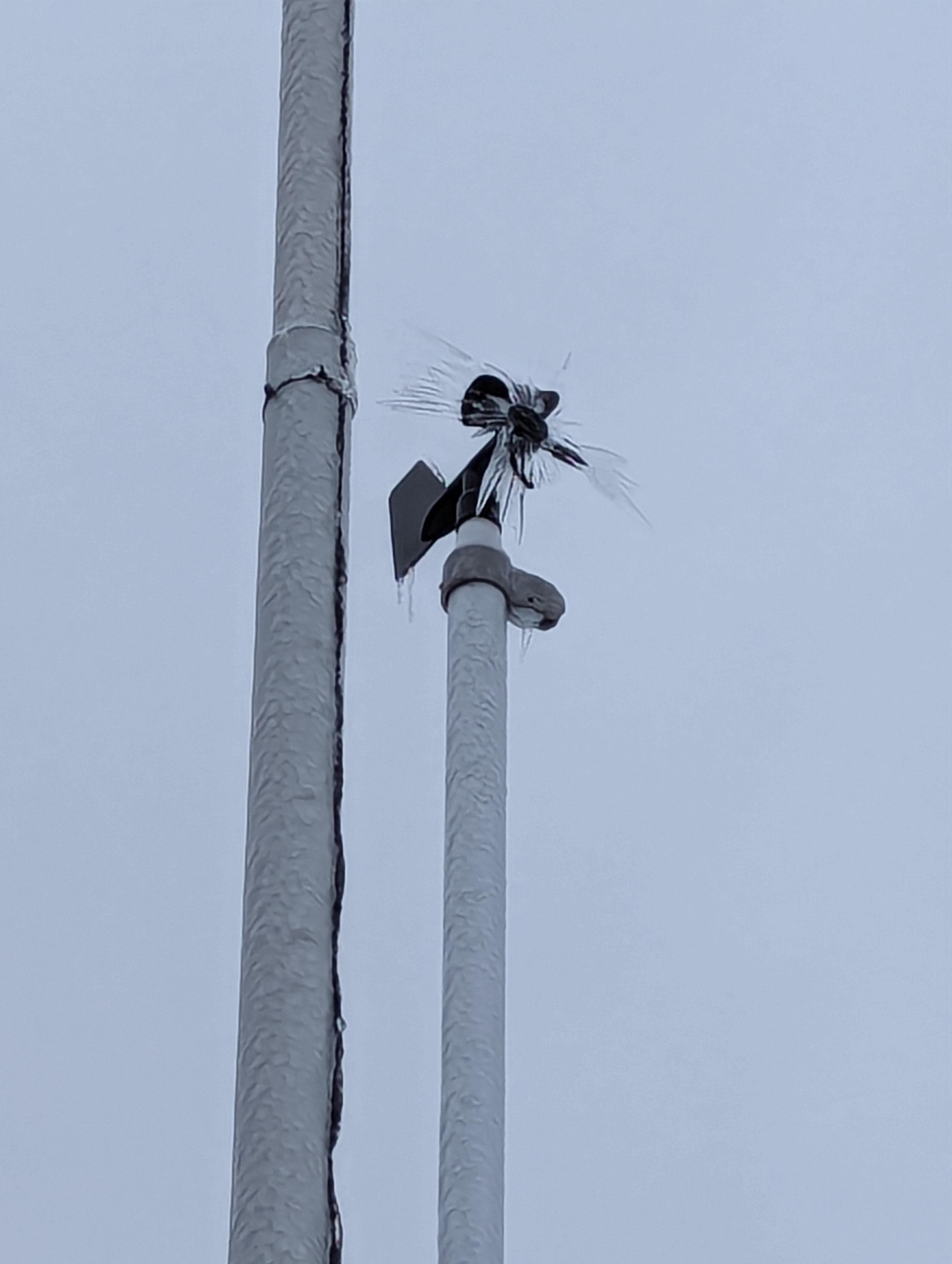
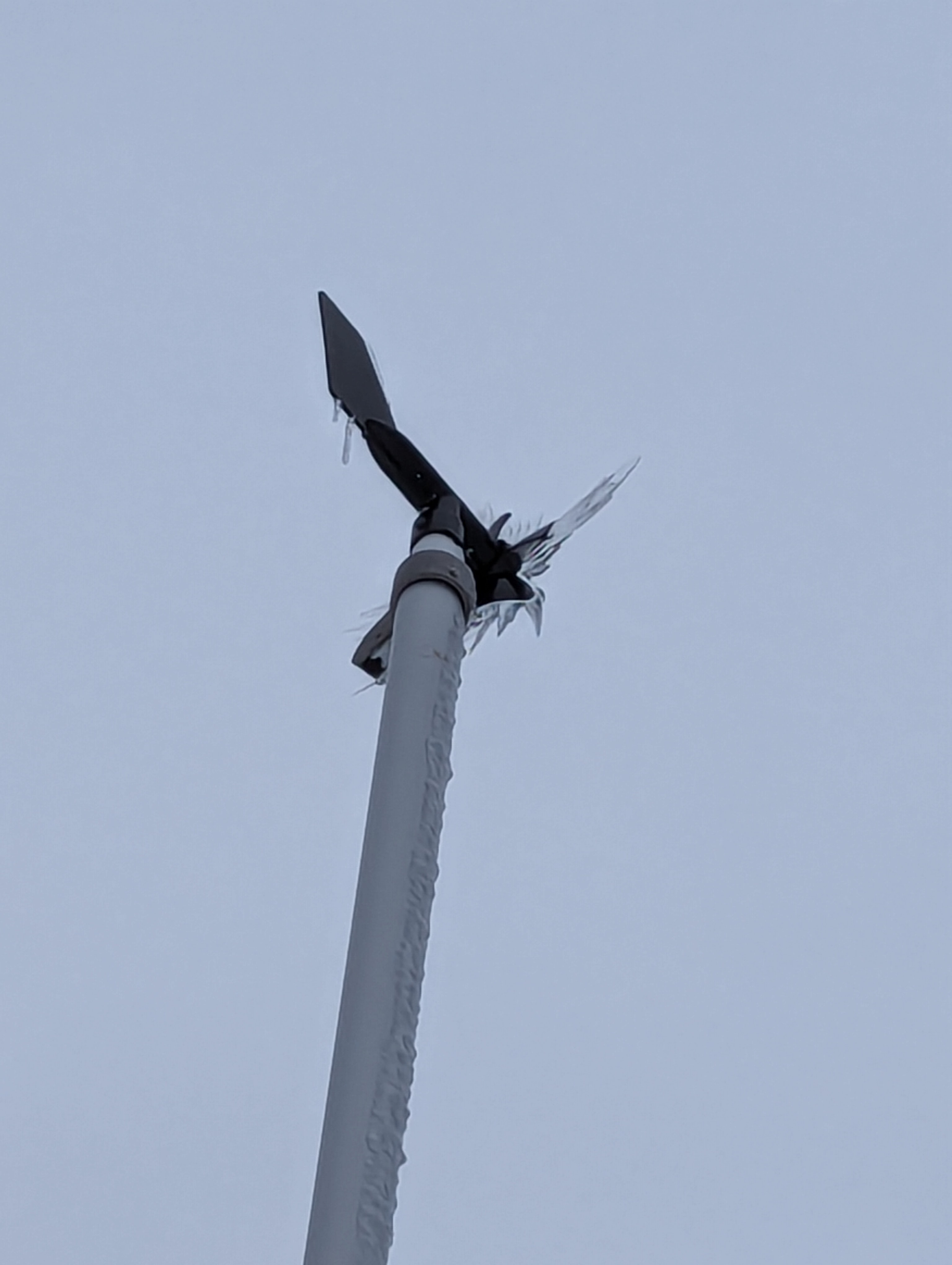
Still a nice wintery scene across the high points Burlington, CT... Sunday's 4" snow/sleet holding tight and solid glaze from several freezing rain on trees, etc... My Rainwise anemometer still encased in ice!

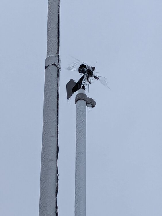
Geeze, I’m only 20 miles south of you yet it looks like you live in a different country. Looks like March 31st here geese are out not a snow pile in sight.
-
1
-
-
NAMs with an outlier cold solution and weenie SWCT 2-4” snow band early Friday AM. Every other piece of guidance is far too warm.,
-
12 minutes ago, qg_omega said:
Congrats
I like the 3" spot in Maine..
-
2
-
-
2 hours ago, 40/70 Benchmark said:
Yea, that would be the grand finale to this season....a Feb 2010 reenactment.
If I got teased like that again with multiple storms of 12-24” within 25 miles of me id retire from weather.
-
1 hour ago, RUNNAWAYICEBERG said:
From your hair?
Lol no I had a trace on my truck
-
14 minutes ago, RUNNAWAYICEBERG said:
At least we are dry for the next 10 days until the next Rainer comes.
.“Snowing” now
-
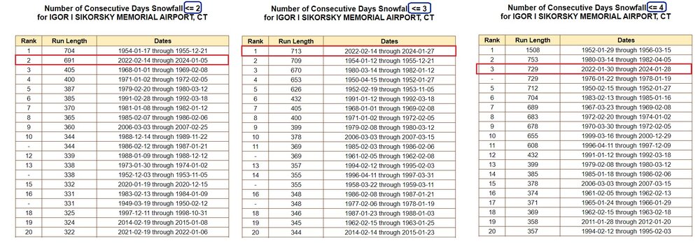
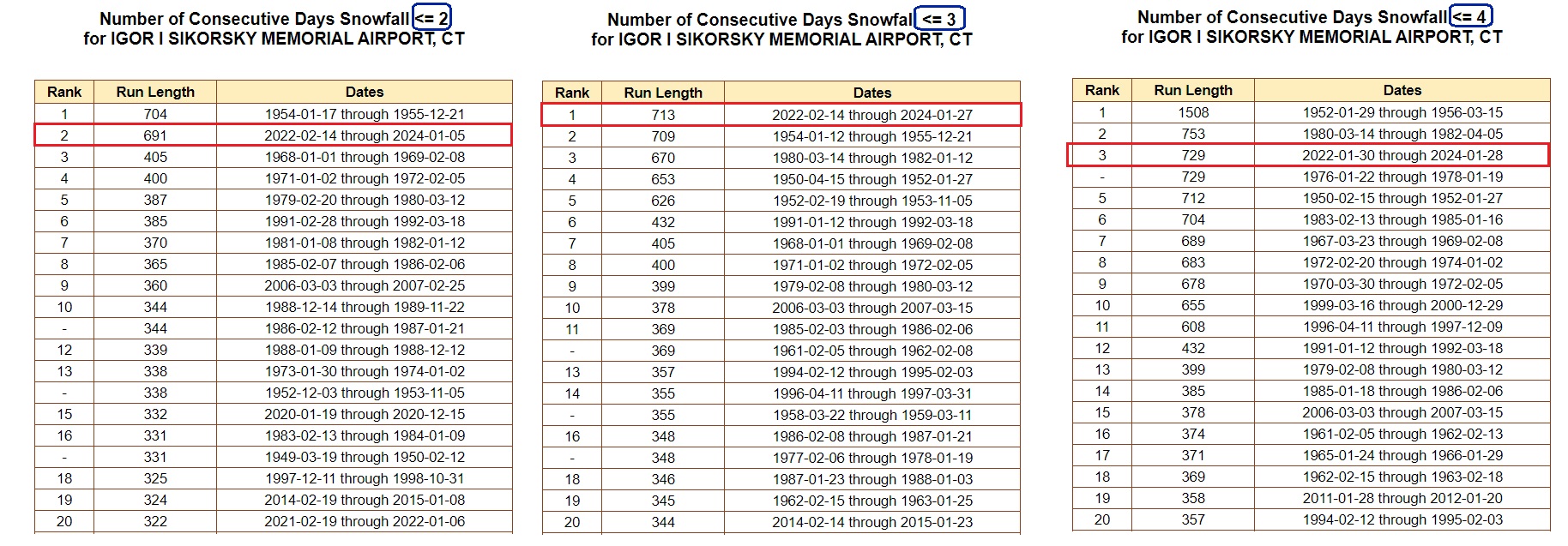
BDR futility chart from Ralph Wx Obs on twitter. This type of stretch has happened before for BDR. Seems like the real anomaly is the extremely snowy stretch BDR had in the 2000s. Currently in the 729+ day mark without a 4”+ snowfall which is no where near the record which was 1508+ days in the 50s. It’s not uncommon there on the immediate shore to go a few years without a decent snowfall.
-
 3
3
-
-
26 minutes ago, MJO812 said:
Meh I'm sitting at 2.2 here in NYC.
You are preaching to the choir man.. I'm at 6" which is about 44" shy of my seasonal 30 year average going into February yet again.. It's peak climo something will pop, maybe not for NYC but something will pop.
-
Just now, MJO812 said:
Horrible runs overnight
That's why no one should get excited about any model run past 7 days .
Conversely don't get too down.. Something can easily sneak up
-
1
-
 1
1
-
-
Just now, CoastalWx said:
Can pretty much lock in a rat. Hopefully we can torch and end this sooner rather than later.
Another historic rat from Dec 1 to Feb 10th no doubt (last year was worse still here with 4.5" through Feb 27).. Question is will we get a MAJOR to take us out of the rat territory for the record books in the tail end of winter?
-
3 minutes ago, Go Kart Mozart said:
Just askin...but would say.... Litchfield CT be considered non-mountainous?
Well if it’s just isolated in the hills then no. But there’s plenty of regular terrain there.
-
8 minutes ago, ORH_wxman said:
Yeah threat is a really vague term.
Just posting so others can follow along with the friendly wager.
-
4
-
-
Just now, powderfreak said:
Gotta use the positive snow depth maps. They’ve been pretty decent in this one.
Positive snow depth maps had me at 2-3” this morning lol I had 15 minutes of 80% rain/snow . It’s not about that, it’s about the .8” of qpf it has for that area after that 5pm which isn’t happening.
-
1
-
-
1 hour ago, CoastalWx said:
I just didn’t expect it to get utterly neutered again this year. But here we are.
I was due to get neutered anyways at least that was done for me by Mother Nature

.png.16e8c63eb49a91f8ac5c176947915092.png)


It was a Flop... February 2024 Disco. Thread
in New England
Posted
Verbatim there’s a ton of cold and a great airmass, it cuts west before transferring so the mid levels warm south of the pike and a ton of mixing. All we can take out of this run is that it has a juicy storm again