

wxsniss
-
Posts
5,444 -
Joined
-
Last visited
Content Type
Profiles
Blogs
Forums
American Weather
Media Demo
Store
Gallery
Posts posted by wxsniss
-
-
Just now, wxsniss said:
At KBOS too, soundings continue colder, we have more buffer for the 3z-5z hours that follow... trends are solidifying, and cold all the way to the surface:
At the critical 3z:
12z:
  3  850  1477  -2.0  -2.4  97  0.5  -2.1 123  19 284.1 284.7 279.0 294.7  3.76
  4  800  1961  -0.6  -0.9  98  0.3  -0.7 156  18 290.5 291.3 282.8 303.5  4.48
  5  750  2477  -0.8  -1.1  98  0.3  -0.9 190  19 295.7 296.6 285.2 309.6  4.71
  6  700  3027  -2.2  -2.7  97  0.5  -2.4 224  27 300.0 300.9 286.6 313.5  4.49
18z:
  3  850  1472  -2.5  -3.0  96  0.5  -2.7 125  26 283.6 284.2 278.5 293.8  3.60
  4  800  1954  -1.6  -2.0  97  0.4  -1.8 139  25 289.5 290.2 281.9 301.4  4.12
  5  750  2468  -2.1  -2.7  96  0.6  -2.4 144  25 294.3 295.0 284.0 306.6  4.19
  6  700  3015  -3.9  -4.7  95  0.7  -4.3 171  25 298.1 298.8 285.2 309.7  3.86
Though warmer by 6z, so the warming tongue might move in slightly faster on this run
-
At KBOS too, soundings continue colder, we have more buffer for the 3z-5z hours that follow... trends are solidifying, and cold all the way to the surface:
At the critical 3z:
12z:
  3  850  1477  -2.0  -2.4  97  0.5  -2.1 123  19 284.1 284.7 279.0 294.7  3.76
  4  800  1961  -0.6  -0.9  98  0.3  -0.7 156  18 290.5 291.3 282.8 303.5  4.48
  5  750  2477  -0.8  -1.1  98  0.3  -0.9 190  19 295.7 296.6 285.2 309.6  4.71
  6  700  3027  -2.2  -2.7  97  0.5  -2.4 224  27 300.0 300.9 286.6 313.5  4.49
18z:
  3  850  1472  -2.5  -3.0  96  0.5  -2.7 125  26 283.6 284.2 278.5 293.8  3.60
  4  800  1954  -1.6  -2.0  97  0.4  -1.8 139  25 289.5 290.2 281.9 301.4  4.12
  5  750  2468  -2.1  -2.7  96  0.6  -2.4 144  25 294.3 295.0 284.0 306.6  4.19
  6  700  3015  -3.9  -4.7  95  0.7  -4.3 171  25 298.1 298.8 285.2 309.7  3.86
-
1 hour ago, 40/70 Benchmark said:
This is probably going to be a season that manufactures plowable out of a quail queef.
Yeah it has that feeling. Been about 3.5 years since we had that kind of mojo in SNE. Only downside is it will do a number on work and sleep.
Won't be available to do Euro PBP but there is fairly decent guidance consensus now that GFS has trended favorably. If Euro holds or continues to tick colder, we may see watches in interior later today. Even with the caveat that we have little buffer at 800-700mb in that critical 3z-6z window.
-
Not that Kevin needs validation, but based on guidance right now (weighing 0z Euro + 12z 12k/3kNAM + 12z RGEM): I wouldn't be surprised if watches show up for parts of interior SNE...
Maybe we are trigger shy with this season opener, but last night's Euro would support it
It's all about 800-750mb temps in the 0z-6z timeframe and intensity of initial WAA thump. if everything caves towards GFS this afternoon, then no
-
4 minutes ago, weathafella said:
Anyone able to post RGEM snow map? Tyia. Phone posting.
Obviously would not take this verbatim, but RGEM has trended colder and supports heavy thump through most of SNE before changeover after 5z-6z

-
12z RGEM is also colder than 6z RGEM... heavy thump in 0z-4z timeframe
-
7 minutes ago, weathafella said:
That’s 3-6 verbatim on NAM TO BOS. 925 cold till dawn.
800mb gets us though, looks to me like it warms in most of SNE after 6z Fri... but damage is done before that...
Nice to see the more bullish guidance hold... for now... when does the GFS join?
-
12z NAM might even be a hair colder than 6z run at 800 and 850... and continues with heavy WAA thump through 6z Fri
-
Yeah the higher totals / more widespread warning in SNE (outside of 128) depends on intensity of that WAA (Euro / RGEM / 3k NAM show this, GFS does not), and soundings (which appear very close and have maybe ticked slightly warmer as we get closer)...
RGEM (though end of its range) actually looks colder than NAM at 850, but can't tell if there's a warmer tongue at 800-700 mb layer that spoils it
Haven't looked at 6z Euro or Snapface or whatever it is
-
 1
1
-
-
Good to be back fellas...
0z Euro with a heavier WAA thump... everything moves in a bit earlier, 850s slightly warmer in pike region, but almost 0.5" more qpf 0z-6z Friday... supports 3k NAM / RGEM at least in intensity of the thump...
I can't see Euro cross-sections but judging from 850s looks like still uncertain soundings approaching 6z near pike... still, with greater intensity of that initial thump as depicted, the NWS 2-3" is looking like a very reasonable starting point and, if things hold, will have to be increased outside 128
-
Have been offline for most of non-winter so missed this... what's the deal with 6z/18z Euro?
Is it run off 0z/12z data?
Are 6z/18z runs less reliable than 0z/12z runs similar to NAM/GFS are?
More data sometimes can confuse more than it clarifies, so curious how this will contribute this winter.
TIA
-
I like the Euro cross-section products available on weatherbell for winter storms... anyone know if other services offer similar?
I've always considered NWS to be the gold standard for forecasts, but it's interesting to see how many private services are now competing.
Along with the pervasive access to (and improving quality of) computer models that have taken some of the fun out of these forums.
I've commented on this before... uncertainty and flawed modeling are part of why this hobby can be so suspenseful, addictive, and fun. And why it's a learning experience too. Maybe it's inevitable, but I'd hate a future where anyone could just rip-read a 100% accurate 96-hour computer model clown map that supplants the need to understand meteorology or the need for skilled forecasters.
-
That signature looks legit
-
2 hours ago, #NoPoles said:
Well she's clearly falling apart...i wish they would.go over why...technically it is traversing over warm water...but the sw quadrant has always struggled...is it sheer, dry air, both? I wish they would talk about structure and environment...there must be some time to talk about that stuff...instead of just using the same graphics and rotating through a list of catastrophic adjectives.
Agree.
Have been watching this peripherally, haven't posted at all. It was obvious the mechanics were never the same after that first ERC, and the ragged / dry southwest quadrant has been a visible issue ever since. Echoing Ray and others the past 48 hours, you can sense when these systems are "infected" with disrupted mechanics that they just can't shake out, regardless of favorable extrinsic features. Maybe modeling is good at reading large extrinsic synoptic features (shear, steering, water temps, etc) but is not as good at recognizing these broken intrinsic features? Intensity forecasts from just 24-48 hours ago will have been way off. Obviously still anticipating significant storm surge and flooding impacts.
But yeah would be nice if there was a little more thoughtful analysis of what's going on, and not the stupefied repetitive track maps, Cat # graphics, and histrionics. TWC wants this cash cow bad.
-
 2
2
-
-
2 minutes ago, weathafella said:
Sky is brightening....rain lower in intensity. We move on.
Barring any redevelopment, vis sat says we may even see sun later this afternoon... I'm relieved with tix for ball game this afternoon
-
22 minutes ago, CoastalWx said:
Other than that cell, there isn’t much of a wind signature. My guess that’s why there isn’t a need for a large SVR.
And ground truth confirms... there is almost no wind with these downpours
-
2 minutes ago, sbos_wx said:
There is rotation SW of Franklin to keep an eye on. Really weak.
Yeah south of pike was where I was watching for redevelopment... but at this point the mode is really messy to say the least, if more isolated these eddies might have had a better chance
-
Have tickets to Sox game 4pm... glad this line is getting an early start
Webster:
-
1
-
-
How are there no severe warnings up and down this line with damage already on ground?
Couplet keeps tightening then loosening, if the line weren't so messy rotation might redevelop south of pike
-
Decent couplet north of Granby
-
4 minutes ago, HIPPYVALLEY said:
Had a chat with God tonight.
Wow... glad you're ok!
When the adrenaline clears... was that hail or branches?
-
1 hour ago, Ginx snewx said:

I and probably eveyone was too exhausted to do a post-analysis... thought I'd toss up some tired and probably incomplete impressions.
I went back through model runs in the 48 hour leadup and compared to the obs map above.
Thought this was a clear NAM winner. Feel like it's had a good season. Very clear banding signatures that happened. Euro was good too. The old EE rule and ignoring all the other model noise would have given us the best handle of this particular storm.
Most guidance wanted to jackpot southeast MA, but between mid-level processes generating bands further northwest and initial boundary layer issues southeast, jackpot ended up in the 495 corridor and extended further north than most expected.
RGEM was spastic and more wrong than right.
GFS was a national embarrassment, pretty much ignorable. Ok with SLP track, but qpf depictions and thermals were a joke.
-
2 minutes ago, weathafella said:
Logan at 12.1 as of 7pm. They’ll end up with 13-14. Mid 50s for the season so far.
Per usual, an anomaly compared to every surrounding site. I'd expect most sites in the immediate metro area (Chelsea, Revere, Hyde Park, South Boston) near 15" after that 5-7pm band.
Some other nearby reports:
Somerville 19.9 733 PM 3/13 Social Media
Revere 15.0 632 PM 3/13
-
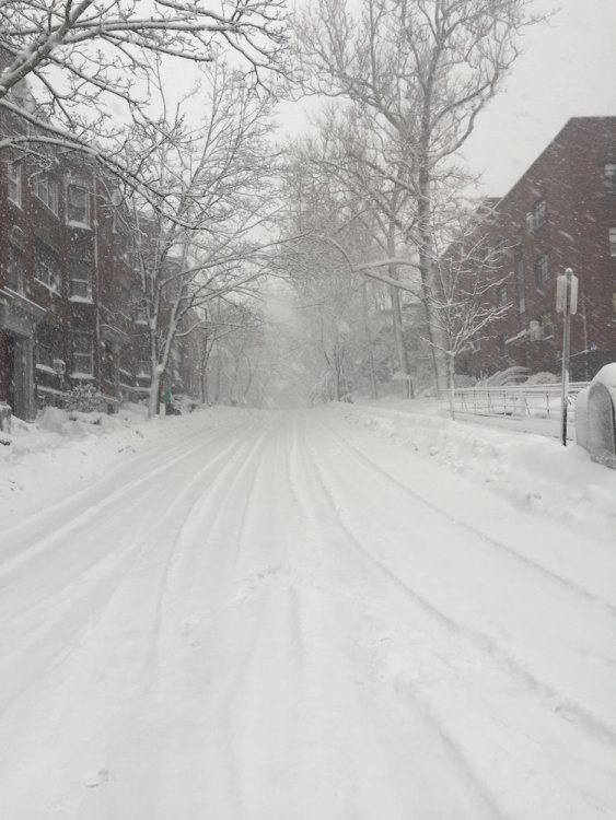
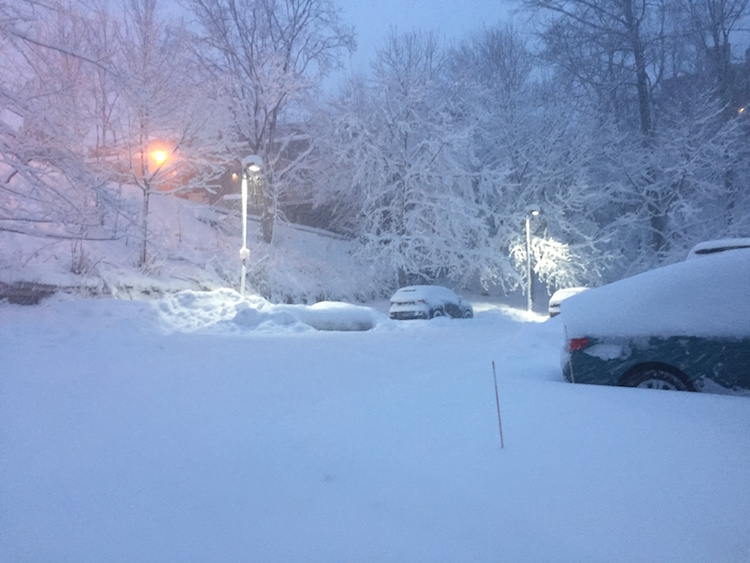
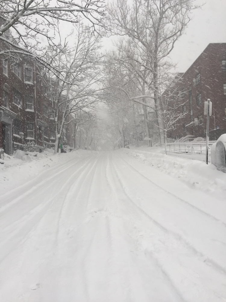
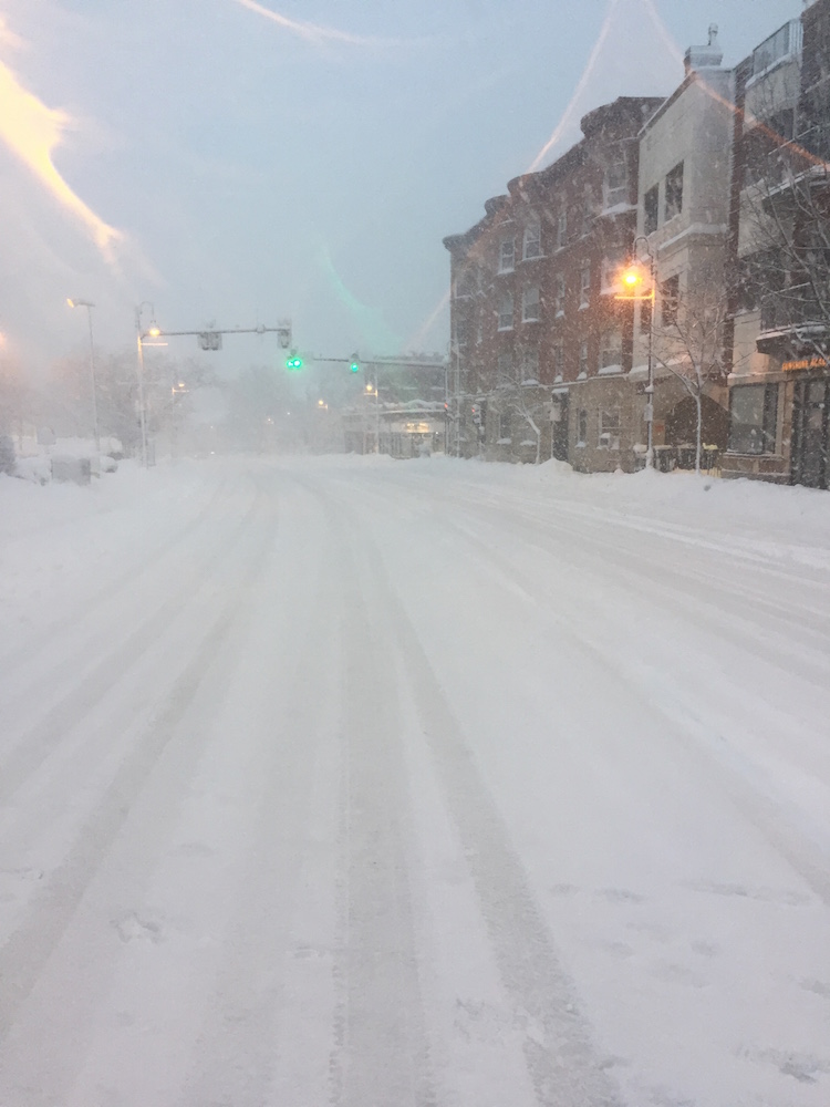
Just returned from a weenie walk around Coolidge Corner... AWT that band did not disappoint! Beautiful out there!
Judging from rate of accumulation of freshly plowed pavement, that band reached rates 2" / hr. Amazingly fluffy snow, and notable lack of strong winds.
I think we and Boston metro area end up 15-18" when all is said and done.


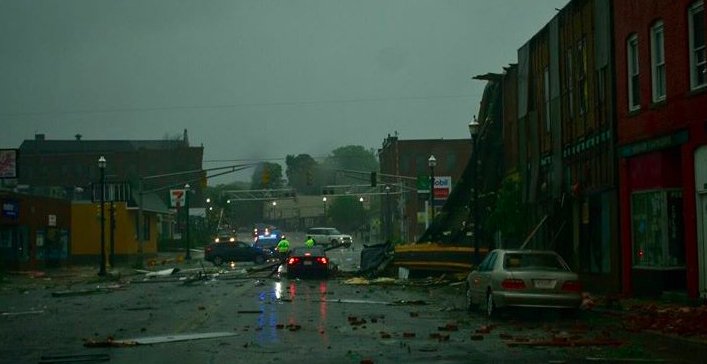
Nov 15/16 regionwide event
in New England
Posted
18z vs. 12z RGEM maybe a hair faster bringing in flip to interior SNE by 5z-6z... maybe noise... pretty much similar significant thump beforehand