Disc
-
Posts
4,052 -
Joined
-
Last visited
Content Type
Profiles
Blogs
Forums
American Weather
Media Demo
Store
Gallery
Everything posted by Disc
-
Easy +SN for a while now.
- 553 replies
-
- 21
-

-

-

The Jan 31 Potential: Stormtracker Failure or 'Tracker Trouncing
Disc replied to stormtracker's topic in Mid Atlantic
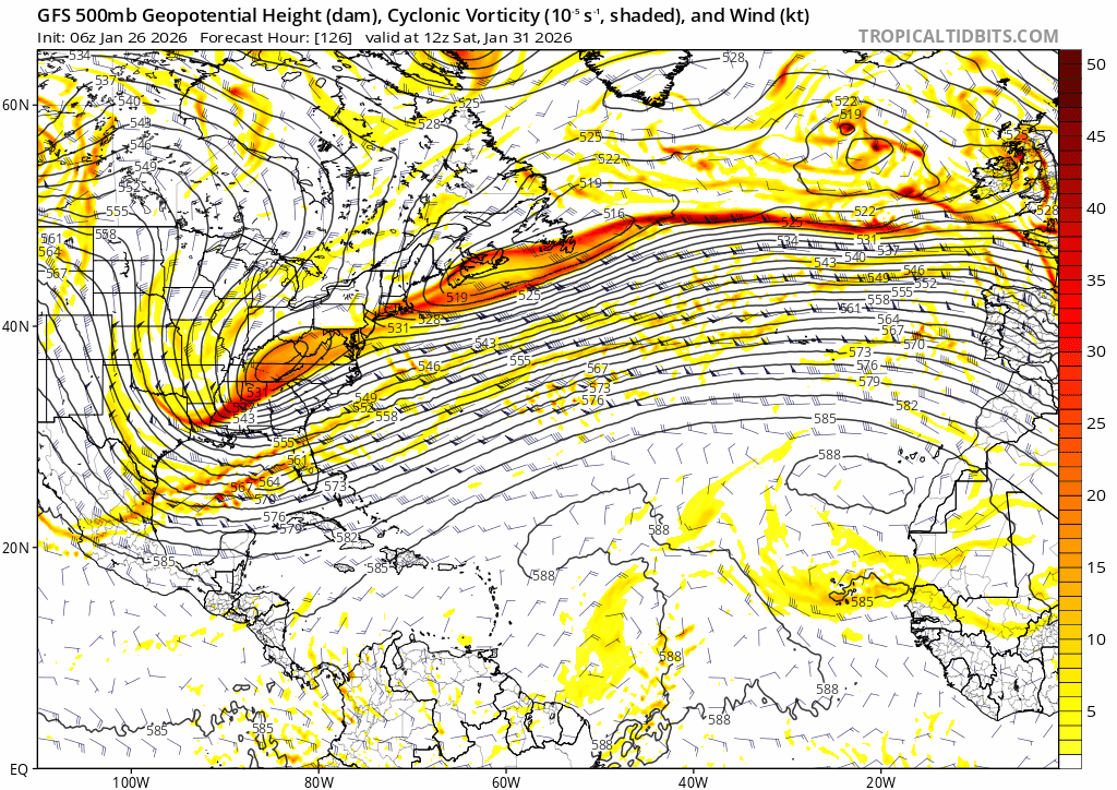
6z with the goods again, but still a C VA special. It's locked in..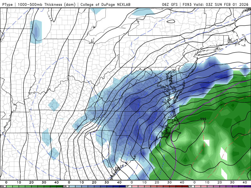
-
The Jan 31 Potential: Stormtracker Failure or 'Tracker Trouncing
Disc replied to stormtracker's topic in Mid Atlantic
As Gen Z would say, my hairline is already "chopped". -
The Jan 31 Potential: Stormtracker Failure or 'Tracker Trouncing
Disc replied to stormtracker's topic in Mid Atlantic
I don't have a choice! We're up trying to make a forecast based off these runs, pulling out what little hair we have left. I'll see everyone for the 6z GFS. -
The Jan 31 Potential: Stormtracker Failure or 'Tracker Trouncing
Disc replied to stormtracker's topic in Mid Atlantic
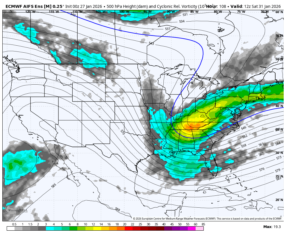
Still a steady trend west with the Euro-AI Ens.
-
The Jan 31 Potential: Stormtracker Failure or 'Tracker Trouncing
Disc replied to stormtracker's topic in Mid Atlantic
UKMET is nowhere close to the GFS. Gonna be mostly OTS. -
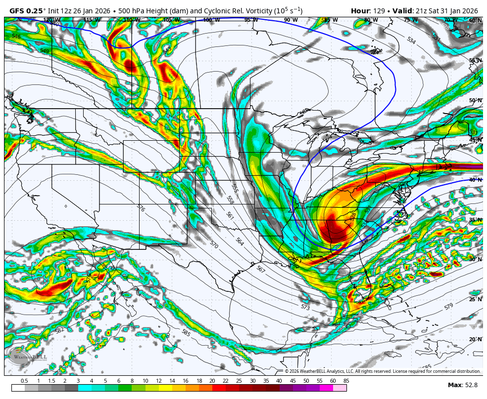
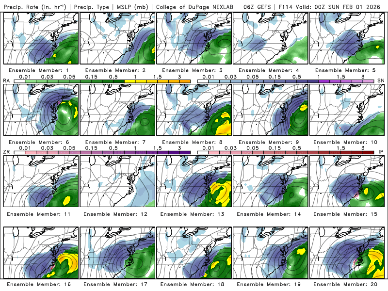
Some nukes showing up in the individuals on the 6z GEFS.
-
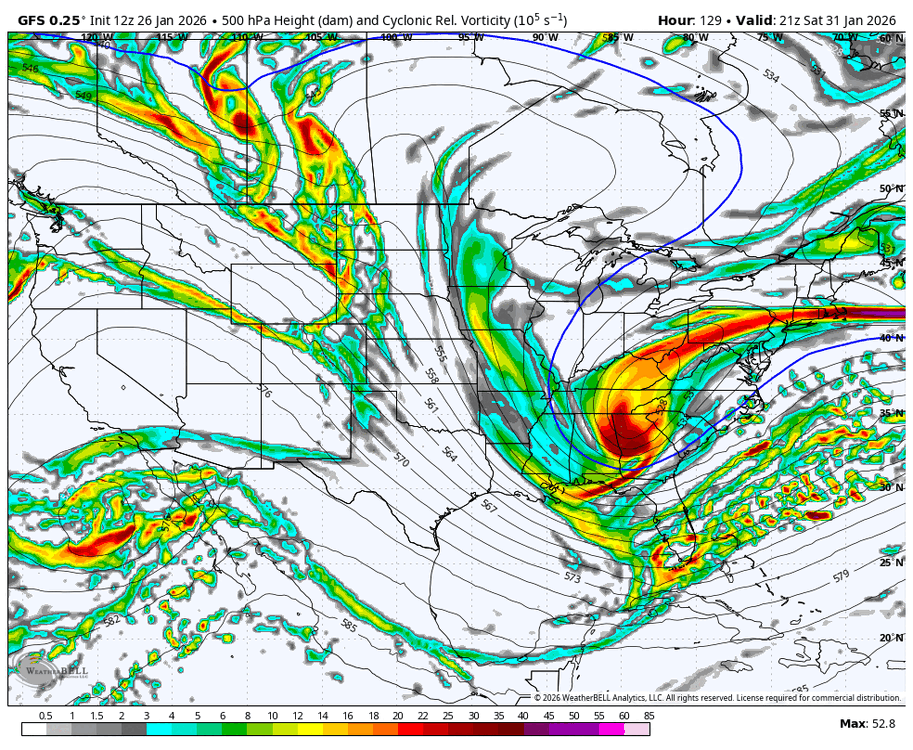
I like what I am seeing over Nova Scotia as well. A lot less interaction with that piece. You can see it trending east with each run. This is what we want to see.

-
Good morning, Mid-Atlantic weenies.
-
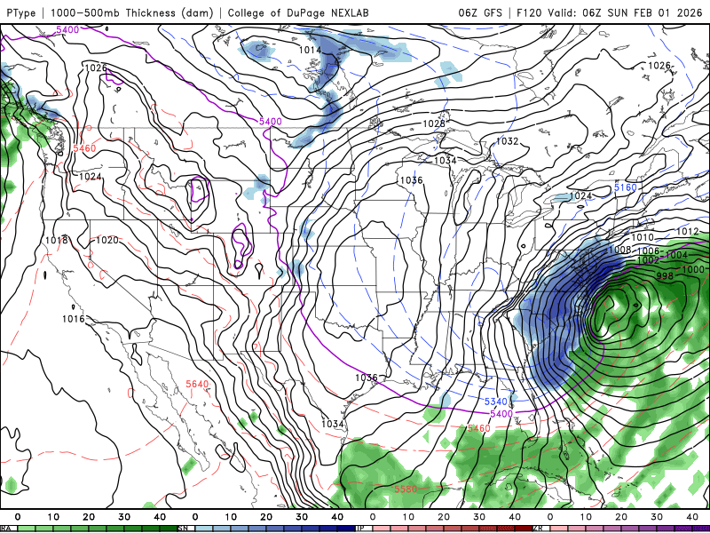
Major improvements on the 6z GFS. Much more favorable NS progression, going neutral tilt much faster and slightly west.
-
GFS AI Ens continues its trend NW.

-
This is an incredibly delicate setup. So many little pieces moving around and we'll continue to see some wild swings.
-
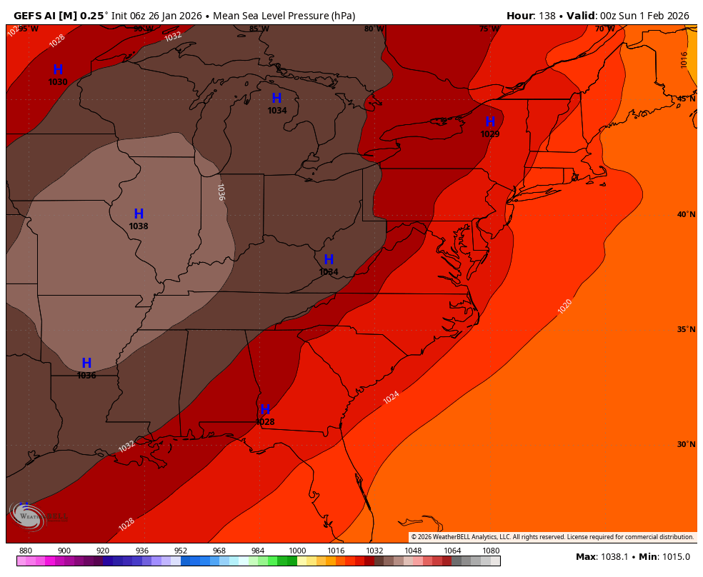
Well it's not gonna get there yet, but 5H continues to improve.
-
Blacksburg VA
-
Can confirm I have a ridiculous amount of sleet. I am hoping the 3k is correct instead of the HRRR. The 3k keeps me as sleet through this afternoon, HRRR goes to freezing rain here by sunrise. One of those scenarios will be very bad. Temp still falling... down a couple ticks to 7.2F
-
This has gotta be some of the heaviest sleet I've ever seen. Temp is now down to 7F. Insanity!
-
Southern Crippler - Get well soon Jimbo Storm Obs
Disc replied to BooneWX's topic in Southeastern States
It's hammering sleet in Blacksburg.. 8.3F too. -
Based off what I can tell, the transition line is from about Lewisburg, WV, east to Lynchburg, VA and then drops SE towards Emporia. This seems to line up fairly well with guidance so far.
-
Raging sleet storm now. Down to 8.8F. This was heading into work. Fingers crossed we don't flop to ZR, or getting home might be an issue in the morning.
-
Just measured 2" on the snowboard. Down to 10.8F. Still all snow. Blacksburg VA
-
14.0F - Blacksburg, VA. All snow.
-
Keep in mind, these maps include sleet. It may start as brief snow, but predominant p-type in NC will likely be sleet.
-
-
We'll be working on it tonight and these should go down, especially along and south of the VA/NC border.
-
Once they start cutting, it's hard to bring 'em back is my rule of thumb. Trend so far hasn't been great tonight.