dendrite
-
Posts
73,495 -
Joined
Content Type
Profiles
Blogs
Forums
American Weather
Media Demo
Store
Gallery
Everything posted by dendrite
-

Friday February 6 FROPA / WINDEX small event
dendrite replied to HoarfrostHubb's topic in New England
Some of the models almost have a little meso high over PWM with enhanced low level convergence in that BOS-LWM-MHT zone with a more easterly component off the GOM. -
Friday February 6 FROPA / WINDEX small event
dendrite replied to HoarfrostHubb's topic in New England

-
It’s been quite a winter for the fakiators
-
Free reign to post about warmth when he leaves 2/13
-
Good winter for the radiators. Not that impressive min wise on the hills. If I finish with a min of -6 that will be one of the least extreme winter mins for me. Definitely a yore feel with the bottom falling out in the pits on a nightly basis though.
-
Min 8.9° Lots of wood stove smoke in the air
-
IIRC there were a few unbelievable OP runs showing a day or two supporting 70° and then the models obviously backed off from that. But then there was the windshield wiper effect where some didn’t think we were going above the 30s and it ended up being a week well into the 40s.
-
I remember reading about the Jan thaw getting muted too and it ended up +10 over a 10 day stretch. But sure, the cold has won out in the extended more often than not for the first 2/3 of winter. But I don’t think many have been predicting toucans and stunned iguanas. It’s more just a relaxation of the pattern with more snow/ptype threats and more fair weather days above freezing given the latitude gain of the temp gradient.
-
Very little wind up here. Glad we here.
-
Another pleasant sunny day. High 29°
-
Half of those are very Steiny here for a d15 QPF total
-
New episode this Sunday

-
Gold members?

-
Always? No. I try to, but sometimes I go 8 or 12. I will extend it sometimes so that I can clear at midnight to get a daily snow and liquid amount.
-
I did the math out for the sites already
-
Clearing every 6hrs is a nice interval so that places that get a lot of high ratio snow…like upslope areas and LES..don’t get penalized by compaction. Take BUF in late Dec 2001. 24th starting 6z depth 0” New snow 20.5” ending 5z depth 18” (+18”) 25th 5z depth 18” new snow 4.9” ending 0z depth 18” (0”) 26th 12z depth 18” new snow 8.0” 6z depth 25” (+7”) 27th 6z depth 25” new snow 21.9” 6z depth 33” (+8”) 28th 6z depth 33” new snow 26.2” 20z depth 44” (+11”) 0z depth 41” (or +8”) 12z depth 38” (or +5”) That’s 48.1” in the final 2 days with only 13” to 19” depth gain depending on when you caught the last depth measurement. Imagine it snowing hard enough to produce 26” new with 6 hourly clearings, but it only goes in the books as 5” the next morning because of compaction?
-
Friday February 6 FROPA / WINDEX small event
dendrite replied to HoarfrostHubb's topic in New England
Chilly Sunday there. Probably a +7/-7 type day here. -
-
They did that a lot back then with the major storms. I mean, can anyone recall big CAA winds after a damaging LLJ on the front end?
-
DragGW in 93 SEVERE WEATHER STATEMENT-BLIZZARD WARNING NATIONAL WEATHER SERVICE BOSTON MA 430 PM EST SAT MAR 13 1993 ...AN AWESOME STORM...WITH THE POWER OF A HURRICANE HAS EMBRACED NEW ENGLAND... AT 5PM...THE WHOLE MBTA TRANSPORTATION SYSTEM WILL SHUT DOWN. THE TOBIN BRIDGE CROSSING INTO BOSTON WILL SHUT DOWN AT 530 PM. LOGAN AIRPORT IN BOSTON WAS OFFICIALLY CLOSED WITH WIND GUSTS OF 70 MPH AT 4 PM IN BLIZZARD CONDITIONS. THE MASSACHUSETTS TURNPIKE WAS A DRIVE AT YOUR OWN RISK VENTURE...WITH TOLLS NOT BEING COLLECTED. PROPANE TANKERS AND TANDEM TRAILER TRUCKS WERE BANNED FROM THE MASS PIKE. THUNDER AND NEAR ZERO VISIBILITY WILL AFFECT MUCH OF SOUTHERN NEW ENGLAND NORTH OF INTERSTATE 95 THROUGH 6 OR 7 PM. MOST OF INTERIOR NEW ENGLAND WILL HAVE 12 TO 18 INCHES BY 8 PM WITH A FEW LOCATIONS FROM THE MERRIMACK VALLEY THROUGH THE WORCESTER HILLS AND THE NORTHWEST HILLS OF CONNECTICUT REACHING 2 FEET BY MIDNIGHT. THE EXCEPTION IS THE SOUTH COAST FROM NEAR PROVIDENCE TO CAPE COD WHERE ONLY 4 TO 8 INCHES WILL OCCUR. DRIFTS TO 10 FEET ARE POSSIBLE IN THE HIGHER TERRAIN LOCATIONS OF CENTRAL AND WESTERN MASSACHUSETTS AND THE NORTHWEST HILLS OF CONNECTICUT. THE BLIZZARD WAS IN A TRANSITION TO INTENSE SLEET ALONG THE SOUTH COAST OF CONNECTICUT TO JUST SOUTH OF PROVIDENCE TO CAPE COD. IT WAS RAINING AT NANTUCKET ISLAND. THE TRANSITION TO SLEET SHOULD REACH BOSTON BETWEEN 8 AND 9 PM. AT 4 PM...8 TO 16 INCHES OF SNOW HAD FALLEN ON THE METROPOLIS FROM WASHINGTON DC THROUGH PHILADELPHIA AND NEW YORK CITY....WITH 5 TO 11 INCHES HAVING OCCURRED IN CONNECTICUT...MASSACHUSETTS AND RHODE ISLAND. SNOW WAS ACCUMULATING AT THE RATE OF 2 TO 3 INCHES AN HOUR OVER THE INTERIOR OF SOUTHERN NEW ENGLAND. THE STRONG WINDS WILL BRING DOWN TREES WHICH WILL KNOCK OUT POWER. THE BLIZZARD WILL ABATE TOWARD TONIGHT EXCEPT POSSIBLY IN THE FAR WEST PORTION OF MASSACHUSETTS AND THE NORTHWEST HILLS OF CONNECTICUT. HOWEVER...PLEASE DONT BE LULLED INTO THINKING THIS STORM IS OVER. DURING THE LULL....YOUR BAROMETER WILL READ CLOSE TO 28.4 INCHES...NEARLY A RECORD IN SOME PLACES. TREAT THIS LIKE A HURRICANE...THE WIND ON THE BACK SIDE OF THIS STORM SOMETIME SUNDAY MORNING MAY BE MORE VIOLENT THAN THAT WHICH OCCURS THIS AFTERNOON. A FEW GUSTS TO 80 MPH ARE POSSIBLE IN SOUTHERN NEW ENGLAND ANYTIME FROM LATE THIS AFTERNOON INTO SUNDAY AFTERNOON. ...............ROADS WILL BECOME COMPLETELY IMPASSABLE........... ..........UNLESS ITS AN EMERGENCY...PLEASE...PLEASE DO NOT TRAVEL...IT COULD BE A FATAL MISTAKE... THE STORM AT 4 PM WAS LOCATED NEAR PATUXENT RIVER NAVAL AIR STATION ON THE CHESAPEAKE BAY...NEAR ANNAPOLIS MARYLAND WITH A CENTRAL PRESSURE OF 28.47 INCHES. IT IS PROJECTED TO PASS BETWEEN WORCESTER AND BOSTON AROUND 1 OR 2 AM SUNDAY. DRAG SEVERE WEATHER STATEMENT-BLIZZARD WARNING NATIONAL WEATHER SERVICE BOSTON MA 542 PM EST SAT MAR 13 1993 ...INTENSE BLIZZARD CONTINUES TO POUND THE BAY STATE... LOGAN AIRPORT IN BOSTON RECEIVED A WIND GUST TO 81 MPH AROUND 538 THIS AFTERNOON. ^ MOST OF INTERIOR SOUTHERN NEW ENGLAND WILL HAVE 12 TO 18 INCHES BY 8 PM WITH A FEW LOCATIONS FROM THE MERRIMACK VALLEY THROUGH THE WORCESTER HILLS AND THE NORTHWEST HILLS OF CONNECTICUT REACHING 2 FEET BY MIDNIGHT. THE EXCEPTION IS THE SOUTH COAST FROM NEAR PROVIDENCE TO CAPE COD WHERE ONLY 6 TO 10 INCHES WILL OCCUR. DRIFTS TO 10 FEET ARE POSSIBLE IN THE HIGHER TERRAIN LOCATIONS OF CENTRAL AND WESTERN MASSACHUSETTS AND THE NORTHWEST HILLS OF CONNECTICUT. DRIFTS IN EXCESS OF 5 FEET ARE BEING REPORTED IN THE GREATER BOSTON AREA. SNOW WAS ACCUMULATING AT THE RATE OF 2 TO 3 INCHES AN HOUR OVER THE INTERIOR OF SOUTHERN NEW ENGLAND. THE STRONG WINDS WILL BRING DOWN TREES WHICH WILL KNOCK OUT POWER. THE BLIZZARD WILL ABATE TONIGHT EXCEPT POSSIBLY IN THE FAR WEST PORTION OF MASSACHUSETTS AND THE NORTHWEST HILLS OF CONNECTICUT. HOWEVER...PLEASE DONT BE LULLED INTO THINKING THIS STORM IS OVER. DURING THE LULL....YOUR BAROMETER WILL READ CLOSE TO 28.4 INCHES...NEARLY A RECORD IN SOME PLACES. TREAT THIS LIKE A HURRICANE...THE WIND ON THE BACK SIDE OF THIS STORM SOMETIME SUNDAY MORNING MAY BE MORE VIOLENT THAN THAT WHICH OCCURS THIS AFTERNOON. A FEW GUSTS TO 80 MPH ARE POSSIBLE IN SOUTHERN NEW ENGLAND ANYTIME FROM LATE THIS AFTERNOON INTO SUNDAY AFTERNOON. ...............MOST ROADS ARE COMPLETELY IMPASSABLE........... ..........UNLESS ITS AN EXTREME EMERGENCY...PLEASE...PLEASE DO NOT TRAVEL...IT COULD BE A FATAL MISTAKE... AT 5 PM THE LOW WAS STILL LOCATED NEAR ANNAPOLIS MARYLAND...TAKING AIM ON SOUTHERN NEW ENGLAND. DRAG
-
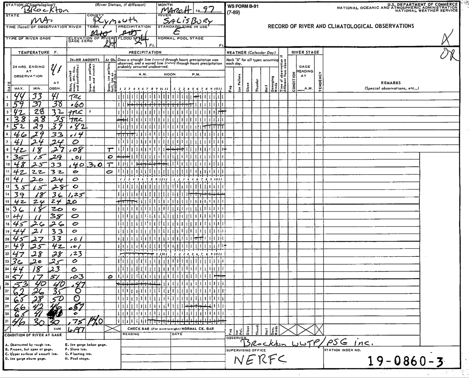
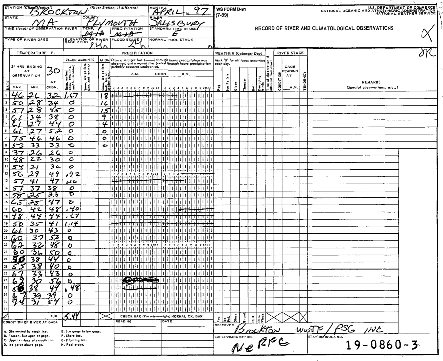
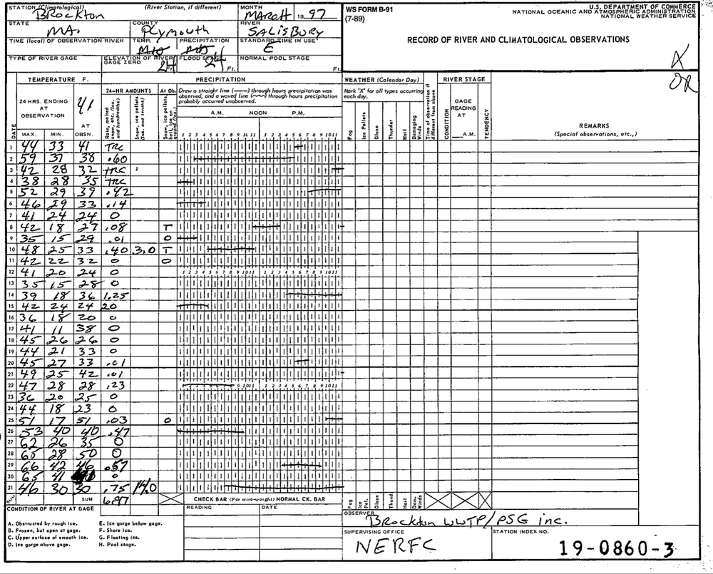
Here’s the original COOP forms if you want to see them for yourself. 14.0/0.75 on 3/31 but 0/1.67 on 4/1.

-
No one is breaking record low maxes on Saturday because of early midnight temps.

-
I’d toss Brockton. They had 14.0” listed in new snow on 3/31 but nothing after that. On the April form they had no new snow listed and only reported depth. The depth for 4/1 was 18”. They had 0” going into the storm. So there’s data that doesn’t jive.
-
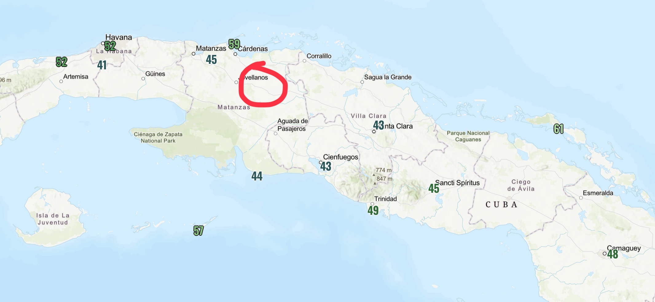
I suppose it’s possible…the more I read, apparently this place is a bit of a rad pit and has fell into the 30s multiple times in recent years. So my guess is that if this station is legit, it’s probably not very old and it probably is more common than you’d think to see 0C there.
-
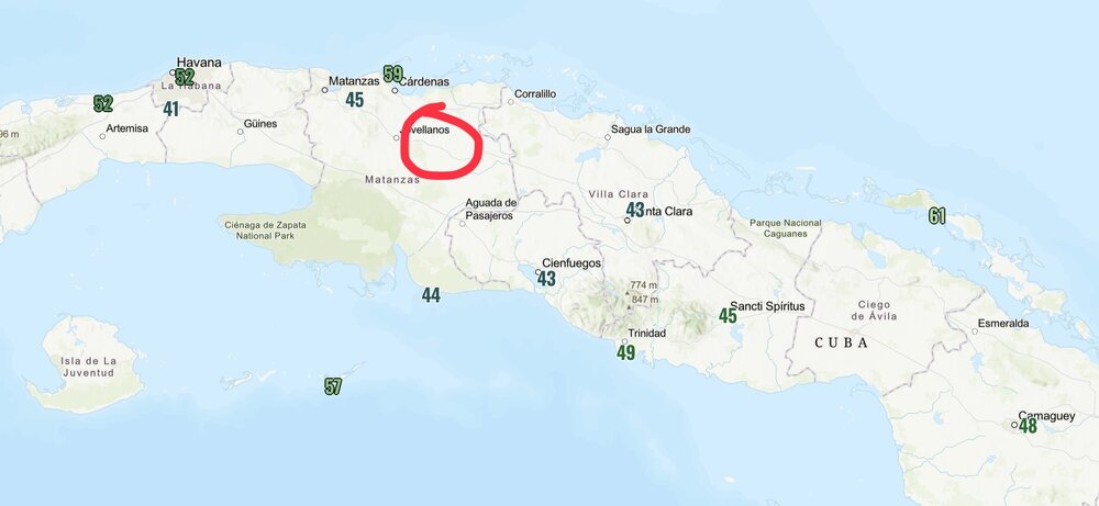
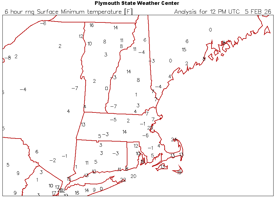
There’s a lot of junk reported obs here too. Here’s the mins from the morning of the 3rdand about where that location seems to be.