dendrite
-
Posts
74,744 -
Joined
Content Type
Profiles
Blogs
Forums
American Weather
Media Demo
Store
Gallery
Everything posted by dendrite
-
Would be funny if the euro finally came close to verifying next week considering how checked out I am
-
I think people lose track of when some of us are trolling and when we’re not. On the last page…I was goofing around and trolling. A couple weeks ago, when the worst of the cold lifted out, a few of us mentioned the worst of winter was behind us cold wise…I think Scoot may have thrown out a back broken too. But it was just in reference to the time of the year, the extended temp outlook for the rest Feb, and climo. But I don’t recall anyone saying snow season was broken.
-
Nope
-
No one was talking about snow.
-
North of pike
-
I live in C NH. I know my reality.
-
Maybe a 3rd straight week of no school for the kids?
-
Is that now? gwlh
-
ok i’m done hopefully it snows down there while it’s 70 and sunny up here.
-
Probably April
-
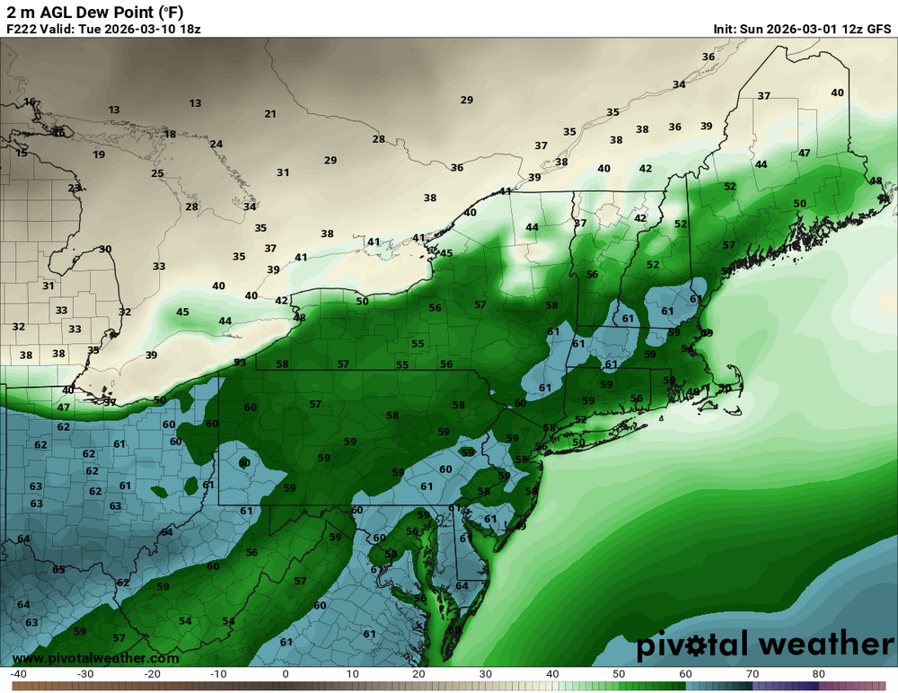
Dews
-
-
-

-
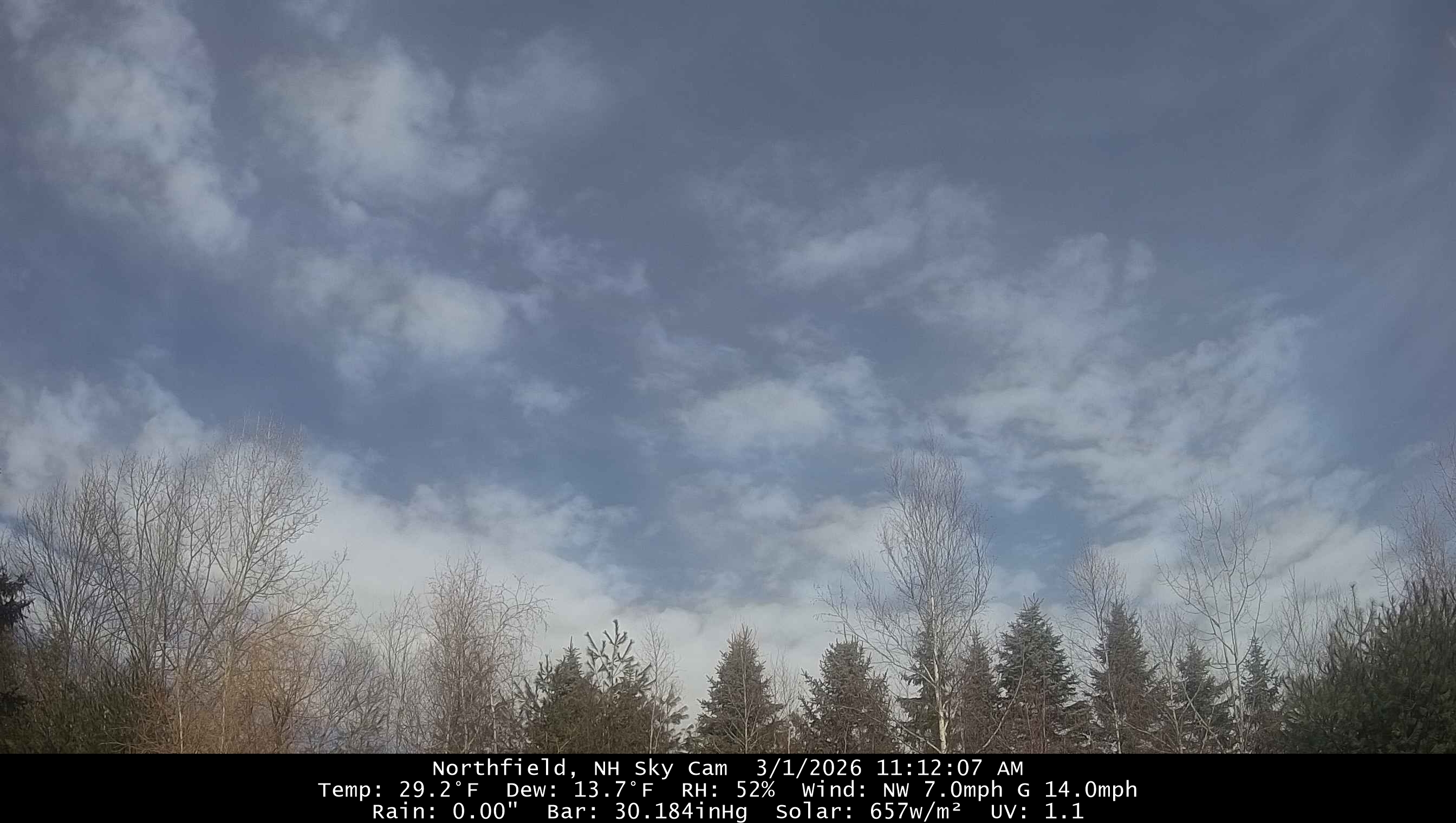
Ripping altocumulus
-
Huh
-
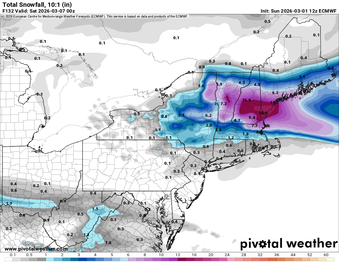
The theme goes on. 2 flakes and sun here while SNE gets another light refresher.
-
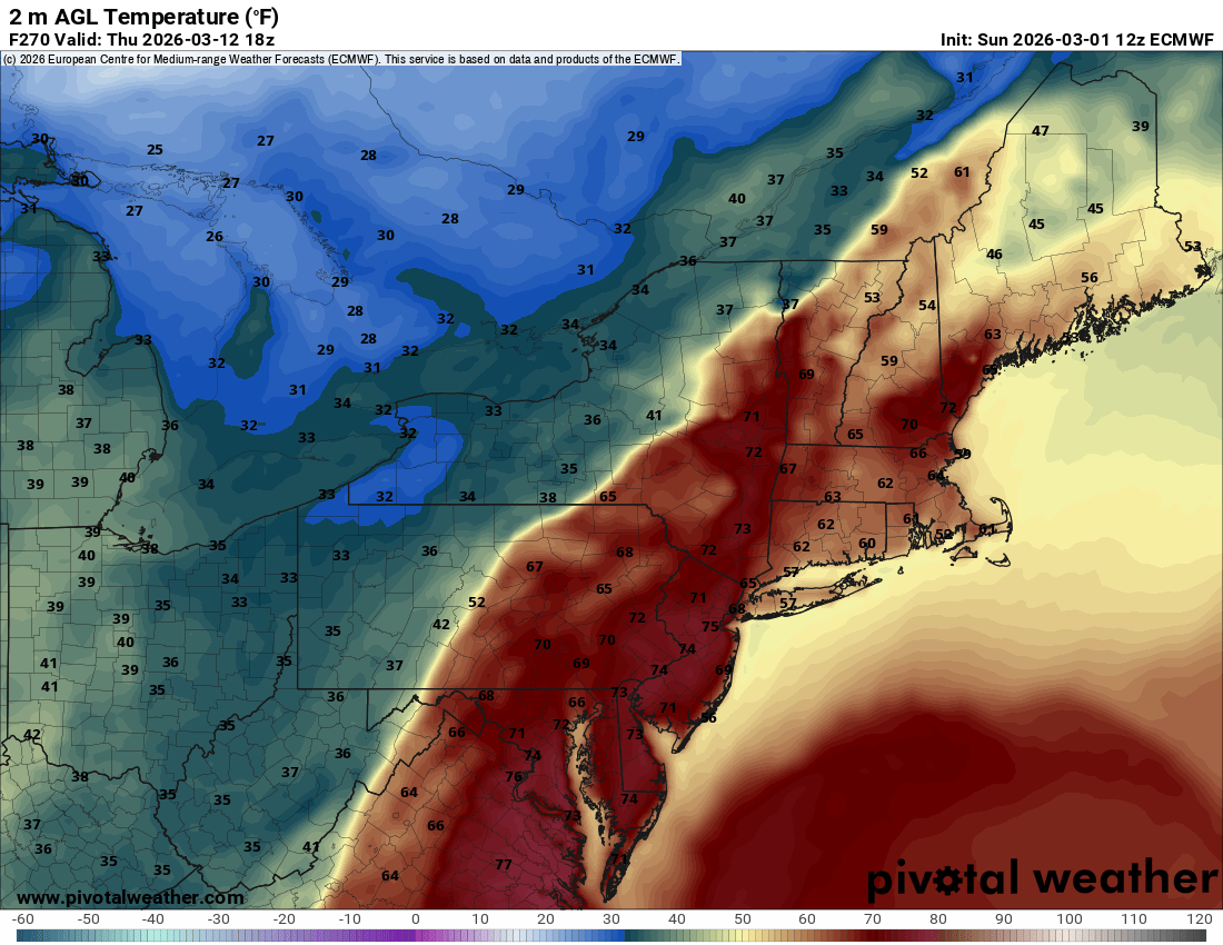
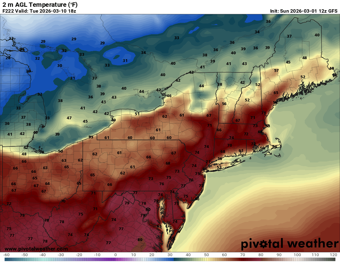
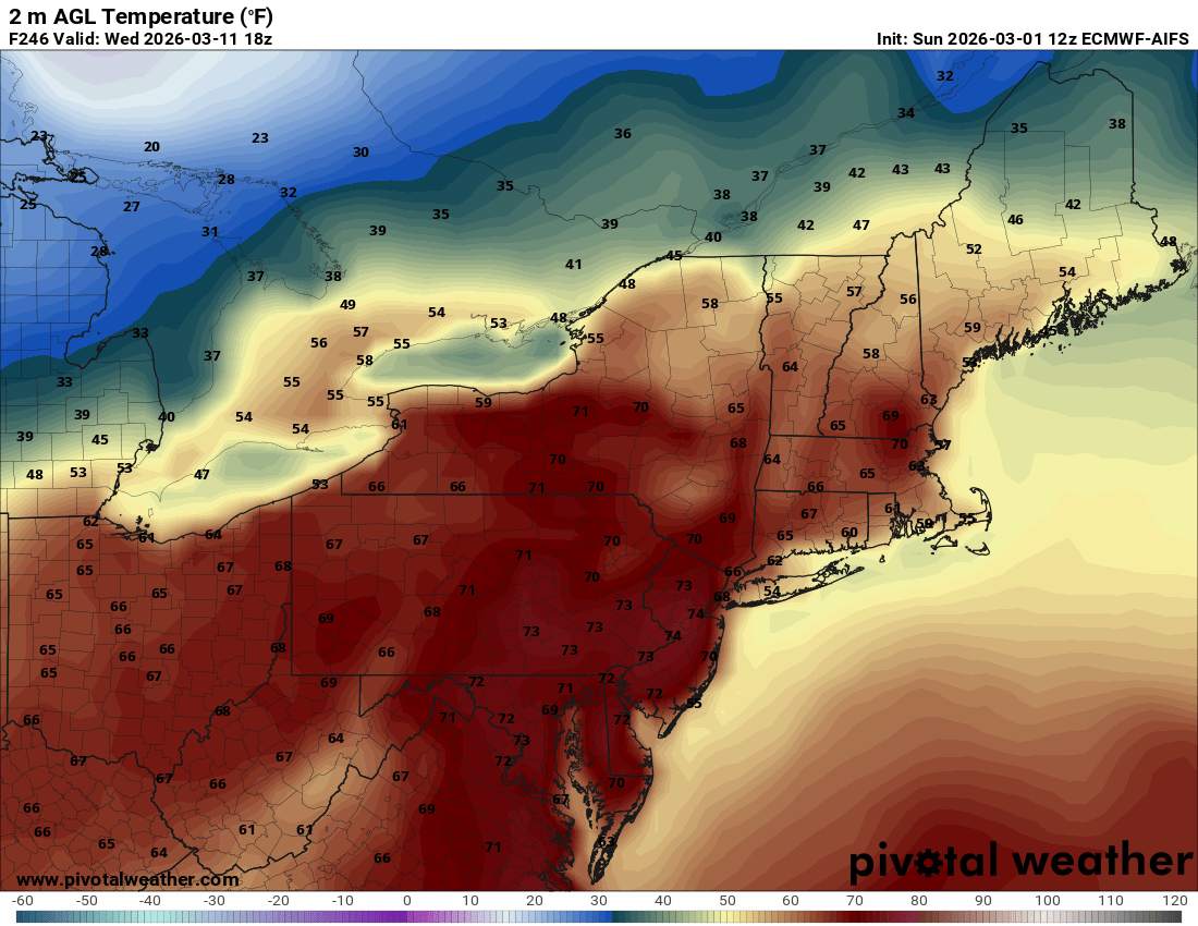
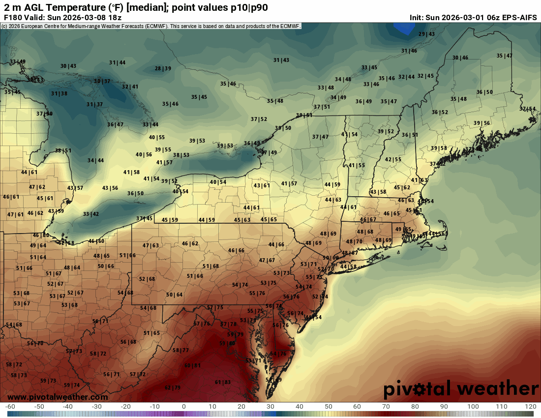
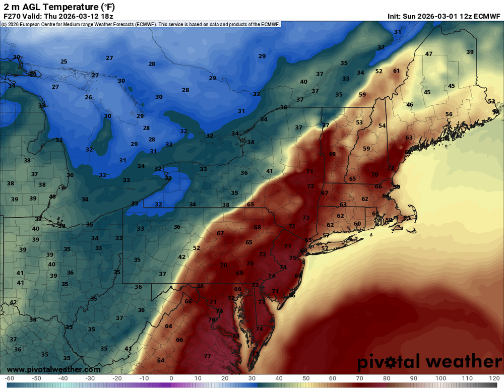
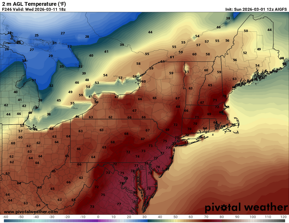
6z eps aifs are still really consistently warm though. Supposedly it’s the best guidance. We’ll see. Still a week out though…seems like we’ve been following it for weeks.

-
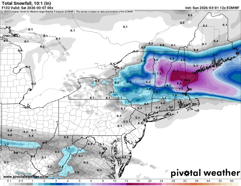
Like I said the other day…2012 isn’t happening. Even NNE was past mud season for that. That was a unicorn for mid March. It’s definitely going to get tainted at the surface at times even with the big anomalies aloft. I don’t think anyone expected 5+ days of 65-70+. I just think we’ll get a day or two in there where we can get more of a W component…especially SoP where the boundaries like to hang up in Wor county. Could be a dew day in there before the cold front comes through to end the warm stretch. That would eat some snow.
-
Yeah I’ll take those 40s and 50s…thanks
-
Looks like 2 or 3 here so far Flakes
-
You’re out on Tue PM?
-
There will still be wintry threats after the warm stretch…still some snow chances next week…especially up here. March gonna March. But we’re transitioning just like we do in September.