dendrite
-
Posts
74,765 -
Joined
Content Type
Profiles
Blogs
Forums
American Weather
Media Demo
Store
Gallery
Everything posted by dendrite
-

May 2024 Discussion - Welcome to Severe Season!!!!
dendrite replied to weatherwiz's topic in New England
My wife heard no thunder. That’s almost over my house. -
May 2024 Discussion - Welcome to Severe Season!!!!
dendrite replied to weatherwiz's topic in New England
Better chance of the Bruins still coming back to beat the Panthers. -
May 2024 Discussion - Welcome to Severe Season!!!!
dendrite replied to weatherwiz's topic in New England
Works for me -
May 2024 Discussion - Welcome to Severe Season!!!!
dendrite replied to weatherwiz's topic in New England
-
May 2024 Discussion - Welcome to Severe Season!!!!
dendrite replied to weatherwiz's topic in New England
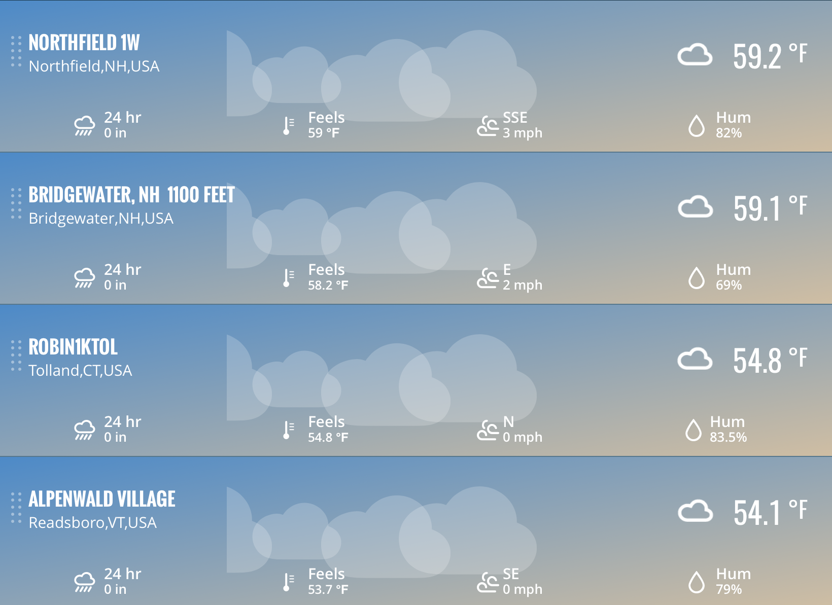
79.5/69 We dewy after the storms yesterday. -
14th Lawn and Garden Thread P Allen Smith 2024
dendrite replied to Damage In Tolland's topic in New England
I should post my lawn right now. It’s more like a meadow. -
May 2024 Discussion - Welcome to Severe Season!!!!
dendrite replied to weatherwiz's topic in New England
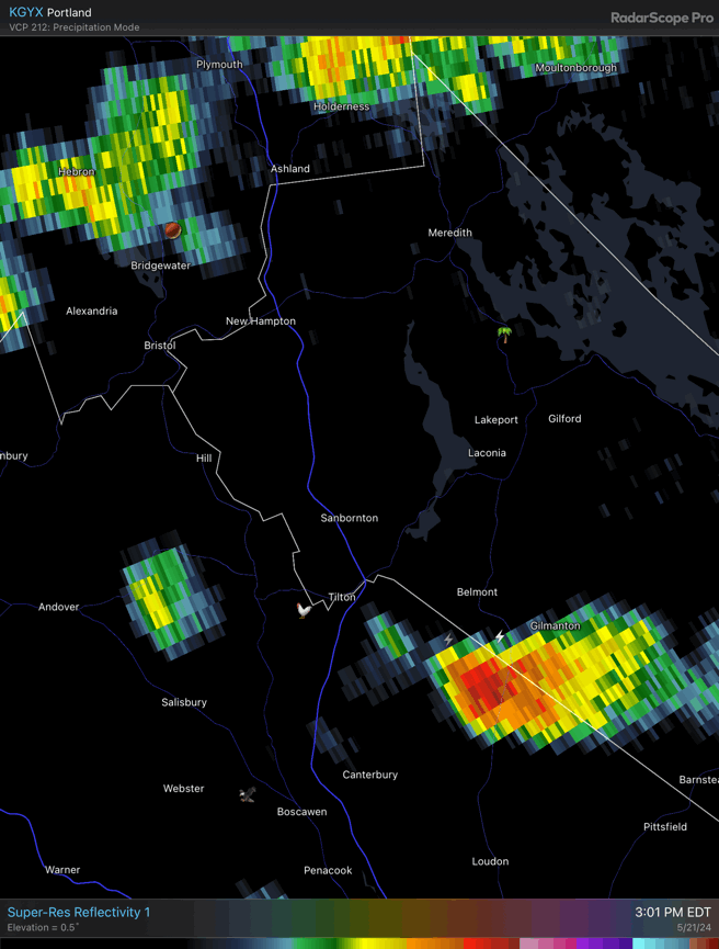
Dumps like a truck.
-
May 2024 Discussion - Welcome to Severe Season!!!!
dendrite replied to weatherwiz's topic in New England
TSRA Into the low 70s after a high of 86°. At least I don’t have to water tonight. -
May 2024 Discussion - Welcome to Severe Season!!!!
dendrite replied to weatherwiz's topic in New England
TAMU usually updates pretty fast. https://wdi.geos.tamu.edu -
May 2024 Discussion - Welcome to Severe Season!!!!
dendrite replied to weatherwiz's topic in New England
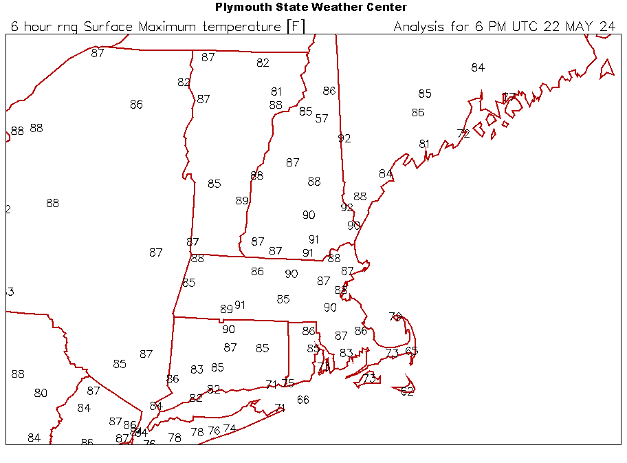
Tomorrow’s highs for the MOS munchers
-
May 2024 Discussion - Welcome to Severe Season!!!!
dendrite replied to weatherwiz's topic in New England
MAV is damn hot for tomorrow. CON 94, MHT 94, LEB 93, LCI 92 -
May 2024 Discussion - Welcome to Severe Season!!!!
dendrite replied to weatherwiz's topic in New England
80° -
May 2024 Discussion - Welcome to Severe Season!!!!
dendrite replied to weatherwiz's topic in New England
Feels like a paradigm shift this morning after that last bit of stratus vaporized. Like we opened the door to the warm weather the rest of the country has gotten to experience. -
Those Vermont bears are very angry. Mine always have a look of guilt after accidentally breaking my bird feeders.
-
May 2024 Discussion - Welcome to Severe Season!!!!
dendrite replied to weatherwiz's topic in New England
It’ll dissipate. The Monads are clear so it’s shallow stratus junk. -
May 2024 Discussion - Welcome to Severe Season!!!!
dendrite replied to weatherwiz's topic in New England
MOS for Tuesday…maybe another +1 day?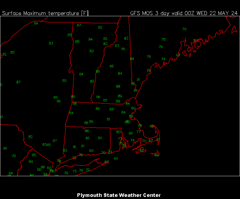
-
May 2024 Discussion - Welcome to Severe Season!!!!
dendrite replied to weatherwiz's topic in New England
How many “tomorrows” do we need to talk? -
May 2024 Discussion - Welcome to Severe Season!!!!
dendrite replied to weatherwiz's topic in New England
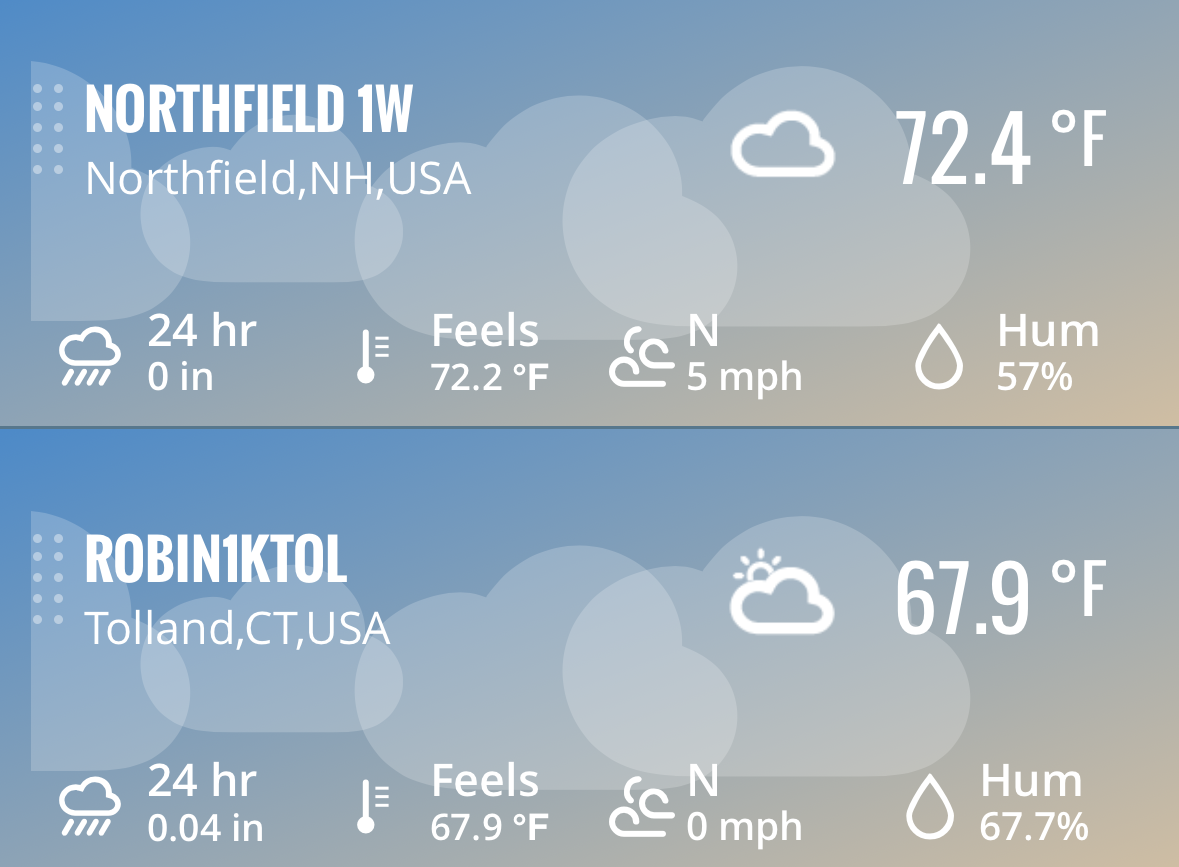
0.05” on the day. Got a lot done. Got up to only 64°, but it’s better than the high of 56.3° that some had. -
May 2024 Discussion - Welcome to Severe Season!!!!
dendrite replied to weatherwiz's topic in New England
He’s basically an overflow morgue for Mitch right now
-
May 2024 Discussion - Welcome to Severe Season!!!!
dendrite replied to weatherwiz's topic in New England
Yup. Good pawpaw grafting weather. They like sustained heat for callousing. I know what I’ll be doing tomorrow and Mon afternoon. -
May 2024 Discussion - Welcome to Severe Season!!!!
dendrite replied to weatherwiz's topic in New England
What happened to my washout? Euro and 3k are negligible here. -
May 2024 Discussion - Welcome to Severe Season!!!!
dendrite replied to weatherwiz's topic in New England
My ashes and pawpaws are just leafing out. I think the latest trees on my property are the northern catalpas. Those still look like stick season. -
May 2024 Discussion - Welcome to Severe Season!!!!
dendrite replied to weatherwiz's topic in New England
Let’s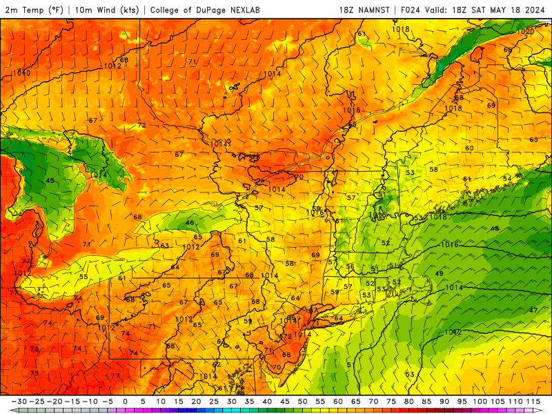
-
May 2024 Discussion - Welcome to Severe Season!!!!
dendrite replied to weatherwiz's topic in New England


-
May 2024 Discussion - Welcome to Severe Season!!!!
dendrite replied to weatherwiz's topic in New England
Gotta feel for those people in CT living so close to that nasty Atlantic.