dendrite
-
Posts
74,758 -
Joined
Content Type
Profiles
Blogs
Forums
American Weather
Media Demo
Store
Gallery
Everything posted by dendrite
-
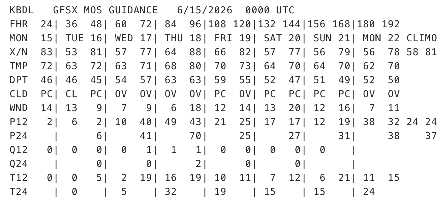
Extra log on the fire this week at BDL
-
Scoot is A90ATT now
-
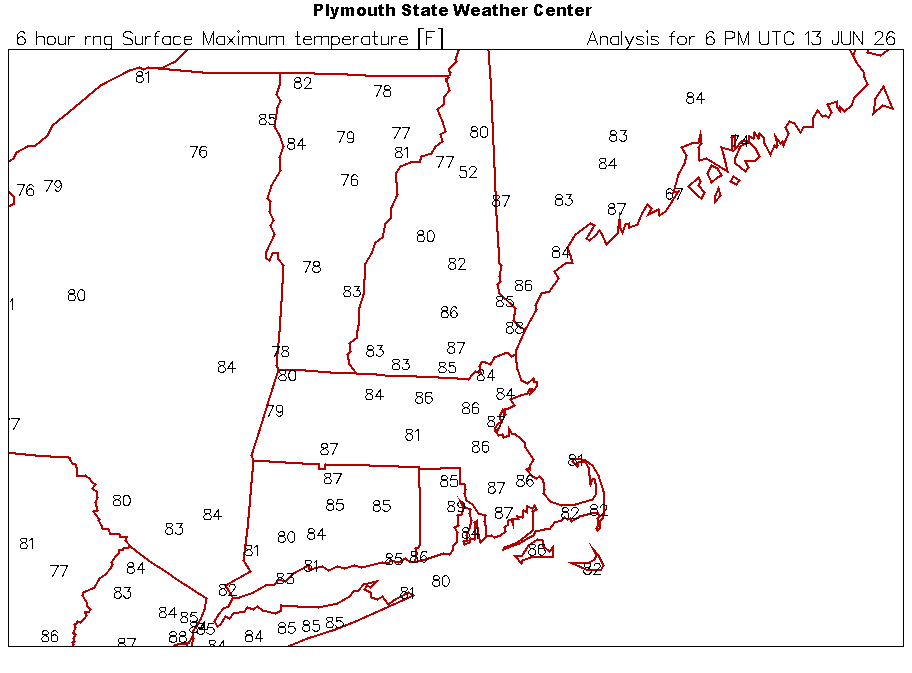
Only upper 70s and 80s this week. Frigid.
-
It blew right back up to your east too. I always hate that.
-
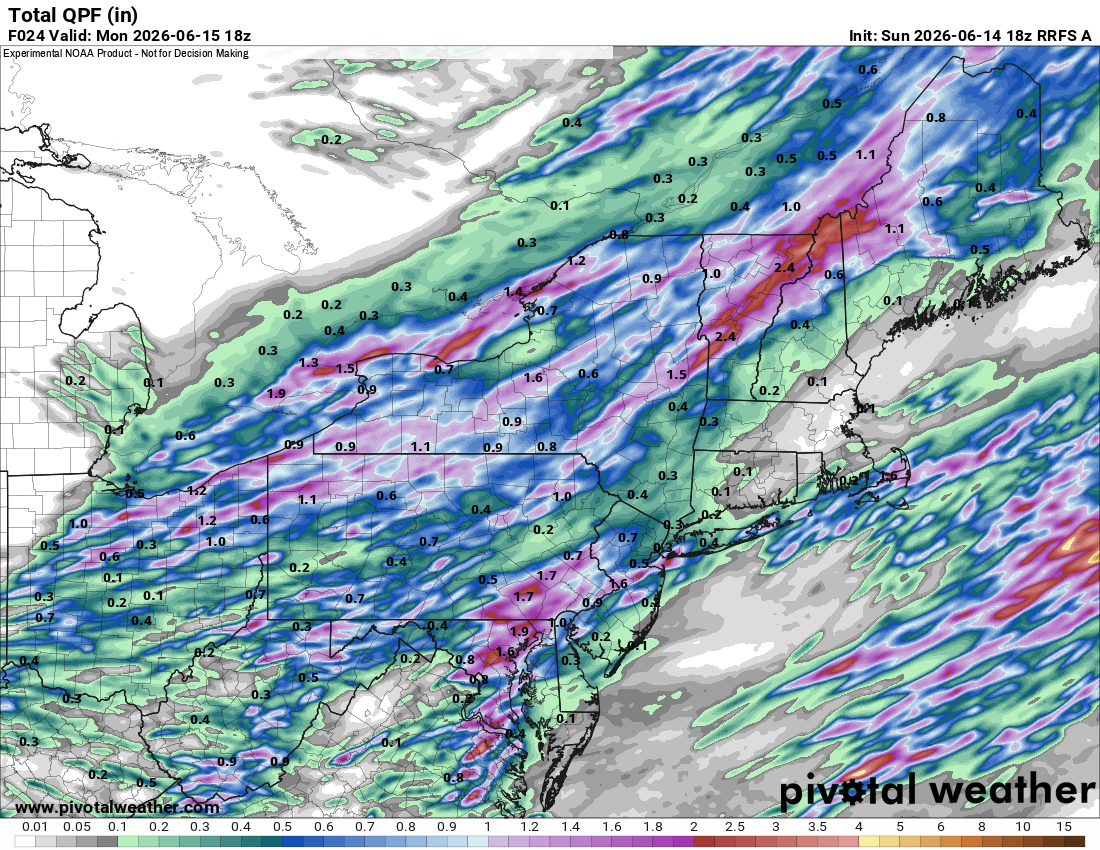
0.90”! We take! 62.8°
-
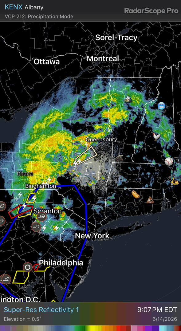
I just mean convective models are pretty dry CON-south yet radar looks fairly wet to our west.
-
Really excited to see this vaporize in real time

-

-
All I can say is that my life is pretty plain
-
Reefers
-
They get more snow on the FL gulf coast now than we get severe
-

-
-
81.7/63 Meh on storms. Can't wait for my 2 rumbles and 0.05" to pass through around midnight while 10 miles north gets 1"+.
-
Shoulda known better
-
Retired model
-
BOS with 90° today
-
What a day
-
Shannon Hoon pattern down there At least your grass is more alive than he is
-
62.0/56 Refreshing morning.
-
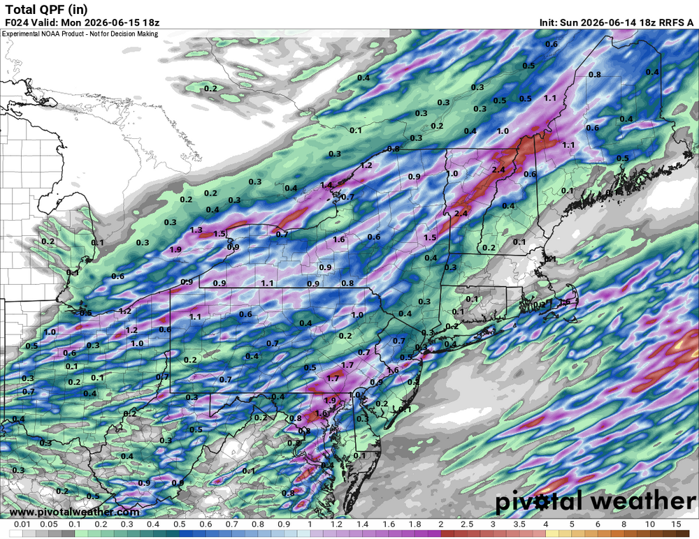
Same area of CT wins again
-
There's no CT west of the river?
-
Congrats W MA and CT again.
-
Warmest July on record at CON was +3.9F in 2024
-