djr5001
-
Posts
1,922 -
Joined
-
Last visited
About djr5001

- Birthday 12/10/1985
Recent Profile Visitors
3,327 profile views


-
When visibility is low and temp is 32-34 it will show up as freezing fog i believe
-
Regarding previous difference in maps discussion - I am wondering if the weatherbell map is 28km resolution since the maps I saw posted here had “gfs 0.25” and pivotal is 13km. That would be one way to explain output map differences.
-
I believe I had it explained to me a few years ago that they have discretion to issue warning because of the ice when forecasted to be more than a glaze.
-

Central PA - Winter 2020/2021 Part 2
djr5001 replied to MAG5035's topic in Upstate New York/Pennsylvania
I know I am several inches behind what others have reported in the area so this difference may be right. 4” today puts me at 20.9” for the month - I am missing some of my data so I don’t know what my season total is at the moment. I know there was at least one event (around the 10th maybe) that east shore & city had reports of an inch or two more than what I had as a heavy band just missed home to the south and east. -
Central PA - Winter 2020/2021 Part 2
djr5001 replied to MAG5035's topic in Upstate New York/Pennsylvania
Yep 3k NAM is showing pretty strong push of warm air around 700mb that would really knock down totals across MD/southeast PA as sleet -
Central PA - Jan 31 to Feb 2 Winter Storm
djr5001 replied to MAG5035's topic in Upstate New York/Pennsylvania
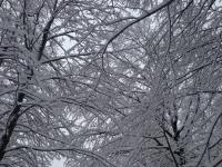
Getting bigger flakes at home now but still a good bit of sleet mixed in - I only have 3.25” total so far -
Central PA - Jan 31 to Feb 2 Winter Storm
djr5001 replied to MAG5035's topic in Upstate New York/Pennsylvania
It at least flipped back to snow - but have been on the edge of this so far so not dumping but more moderate here -
Central PA - Jan 31 to Feb 2 Winter Storm
djr5001 replied to MAG5035's topic in Upstate New York/Pennsylvania
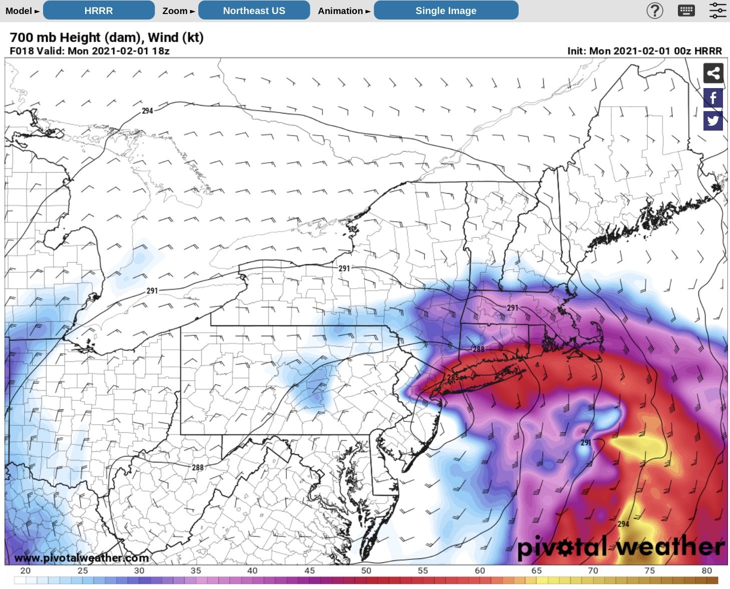
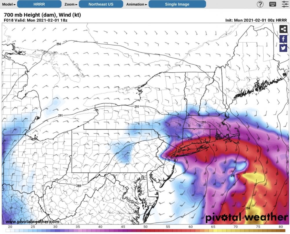
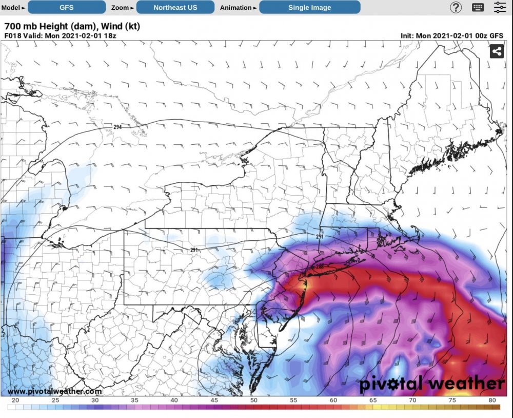
It is all about how far west the model runs are sending the upper level dynamics - the runs that are sending it west are the ones spitting out the higher numbers on the snow maps and the ones that are not look like this GFS map or the much lower HRRR solution. The upper level dry air showing up so well on current water vapor imagery already as well as the model runs worries me (as in need under banding for good snow or face dry slotting), but will have to see how things shake out tomorrow.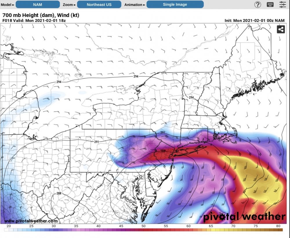
-
-