Interstate
-
Posts
5,731 -
Joined
-
Last visited
Content Type
Profiles
Blogs
Forums
American Weather
Media Demo
Store
Gallery
Everything posted by Interstate
-
Nothing made it east of central Baltimore County... I heard the rumbles of thunder... and got a few rain drops... Still no AC for me yet. Next Wednesday looks like when I will turn it on.
-
Still holding out
-
I am expecting to see all white on today's Drought Monitoring Report.
-
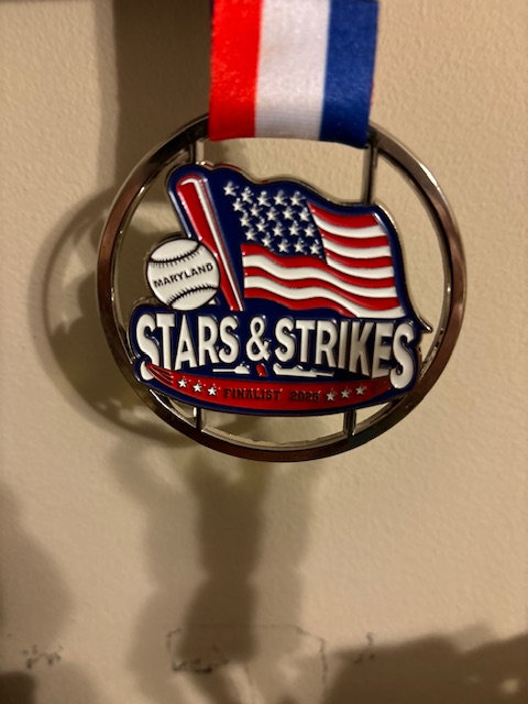
Got nothing but a few sprinkles from today’s storms. Thank god. Spent all morning raking baseball diamonds to play this afternoon.
-
Finished off with .71. Another .2 overnight
-
They fixed the wind advisory to tomorrow morning instead of Sunday
-
Everything is moving out quick. Going to be a bust here in 21057
-
Back to steady rain and no lightning or thunder. Yeah I was questioning the 30 hour wind advisory too.
-
Finally a good flash and crack of thunder. Storm in Baltimore is expanding east and north.
-
I have had 5 flashes and some thunder in the distance. That is about it.
-
Looks like a lot of the cells are weakling rapidly
-
Mostly just a steady rain here in 21057. Just some lightning every once and a while .17 so far
-
They look like they are dissipating as they move NE... Still looks like a couple of hours off until they hit the Metro areas.
-
huh?
-
12z HRRR has shifted the heaviest stuff to the north of the M/D line.
-
Yeah we have the same problem here in Baltimore county. They refuse to let us bring a tractor/4 wheeler on the fields to drag them. They have to line and set out the bases. We have a group of parents that will rake the entire diamond to get it playable. Oh and we are only allowed to use 2 bags of quick dry per field... any more than that, and the field is unplayable. It is just plain stupid. The tournament we were at in Elkridge this weekend... I was made aware that Howard county has the same issue as we do.
-
I am with you... This weekend is the final games of league play and conference tournament starts next weekend. Very little time to get in any makeup games. Our team is lucky that we do not have any makeup games... Some teams still have 3 or 4 makeup games and are already supposed to play 4 games this weekend.
-
Final total is 2.38 inches
-
2.18 as the last batch of rain moves out
-
1.95 right now and I think we can get to 2.00 when the little bit of rain that is left
-
186 inches for the year? That has to be wrong.
-
If only 5 months ago.
-
1.06 and still counting
-
Yeah. This is our first year really doing tournaments. We are also playing in the Harford County league. The last two years we only did one. This year we are doing 4. They have finished 2 in the first two. We are ending the end with a tournament at the beach. Clash of the Titans. Our first hotel tournament.
-
Travel. We were playing a tournament in Elkridge. Saturday we left the house at 11am and got home at 730pm. Sunday left the house at 10am and got home at 9pm. Made it to the championship game and lost 6-3. We had our chances to win the game. They played great. Total of 5 games and even knock off an undefeated team. I am very proud of these kids and how far they have come.