

mississaugasnow
-
Posts
1,250 -
Joined
-
Last visited
Content Type
Profiles
Blogs
Forums
American Weather
Media Demo
Store
Gallery
Posts posted by mississaugasnow
-
-
2 minutes ago, Ottawa Blizzard said:
It's snowing in north Scarborough now.
Ya, that’s what I was wondering where. Pearson is interesting but I believe it’s been snowing north of Hwy 7 most of the day? I know Kitchener switched at noon but brantford stayed rain all afternoon
-
2 minutes ago, BuffaloWeather said:
Interesting Pearson still reporting 35F and rain. But Toronto has large geographical area so changeover would probably start north of 407 and then make its way to lake. Island is still 36-37F and rain
-
4 minutes ago, BuffaloWeather said:
Changover has begun west of Toronto. I think we changeover 10-11 tonight across far west WNY.
I don’t believe it’s changed for the last few hours. Hopefully the front speeds up for you guys but the weather network doesn’t have snow in Hamilton until 9-10pm
-
8 minutes ago, 96blizz said:

Haha I’m ready for spring now.
-
1 minute ago, BuffaloWeather said:
Was over in Great Lakes forum and didn't realize how bad Detroit snowfall climo is. In the 2014-2015 year I had like 6 events over a foot in one winter at my place. KBUF had 2 in January alone and potential for a 3rd with this event.
Ya Toronto and Detroit are similar. Toronto got lucky two weeks but there’s a reason why 12-20” paralyzed the city and the clean up wasn’t even finished two weeks later haha
-
 3
3
-
-
Just now, rochesterdave said:
Luckily, we are mostly waiting on the second wave which has better dynamics and should be cold by then. I think a bust for most of us would still be 7-8”, as offered by NWS low end. Sorry it didn’t work out up there.
I think for SE MI and Ontario crowd is that we both got threaded by wave 1 and 2. 1 was north and 2 south. That’s why immediate border cities like Buffalo-Niagara need a bit more amped system. I think Rochester sits pretty good
-
1
-
-
The snow line looks about 50 miles further west from where most models had it at 5pm
-
Lol not to be that Debbie but I’d be careful with those numbers. Detroits storm evaporated. Transition events in GL region is tough and normally slower. A lot riding on that 2nd wave. Detroit snowed all day and saw 2”
-
1
-
-
1 minute ago, rochesterdave said:
Wow. GFS increased totals. That little hole over Rochester is some kinda cosmic retribution.
Haha this is some kind of revenge from CNY on S.Ontario.
Heavy rain now expected to last until midnight with 1-3cm or under 1” during the night and 2-5cm tomorrow. So storm will now go from 8-16” modelled a few days ago to 2-3”
-
20 minutes ago, Thinksnow18 said:
This system seems to be dwindling more and more. When it looked like 12-18” fir many it had more appeal. This is meh.
Ya, this storms a bust for southern Ontario. Hopefully you guys make out a bit better. Certainly nothing big though
-
7 minutes ago, Toronto4 said:
Looking like a 2-4” event for the GTA at most as per latest model trends. Rain is scheduled to change to snow sometime around 6-7 pm.
Besides the January 17, 2022 storm, the Nov 28, 2021 snowfall is the next best event of this winter. 4-5” of picturesque snow and temperatures remained at or just below freezing with minimal impact on roads.
The snowpack though will most likely not budge without massive heat and rain after this haha
-
1
-
-
1 minute ago, tim123 said:
Not much rain even gets into roc maybe couple tenths.
Lucky, its pouring rain here with upper 30s and dew points mid 30s.
Haven't seen a bust like this in some time. Good news is that this wasn't a typical snowstorm so the excitement never got up as high as it usually does.
-
 1
1
-
-
Just now, DeltaT13 said:
Critical thicknesses are all stacked up right on our doorstep but nothing really pushing it SE too fast. Going to be a long 9 hours or so of snowpack eating rain.....
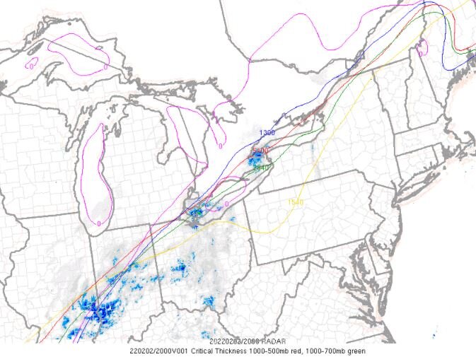
ya, its definitely slower than what we originally anticipated. How many hours you think left for Hamilton? My guess is around 5-7pm but originally I thought 2-4pm and I have to keep pushing it back
-
So judging from upstream Detroit and now Hamilton-Toronto it appears that the models were wrong with the cold air bleeding in. I think Buffalo-Niagara will struggle to reach 6" now as well. Most of that should come with the 2nd wave
-
Just now, Powerball said:
From what I can see, the HRRR shuts out everyone but you and DTW from the snow by early tomorrow morning, and even you/DTW are only fringe.
ya, I think this storm is a big time bust for Detroit and Toronto. Local weather station just mentioned max amount will most likely be 4".
-
1 hour ago, snowstormcanuck said:
-RA and 35. Just sitting back and waiting to see what transpires.
Global News dropping amounts. Not a giant surprise. Have you guys lost much to melt?
-
9 minutes ago, Stebo said:
We are going to struggle to get to 6" trust me. We are getting screwed. Solid storm sure but when you are forecasted double to triple. It's a complete rug pull.
Ya, these transition events are notoriously bad for amounts. Heavy rain still here and temperature is actually slowly climbing still.
-
7 minutes ago, vortmax said:
Seems maybe the NW solutions may win out...we shall see.
wow just saw Buffalo is 44F. I was skeptical when NWS said no snow until Thursday yet EC said change over by late afternoon/early evening.
Heavy rain here as well*
-
15 minutes ago, Thinksnow18 said:
Yes temps soared quite a bit more today than I thought they would. I was under the impression the front would be close to moving through by now and a slow bleed of cold air would ensue. Now it appears the cold air won’t be far behind once the front moves through.
Still rain over here in west Niagara. 38F wind still SW
-
11 minutes ago, nwohweather said:
I'm going full broken record here, but the models never really showed a full change over in Toledo until around 1-2. IMO everyone is jumping the gun here on lowering totals including the TV stations. Reports out of IL/IN are pretty convincing
I can see it but lowering the totals also makes sense. I think 12" will be the max for NW Ohio and SE MI. Too much qpf was lost to rain/wet snow. Buffalo mentioned ratios could be as low as 4-6:1 for a period of time.
-
1
-
-
Snow depth down to 4" with a temperature of 37F and light rain.
This will most likely become a big glacier since its absorbing the water and not melting as fast as I thought.
-
Snow depth down to 4" with a temperature of 37F and light rain.
This will most likely become a big glacier since its absorbing the water and not melting as fast as I thought.
-
7 minutes ago, Jonger said:
This is my concern.

Environment Canada has cancelled the weather advisories for Toronto. Its rare for them to do it before the event has really started but shows how little impact they expect this storm to have.
Original winter weather advisory was for 4-8" but now the forecast mentions more rain and max 2-4" for the event.
-
1
-
-
Just now, vortmax said:
So, they aren't going with the RGEM it seems.
nah, judging by the newest update from them. Rain all of today with only 2-4" tonight and tomorrow. Not often they cancel an advisory they issued before snow even falls. Shows how little impact they expect this storm to have on Toronto and the suburbs
-
1
-

Feb 2-4th Snowstorm- Observation Thread
in Upstate New York/Pennsylvania
Posted
Surprised EC has kept Winter storm warnings for Hamilton though. I guess either we see 20-30cm in the next 24 hours and I eat crow or we see the 5-15cm most Mets are now suggesting