Quasievil
-
Posts
1,031 -
Joined
-
Last visited
Content Type
Profiles
Blogs
Forums
American Weather
Media Demo
Store
Gallery
Everything posted by Quasievil
-
This is what we need it do at this range. Good news.
-
Agree. Ten Eyck is way better.
-
I've simply never seen it he used in any meaningful discussions. I'll be sure to refer to it more.
-
Concerning nonetheless.
-
Agree. I was surprised by how low they went. 12z EURO run is huge
-
Yeah, interesting his take here. Not having the ICON on our side, whatever, but the NAM still not onboard is concerning.
-
Honestly, I can buy into the conservative view here. You either A) go with what a progressive/la Nina 2021 pattern would produce or a major snowstorm.
-
Does give you an indication of how we could “fail” (northern stream stronger/more confluence, blah, blah) around here. Do think a middle ground between the CMC and GFS is a good call right now. Gotta wait for the models to stop shifting.
-
December 2021 Medium/Long Range Discussion Thread
Quasievil replied to North Balti Zen's topic in Mid Atlantic
From a cursory analysis this far out, grain of salt type stuff, L sitting over Great Lakes kills the storm on the CMC: 12Z GFS is further north so the storm can happen, although it's warm. That GLL needs to get the heck outta here for any chance.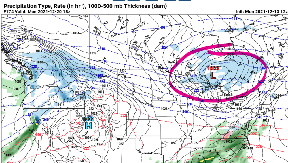
.thumb.png.d0061d76f1466012e9d65ec20ea1465f.png)
-
No, it's just rare.
-
Light mist. 28. Who would've thought rain is possible at 28 degrees? 2021!
-
I'm having trouble forgiving it for its "We're going to get 40" less than 12 hours before the event started". Must be tossed until proven otherwise... ha!
-
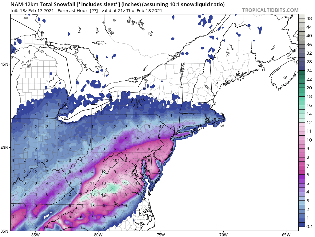
Def the standard issue NAM overdoing precip.
-
Exactly. By the time it starts sleeting, we've got a comfortable snow pack. Lock it up.
-
I'd say that's a NAM'ing.

-
Ha! Walk across the street and get snow, step back over and get sleet! Awesome! Let's hope it's wrong.
-
Unless you live right here! Oh wait, that's me! #sleet
-
Agree. Being conservative is the right approach here. We've simply failed too many times to expect anything different., EDIT: I would love to be wrong about this.
-
HA! Fair point. This year at least, the RGEM has been spitting out these ridiculous snow totals.
-
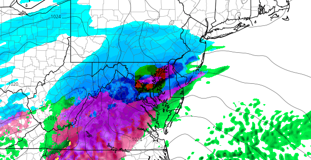
Exactly. CMC, EURO, all had a GL low.
-
Makes sense. Banding is typically a crap shoot so I like our chances.
-
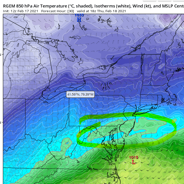
I really don't understand this warm layer on the RGEM. With 700 and 850's warm, this explains why the RGEM is holding back on totals. This will be the time it gets it right. Where my 40" from a few weeks ago?
-
It would be an unfortunate exclamation point to this season around these parts.
-
Brutal cutoff east of 95. Brutal. Let's hope for a more southern push tomorrow.
-
That's an incredible drop.


.png.2d7fe7b30ac0cac15a0e809f839b1a67.png)