

Dark Star
-
Posts
779 -
Joined
-
Last visited
Content Type
Profiles
Blogs
Forums
American Weather
Media Demo
Store
Gallery
Posts posted by Dark Star
-
-
22 hours ago, LibertyBell said:
I dont think it works that way. I notice the companies adjust their costs so if the winter is warmer they charge more per unit to make up the difference.
Yeah, they are guaranteed to cover their base costs...
-
 1
1
-
-
55 minutes ago, bluewave said:
Each new El Niño boosts the temperatures to a higher baseline. The 09-10 El Niño marked the beginning of a much warmer summer pattern which continues to this day. The 15-16 El Niño coincided with a shift to much warmer winters. The winter warming shift was of a higher magnitude than we have seen relative to the previous means than the summers. Now the global temperature jump with the 23-24 El Niño was even higher than the 15-16 super El Niño even though it wasn’t as strong. So it will be interesting to see what happens to our temperatures and weather patterns in coming years at this even higher temperature baseline.
Is this "what came first, the chicken or the egg?" I would thing the increase in temperatures is driving the el Nino to become warmer each year. The El nino just distributes (or concentrates) the wealth? Because if the El Nino is actually causing the increase in warmth and not as much the greenhouse gases, do we have to re-assess?
-
 2
2
-
-
1 hour ago, psv88 said:
It has been a decade since we’ve had a cold winter. Feels like ancient history. Nina, Nino, doesnt matter. The super nino in 2016 may have changed the climate for good
Not sure if I ever heard that about the 2016 el nino. Is that possible that a previous "system" can have that kind of impact?
-
32 minutes ago, Dark Star said:
I just caught a bit of something that Jeff Berradelli posted about potential upwelling cooling the ocean's surface. But wouldn't that eventually just overall heat the entire ocean column? Wouldn't the surface heat just get transferred deeper into the oceans? Asking for a friend...
Not sure if I can digest the study in this link concerning the oceans absorbing atmospheric heat...
-
1
-
-
3 hours ago, LibertyBell said:
It makes a lot of sense and here's another caution flag and this is for those who think nature will balance everything out on its own.... think of what it will take to "recalibrate" and what kind of effects that recalibration will have on us as a species.
I just caught a bit of something that Jeff Berradelli posted about potential upwelling cooling the ocean's surface. But wouldn't that eventually just overall heat the entire ocean column? Wouldn't the surface heat just get transferred deeper into the oceans? Asking for a friend...
-
1
-
-
9 hours ago, RU848789 said:
Deep winter still here in Metuchen. Have had 2+" otg here since last Tuesday (10 days), which is nice. 24.6" on the season, which is more than anyone on the entire NE corridor from VA to Boston - not sure that's ever happened for me in my 30 years here, as we've gotten quite lucky this winter, especially with the amazing 11.25" on Saturday, which, in retrospect, is, I think, the most snow I've ever had over a 5 hour period, as it was just pouring with 4"/hr over one 30 minute period. Top 5 all-time storm for me because of the sustained heavy snow and the huge overperformance relative to forecasts.

NOTHING left here in Garwood (cental Union County). Only piles left from shoveling. Anything that gone sun (12") melted by Tuesday. Considering we were near normal temperature wise, and I don't consider mid February to be a bad "sun angle" yet...
-
1 hour ago, jm1220 said:
The snow compressed a lot after it first fell, then the daily melt/refreeze makes it pretty much bulletproof. Lots of water in that snow as well. Helps preserve it well.
12" here in Jersey melted in less than a week.
-
5 hours ago, jm1220 said:
We can make a lot happen with even marginal conditions-the storm a week ago was a setup that most would say isn’t ideal for NYC and it was still a widespread warning event for most. The Sat storm came in and was at least an advisory event everywhere. In Jan we did have the 2 minor events. I remember that as lousy as Winter 18-19 was, we still did have a good March period. It’s just a matter of setting up a good enough pattern for even a few days to get the pieces together for a MECS. Too bad that couldn’t happen this year (or is very unlikely to), the background state and especially Pacific are just too hostile.
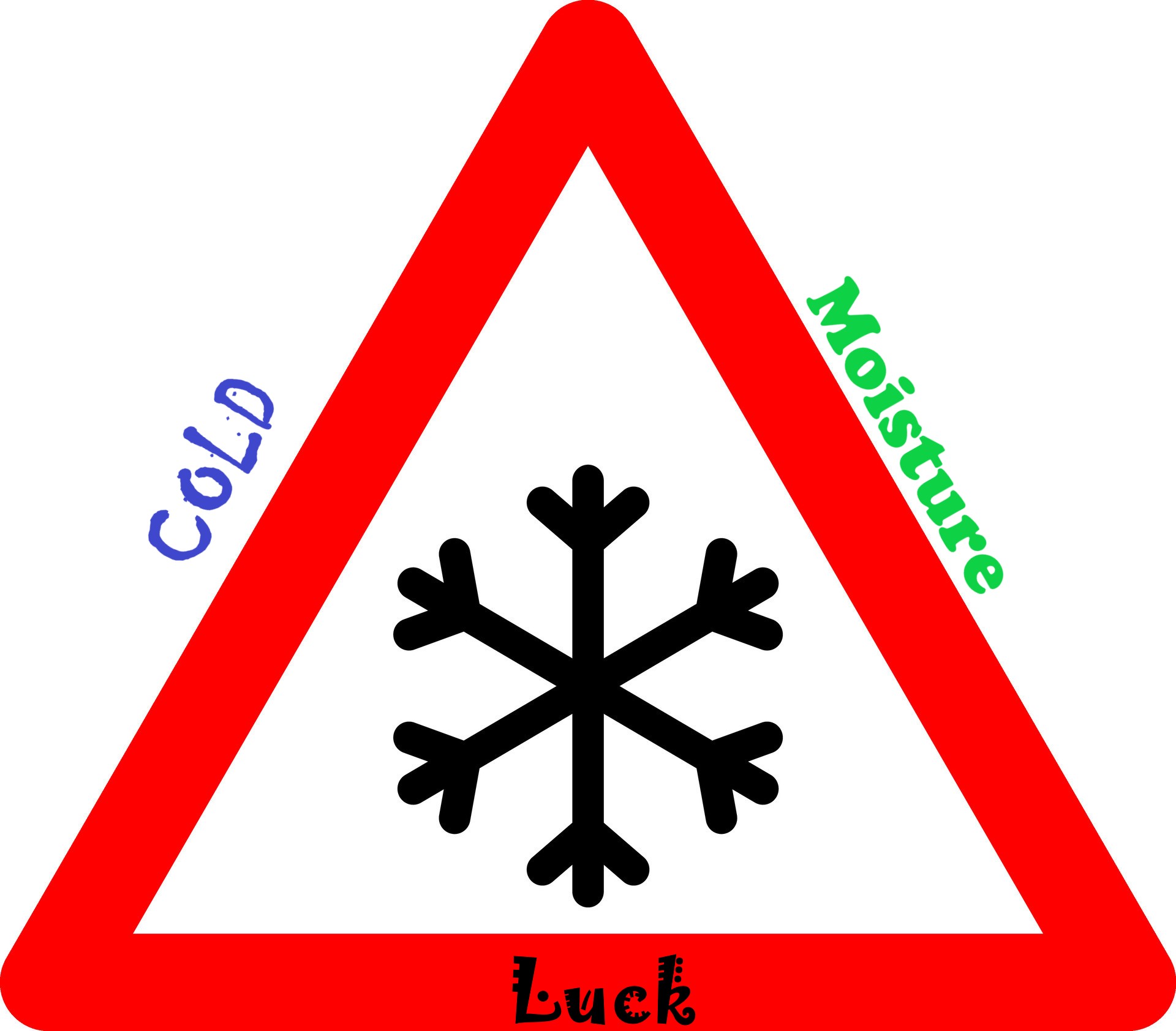
The Tuesday storm started a little later than what was progged a week in advance, allowing the "cooler" air to advance, and the storm was further south. The cooler air mass was firmly in place for Saturday's storm, so I still say the SNOW Triangle: Moisture, cold and luck.
-
2
-
-
1 hour ago, snowman19 said:
Yep. And look at where all the arctic cold is…locked on the complete opposite side of the pole in Eurasia and it stays there into March. This winter is not only on life support, the Priest has given it Last Rights and the heart monitor is starting to flatline…..
That's where the cold air was earlier this season. I was shocked when we got anything that came close to winter this year. For intent and purposes, looks like its over. Can never rule out a March "storm"...
-
3
-
-
3 hours ago, Brian5671 said:
Probably not a concern this year....

I assume it was a rare event.
-
On 2/14/2024 at 11:13 PM, BxEngine said:
I just want a ridge in early march when i go to bahamas.
Went to the Bahamas either in late March or April one year, and it was so cold, you couldn't go in the pools or the ocean.
-
12" of snow since Tuesday, and all melted in the sunny areas. I mean it hasn't been above normal temperatures and it's only the middle of February.

-
Wow, 6" here in Garwood, central Union County, NJ.
-
4
-
-
7 hours ago, Krs4Lfe said:
2 things that astonish me, and yes I know, I’ve said them before, but I can’t help but repeat them now.
1. a quick pattern regression after Feb 25th or so, into one that is consistent with a western trough and eastern ridge, which would provide west US with ample opportunity for both winter weather and severe storms (this is a complete shift from the projected pattern for the same period that has been showing up the past few weeks)2. If any winter could be dubbed “the year without a winter” it would be this one. Only twelve named winter Storms from the weather channel up until this point. And for all those who will say it’s unscientific to name winter storms (I agree on some level), lake ice extent is at a record low, temperature anomalies are near a record high for the northern tier, and almost the whole nation is well below average for both snowcover and snowfall to date.
3. in terms of winter weather and severity, this is even milder than 2012,2020, and 2023 for almost the entirety of CONUS. Remember, 2023, while being historically un snowy for this board, was historically snowy for many from west coast through upper Midwest and the Great Lakes. This year, no one is winning (except for a few places in Deep South where one snowstorm is a good season for them). I think NYC has only dropped into the teens like 2 nights at most.
4. And with the projected jet extension in beginning of March, that will put this winter to bed, the chefs kiss. 3 jet extension torches. One for the last 3 weeks of December, one in first 2 weeks of February, and one projected in early March. Critical timeframes of winter totally shunted CONUSwide by a dominant pacific. Incredible. Surprisingly, with the clipper event coming up (and other snow not withstanding), NYC has more snow than 2020, 2023, 2002, 1998, and will likely have more than 2012 when all is said and done. Yet with the great patterns indicated for much of the season, somehow this hurts even more. And it’s awful for storm tracking when much of the nation has been void of snow.
For me, last year was the year without a winter, in this region. Although I realize places like Minnesota have been unseasonably warm this year.
-
1
-
-
8 hours ago, LibertyBell said:
that must've been the 60s lol
The "walking to school uphill in 3 feet of snow" probably evolved over many decades, AND not necessarily occuring in the immediate NYC metro area. Also, no doubt, people from eastern PA and other outlying areas, moved into the area during the 50's and 60s, and brought tales of heavy snow with them.
-
1
-
-
On 2/13/2024 at 5:28 AM, nycsnow said:

Wrong. Snow hole. By the time this was published, the heaviest snow was already over (for the area highlighted).
-
1
-
-
34 minutes ago, MJO812 said:
17 years ago today , we had the big storm. I got 5 inches of sleet with temps in the teens .
February 14, 2007 I have listed as a mix of light snow, sleet and freezing rain (maybe 1.5" total sleet snow accumulation)? My notes show that a low was forecast to move into the Great Lakes, but rather slid across southen PA. A secondary formed off the Carolinas and moved north. Heavy snow warnings posted, but warmer air worked its way into mid levels, resulting in a mixed bag. Is this correct? I think the 5.5" sleet storm occurred March 17, 2007?
-
51 minutes ago, Stormlover74 said:
Nyc snow hole aside it shows how hard it is to get 2 awful winters in a row. At least this one is just bad so far and I'd imagine places like Sussex and orange are at their seasonal average to date. Allentown is close
Sounds like the NYC snow hole was worse than mine. Even with a perfect setup, and radar showing the heaviest yet to come, it cut off anyways. That's why I say, snow is a miracle in NYC metro area.

-
1
-
-
6 minutes ago, EastonSN+ said:
We can't complain this year, we performed far better than 97/98 even if we have seen out last snow!!
Avoided first back to back sub 10 inch seasons in my lifetime. Sitting at 12.5.
More than I expected with what looked like a relentless Pacific jet throwing heat into Canada...
-
2
-
-
11 hours ago, SBUWX23 said:
If we had been in the 20s that would not have happened. It's impressive enough that we had the cooling we did without the nice high to our north.
The region was cooler than what was originally thought. When it was first progged, the storm was going to start on Monday. The slight delay allowed more colder air to reach the northeast. Not enough for an ideal setup, but enough to hold off any mixing issues, even with lighter rates over the subsidence (or whatever) over Union County in New Jersey (although I don't know if anybody noticed, the last 10 minutes of precip appeared to end as a light drizzle)?
-
1
-
-
11 hours ago, Kaner587 said:
The biggest issue I noticed was when rates slipped below 1.5/hr then compaction starting eating away at totals. In the period from 8am-10am and then again 1115-1pm totals rapidly increased but between 6-8am and 10-11;15 despite decent rates it barely kept up with compaction
Compaction was not the issue in Union County, NJ. Based on modeling, predictions and the actual storm setup, Union County was going to be in the bullseye. Up until 8 AM, we had about 3" on the ground with the "heaviest" rates yet to come. Instead, during the 8:00 AM hour, the "Subsidence/Snow Hole/Screw Zone" set up over this area, reducing the snow rates. Snow never compacted (appreciably) during the storm here. At the very end, the last 10 minutes of precipitation, it appeared to be falling as a drizzle. Immediately after, the snow became wetter, began melting and true compaction begun.
-
2
-
-
19 minutes ago, NorthShoreWx said:
744 days was a pretty good run.
I think all the storms and misses have been challenging over the last several years...
-
1
-
-
1 hour ago, RU848789 said:
Yeah, just saw that too; wasn't mine as I had 6.0" and didn't report it yet (I usually do post them on the NWS FB page - sometimes they get used, sometimes not). Surprised that Metuchen seems to have gotten the most in Middlesex County, although I've seen reports not too far N of us in Union County (Westfield, Roselle, etc.) of 7-8", so maybe not a surprise. Maybe that subsidence death band hurt folks south of us more than it hurt us and we did get a hellaciously good band, getting 1.75" in one hour through 8:30 am.
The snow hole held us down to 6" in Garwood, central Union County. The skies started to brighten around 9Am, and I knew the heavy snow was over, even though I was assured "more" was headed my way as the storm began to wrap around...
-
1
-
-
1 hour ago, SACRUS said:
Up to 34 with 4" snowfall off .78 in the bucket. Snow ended about 5 mins ago and skies brightening
There goes my snow hole...

Extended summer stormlover74 future snow hole banter thread 23
in New York City Metro
Posted
I don't know, hamsters seem to enjoy their life, living in our kitchen when I was a child. He was very attentive and affectionate. My mother used to feed him different things she was cooking. Some people "cage" dogs. That I don't agree with.