
dmcginvt
-
Posts
547 -
Joined
-
Last visited
Content Type
Profiles
Blogs
Forums
American Weather
Media Demo
Store
Gallery
Everything posted by dmcginvt
-
Going on gut 7 inches today in my yard. I can tell by the snow i did note nws saying ratios might go down but this is dry right now its gonna get fluffy for early dec
-
I wouldn't discount anything its ripping in Waterbury Center but determining any snowfall will be a challenge with this wind.
-
Spooky Season (October Disco Thread)
dmcginvt replied to Prismshine Productions's topic in New England
yup 28 here already. Took the trash out in shorts and a tshirt. Had to remind myself for a minute that I love winter. Stayed out for a few minutes to suck it up now. It always makes a difference in the long run forcing the acclimation. Death to all the things that grow -
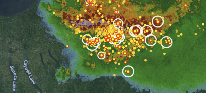
threat went south but no shortage of moisture there will be flooding somewhere possibly central midd to leb line (nevermind moving too fast), but nothing like NY nice complex ene of the finger lakes I think thats why we were slight earlier and moved.....man thats some rain and lightning
-
lol no summer thread makes sense I guess because it's dead in summer, but man there is some rain coming tonight, i just feel it
-
Messenger_creation_B82CDCE7-C201-4392-A1B8-8DA0AA363407.mp4
-
Dude it is dumping hard literally pouring snow at well over inch an hour right now
-
damn best explanation ever/ It goes for that garfield area of hyde park too up by green river res. Just a magical place for snow. Everything that comes down the lamoille valley and has a little elevation just gets crushed because theres nothing else to stop it it is essentially the upslope between say whiteface (aka sterling but not the sterling at smuggs it's confusing) and idk belviedere as far as peaks go. I did not explain that well, but there's just enough rise coming out of the lamoille valley that this area gets so much snow
-
drove thru it coming back from burlington. it was dumping 28 and very wet huge flakes. an inch in the left lane. the most crazy plow ever was coming though. Seriously I need to know more about this plow. It was huge and hard to pass and red and yellow. I have never seen anything like it
-
Cant wait to see what this week brings. PF did you work with Mark Dvorak? Taking pictures, Just curious. Man it's snowing again. Ill be skiing monday looks like another amazing day
-
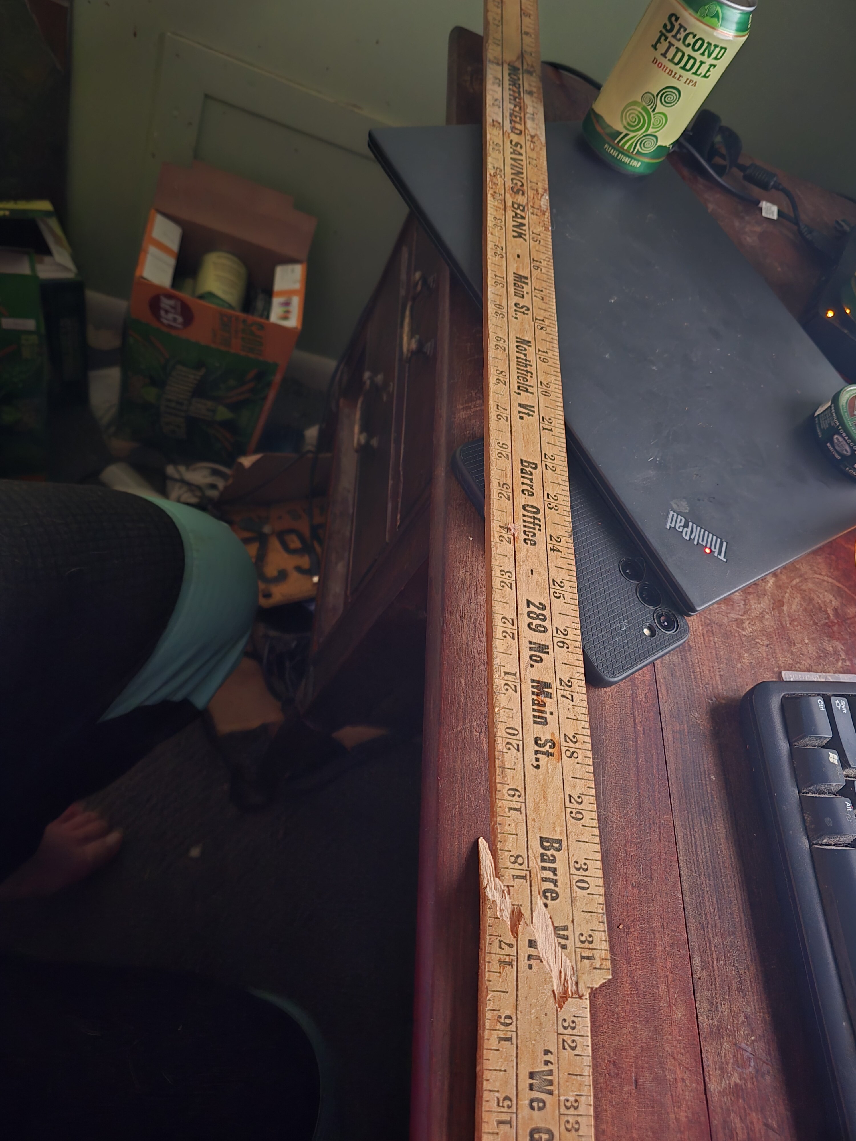
I too want to comapre it between PF me and you down in the valley It broke at 31 inches. but itwasnt done i measured another 6 the sad part is the is a really old nsb stick.

-
I too want to comapre it between PF me and you down in the valley, my yardstick isnt big enough and in fact I broke it trying to go deeper
-
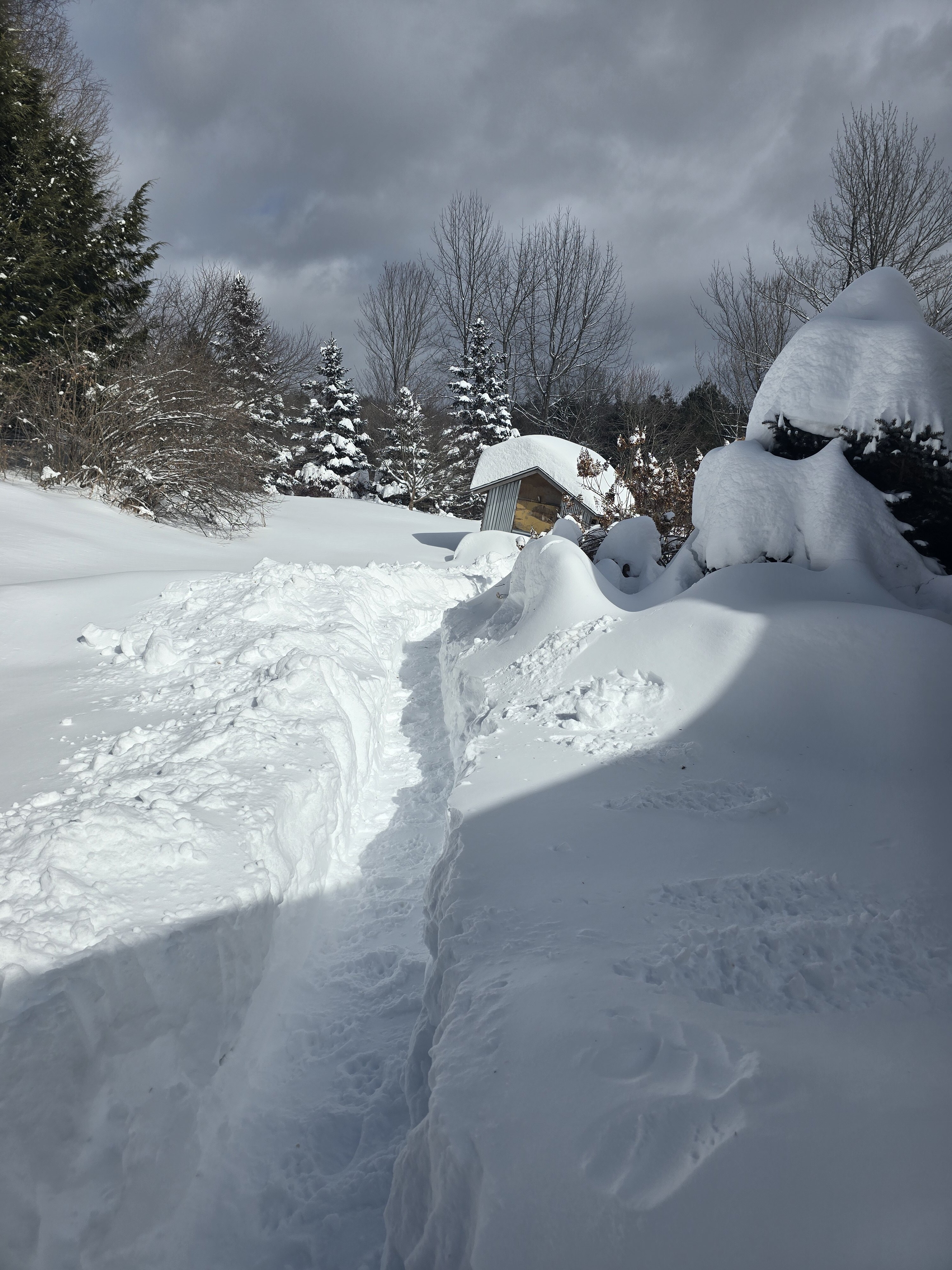
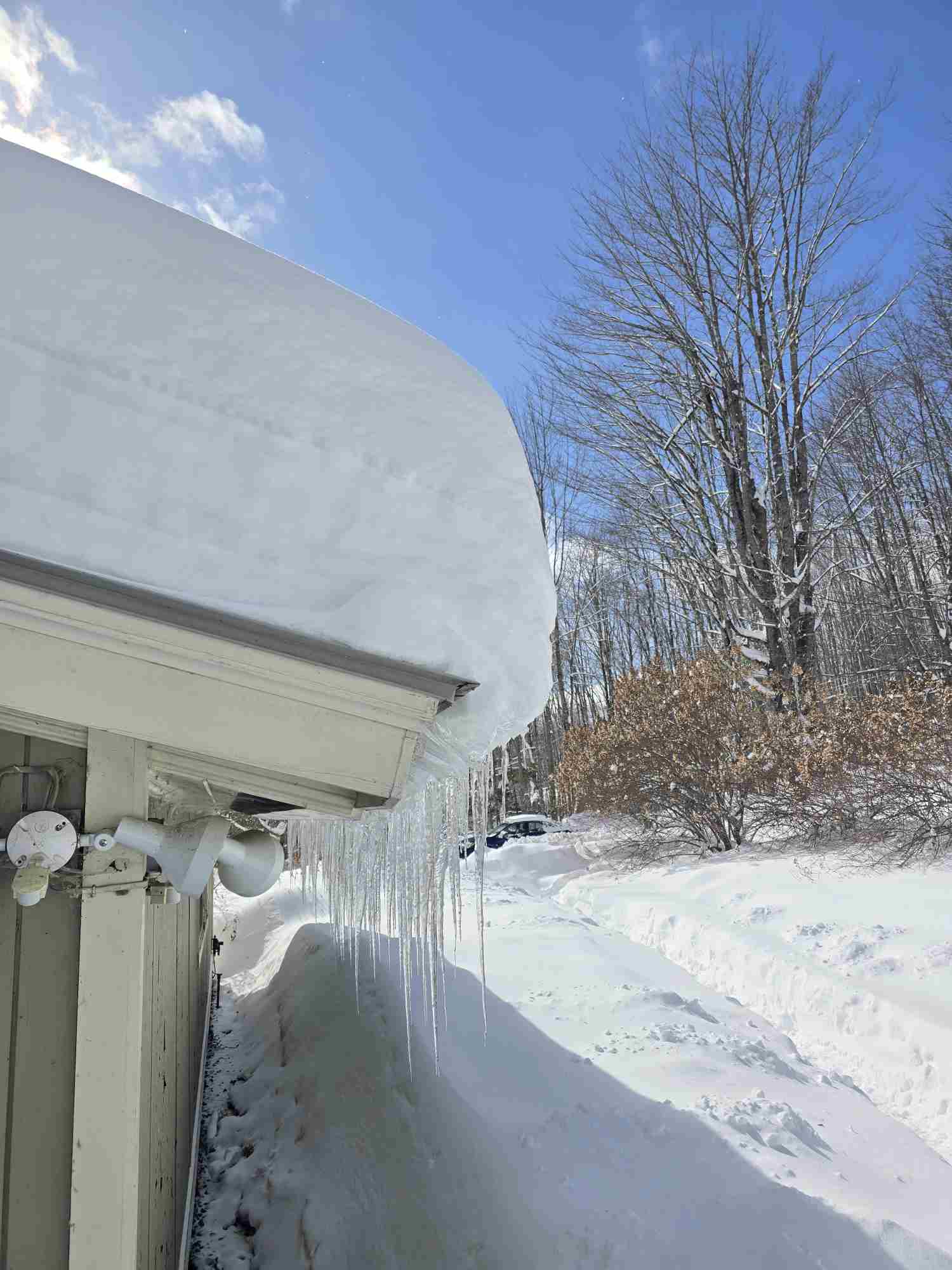
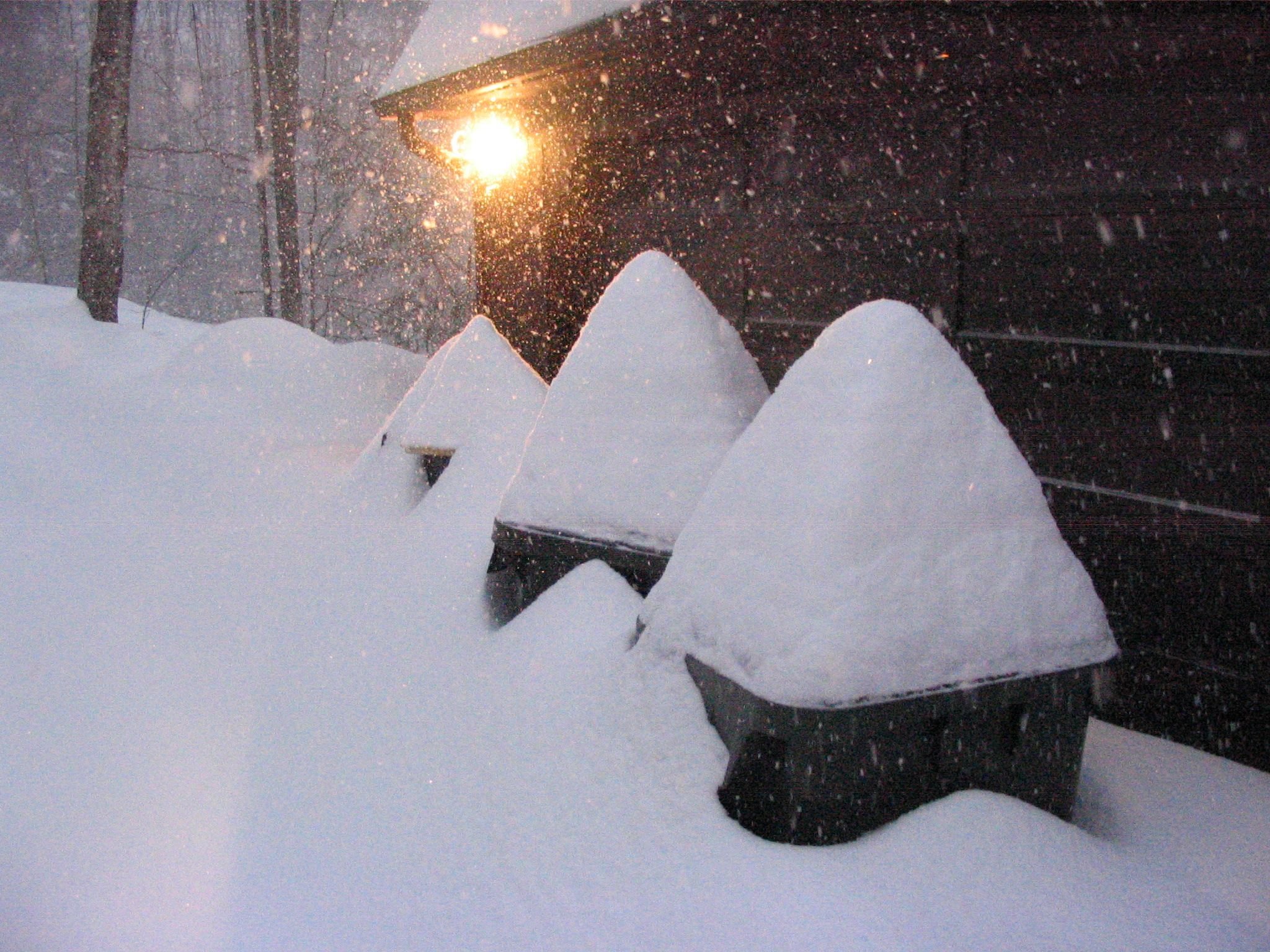
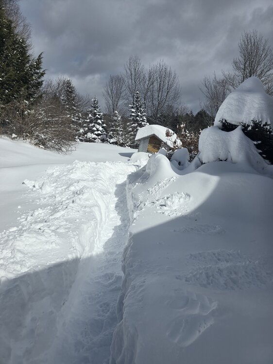
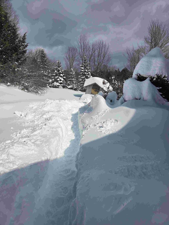
I dont think anyone realizes just how good we have had it. You get PF's posts. Im 5 miles S. slightly higher elev. It just kept coming and this storm put us over the top. I have been in this area since 87 minus a short stint for 3 years in methuen when it also snowed hard(2000-2003). 2006-2007 we had Valentines day and then its snowed till april. And then the next winter even beat that. This winter is beating both. Its literally silly, my depth is 37 avergaged. I have a board and i wipe it. I got 16 inches. But man its been nickel and dime the whole way but nonstop. I only have 2 days where we went above freezing since around xmas. That shoveled path, you are walking on 2 ft of packed snow Also a friend has goats living here, that shed is a trailer that the goats get transported in and holds their hay
-
-
Hope people are safe in the notch tomorrow Special Weather Statement National Weather Service Burlington VT 356 PM EST Mon Feb 17 2025 NYZ034-VTZ006-017-181200- Western Essex-Lamoille-Eastern Chittenden- Including the cities of Lake Placid, Newcomb, Johnson, Stowe, Richmond, and Underhill 356 PM EST Mon Feb 17 2025 ...INCREASED RISK FOR AVALANCHES IN THE NORTH COUNTRY... Recent snowfall combined with the pre-existing state of the snowpack has created the potential for avalanches in the backcountry of the Green Mountains in Vermont and the Adirondacks in northern New York. Outdoor enthusiasts heading into the backcountry to snowshoe, ski, or ice climb need to be aware of the avalanche danger, the risks involved and take the appropriate precautions. Avoid avalanche prone areas such as steep, unstable slopes or downslope areas from vulnerable locations. If skiing, hiking, or snowshoeing stay on marked trails and avoid exposed open slopes. Monitor announcements from local or state officials about the possible risk of avalanche and stay tuned to the latest National Weather Service forecasts and statements.

-
had a minute that it was snowing like 2/14/07. It didnt last but man we got a half inch like 10 minutes. Now it's just about 0.5 per hour
-
It's silly i haven't seen depth or snow like this in years. And it's dumping right now. Like raining snow small flakes literally pouring snow
-
storms gonna be wild, Stowe is already packed. couldnt believe the shaws in waterbury at 1pm. hype is real. We got the snow, they are coming hard. Im going into a cocoon.
-
I love the fact that at least my area doesnt have to live and die with every run. The past I dont know 6 weeks? Have been unreal. I dont have an amazing snowpack. But the mtn does. Nickel and dime has kept us in winter wonderland. The mtn is unreal. So much snow everywhere. (except on the trails). Its been a long time since I have seen it personally. The fact that it isnt going away and more is coming. no words. best winter in a long time. The train of storms coming will be all over the place, if we get more 3 to 4 out of it fine. Let them sne folks eat cake, even the mid atlantic. We are doing just fine here.
-
I wish this had like reddit upvotes. Most amazing answer ever!
-
but what happened to the snow board cam, first it died, now its off the page altogether!
-
def raining Im like 5 miles the crow flies from you just let the dog back in he's wet. its not wet snow it's water of no white shade. temp is dropping though. Hopefully back to snow we go
-
I know. Always better to err on the side of less. I appreciate it soo much. We have temp issues tonight so elevation will matter. 32.4 here right now (820') and it's raining. to mping
-
hrrr says more 9. rap say no 6 tops. I always add to pf and im usually right because he's the most conservative peep i have ever come across and it's fair. Mansfield never lets down. Plus that plume added by the guns adds to the nuclei needed. just sucks the moisture out of the cloud and puts it on the trail. Will be an early bedtime to get up there at 7:30 again. Im home and back to regular skiing and so happy. Its been 5 years since I skied so much. Im old and I think all the old regulars are going to pull me in as they see me now. I dont want to ski with them!
-
Definitely skied like a fluffy 4 inches too. The snowgun pea soup at the top left a lot to be desired though! zero vis down to the haychute. could barely see the ground below me But at least it was warmer than this weekend!