

packbacker
-
Posts
11,642 -
Joined
-
Last visited
Content Type
Profiles
Blogs
Forums
American Weather
Media Demo
Store
Gallery
Everything posted by packbacker
-
Southeast Sanitarium - A Place to Vent
packbacker replied to Jonathan's topic in Southeastern States
We better hope that overrunning over performs as come about 11pm or so we will flip to sleet (i hope not rain) and then we probably won't flip back until late morning when hopefully we can get another 0.15-.2" QPF. Reminds me so much of last Januarys event, we thought mix of snow/sleet and it ended up being all sleet. Bummer...but there are worse problems to have. We sure have had some tight gradients the past few years...I guess it's better then not having any gradients. Looking forward to the warmth come mid next week, we should torch for a couple of weeks and possibly longer. -
Southeast Sanitarium - A Place to Vent
packbacker replied to Jonathan's topic in Southeastern States
I said I was going to ride the RGEM and Euro...RGEM was pretty good, Euro in 90 mins. UK comes out in 10 but don't put to much faith in it now. -
Southeast Sanitarium - A Place to Vent
packbacker replied to Jonathan's topic in Southeastern States
That's the thing the CMC/RGEM/GFS we all jack because we are toeing the line. I could literally seeing a NW shift and we get slop and end up with 1-2" or we get 5-6" of concrete. I don't know what to think... -
Southeast Sanitarium - A Place to Vent
packbacker replied to Jonathan's topic in Southeastern States
We are 30 miles from a cold rain and 30 miles from all snow. Right now we are in sitting in QPF max with a mix bag of junk. The heavy snow is like 50-75 miles wide. I will be happy, very happy with 3-4" of sn/ip mix. I have given up on the all snow, I just hope to avoid rain. -
Southeast Sanitarium - A Place to Vent
packbacker replied to Jonathan's topic in Southeastern States
The 4km NAM is all sleet and no snow. If these NAM's are correct then I give up...this would be a tough pill to swallow. I do think we taint a good bit but to get no snow with what the other 18 models are showing... -
Southeast Sanitarium - A Place to Vent
packbacker replied to Jonathan's topic in Southeastern States
30 mins...I do think the NAM is probably a hair to far NW but don't think it's that overdone. It does do fairly good job on temp profiles so that's what's most concerning. I would take the RGEM over the NAM any day but you can't ignore it. -
Southeast Sanitarium - A Place to Vent
packbacker replied to Jonathan's topic in Southeastern States
Looks the same but much more QPF. Verbatim it has 1" QPF of sleet so 3" of sleet with 0.25" of snow. So that would be 5" of sleet/snow, if NAM is correct. Reminds me of Jan 2010. -
Southeast Sanitarium - A Place to Vent
packbacker replied to Jonathan's topic in Southeastern States
I don't think there was a single ensemble member that showed this on the GEFS or EPS today...70 members. -
Southeast Sanitarium - A Place to Vent
packbacker replied to Jonathan's topic in Southeastern States
I guess verbatim we are a lot of sleet then temps do finally crash hard and we flip to snow. But goodness...it has solids snows into Indiana and WV...several inches. -
Southeast Sanitarium - A Place to Vent
packbacker replied to Jonathan's topic in Southeastern States
NAM is a disaster...maybe it is correct. It's got heavy snows all the way back to TN. RDU is all rain. -
Southeast Sanitarium - A Place to Vent
packbacker replied to Jonathan's topic in Southeastern States
Oh gosh...don't remind me of that...maybe that's how I get the NAM stop shifting N...book a trip to NoVA! -
Southeast Sanitarium - A Place to Vent
packbacker replied to Jonathan's topic in Southeastern States
The QPF max is a little west of the globals and considering the SREF I would think that's about right.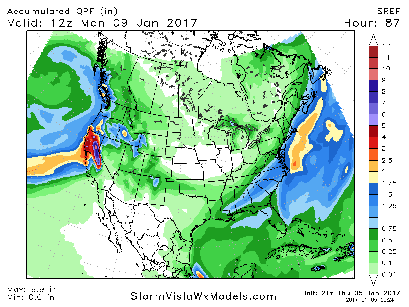
-
Southeast Sanitarium - A Place to Vent
packbacker replied to Jonathan's topic in Southeastern States
If nothing the NAM is consistent. Sheesh... -
Southeast Sanitarium - A Place to Vent
packbacker replied to Jonathan's topic in Southeastern States
LOL...I honestly don't know whether we are getting 1-2" with rain/sleet mix or 5-6 snow/sleet. And it starts in roughy 24 hours. -
Southeast Sanitarium - A Place to Vent
packbacker replied to Jonathan's topic in Southeastern States
Now that I type that RGEM coming in way more amped...LOL. -
Southeast Sanitarium - A Place to Vent
packbacker replied to Jonathan's topic in Southeastern States
Was just reading the thread for the Jan 28, 2014 event. It was simliar with tight gradient and we were hoping for a last min NW shift and never got it...still got 2-4" across the area. The NAM did show some crazy totals that didn't verify. The RGEM/Euro ended up being most correct on just about everything, QPF/temps/gradient. -
Southeast Sanitarium - A Place to Vent
packbacker replied to Jonathan's topic in Southeastern States
Even RAH backed off for Raleigh, worried about mixing and shifted max snowfall in 85 corridor. -
Southeast Sanitarium - A Place to Vent
packbacker replied to Jonathan's topic in Southeastern States
That looks awesome, if I look east I see rain, if I look west I see snow. -
Southeast Sanitarium - A Place to Vent
packbacker replied to Jonathan's topic in Southeastern States
To separate or not to seperate...that's the question for a whole bunch of people in the SE. Surprised the GEF/GFS are so locked in. So it's USA/UK vs Canada/Europe. Wonder how the German and French model are doing. -
Southeast Sanitarium - A Place to Vent
packbacker replied to Jonathan's topic in Southeastern States
So you have GFS/UK vs CMC/Euro. Euro was quicker because of no stream separation. -
Southeast Sanitarium - A Place to Vent
packbacker replied to Jonathan's topic in Southeastern States
Qpf max shifted a hair east that run. Don't know what to think except the NAM's are terrible. Blend of the GFS works for us and the GEFS were unreal. Let's hope 0z holds LOL -
Southeast Sanitarium - A Place to Vent
packbacker replied to Jonathan's topic in Southeastern States
Didn't dig as far sw though...hmmmm -
Southeast Sanitarium - A Place to Vent
packbacker replied to Jonathan's topic in Southeastern States
Euro already stronger through 12 with sw low. -
Southeast Sanitarium - A Place to Vent
packbacker replied to Jonathan's topic in Southeastern States
Really think this Euro run will be close to what verifies, don't think it shifts huge inside 36....I hope! -
Southeast Sanitarium - A Place to Vent
packbacker replied to Jonathan's topic in Southeastern States
Interesting... PACIFIC NORTHWEST TROUGH TRACKING TO THE EAST COAST SATURDAY WITH COASTAL CYCLOGENESIS NEAR N FL/GA SAT MOVING TOWARD SE NEWFOUNDLAND BY LATE SUN ~~~~~~~~~~~~~~~~~~~~~~~~~~~~~~~~~~~~~~~~~~~~~~~~~~~~~~~~~~~~ PREFERENCE: NON-NAM BLEND CONFIDENCE: AVERAGE OVERALL THE MODEL AGREEMENT IS MUCH STRONGER AS THE AMPLITUDE OF THE WAVE SEEMS TO BE COMING INTO CONSENSUS. THE SPREAD REMAINS, GENERALLY, IN THE TIMING OF THE WAVE ITSELF. THE 00Z ECMWF AND LESSER SO THE ECENS MEAN KEEP WITH CONTINUITY OF THE LAST DAY OR SO OF SLOWER SOLUTIONS IN COMPARISON TO THE REST OF THE SUITE WHICH GENERALLY IS A TAD SLOWER THAN THE GFS/GEFS. WHILE THE SPREAD IN THE TIMING REMAINS MODERATE TO HIGH THE ALIGNMENT OF THE MODELS WITHIN THE SPREAD SEEMS TRADITIONAL OF A PATTERN THAT IS BECOMING BETTER HANDLED OVERALL. AS MENTIONED IN PRIOR SECTION...THE 12Z NAM SHOWS A GREATER PHASING WITH THE DOWNSTREAM POSITIVE TILT TROF AND THEREFORE IS DRAWN NORTH/EAST MORE AND MAKES THE SURFACE LOW WELL AHEAD OF THE MAIN ENSEMBLE CLUSTERING. THIS IS A KNOWN NEGATIVE BIAS OF THE NAM AND THEREFORE IS NOT INCLUDED IN THE BLEND. AT THIS POINT A NON-NAM BLEND IS PREFERRED TRYING TO MEET IN THE MIDDLE BETWEEN THE GFS AND ECMWF CAMPS...THOUGH WILL FAVOR MORE TOWARD THE FLATTER FASTER SOLUTIONS IN WEIGHTING. CONFIDENCE IS STEADILY INCREASING BUT REMAINS NEAR AVERAGE.