psuhoffman
-
Posts
27,419 -
Joined
-
Last visited
Content Type
Profiles
Blogs
Forums
American Weather
Media Demo
Store
Gallery
Everything posted by psuhoffman
-
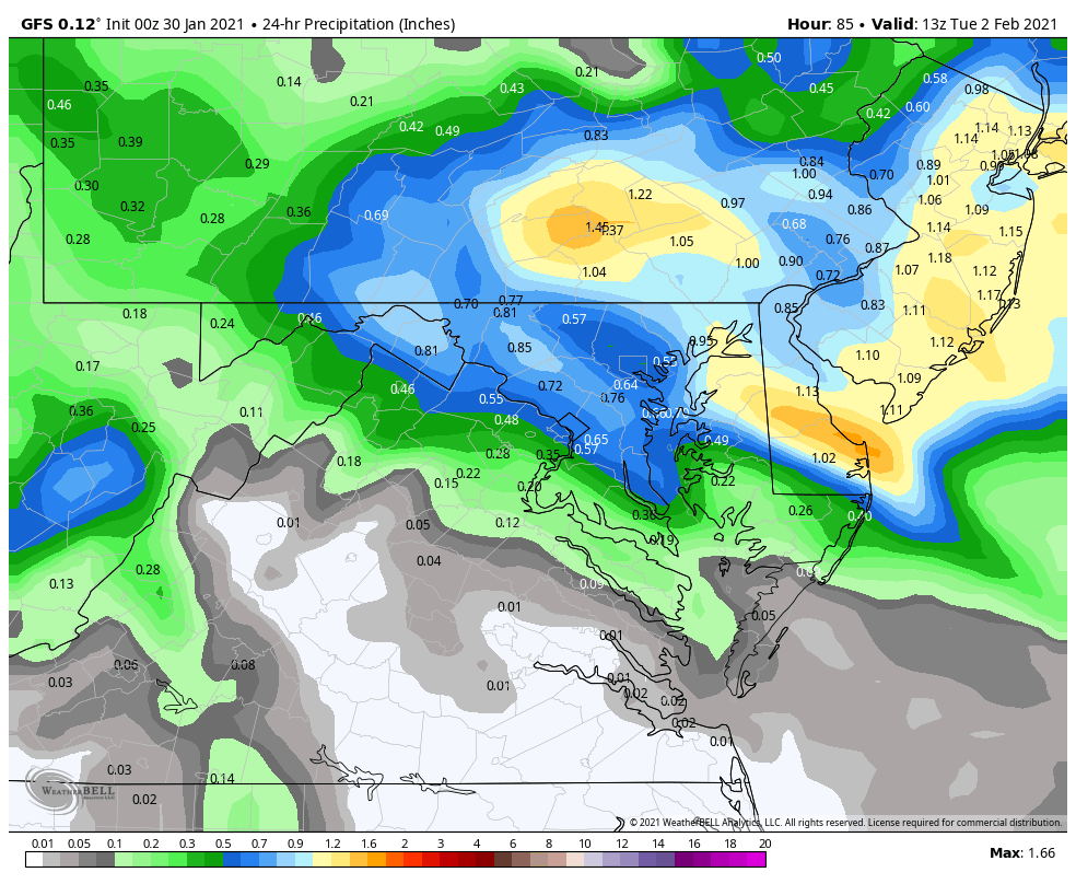
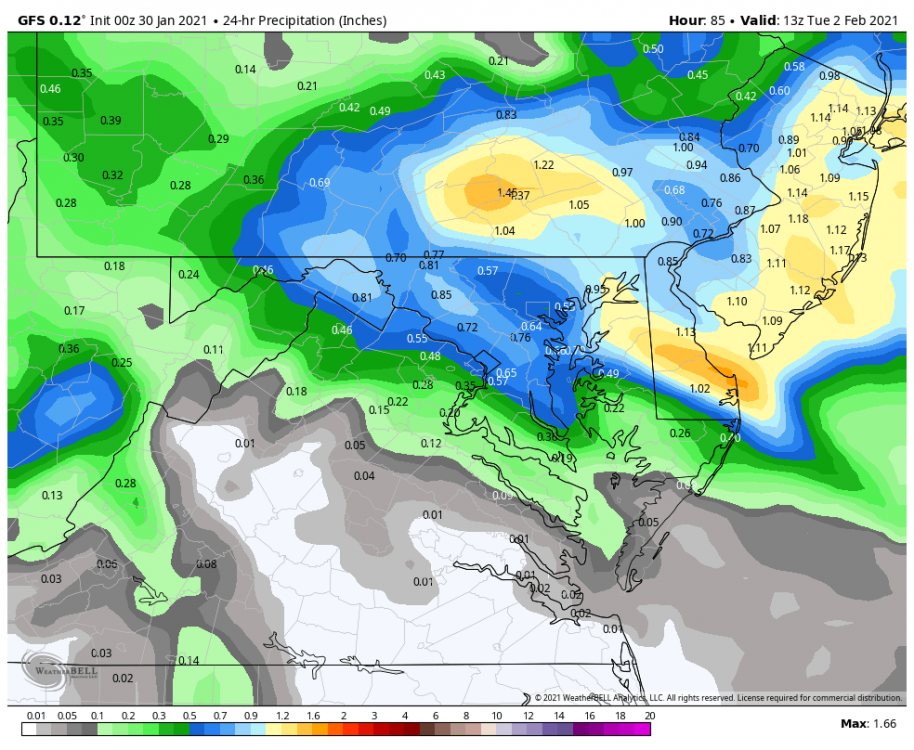
We got the full tuck. Better track. Further SW. but it didn’t really work out to a better result. The WAA really got suppressed. That hurt DC south. Most places lost 1-3” there. Then we got stuck in the dry slot too long. And despite a better deform band it didn’t extend as far south into VA despite a further southwest stall of the surface low. That part shocked me. I looked at the slp first and expected a better result then what I saw when I looked at the qpf.
-
One last point with ccb trends. This is the Cmc ensemble. Totals in central VA went down ENE because the WAA trended weaker. But the CCB trended a lot better. This is just the ccb part from 12z to 0z overall
-
So with only the euro left...the NAM is late with the CCB and a miss but has the best WAA lol. But among the other guidance DC gets clipped good by the ccb on the gfs (yea too much rain due to gfs awful thermals) rgem, ggem and icon. And the UK is south and a VA to DC special. VAs results were hurt most tonight by a trend to suppress the WAA wave more. Unfortunately once you get SW of DC a higher % of their snow was always going to be the WAA. So that drying up will hurt the further south more and north less. The euro is big Imo. So long as it doesn’t agree with the NAM I don’t think we’ve seen a huge shift in the CCB. We have seen the WAA weaken and that’s a problem for the southern 1/2 of the region that need that to be the majority of their snow.
-
Luckily the areas most likely to fail with WAA are most likely to win with the ccb so it mitigates that somewhat.
-
That’s hilarious and so true!
-
It sounds counter intuitive but it’s a complicated setup. The suppressive flow is relaxing. As it does eventually the coastal storm will amplify, phase and get captured. Once that it will stall and tuck and where that happens to the NW is where the heavy snow will develop. Illustrated below by the ggem. the capture/tuck was perfect there for DC northeast. The heavy snow is banding in the deformation axis where there is the convergence of winds and sheer at different levels. Look at how the winds ahead of the h5 h85 and surface levels all converge on that zone. Additionally you have moisture transport into that zone from the east. So you add moisture, instability and lift from convergence and that death band is what you get! But one issue on some guidance is the h5 opens up as it presses up against the shear from that suppression and because of that the transfer process is delayed and so the low doesn’t phase and capture until further northeast up the coast? I give you the NAM same scenario but the low is further northeast at the same time AND it never really got its act together and synced at at all levels like the rgem/ggem did. The result is the ensuing snow bands set up north. But yes suppression had a part in that. It’s delicate though. The suppression is easing. If it eased too soon the primary could hang on too long. If it suppressed initially we lose some of the WAA wave then the coastal front could be further southeast and the secondary will develop further ots. It’s a tricky balance. Miller Bs are a pain in the a$$ compared to muller As to pin down. If this was a juiced up gulf low we probably would have a better idea how it’s going to go by now. But guidance has a notoriously difficult time with transfers and phases. I’ll never forget how EVERY model was giving be a 6-10” snow from the CCB in early March 2018 only about 12 hours out and then the whole thing shifted northeast and I didn’t get a flake from the coastal. On the other hand a similar storm in Feb 1996 was supposed to hit NJ and crushed DC with no warning. I never count on a ccb from a miller b secondary until it’s snowing from it.
-
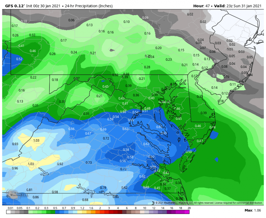
It’s hard to pin for everyone because the rain snow line is moving north then sinking south. But for the DC metro and northern VA this is all snow from the WAA and this is snow from the CCB so far tonight my only qualm for N VA would be the coastal capture is happening a little slower and that risks shifting the CCB northeast of the area if it develops too late. But that’s always a risk with a miller b. The DC split.
-
12 hours ago that vort over New England was trending south. It has since relaxed some. But in a way suppressed is still an issue just not in an easily apparent way. But the fail option is to see the WAA wave suppressed...then have the coastal develop too late like the NAM. That ends up looking like the problem was a north trend because the coastal wraps snow back in to our north but in reality suppression initially helped that happen. We need a storm to develop a healthy circulation and amp up quicker down here compared to the other northeast cities further up the coast.
-
I hope we can get DC into the double digits.
-
I thought it would be better for DC but it was kinda pathetic with the WAA do it ended to kinda ehh even with the better ccb
-
Holy cow is that a good run. Snows forever on the back side. Expanded the deform significantly also like the euro did.
-
What was odd was the mslp actually improved slightly but the storm had a “blown out” look to it and never wrapped back up. Very odd to have a captured tucked low off OC and all the precip is up in PA. ETA: ehh on second look the low gets captured further north then I thought on first glacé.
-
I know it’s the SREF but it’s still better for them to look good then bad. And they look VERY good.
-
Nothing not to like about the EPS. More amplified less positively tilted trough. H5 cuts off in a better spot. Low is less progressive after being captured leading to the bump up in the snow mean. Most significantly a BIG expansion and ramping up of the precip shield across the members. Snowfall expanded on BOTH sides of the max stripe! That is a good sign heading into the home stretch.
-
Ironically the same happened to me where I was up in PA that year. Got about 8" but all around got like 10-12...was stuck between meso bands all afternoon.
-
BTW I think you can still do pretty good with a more amped solution...I think a decent front end is likely and then so long as the storm exits more east then north (likely given the blocking) that deform axis will be shifting southeast as it exits and can clip you on the way out. March 2018 was a good example of that.
-
That NS vort over New England that was trending south every run for 36 hours before reversing course was giving me shades of every great setup we have wasted in the last 5 years. It seems we've been screwed several times by something like that recently. Likely a correlation to the dominant NS patterns we've been in. Que someone with #remindsmeof2018
-
that is REALLY hard to do on the coastal plain with a miller b hybrid where the primary is coming across west to east at about our latitude. Doesn't mean it can't end up a good storm...but there is almost always going to be a period during the transfer/secondary process where you end up in the dry slot and some of the warmer air riding across ahead of the wave sneaks in and without the dynamic and convective cooling and heavy precip to help mix out mid level warm layers...and to keep the surface saturated...its just hard. It's possible...and there was that one euro run (besides the runs many days ago when this was still in fantasy land range and models tend to mess up more major aspects) that struck the perfect balance, but you are playing with fire with that. To get all snow with a miller b coming across this far north you kind of need it to be de-amplifying and sinking southeast. But then you risk something like March 2013. If you hit the jackpot perfectly you can get something like that one euro run where it de-amplified the perfect amount then the coastal started to amplify just in time to give DC a 12" cold smoke outcome...but like I said that is walking a high wire and its playing with fire. You get SLIGHTLY more suppression and the coastal doesn't amp up in time with that scenario and suddenly you have a dying WAA wave and its a pathetic nothing burger for everyone. That said I am not ignoring the challenges of your geographic location. But you can do pretty good from the WAA thump still...4-6" is very possible...and then you need to have that deform band sink south on Monday and give you some love on the way out. If we can get this storm to tuck into the VA capes then fade ENE from there that is very much on the table.
-
That hole is an area that got unlucky twice. Ended up between bands during the WAA then again during the deform. Subsidence can be cruel. Btw euro started to pick up on that duel banding structure on the NW side that happens EVERY time. There will always, in EVERY storm, be unlucky little pockets like that. I actually ended up in one in 2016. I got 28”, and no I’m not complaining one bit I’m not crazy, but all around me got 30-36”. I ended up in a couple dead zones between banding and oh well. But no model can get either the meso banding or the associated screw zones between them right from 24 hours let alone 72 so I wouldn’t sweat it. That’s something for the now cast.
-
Agree it ended very well. Trough was less positively tilted. Low started to get going further west and tucked a bit more which had the desired effect on the deform zone across our area. I’m happy with it. It was a very acceptable run but left some room for improvements. I do think we see a full tuck like other guidance on tonight’s run.
-
Full tuck at 1am
-
Baby step
-
Slightly more ridging in front and a slightly more amplified h5 at 33 hours. Heights to the NE maybe a slight smidge less suppressive
-
@Bob Chill welcome back!!!!! Missed you
-
18z gefs really ramped up the deform Monday!