

uofmiami
-
Posts
1,637 -
Joined
-
Last visited
Content Type
Profiles
Blogs
Forums
American Weather
Media Demo
Store
Gallery
Posts posted by uofmiami
-
-
86 to 87 in Syosset & Muttontown so far
-
2.11” total so far in Syosset & 1.90” in Muttontown. Currently 48 at both, feels like March outside.
-
37 minutes ago, bluewave said:
The new ground level stations look interesting. Not a big fan of the rooftop station temperatures. I posted the high temperature summary from Saturday.
http://nysmesonet.org/networks/nyc
Ten sites are located at ground level, eleven sites are deployed on roof tops, and one site is located on a pier. A majority of Micronet stations measure air temperature, relative humidity, precipitation, and pressure. A mix of stations also measure wind speed and direction, solar radiation, snow depth, soil temperature and moisture, surface (skin) temperature, and water temperature. Micronet data are collected every 5 minutes, quality controlled, archived and made available to users in real-time. The 17 Con Edison sites and 5 NYS Mesonet sites located in NYC are shown in the data display below.
Station Max Min Avg Max Min Max Min Liquid Peak Gust Peak 5m Avg Integrated 13th St./16th / Alphabet City 93 67 80 93 67 66 28 0.00 13 4:10pm4 2:20pm17.0 160 Ave. / Howard Beach 91 61 77 91 61 87 29 0.00 28th St. / Chelsea 90 66 79 90 66 73 29 0.00 19 2:40pm6 2:40pm15.3 Astoria 91 64 78 91 64 77 29 0.00 17 4:40pm9 2:05pm17.7 Bensonhurst / Mapleton 92 65 79 92 65 73 28 0.00 15.7 Bronx Mesonet 88 64 77 88 64 73 34 0.00 23 3:00pm13 3:00pm19.8 Brooklyn Mesonet 88 63 77 88 63 74 31 0.00 28 2:40pm18 2:40pm18.3 Brownsville 94 64 79 94 64 76 26 0.00 Corona 92 65 79 92 65 73 27 0.00 E 40th St. / Murray Hill 90 67 79 90 67 64 30 0.00 Fresh Kills 91 64 79 91 64 66 30 0.00 20 6:00pm11 5:40pmGlendale / Maspeth 90 64 79 90 64 75 29 0.00 Gold Street / Navy Yard 90 68 80 90 68 60 29 0.00 22 3:00pm12 3:00pm18.2 Lefferts / South Ozone Park 93 62 78 93 62 83 28 0.00 Manhattan Mesonet 87 70 80 87 70 60 32 0.00 30 2:35pm17 2:30pm15.7 Newtown / Long Island City 90 66 79 90 66 66 27 0.00 18 5:15pm7 2:40pm16.9 Queens Mesonet 88 63 77 88 63 76 32 0.00 23 3:00pm15 4:50pm18.0 Queensbridge / Dutch Kills 91 67 80 91 67 68 27 0.00 15.2 Staten Island Mesonet 89 65 78 89 65 63 32 0.00 28 6:00pm16 2:45pm18.1 TLC Center 89 66 78 89 66 67 30 0.00 19 3:05pm8 2:40pm17.8 Tremont / Van Nest 93 64 79 93 64 75 28 0.00 16 2:25pm5 3:05pm17.7 Interesting that the Manhattan mesonet, E of Central Park in Lenox Hill section only reached 87, yet some complained about Central Park's high temp that day. Curious to see how that Mesonet location's high temperatures are compared to Central Park's high temp this summer. I would have thought it would have been warmer compared to the Park, being it's measure on the roof at that site.
-
 1
1
-
-
88 in Muttontown (88.3) & Syosset (87.5) for the high.
-
89 (88.8) in Syosset and 88 (87.9) in Muttontown for the high today.
-
80/81 now in Muttontown & Syosset. 82.1 was the high in Muttontown & 81.1 in Syosset so far.
-
38 minutes ago, bluewave said:
When was the last time that Newark was 17° warmer than LGA at 2pm?
Newark/Liberty PTSUNNY 88 53 30 SW14G21LaGuardia Arpt PTSUNNY 71 46 40 NE9
82 at 3pm for LGA, that didn't last long.
-
80 in Muttontown & Syosset at 2pm
-
78 in Muttontown & Syosset
-
Had some nice thunder with the line that just passed here in Syosset.
-
Have to wait until May for any 80+ heat it seems with this pattern.


-
51 minutes ago, CIK62 said:
And this they call the "new improved version" of the GFS:

Looks like a WxBell issue. Here is the meteogram from Weathermodels.com:

-
1
-
-
Was 11% at my station in Muttontown I saw. I'll check later to see if it dropped below 10% at one point.
-
1
-
-
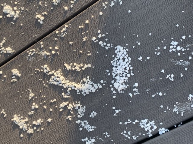
Had some graupel fall overnight it seems, as awoke to this on my deck.
-
5
-
-
29 in Muttontown & 30.3 in Syosset for low, frost as well.
-
35 minutes ago, BxEngine said:
Sorry in advance for the spam guys.
im sure some have seen the news about the spring valley firefighter who made the ultimate sacrifice this past week after saving numerous lives at a nursing home fire here in Rockland. Jared was a friend, and he leaves behind 2 young boys. If anyone can spare a dollar or two, it would be incredibly appreciates.
Tragic story, as a father to two kids (5 y/o & almost 3 y/o) myself it hit home. I donated $100 anonymously on Wednesday.
-
2
-
-
81.8 in Muttontown & 81.3 in Syosset for the highs. Both stations have gusted to 37 mph. Mid 70s now at both locations.
-
1
-
-
1 hour ago, sferic said:
With which run today?
12z is the v16 upgrade & new operational going forward.
-
1
-
 1
1
-
-
1 hour ago, psv88 said:
23* this morning. Probably get a few more freezes out here. In the city now to get my second vaccine shot. Nice day to walk around with the kids
Good luck with your shot. My brother is taking his wife for her 2nd shot this morning at Javits as well.
-
4
-
 1
1
-
-
31 minutes ago, lee59 said:
19 degrees here earlier this morning, now up to 25 and climbing fast.
17.7 in Muttontown this morning. Only got down to 21.3 in Syosset.
-
1
-
-
8.4” in Syosset for a final, fell slightly above the range of 6-8” I thought would fall.
-
1
-
-
2 minutes ago, jfklganyc said:
When can we start talking about sun angle?
That's a March topic, soon enough we'll be discussing that.
-
 1
1
-
-
URGENT - WEATHER MESSAGE
National Weather Service Upton NY
255 PM EST Wed Dec 23 2020

CTZ009-NJZ006-NYZ071>075-176>179-240400-
/O.UPG.KOKX.HW.A.0002.201224T2300Z-201225T1400Z/
/O.NEW.KOKX.HW.W.0005.201224T2300Z-201225T1500Z/
Southern Fairfield-Hudson-Southern Westchester-
New York (Manhattan)-Bronx-Richmond (Staten Island)-
Kings (Brooklyn)-Northern Queens-Northern Nassau-Southern Queens-
Southern Nassau-
255 PM EST Wed Dec 23 2020

...HIGH WIND WARNING IN EFFECT FROM 6 PM THURSDAY TO 10 AM EST
FRIDAY...

* WHAT...South winds 25 to 35 mph with gusts up to 65 mph
  expected.

* WHERE...Portions of northeast New Jersey, southern Connecticut
  and southeast New York.

* WHEN...From 6 PM Thursday to 10 AM EST Friday.

* IMPACTS...Damaging winds will blow down trees and power lines.
  Widespread power outages are expected. Travel will be difficult,
  especially for high profile vehicles.
-
1
-
-
1 minute ago, bluewave said:
Flood watch issued to our north.
&&

.HYDROLOGY...
Flood Watch in effect for much of the region (except Herkimer,
Hamilton, Fulton and northern Warren counties) from 6 PM Thursday to
6 PM Friday...

A storm system and cold front approaching from the west will
bring the threat for moderate to heavy rain to the region late
Thursday into early Friday morning. In addition, there is the
possibility for a several hour period of strong winds and above
freezing temperatures, which may allow for significant snowmelt.

Rainfall amounts of 1-3 inches are expected Thursday afternoon
and night, with greatest amounts expected across the SE
Catskills. The extent of snowmelt will depend on how slow the
front moves through the region, with slower movement allowing
for a greater length of time for warm temperatures and strong
winds to ripen and potentially melt out the snowpack. This
potential for melting currently appears greatest across western
New England, extending into the mid Hudson Valley and SE
Catskills, however could occur farther north if the front moves
slower.

Due to this potential for heavy rain, and possible significant snow
melt, a flood watch has been issued for much of the region from
Thursday evening through Friday afternoon.

Trends will be watched closely, especially regarding snowmelt
potential, over the next few days to determine potential extent of
flooding. Minor to possibly moderate river flooding will be
possible along with urban and small stream flooding, especially
where storm drains remain clogged from snow and ice.
Lots of flood watches issued for inland locations due to the snowpack melt & runoff w/rainfall. Nice call days out on the potential!
-
5
-


June 2021
in New York City Metro
Posted
90 in Muttontown & 89 in Syosset currently