uofmiami
-
Posts
2,305 -
Joined
-
Last visited
Content Type
Profiles
Blogs
Forums
American Weather
Media Demo
Store
Gallery
Everything posted by uofmiami
-
Let em, they look like fools. Models had our rain coming in the overnight on runs over a day ago. 1.37” in Syosset.
-
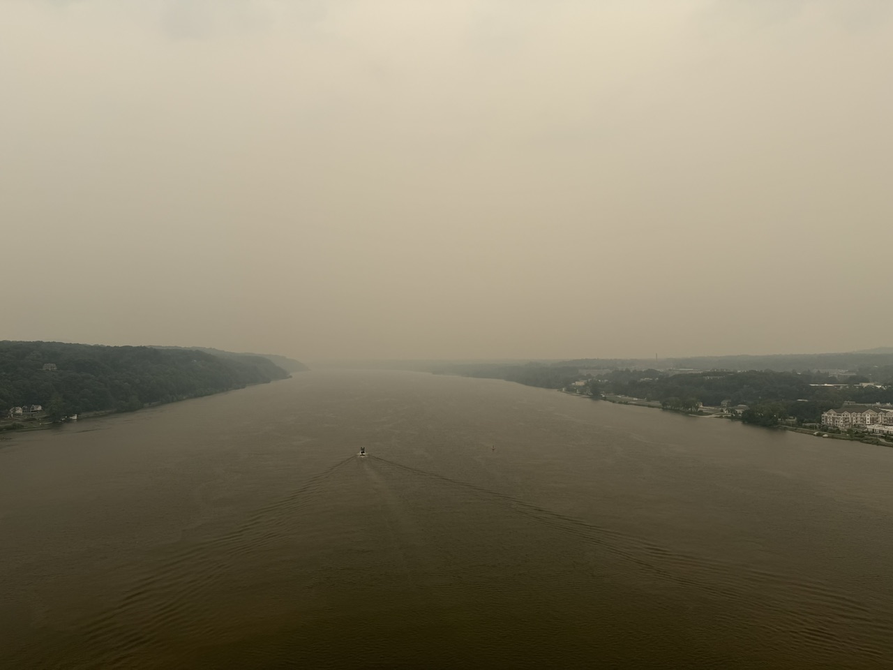
Smoke followed me home. Temps dropping now due to smoke it seems. Picture from the walkway over the Hudson, a little before 1pm.

-
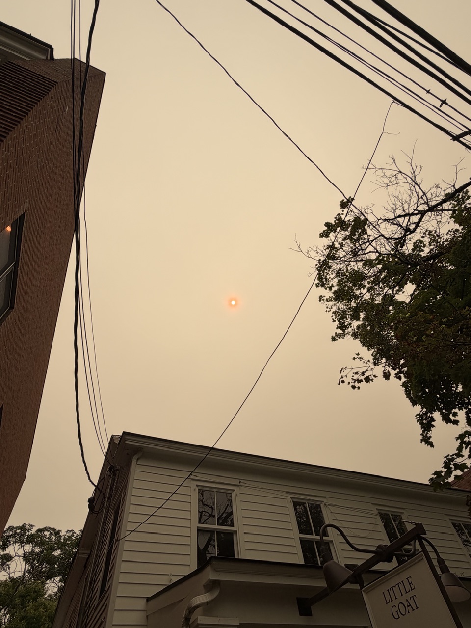
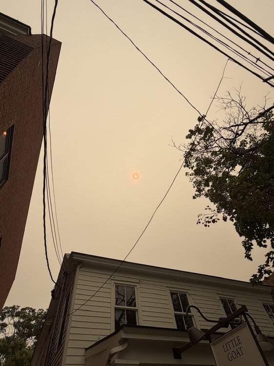
Thick smoky sky in Rhinebeck currently with a light smell of smoke at the surface. Flashbacks to 2023. Can’t even feel the sun at the moment.
-
Central Park was 85, not sure where the 82 came from.
-
I think any new gas station or existing gas station that does a renovation is required to install a generator, to alleviate any gas runs.
-
Always depends on size of propane tank. I have a natural gas line for my WHG (20kw), but my parent’s house has a buried 500 gallon tank for their WHG (50kw), as I recall. It was getting low a week after Sandy.
-
3.42” in Syosset & 2.43” in Muttontown.
-
96 at my stations currently. Just got back from double header 10u baseball games in Hicksville. It’s getting hot out there but thankfully there is a breeze even in the sun. Just have to stay hydrated & throw sunscreen on.
-
-
Finished at 100.8 in Muttontown & 100.1 in Syosset for highs.
-
100.7 in Muttontown & 100.1 in Syosset currently
-
100 in Muttontown finally. 99.5 for Syosset so far.
-
99.5 Syosset & 99.3 Muttontown so far for highs now.
-
98.9 Syosset & 98.7 Muttontown so far for highs.
-
98.2 currently at both my stations.
-
Yeah wasn’t bad just N in East Meadow for Little League baseball. Breeze helped this evening. One win away from winning the district & advancing to sectionals.
-
91.8 for the high at both my stations today.
-
Yeah I posted this in the banter thread yesterday. Scary stuff for his age, glad he survived.
-
Not sure if anyone saw this. Earthlight almost saw the light:
-
88 again today at both my stations.
-
You have to delete old attachments from prior posts. Go to account and my attachments.
-
Same for my stations.
-
I would have received 10" of snow, no complaints. 1.01" in Syosset & 1.00" in Muttontown from the storm.
-
0.96” in Muttontown & 0.94” in Syosset with rain popping on radar.