poprock49
-
Posts
24 -
Joined
-
Last visited
Content Type
Profiles
Blogs
Forums
American Weather
Media Demo
Store
Gallery
Everything posted by poprock49
-
Outta gas and Outta Time: Early March Winter Storm finale
poprock49 replied to Ji's topic in Mid Atlantic
12k NAM looks solid, better than 18z -
Feb 22nd/23rd "There's no way..." Obs Thread
poprock49 replied to Maestrobjwa's topic in Mid Atlantic
It's pretty nice. Best I could do to show, if you ask me I'm giving SnowenOutThere a run for his money
-
Feb 22nd/23rd "There's no way..." Obs Thread
poprock49 replied to Maestrobjwa's topic in Mid Atlantic
Dumping here with winds picking up -
Feb 22nd/23rd "There's no way..." Obs Thread
poprock49 replied to Maestrobjwa's topic in Mid Atlantic
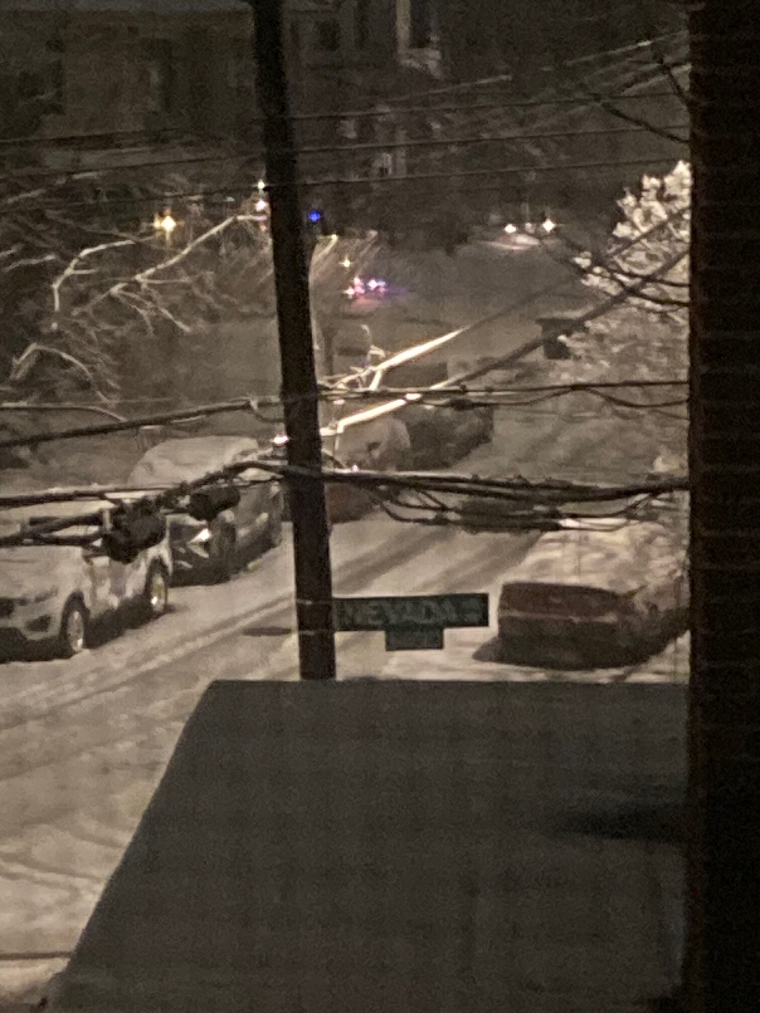
Roads starting to give a bit here in NW. Accumulating very slowly but maybe the elusive norlun can turn that around -
Feb 22nd/23rd "There's no way..." Storm Thread
poprock49 replied to Maestrobjwa's topic in Mid Atlantic
This was the first post I saw after logging on just now and I thought we’d lost it, felt my heart skip a beat -
UHI doesn’t nearly (like, not even close) account for everything’s that’s happened. It’s true that before DCA the city’s official readings may have come from some slightly cooler location, but the decline has been steady and, most importantly, is visible in the same manner region wide, not to mention the rest of the country and the world. It’s just that DC has official records going back to the 1870s (longer than many other locations and what could be considered pre-industrial for these purposes) and therefore the trend is very obvious in its data.
-
You're right that climate change isn't linear (almost nothing is) and that there are other factors, but it really boils down to emission-caused warming. Saying otherwise is dodging the issue imo. And applying the non-linear logic just makes things worse for us as the climate is warming at an ever increasing rate! DC's snow climo used to be around 20 inches; it is now 13.8. I was reading an old (2018 or 19) CWG article the other day and it cites DC's climo as a bit over 15 inches, because that's what the average was for the 1981-2010 data period. That's a 1.5 inch decline (20+% of the total loss) from a mere 10 year shift! That's a shocking statistic that I never would have guessed before I started learning about this stuff. I'm no expert, but that's my two cents.
-
Sleeting more heavily again and radar looks healthy… I may have been silly to discount the NWS forecast so soon
-
Kinda hard to classify the intensity of sleet, but I’d say this is mod-heavy. Don’t mind it actually
-
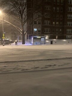
From the walk!
-
I'm surprised by how heavy it is. Flakes aren't big but not puny either
-
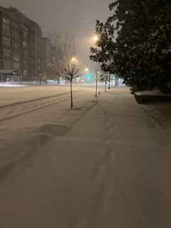
Finally going here in Chevy Chase. Won't pretend that hole didn't piss me off, but now I can get some sleep and be ready for the goods!
-
I’m still waiting here (maybe 2 miles from you?) but should be any minute.
-
The suspense is getting to me...
-
January 24-26: Miracle or Mirage JV/Banter Thread!
poprock49 replied to SnowenOutThere's topic in Mid Atlantic
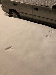
Wow... there are at least two foxes living in my neighborhood (have heard them mating), but definitely no coyotes lol -
January 24-26: Miracle or Mirage JV/Banter Thread!
poprock49 replied to SnowenOutThere's topic in Mid Atlantic
12z RGEM finally ran - looks super heavy with the thump! Holds back the sleep maybe another 1/2 hour to an hour -
Jan 24-26 Weekend Snow and Sleetfest Model Thread Part Tres
poprock49 replied to H2O's topic in Mid Atlantic
It might be more of a timing thing. Thermals are a bit worse but heavier rates get going earlier and many end up with same total hours of snow. -
I believe mets here have said thundersnow is very unlikely given the set up
-
Same result? I know you're trolling but man, that GFS run is substantially better for the forum as a whole. And no, I'm not just saying that because I happen to be on the right side of this pixel

-
January 24-26: Miracle or Mirage JV/Banter Thread!
poprock49 replied to SnowenOutThere's topic in Mid Atlantic
Could someone explain to me what the difference between data obtained via flights like this and the data that does into any old model run? It seems to me that each suite must have new data, so is it simply more precise for a particularly relevant area when gathered this way? -
Yeah, I'm suspicious of it because of how large a swath of high totals that is. Of course, that's partly because it's an ensemble, but it has central/southern VA and even northern NC doing really well (like yesterday's runs) while having similar amounts in Baltimore. If this is a flawed analysis please feel free to let me know lol, just thought I'd take a stab at it!
-
Really glad about this; before it was looking like the meat of the storm would be overnight, and though that is still true it won't even be close to done by Sunday morning
-
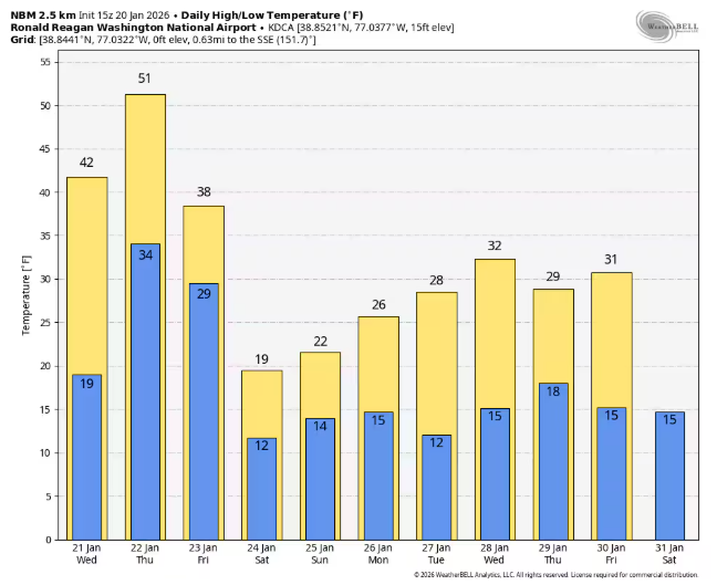
Yep. NBM, courtesy of CWG's article
-
Hey all, I'm here to add to the barrage of teenagers (HS, I'm roughly between @bncho and @Nomz). Been heavily lurking for about a year but I'm so hyped for this storm I finally decided to post. My APUSH teacher had some sage advice for my class today that I'll share here: "don't get too excited, the energy warms up the atmosphere." lol. Let's reel this one in!