jsw
-
Posts
223 -
Joined
-
Last visited
About jsw

- Birthday August 24
Recent Profile Visitors


-
About 4" here in Brattleboro. It stayed all snow until around 9pm. I was expecting only a couple inches, so this was an overperformer!
-

"Don’t do it" 2026 Blizzard obs, updates and pictures.
jsw replied to Ginx snewx's topic in New England
Meanwhile, here in Brattleboro, maybe 3 inches? CT River dry slot. -
"Don’t do it" 2026 Blizzard obs, updates and pictures.
jsw replied to Ginx snewx's topic in New England
All-time record in my old hometown. Toggle navigation Record Report Issued by NWS Boston, MA Current Version | Previous Version | Text Only | Print | Product List | Glossary On Versions: 1 2 3 4 5 415 SXUS71 KBOX 231808 RERPVD RECORD EVENT REPORT NATIONAL WEATHER SERVICE BOSTON/NORTON MA 105 PM EST MON FEB 23 2026 ...RECORD SNOWSTORM FOR PROVIDENCE RI... AS OF 1 PM, THE SNOWFALL TOTAL AT RHODE ISLAND T.F. GREENE INTERNATIONAL AIRPORT WAS 32.8 INCHES. THIS BROKE THE RECORD FOR THE GREATEST SINGLE SNOWSTORM ON RECORD, WHICH WAS 28.6 INCHES SET DURING THE BLIZZARD OF `78, ON FEBRUARY 6-7, 1978. AN UPDATE WILL BE SENT THIS EVENING ONCE WE RECEIVE THE NEXT SNOWFALL TOTAL AROUND 7 PM. $$ JWD/KJC US Dept of Commerce National Oceanic and Atmospheric Administration National Weather Service 1325 East West Highway Silver Spring, MD 20910 Comments? Questions? Please Contact Us. Disclaimer Information Quality Help Glossary Privacy Policy Freedom of Information Act (FOIA) About Us Career Opportunities -
Eyeballing 3 - 4 inches here in Brattleboro, enough to cover dirty snow and S-facing bare spots.
-
November 2025 general discussions and probable topic derailings ...
jsw replied to Typhoon Tip's topic in New England
Weather related: a weaker polar vortex = colder air in New England. Yeah that's good, but as a weenie, I didn't know if we want a weak or strong polar vortex. Now, my question: wouldn't that upper level flow also be conducive to surface low pressure riding up the East Coast? I.e., storm track? Thanks! https://www.wbur.org/news/2025/11/21/polar-vortex-what-to-know-new-england-boston-december?utm_source=npr.org&utm_medium=referral&utm_campaign=local_headlines&utm_content=homepage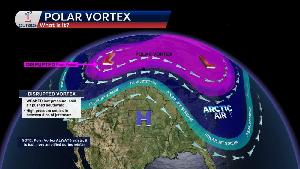
-
November 2025 general discussions and probable topic derailings ...
jsw replied to Typhoon Tip's topic in New England
Now 17F/15F, clear as a bell. We'll have to let it warm up a few degrees before our house-painting contract begins today...brrr! -
November 2025 general discussions and probable topic derailings ...
jsw replied to Typhoon Tip's topic in New England
Yup...
-
November 2025 general discussions and probable topic derailings ...
jsw replied to Typhoon Tip's topic in New England
Thank you for bringing me on topic! -
November 2025 general discussions and probable topic derailings ...
jsw replied to Typhoon Tip's topic in New England
Roommate is from there, born and raised. I have seen some really nice photos from that area. And it's always the cold spot (SLK). -
November 2025 general discussions and probable topic derailings ...
jsw replied to Typhoon Tip's topic in New England
Saw a link on NPR, NOAA site with Aurora info/forecast. Most is over my head, but it shows strong activity continuing in the Northern Hemisphere. Also, I am a sucker for nice visuals... Haha. https://www.swpc.noaa.gov/ -
November 2025 general discussions and probable topic derailings ...
jsw replied to Typhoon Tip's topic in New England
Nice! I lay down to read and fell asleep before 9pm. I have seen the glowing white curtain type, but never bright colors. Thanks! -
November 2025 general discussions and probable topic derailings ...
jsw replied to Typhoon Tip's topic in New England
Flakes were in the air a couple of hours ago here, first snow of the year! If the spine of the Green Mountains doesn't block all of what is showing now on radar, we're in for some more proper snow showers. -
November 2025 general discussions and probable topic derailings ...
jsw replied to Typhoon Tip's topic in New England
Now, 31/25. We got about a half inch of rain for the duration. Came down in buckets for about a half hour yesterday evening. Good to see some snow high up and up North! Mountains are also blowing snow like crazy. My favorite time of year--first snow to end of March. -
November 2025 general discussions and probable topic derailings ...
jsw replied to Typhoon Tip's topic in New England
It's 25/24, up from 24/22 an hour ago. That's KEEN. T minus 23 days until I mount my very own outdoor thermometer at my new apartment, just like the good ol' days. I will no longer be a poor excuse for a weather nerd!!! -
November 2025 general discussions and probable topic derailings ...
jsw replied to Typhoon Tip's topic in New England
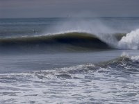
It's true. I have not seen a water spout with my own eyes either. Someone had posted the photo from Narragansett Bay on my local surfing forum. It is a cool image. I also have not seen with my own eyes a funnel cloud over land.

