-
Posts
3,557 -
Joined
-
Last visited
Content Type
Profiles
Blogs
Forums
American Weather
Media Demo
Store
Gallery
Everything posted by wthrmn654
-
If not, moderators will likely step in. He's not learning and clearly thinks it's a joke.... sadly.
-
Oh I'm on mobile, I found how to manually add names thrive the account area.. thanks!
-
Pssst...Where's the ignore button ?
-
Seriously please stop. We are begging you.
-
Your a category 9 hurricane on the intensity level... My gosh
-
I forgot about that button, time to press ignore myself. Lol
-
Speed was slower and it had 0 dry air or shear top contend with.
-
You
-
Yes, the big caveat here is that just like operationals often times underperforming with TC intensity, as is their inherent design (not a flaw), TC models often times overperform. There are always caveats and to err on the side of caution. Nothing beats in situ data. We'll need recon to verify if Ernesto is definitely going to start any rapid deepening tonight or obviously a substantial increase in ADT. We don't even have a clear eye yet, though that is probably coming. 8 pm shows 80mph winds.
-
Who is this guy?! His names on Google searches....
-
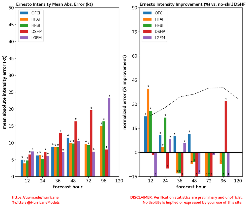
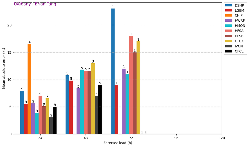
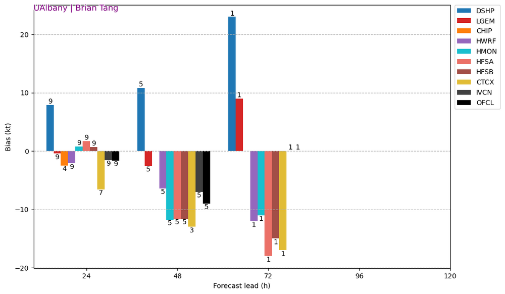
Let's remember, need a couple runs of consistency to raise confidence level for anything. Also some of the crazy pressures that some models show usually so not get that low... atleast in recent memory.
-
-
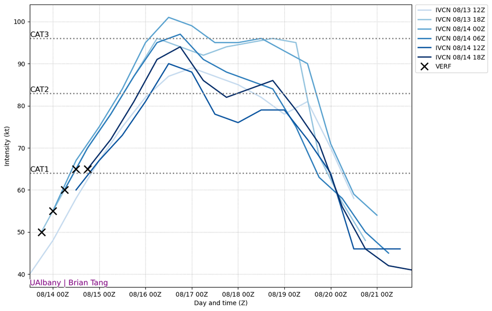
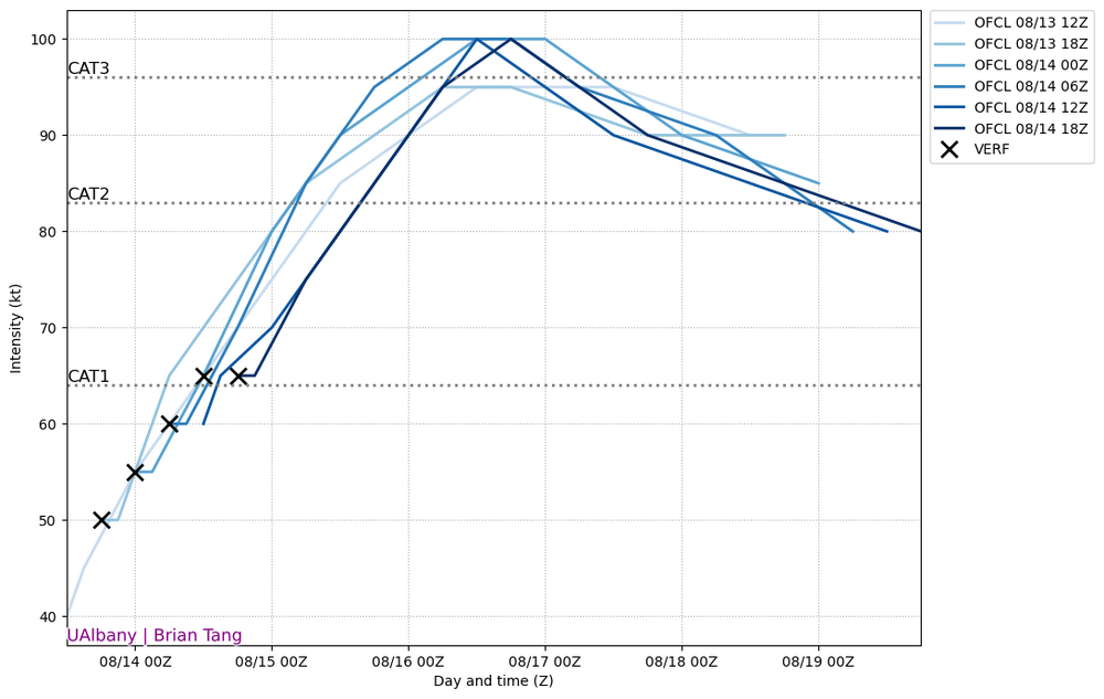
Dude, you don't just look at hurricane models..... nothing says anything over car 3 consensus or offical.. this was mentioned earlier that it's a consensus... How about instead of doing the what if, please focus on the facts/ what is known and on the table now. 00z intensity now suggest we peak at 36 hours.
-
-
Nhc says peaks in next 48 hours Most of the intensity models indicate that the hurricane should peak in intensity in about 48 hours. At that time, the official forecast shows a peak of 100 kt--major hurricane--which is near the top end of the guidance and close to the HAFS-B, COAMPS-TC, and HCCA models.
-
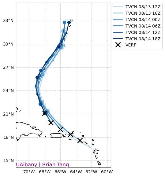
Hurricane Ernesto Discussion Number 13 NWS National Hurricane Center Miami FL AL052024 500 PM AST Wed Aug 14 2024 Visible satellite imagery shows that Ernesto's cloud field is gradually expanding, and there have been hints of an eye potentially forming in the Central Dense Overcast. The Air Force Reserve mission from a few hours ago found that the central pressure had fallen to 989 mb, but there were no indications that the maximum winds were any higher than 65 kt. The initial intensity is therefore held at that level, which is also supported by the latest satellite intensity estimates. Ernesto is still moving northwestward but continues to turn to the right, and the initial motion is 325/14 kt. A turn toward the north-northwest and north is expected tonight and on Thursday as the hurricane moves through a break in the subtropical ridge, but the trough causing this break is forecast to leave Ernesto behind later in the week. The result is that Ernesto is likely to slow down while it passes very near Bermuda Friday night and Saturday. Thereafter, a second trough approaching from the west should cause Ernesto to accelerate toward the northeast, near or just south of Atlantic Canada. The track models are in very good agreement on this scenario, but there is a bit of east-to-west spread after 48 hours. The new NHC track forecast has been nudged eastward after 48 hours to be close to the multi-model consensus aids, although at this time it is too soon to know exactly how close Ernesto's center will move to Bermuda this weekend. An environment of warm ocean waters (around 29 degrees Celsius) and low to moderate shear should allow Ernesto to strengthen gradually during the next few days. Most of the intensity models indicate that the hurricane should peak in intensity in about 48 hours. At that time, the official forecast shows a peak of 100 kt--major hurricane--which is near the top end of the guidance and close to the HAFS-B, COAMPS-TC, and HCCA models. A weakening trend should begin after 48 hours due to moderate shear and a drier, more stable atmosphere, but the weakening is likely to be gradual. As a result, the official forecast keeps Ernesto as a hurricane throughout the 5-day forecast period.
-
dude you need to take a chill pill one minute your talking about one thing then seconds later something else then crying about the storm then starting the cycle over again... come on now
-
nhc said it would have bouts of bad stuff per the 11am discussion Although Ernesto is moving over very warm waters, the hurricane might have to deal with bouts of increased shear and nearby dry air during the next several days. That said, the intensity guidance shows continued gradual strengthening, and the official forecast still reflects the possibility of Ernesto becoming a major hurricane in about 48 hours. Much of the intensity guidance has come down on the peak intensity this cycle, but for now we'll maintain continuity and wait to see if this trend continues.
-
sat estimates. weakening flag is on as of 17 z, winds estimated at 57knots pressure of 987mb
-
Time MSLP/Vmax Fnl Adj Ini Cnstrnt Wkng Rpd ET ST Cntr Mean Scene EstRMW MW Storm Location Fix 2024AUG14 172020 3.6 987.7 57.0 3.3 3.5 3.5 NO LIMIT ON OFF OFF OFF -68.34 -58.08 UNIFRM N/A -2.0 20.97 67.92OES16 25.9
-
@WxWatcher007 id say your wish about only analysis and good posts versus reality didn't exactly go as planned. lol been some nonsense posts throughout at times lol maybe next storm!! Edit: and i won't name any names ! lol
-
ill show you the ensemble intensity map from 6z for example.

