wthrmn654
-
Posts
3,953 -
Joined
-
Last visited
Content Type
Profiles
Blogs
Forums
American Weather
Media Demo
Store
Gallery
Everything posted by wthrmn654
-
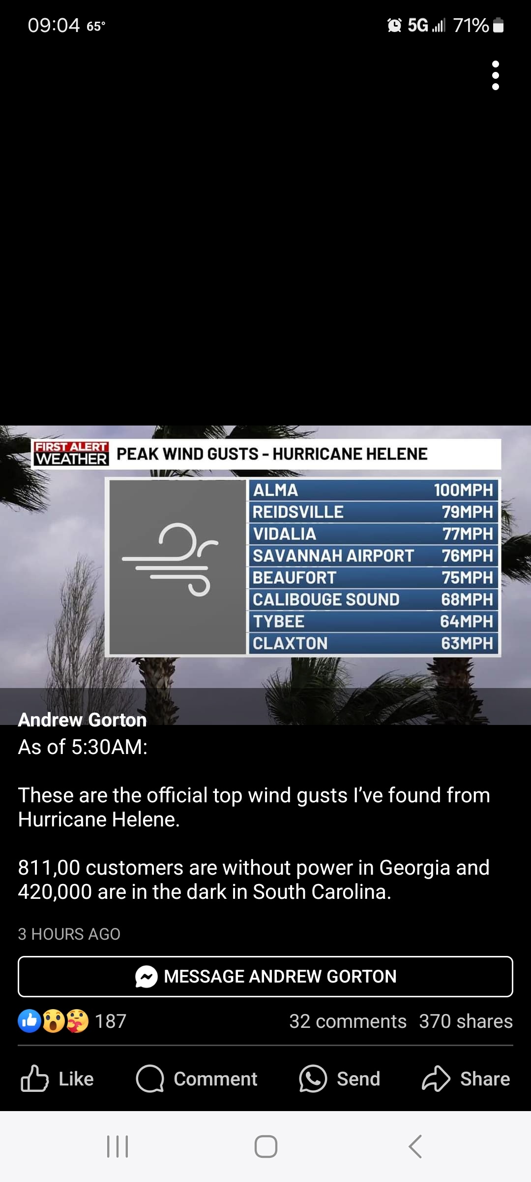
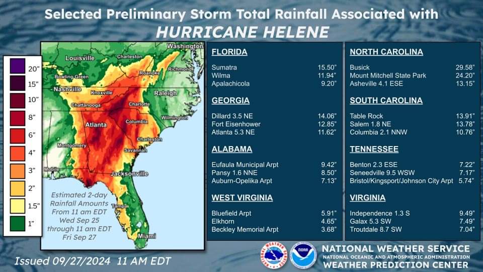
Holy shisters these are rainfall amounts from 11 am!
-
I wonder if I'll be going down south to help out with fire dept. I haven't heard of any requests as of yet.
-
Quite spectator that anyone in ground 0 zone of landfall have power right now
-
In Lafayette only 2 people have power. Hamilton 5
-
Taylor County has 99.6%without power, only 29 people have power wow Taylor County of Florida Customers Tracked 13,998 Customers Out 13,969 Outage % 99.79% Last Updated 2024-09-27 11:45:38 PM Electric Providers Customers Tracked Customers Out Duke Energy 6,069 6,057 Tri-County Electric Coop 7,929 7,912
-
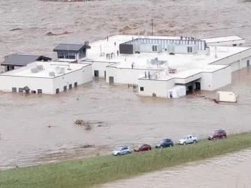
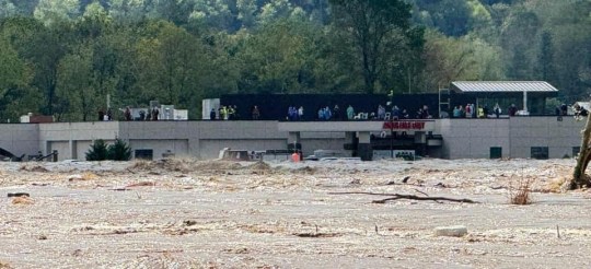
Wow hospital in TN had to do evacuation by helicopter from roof for 45 people water nearly to roof! https://www.knoxnews.com/videos/weather/2024/09/27/helene-floods-trap-dozens-hospital-roof-tennessee-helicopter-rescue/75417195007/

-
Up to 42 deaths... worst case scenario, people didn't need warnings and got trapped and died, you could have several hundred dead when all is said and done. Best case scenario, everyone's been smart and maybe up to 100 have lost they're life's in total. I'm hoping for 2nd choice at this point. So much destruction, Helene will be retired and removed from list no doubt.
-
I-40 mile at mile maker 6 is gone closed indefinitely, many bridges are gone in places, rock slides, mud slides. Bridges gone in TN. Wild
-
Great thank you, I assumed what I had read was a mission I read about
-
did anyone hear anything more about that noaa 42 plane we saw doing circles yesterday? ive seen some reports saying they got damaged and stuck in plane and i also saw some saying they were doing a UAV mission which i did find on the recon flight plan....
-
Just saw up to 30 deaths sadly
-
They used aqua fence around hospital in Tampa and everyone was making fun of them and laughing, just saw a video of the aquafence standing strong one side bone dry, the other side a lot of water against it !
-
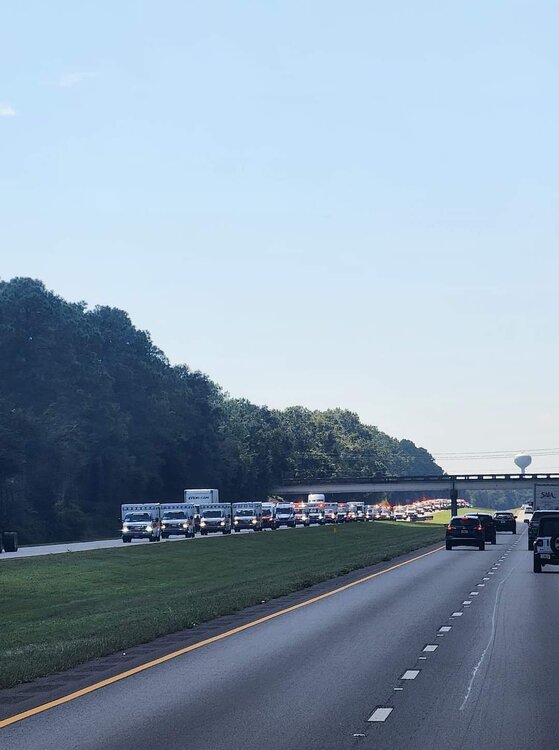
A convoy of ambulances following a convoy of lineman trucks. : Richard Andres #Helene
-
Storm surge report from around 1150 last night: At least 8-10 feet of surge in Steinhatchee right now @NWSTallahassee Update about 10 mintues ago, there are so many mixed death reports for obvious reasons. Points Death toll: At least nine killed by Hurricane Helene More than 4 million homes and businesses left without power Hundreds of flights cancelled Friday following the storm Helene becomes tropical storm in Georgia after 140mph winds ravage Florida
-
Not sure what state these are for.
-
Weather Channel said that
-
Can't say I've ever seen radar estimates like that before ever! Wow And even if you were to cut that total in say half it's still 15 inches! Poor southeast!
-
I can't link you to individual Webcam but they're are several in fort Meyers that were moved around and show the area along coast s of right now, idk how they still have power. That is time lapse ones I'm sure there ones that are normal speed too https://www.weatherbug.com/weather-camera/?cam=FTOMY
-
https://www.google.com/amp/s/www.nbcnews.com/news/amp-video/mmvo220277829738 https://weather.com/storms/hurricane/video/cedar-key-damage-from-hurricane-helene Key updates More than 3 million customers without power in Florida, Georgia and Carolinas Rain totals from Helene top a foot from Florida to the Carolinas, setting records With one dead in Florida, DeSantis predicts more fatalities
-
Another big crop that I hope isn't hurt is Christmas trees!
-
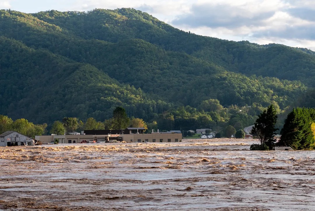
Western North Carolina record breaking flooding already happening already, I think I heard dates of like 1938 or something.
-
Cedar key Florida 9.3 feet current water level
-
3 deaths reported so far
-
Last frame on radarscope the eye has a square look to it
-
Clearwater is approaching major flooding. 5.98 feet