wthrmn654
-
Posts
3,953 -
Joined
-
Last visited
Content Type
Profiles
Blogs
Forums
American Weather
Media Demo
Store
Gallery
Everything posted by wthrmn654
-
-
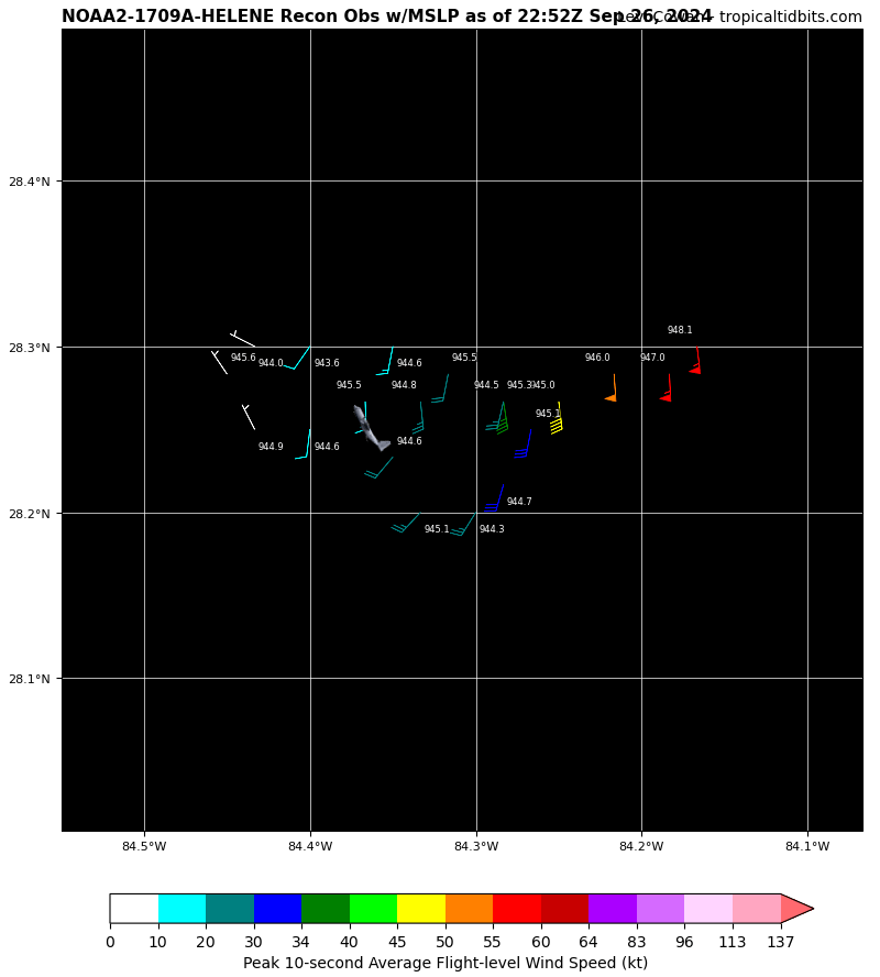
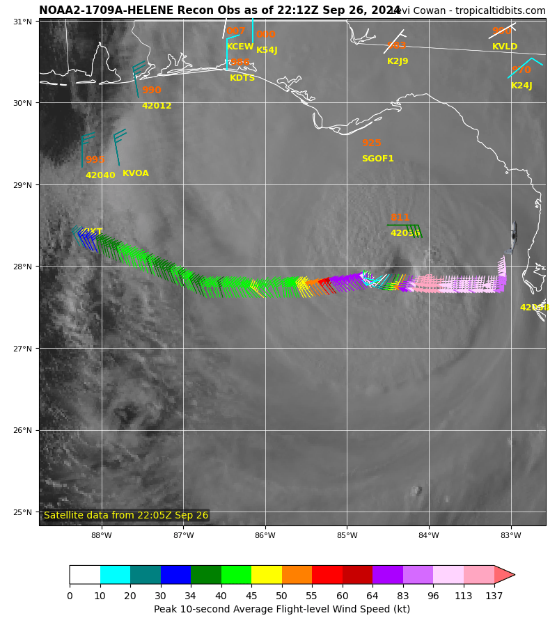
Ne eyewall drop sonde had 110 knots at 150M a little while ago jeez
-
I'll throw this here but idk if this is why the plane was doing weird things earlier.. B. DURING THE NOAA 42 MISSION TASKED IN TCPOD 24-117 FOR THE 27/0000Z SYNOPTIC TIME, ONE SMALL UAS IS PLANNED FOR RELEASE 105 NM EAST OF HELENE'S CENTER AT APPROXIMATELY 26/2115Z AND ANOTHER 105 NM SE OF THE CENTER AT APPROXIMATELY 27/0000Z. THEY WILL OPERATE AT OR BELOW 5,000 FT FOR ABOUT 1 TO 1.5 HOURS.
-
If something truly had happened I'm sure we'll hear about it in the coming days. I think they were doing rapid tracking.
-
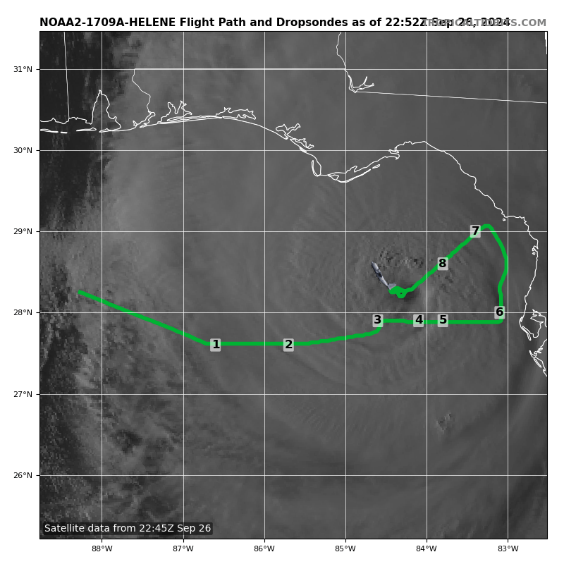
Not sure what your looking for exactly but I found this recon site that gives far more stuff I do believe https://cyclonicwx.com/recon/mission/HELENE_NOAA2_1709A/
-
What a nice eye.
-
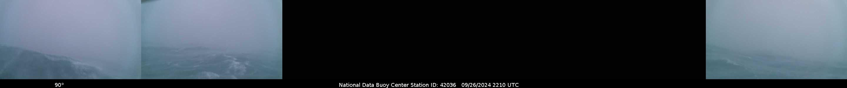
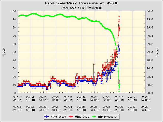
Buoy data says the eye has passed it The pictures that the buoy is sending back are pretty cool looking
-
ADT satellite estimates suggest we have leveled off.
-
Noaa plane is back to normal teal getting closer to center and that other random fake recon plane is now missing from radar
-
Teals already started sampling.
-
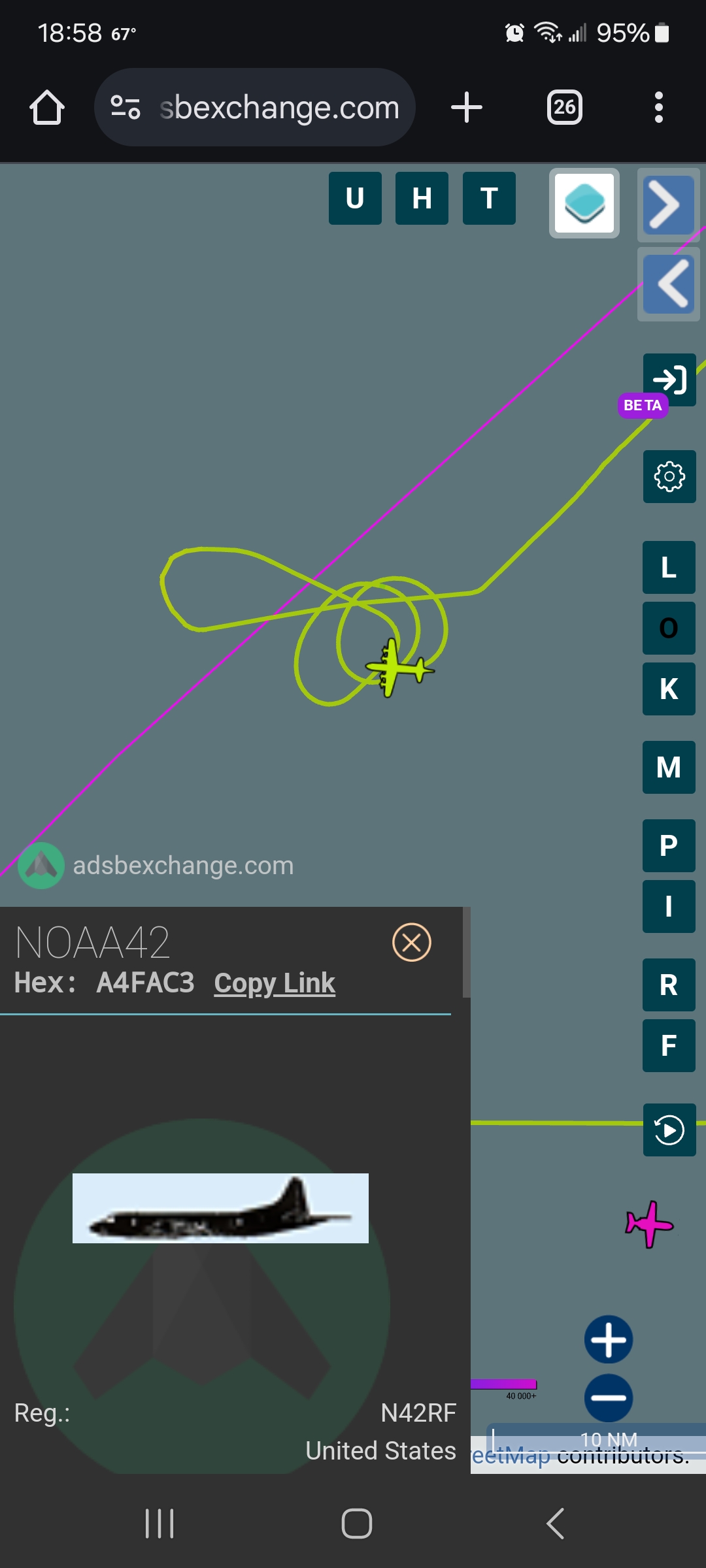
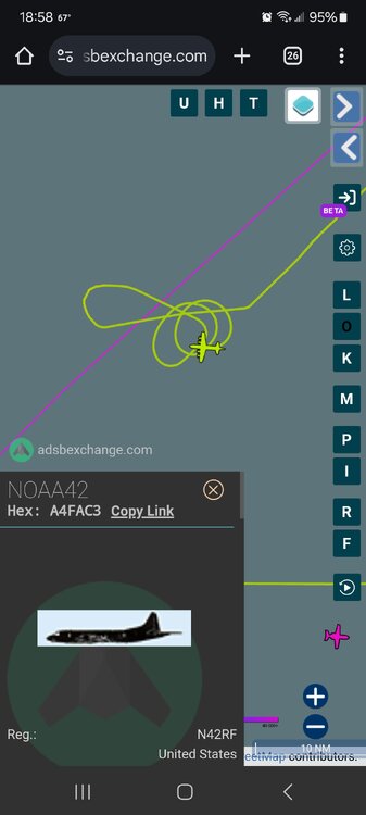
Well there up to about 12 loops so one of these numbers must be the center...
-
Buoy must of taken a bit but still alive!
-
SUMMARY OF 700 PM EDT...2300 UTC...INFORMATION ---------------------------------------------- LOCATION...28.3N 84.4W ABOUT 110 MI...175 KM W OF TAMPA FLORIDA ABOUT 145 MI...235 KM S OF TALLAHASSEE FLORIDA MAXIMUM SUSTAINED WINDS...130 MPH...215 KM/H PRESENT MOVEMENT...NNE OR 25 DEGREES AT 23 MPH...37 KM/H MINIMUM CENTRAL PRESSURE...945 MB...27.91 INCHES $$ Forecaster Bucci
-
Yeah with teal enroute and being the low pressure sample earlier, I'd guess the same thing. But I really hope it's not mechanical
-
6 loops later at 8 thousand feet and there still sampling the eye...
-
Give them credit for being so determined to find the center
-
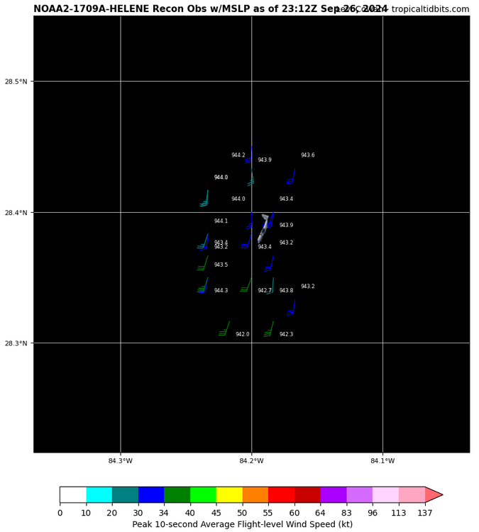
Lmao sorry can't help but laugh at this path, 943 lowest plane recorded.


-
Teal heading to storm, noaa doing loop de loops around the "center" looking at plane tracker. Must of missed center.
-
Just updated satellite estimate, let's see how it matches up with next recon pass. Current Analysis ----- Date : 26 SEP 2024 Time : 221020 UTC Lat : 27:54:35 N Lon : 84:18:00 W CI# /Pressure/ Vmax 6.3 / 929.2mb/122.2kt Final T# Adj T# Raw T# 6.3 6.3 6.9 Estimated radius of max. wind based on IR : 16 km Center Temp : +0.7C Cloud Region Temp : -73.3C Scene Type : EYE
-
Looks brutal in the Gulf!

-
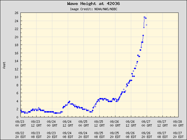
Waves are still updating It appears, nearing 25 feet!
-
We may of lost the buoy...
-
I'm afraid there could be many lives lost, and many trees lost. The timber industry, farmers are going be hurt badly. There's nothing good about this situation at this point.
-
My God, look at far east those crazy winds extend, not sure how much of that mixes down to surface but I hope people run for there lives if they haven't yet! And to note, that is the buoy by the center, looks like it will go just east of it!

-
Nhc 6 pm winds are 125 mph. Was corrected