GramaxRefugee
-
Posts
1,774 -
Joined
-
Last visited
Content Type
Profiles
Blogs
Forums
American Weather
Media Demo
Store
Gallery
Everything posted by GramaxRefugee
-
Nov 5 and 12 seem to be the only weekends without rain at my station since Sept 3. Some pretty minor, but still.... I'm getting sick of rainy Sundays. Just emptied 0.99" for today. Plenty still falling. Temp 54f
-
I asked for that dish in a Mexican restaurant once, and the waitress said that's an Italian thing. (Where she worked before). Guy at the next table said it's a French cheese appetizer. "Quickly with cheese". Pretty confusing, so I just had the tacos. Y'know, play it safe.
-
23f for our low. Frosty but nice.
-
low 27
-
They say opposites attract.
-
You misspelled "score fixing by an enemy of Tom". (all starting to make sense now)
-
Both erroneous, I can tell right now. (Their reputation precedes them)
-
0.5" in Anne Arundel.
-
6 flakes landed on my windshield waiting at the red light in Annapolis. (A few more flurries when I parked at work.)
-
Just plain light rain in Annapolis, (even though we've been on flurry watch) edit: sleet mixed in for a bit now; and maybe a few flakes.
-
Foggiest I've seen in a long while here in AACo. Drove 6 miles and back this evening and had to be more watchful than usual for deer/critters.
-
Nov total 2.92" Highest temp 75. Lowest 22
-
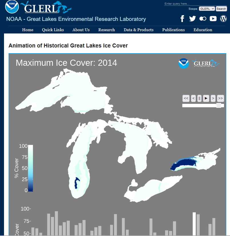
Never (in satellite era). This is not too shabby 2014. (2015 about the same): link for the curious: https://www.glerl.noaa.gov/data/ice/historicalAnim/

-
22 low eta: the tidal South River was shockingly frozen about 1/3, I estimate. I expected only some skim ice on the periphery.
-
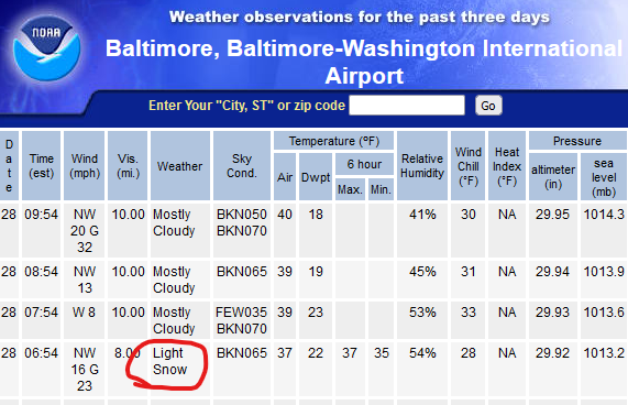
Well here ya go Nov snow lovers... FDK and others also, but not IAD or DCA (as far as I could see) Take note that DCA went 2 f lower than BWI
-
Reached a low of 27 after midnight, but climbed to about 32 by dawn. No evidence of snowfall here.
-
.24" so far
-
My morning low has already been beaten by 1, and clear sky with 25 DP tells me it will be lower by midnight. Currently 28/25
-
Low 29.
-
I've had visitors here in winter that also expect us to get more snow than we do. But my friend from coastal Maine, who always hated their weather, described winter as a week of below zero temps followed by a warm up and rain. He's just described winter on much of the East coast; (adjusted for temp).
-
2023 Mid-Atlantic Garden, Lawn, and Other Green Stuff Thread
GramaxRefugee replied to mattie g's topic in Mid Atlantic
Mowed Sunday, (partly to get some bags of leaf mulch). At the time, I was pretty sure I'd have another cutting on the South facing slope at least, but after 2+" of rain I'll have to re-evaluate. In fact, this morning the whole neighborhood was a big mess of wet leaves. -
Storm total 2.4"
-
1.31 at obs time, still raining.
-
I think that chart is wrong for 1987, when we only had 31". Eta : I get closer to 24 than 26, so the basic idea is true. Interesting.
-
Yeah but you know how to work a measuring stick.