stormy
-
Posts
2,192 -
Joined
-
Last visited
Content Type
Profiles
Blogs
Forums
American Weather
Media Demo
Store
Gallery
Everything posted by stormy
-
The monster El Nino by August is nothing more than hype by DT. We can expect a reasonable El Nino by Fall. Probably a better winter next year with more precipitation and better chances of snow! This is the likely pattern. This will save many from suicide....................
-
GEM doubles rainfall expectations for Friday.
-
Thanks Mattie!!! You are illustrating a problem that has created snowfall problems for years.
-
Ha! You gotta be joking!!!!!!!!!!!!!! Most have already overacted to a nearly snow-less winter when part of the reason is that the year started out dry. LOL
-
The ECMWF drops nearly all of the weekend stuff for most. Only real rain now is Friday. Drops from 1.64 to .86"
-
6 hours makes a huge difference with the volatile GFS. Rainfall expectation for my community dropped from 3.99" at 6am to 1.80" noon. 72 hrs from Friday am - Monday am. It will likely spike again at 6 pm.
-
25.4 at 6:45. 20 degrees colder than normal. A station in Highland County reported 19. A 72 hr. 3 model blend from 7 am Friday through 7 am Monday is 2.79". GFS 3.99, GEM2.75, ECM 1.64.
-
30.7 at 7 am. 15 degrees colder than normal.
-
.21" total rain yesterday and 32 degrees this morning. 1.36" total rain for April.
-
The CPC is wrong more often than right with these 6-10 and 8-14 day maps. If we had received the rain predicted by the 6 - 10 day CPC forecast year to date, we would be 5 inches above normal vs. 5 inches below normal. The CPC is wrong more often than right with these 6-10 and 8-14 day forecasts. If we had received rainfall year to date based on these 6 - 10 day maps, we would be 5 inches above normal vs. 5 inches below normal.
-
I am happy to see more people connect with the reality of an expanding NOAA classified "moderate drought" over northern and eastern Virginia. 3 weeks ago, I seemed to be the only one concerned. Droughts cost billions of dollars every year. They create financial disaster for the people who feed America. I live in an agricultural area and have good friends who produce the crops that feed America, including Mattie. Drought causes crop failures and results in higher prices for everyone at the supermarket. Depending on severity, drought can severely affect every person in many ways. I was friends with the former state climatologist for Virginia, the late Dr. Patrick Michaels. Dr. Michaels pointed out that to have a good growing season Virginia needs to go into the growing season wet, because of very high evaporation rates in May through August. We are going into the growing season very dry this year. The last 45 days since March 1, I have received 30% of normal rainfall. We are on the way to be declared a drought disaster area before the summer is over unless this pattern breaks down. It probably will change because of the changing Enso condition. We can only pray for this change, for You, Me and even Mattie.
-
22.8 was the low at 7 am.
-
Larry is the chief meteorologist at WEATHERAmerica.
-
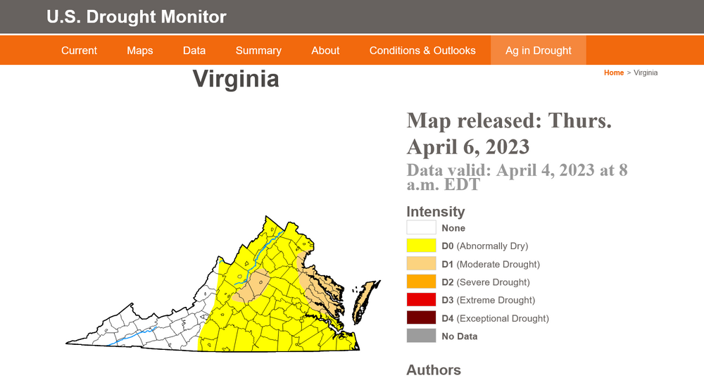
Charlottesville slipped into Moderate Drought with the update this morning:
-
So close and yet so far away..................... Deficits are worsening.
-
Thank you for your explanation, it is appreciated. I completely agree that none of our seasonal guidance has much success past month one. We just aren't there yet.
-
I always enjoy reading analysis by true professionals! Those red letters below your username always adds credibility. Now, on to a non professional. A little over 4 months ago when I issued my winter forecast for my twice weekly newsletter, the CFS was predicting a colder than normal and wetter than normal winter, December - February. We had just the opposite. My track record for the past 15 years has been impressive, this year a total failure, because I weighted the CFS too heavily on what should have been a declining La Nina. The SER acted more like a Nina on steroids! Do any of you guys have any professional thoughts regarding how or why the CFS was such a failure for this past winter?
-
Larry Cosgrove now gives favorability to a west based Nino. Weak/moderate
-
The metrics assimilation cannot capture reality............................ Front crossing the Valley headed for D.C., crossing by 7 pm
-
In the Valley as the front is on our doorstep. Westerly winds to 38 mph and 72 degrees.......................
-
Winds should really kick up when the cold front extending from western Pa. down through eastern W.Va. passes through. I have had a gust to 28 mph during the past 30 minutes.
-
A slight over-performer last 24 hrs. 4 model blend was .21", received .37".
-
I have been amused with some on this forum who are obviously ignorant of this present reality. If this does not change, the coming summer will be parched toast. Is no one concerned when so many seem to be concerned about "why it doesn't snow anymore"..... This is a farcical joke!! The enso shift will probably intervene. I have observed a 6 month lag in enso shift to reality. This 6 month lag encourages an increase in rainfall by late summer and a better winter next year for the snow-lovers.
-
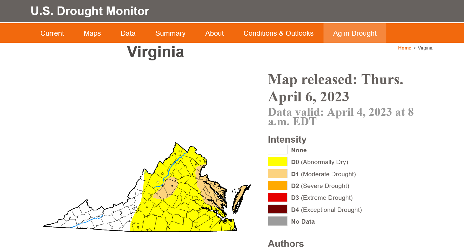
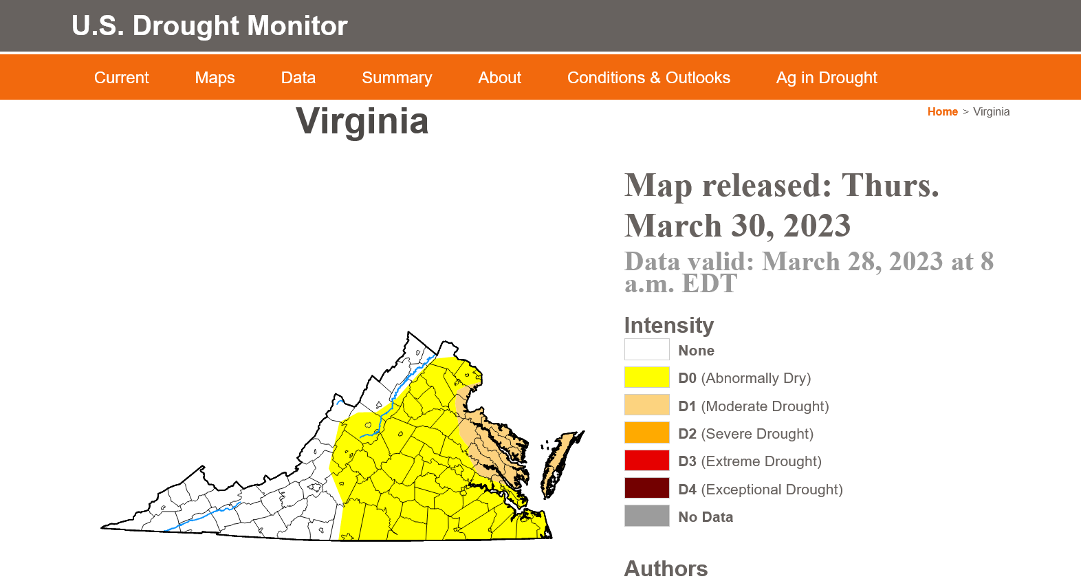
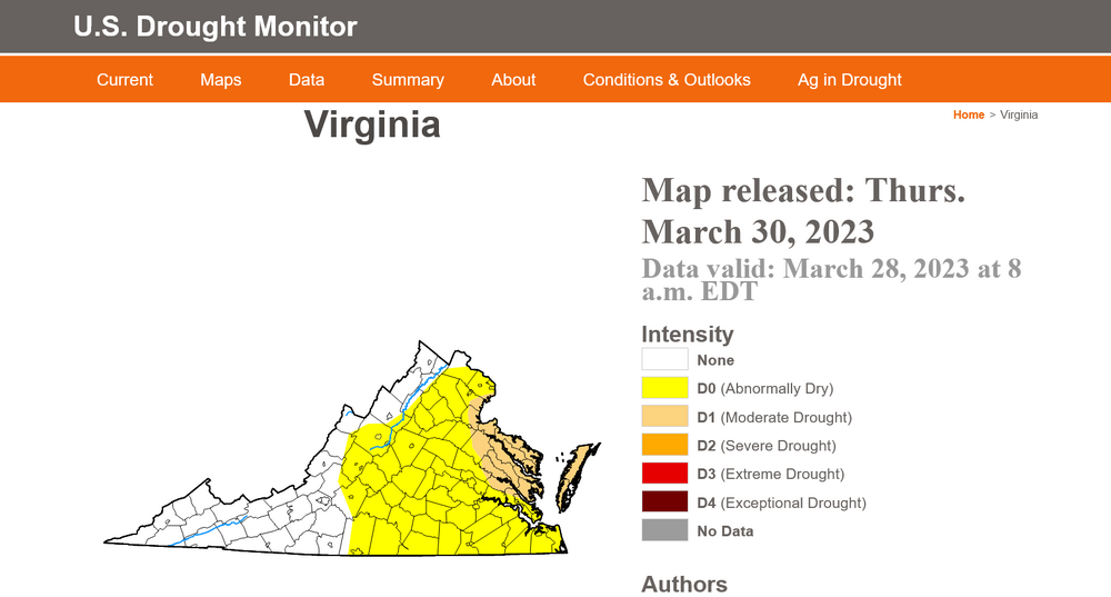
A portion of east-central Virginia was upgraded to moderate drought this morning!
-
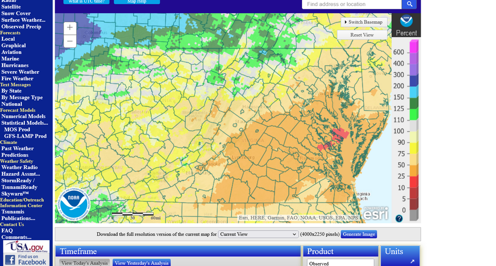
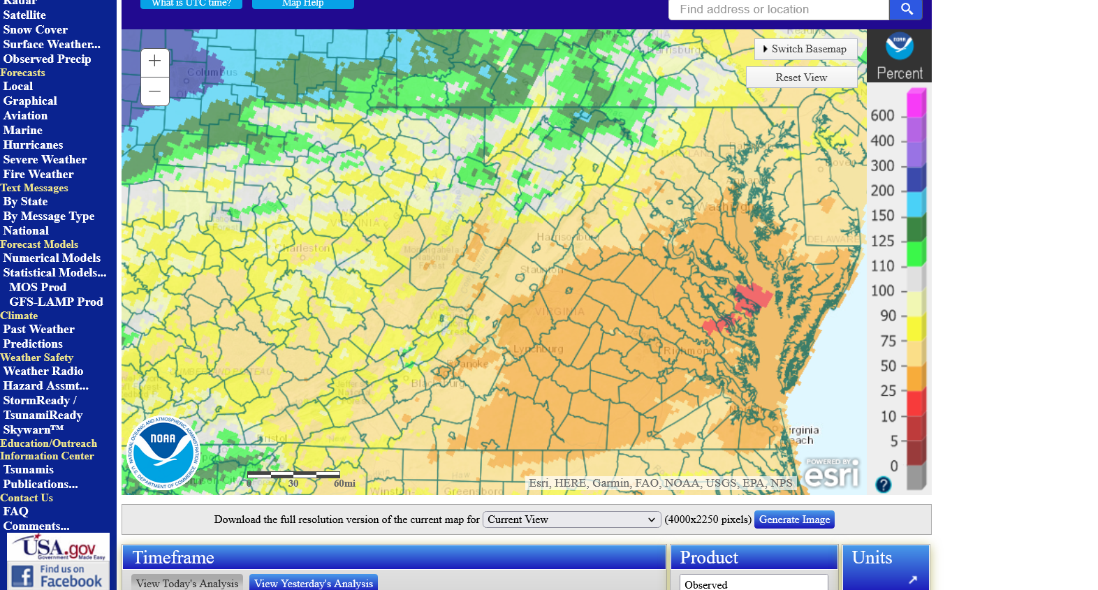
Yes, it has been very dry for the last 30 days south, southeast and southwest of D.C.. Many areas only 25 - 50% of normal. Only areas with normal precipitation are northwest of D.C.. The U.S.D.A. Drought Monitor lists D.C. proper as being abnormally dry. During the past two weeks the percentage of Virginia abnormally dry has increased from 4% to 23%. If this pattern continues, many will be evolving into drought conditions during the spring.