stormy
-
Posts
1,992 -
Joined
-
Last visited
Content Type
Profiles
Blogs
Forums
American Weather
Media Demo
Store
Gallery
Everything posted by stormy
-
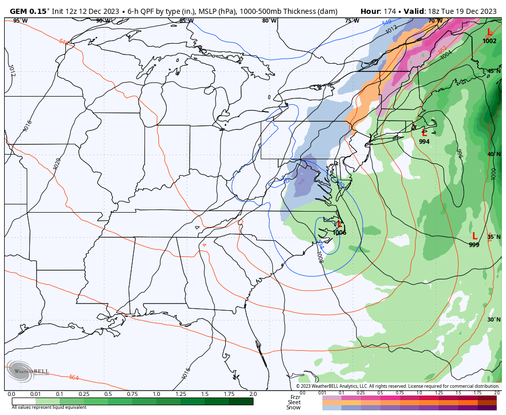
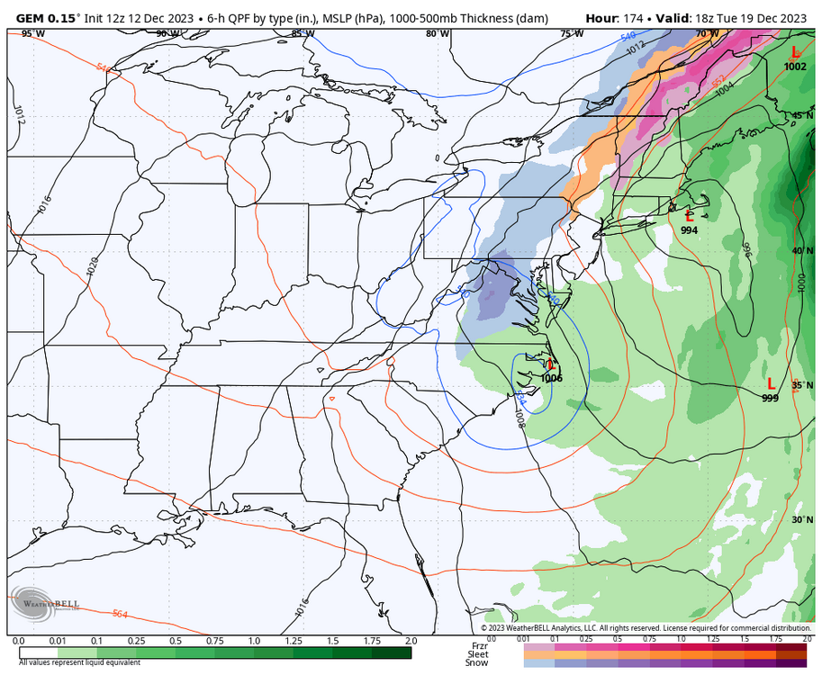
Yesterday afternoon both Ji and I expressed suspicion of possible surprises early next week with an east coast storm. This Watch still exists this morning. The GFS,GEM and Euro all see a significant system affecting the SE/MA coastal region during this Sunday - Wednesday timeframe. Heavy rain, snow and wind are all in the mix with run to run hiccups. The op GFS even gives my area 2 inches of snow on Tuesday night but the GEFS keeps any snow in the mts. to my northwest. The latest ECM gives more impact to the area east of I-95 while the GFS suspects more inland impact.
-
But, a few things you must consider. A 5 year famine would crucify and explode your food prices. It would crucify every living plant or tree on your property. All for a 40+ winter in D.C.???
-
I couldn't care less how much snow we receive this winter. My one reality is that we all need a wet winter considering the drought conditions. A wet winter is my concern, bring on many warm wet systems! It would be a Godsend....................
-
-
Don't shed tears, the CFS is "Crap For Sure", unless it hiccups........ We will be fine...
-
Hey Ji ! , I agree, stay tuned
-
I believe the only comment Ji made yesterday was the 12z 12-11 ECM pushing the storm out to sea with fresh cold air coming in from the northwest while we stay dry. This GEM idea is completely different with the eastern burbs of D.C. getting over 2 inches of rain before enough cold air is pulled down and into the system to transition lingering rain into snow. Today's 12z ECM sniffs but kicks 2.0" rain back to .20" rain before pushing qp to the east as cold air moves in.
-
GEM brings snow next Tuesday by a coastal that creates its own cold air.
-
Do you know how long this "raging pacific jet" has been a problem ? Is it more likely to occur today than 20 years ago or 40 years ago ? How about the 1960"s ?
-
18 z GFS caves to the ECM. I begin to worry everytime this happens. A wet winter is what we need. This is not a step in the right direction.
-
I thought abought 15 minutes ago. This wind is really cold until I realized its December!!
-
18 on top of Spruce Knob at 4 pm. We'll see this temp at 6 am. Some snow still on the ground especially northern exposures at 4 and 38 degrees .
-
12z GFS dumps another 2.0 inches of rain on us a week from today.. Snow? The 540 line is up in Maine.
-
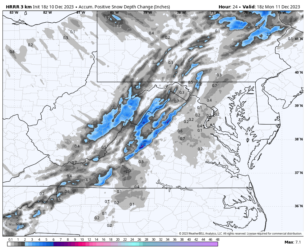
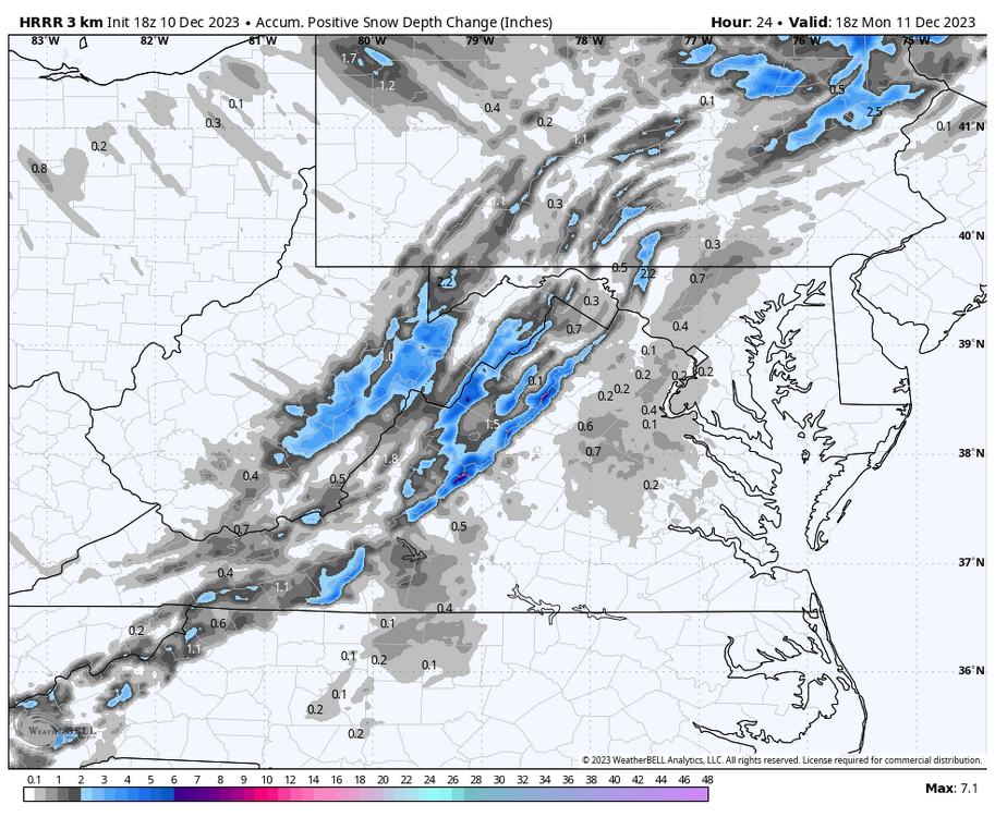
I usually review statistics on every event, winter and summer. A lot of discussion Saturday and Sunday concerned the preferred model measure of total accumulation. What I believed to be the common sense preferred measure because of marginal borderline surface conditions pre and during the event did not measure up very well in review. I usually relied on the Positive Snow Depth Change. In review, I found it to be consistently too low for both myself and Psu. Of course I realize it may have been correct for "skunked" locations. The 10:1 measure was far more accurate. 24 hours pre-event at 06 Sunday : Stormy 2.0" - Total PSDC - GFS .3" ECMWF 1.0" Stormy 2.0" - 10:1 Ratio - GFS 1.7" ECMWF 2.0" 24 hours pre-event at 06 Sunday : Psu 3.8" - Total PSDC - GFS .3" ECMWF 1.4" Psu 3.8" - 10:1 Ratio - GFS 3.9" ECMWF 2.9"
-
32 degrees and light snow, guessing 2 inches.
-
39 with light rain. Snow falling above 2500 ft.. Wintergreen has transitioned with 32 degrees.
-
I will lose sleep later tonight waiting for your banding!! I remember Jan. 2 of 2022 when I recorded a high of 60 degrees. Next morning I had heavy snow at nearly 2 " per hr at times. 8" of snow in 6 hrs. with drifting to a depth of 3 ft. Yes, it can happen!
-
The Positive Snow Depth Change on the 18z HRRR will probably be closer to reality or even generous below 2000 ft. 55 degrees and .72" rainfall at 3 pm.
-
This could be a classic noreaster. Tomorrow is a mess........................
-
Thanks
-
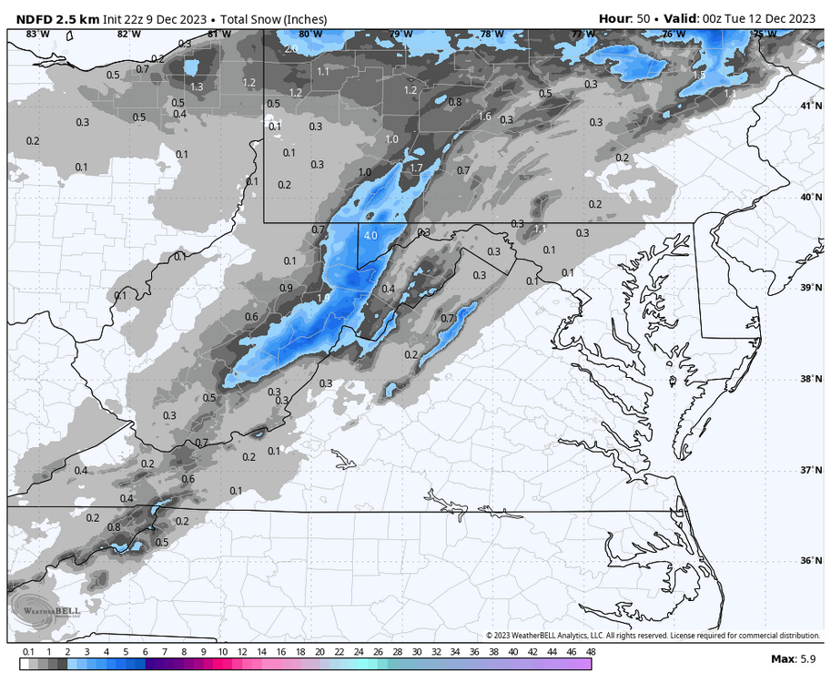
Searching for a better short range model than the NAM as suggested by psu. Lets try the NDFD I could buy this.
-
It would definitely trail the CMC for rationational cooling nightly lows.
-
The GFS finds the 17 storm with 8 inches for the Central Valley. More of an inland runner with mostly rain east of BR. I don't like the Superior LP..........................
-
I have been saying for a long time. Don't ignore the GFS.............
-
I can't find any disagreement with what you say. The 12k dropped 10:1 snowfall from 7" to 2" for my area and dropped total rainfall from 3.15" to 1.63". It amps more toward the coast and shifts precip. footprint which has been a 6 month pattern. Yes, the 3k is still amplified with snow but drops rainfall for me from 2.59" to 1.11". I agree with your thoughts about a short range model with more reliability.