soadforecasterx
-
Posts
146 -
Joined
-
Last visited
Content Type
Profiles
Blogs
Forums
American Weather
Media Demo
Store
Gallery
Everything posted by soadforecasterx
-
We have to snowfall total map yet?
-
January 18th Back Door NW Trend Snow OBS Thread
soadforecasterx replied to Mikeymac5306's topic in Philadelphia Region
Must of missed all the good stuff here in west grove. 2" yesterday, 1" this morning and 1" from the coastal. @ChescoWxwhat camera is that? I've been looking for a high quality outdoor camera. -
E PA/NJ/DE Winter 2025-26 Obs/Discussion
soadforecasterx replied to LVblizzard's topic in Philadelphia Region
Must of been on the edge of the good stuff only 2" here -
How accurate has the FV3 been?
-
This is starting to remind me of the Dec 14th storm. Where models had everything breaking up over the mountains but ending up doing good in the east
-
looks like nam is taking a whole different approach on getting us some snow fall. hopefully it can make it over the mountains.
-
January 2026 Medium/Long Range Discussion
soadforecasterx replied to snowfan's topic in Mid Atlantic
Icon looks to be a step back, kicker is keeping things more positively tilted. -
January 2026 Medium/Long Range Discussion
soadforecasterx replied to snowfan's topic in Mid Atlantic
Still looks to me to be in the GFS camp
-
January 2026 Medium/Long Range Discussion
soadforecasterx replied to snowfan's topic in Mid Atlantic
6z nam and rgem look decent. Still think we are in the game. -
January 2026 Medium/Long Range Discussion
soadforecasterx replied to snowfan's topic in Mid Atlantic
To me Nam looks to be more in the GFS camp then the others. -
January 2026 Medium/Long Range Discussion
soadforecasterx replied to snowfan's topic in Mid Atlantic
Really like the trends on icon and gfs. Always felt the second storm had the better chance -
January 2026 Medium/Long Range Discussion
soadforecasterx replied to snowfan's topic in Mid Atlantic
Seems like Euro moving away from the idea of the first storm but nice amount of members have coastal off the coast for the second storm.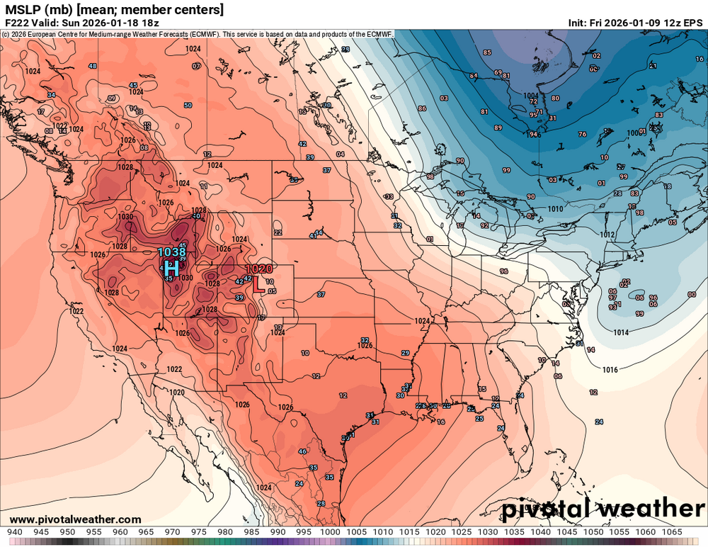
-
January 2026 Medium/Long Range Discussion
soadforecasterx replied to snowfan's topic in Mid Atlantic
Cant be upset about this look.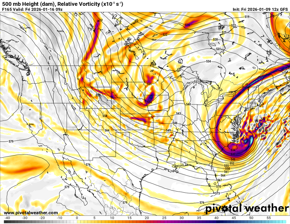
-
January 2026 Medium/Long Range Discussion
soadforecasterx replied to snowfan's topic in Mid Atlantic
about to go negative, can this pull it off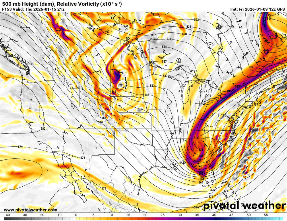
-
January 2026 Medium/Long Range Discussion
soadforecasterx replied to snowfan's topic in Mid Atlantic
wow this thing is so close to being a huge storm -
January 2026 Medium/Long Range Discussion
soadforecasterx replied to snowfan's topic in Mid Atlantic
Not a bad mean if you ask me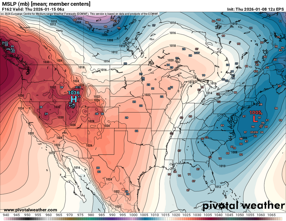
-
January 2026 Medium/Long Range Discussion
soadforecasterx replied to snowfan's topic in Mid Atlantic
That block north of Maine is what I like to see for our bigger storms.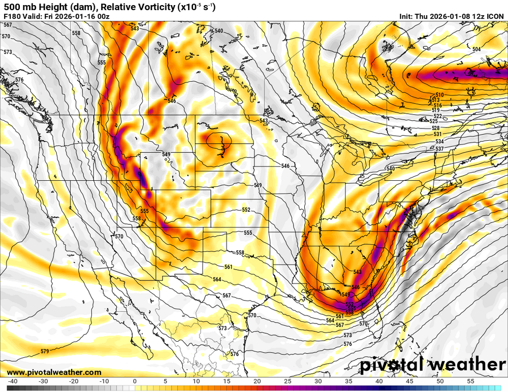
-
E PA/NJ/DE Winter 2025-26 Obs/Discussion
soadforecasterx replied to LVblizzard's topic in Philadelphia Region
Sounds about right, I also planned a trip with the wife to the Poconos. So I-95 is going to get crushed. -
January 2026 Medium/Long Range Discussion
soadforecasterx replied to snowfan's topic in Mid Atlantic
At hour 96 this is alot of change for the last 5 runs..thumb.gif.5dad5aaa355ab8725847e1b10d972a04.gif)
-
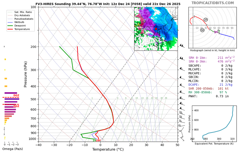
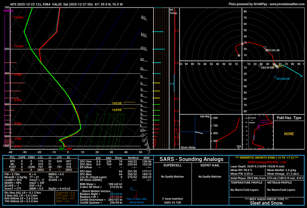
FV3 shows that rates can overcome upper level warmth.
-
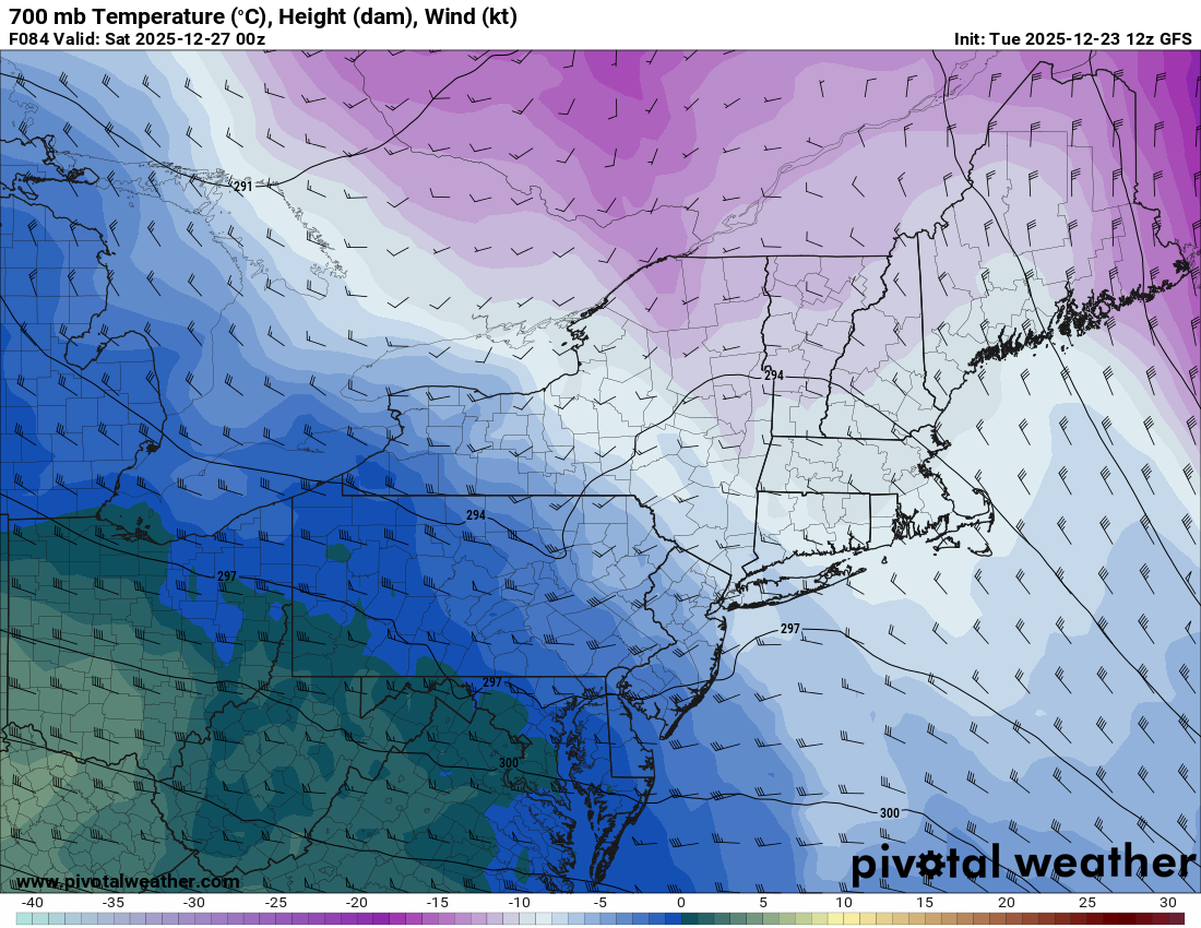
This seems to be the warmest point at the 700 level. You seem to be correct @Ji as long as you have good rates should be snow.

-
look like the warm is closer to the 700 level. can you pull that from weatherbell?
-
12/14: Sunday funday? Will the south win again?
soadforecasterx replied to TSSN+'s topic in Mid Atlantic
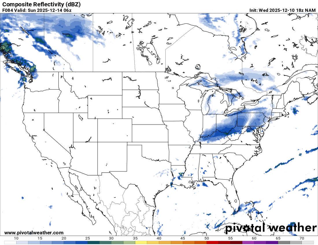
We all just got Nam'd!!! -
go to 18z nam for the composite. Right at 84 you see the explosion of snow in the east. that link defaults to 12z

-
I know Nam is out of its range but just looping to 84 makes you wonder how some one doesn't get a nice 2-4" storm


.gif.4fba76d85808fd8d56914dfb17ebaa78.gif)