

09-10 analogy
-
Posts
1,224 -
Joined
Content Type
Profiles
Blogs
Forums
American Weather
Media Demo
Store
Gallery
Posts posted by 09-10 analogy
-
-
14 minutes ago, konksw said:
Great storm in NW.
It got more impressive as it did its thing. Some legit timpani-like thunder to round things off at the end.
-
 1
1
-
-
Modest thunderstorm in up nw. I know it's severe warned, but nothing like that imby. Lot more T&L than yesterday, though.
-
1
-
-
Another breezy cloudburst with no thunder or lightning (so far; I thought I might have heard some distant thunder a few minutes ago). I mean, pouring, white rain, but only for a few minutes (again, so far). Must have been the fourth or fifth type of event like this in the past few weeks. And as soon as I wrap up posting, it's letting up.
-
Couple decent strikes in up nw. One of those storms that seems to rejuvenate itself. We had cloudbursitis about 15 minutes ago, and now another episode, with brightening skies to the west and north. I just love this kind of stuff. Must be frustrating to those who haven't cashed in on these unpretentious downpours recently.
Now some slow-motion thunder. You can sense this storm is trying to make the major leagues, but it just doesn't have the tools to stick.
-
Got my copy of Grazulis' Significant Tornadoes 1974-2022 today! Subject of some mirth from other householders, but nerds gotta nerd.
-
1
-
 1
1
-
-
Heavy rain shower in up nw. Again, like the past several, no T&L. (At least so far.)
-
I almost forgot what long-duration steady (to now downright heavy) rain was like. I can nearly see the tiny mouths on individual blades of grass opening as wide as they can.
Downpour now with a little breeze. Almost like tropical remnants.
-
18 minutes ago, high risk said:
I'm pretty shocked by the lack of intensity and lack of lightning.
Yeah, me too. Any theories? Dews at DCA were in the mid-upper 60s this afternoon, SBCAPE from the IAD sounding @George BM posted may have been rather anemic ...
This
defines one of the markers of "highly active" lightning is 3000 j/kg CAPE and we were nowhere near that, I think?
I know it's not, "take a teaspoon of 65 dews and mix with bulk shear >30 kt" but why were these storms so ... ill-illuminating?
-
Severe fizzle warning for nw dc.
The thunder sounds like the storm is rolling over and trying to get back to sleep, despite the severe weenies' entreaties to get up and get rowdy. If thunder can mutter, that's what I'm hearing
-
1
-
-
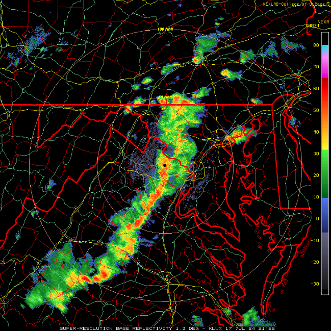
Meanwhile, in Rorschach-test related news, this snapshot of the incoming line could, in a different context, look like a highlighted topographical map of the California Sierras.
Just flip the image and get rid of the all the irritating county and state lines, and overlay it onto a pristine map of eastern CA.
-
1
-
 2
2
-
-
2 hours ago, Rhino16 said:
I hope it happens earlier so hopefully I could see some cool structure, but if anyone happens it seems like it would be 10pm before anything gets to me at the coast.
That's why I like at least two rounds -- one before and one after dark -- to solve the insuperable dilemma between wanting to see dramatic cloud structures, and a great light show.
-
3
-
-
8 minutes ago, MN Transplant said:
Derecho day was still 103 at 6pm, but caught a river wind and dropped to 96 at 7pm. Bounced back to 98 at 8pm.
https://www.wunderground.com/history/daily/us/va/arlington/KDCA/date/2012-6-29
Heh, because of the derecho, the low temp on 6.29.12 was just one degree warmer than normal.
-
Was this watch preceded by a MD? I took a spin around the SPC site and didn't see an mesoscale discussion for the mid Atlantic. Not that it's a precondition but I always like to read their reasoning.
-
3
-
-
I think my location may have gusted over 50 there. I'm not too far from Friendship Village and the warning specified 60 gust potential.
Anyhoo, it's more or less over. Quintessential quick hitter.
-
1
-
-
Decent electrical activity in up nw. Loudest thunder of the year.
EDIT: Hell, this is the best storm of the year IMBY. Wind gusts guestimated at over 45, and very cloudbursty for a couple of moments.
and it's an official SVR warn:
evere Weather Statement National Weather Service Baltimore MD/Washington DC 542 PM EDT Mon Jul 15 2024 DCC001-MDC031-033-VAC013-059-510-610-152200- /O.CON.KLWX.SV.W.0146.000000T0000Z-240715T2200Z/ District of Columbia DC-Montgomery MD-Prince Georges MD-Arlington VA- City of Falls Church VA-Fairfax VA-City of Alexandria VA- 542 PM EDT Mon Jul 15 2024 ...A SEVERE THUNDERSTORM WARNING REMAINS IN EFFECT UNTIL 600 PM EDT FOR THE DISTRICT OF COLUMBIA...SOUTHEASTERN MONTGOMERY...NORTHWESTERN PRINCE GEORGES...ARLINGTON...AND NORTHEASTERN FAIRFAX COUNTIES...THE CITY OF FALLS CHURCH AND THE NORTHERN CITY OF ALEXANDRIA... At 542 PM EDT, a severe thunderstorm was located over Friendship Village, or over Bethesda, moving east at 25 mph. HAZARD...60 mph wind gusts. SOURCE...Trained weather spotters. IMPACT...Damaging winds will cause some trees and large branches to fall. This could injure those outdoors, as well as damage homes and vehicles. Roadways may become blocked by downed trees. Localized power outages are possible. Unsecured light objects may become projectiles. Locations impacted include... Arlington, Alexandria, Rockville, Bethesda, College Park, Greenbelt, Langley Park, Beltsville, Falls Church, Bladensburg, Pimmit Hills, National Harbor, Mclean, American Legion Bridge, Fort Totten, Rosslyn, Crystal City, University of Maryland, Nationals Park, and Howard University. PRECAUTIONARY/PREPAREDNESS ACTIONS... For your protection move to an interior room on the lowest floor of a building. To report severe weather contact your nearest law enforcement agency. They will send your report to the National Weather Service office in Sterling Virginia. Torrential rainfall is occurring with this storm, and may lead to flash flooding. Do not drive your vehicle through flooded roadways. -
potent little drenching in upper nw but no T&L so far
-
935 mb? On July 2?
Jamaica is looking at a body blow tomorrow.
-
Speaking of highways or ... er, streets, WATCH it on Connecticut Avenue around the intersection with Davenport, for those who drive that stretch. Nasty speed camera in there that takes no prisoners (two tickets at 100 a pop for doing 36-37 in a 25 zone). And the "radar enforced" sign is hard to see going southbound on Connecticut. But, hey, gotta juice that revenue stream.
-
1 hour ago, SnowtoRain said:
Honestly, with the breeze this is not that bad
I was kinda thinking along this line. I think ... and this is, as so many of my postings are, totally unscientific ... that I internalized the heat hype so that when it arrived, I was prepared psychologically, and so it hasn't felt that bad either yesterday or today. Perception is a powerful thing. I'm actually sitting here with the window open and a/c off because I need to air out this room. Of course, I'm not carrying bales of hay in the open or wielding a jackhammer or even doing much more than walking to the store. My take on the heat would doubtlessly be a bit different in those cases, and I would be duly bitching about how eneverated I felt.
EDIT: Or maybe I'm just around the bend and need to be committed somewhere. I shouldn't be so phlegmatic about a 110 HI.
-
1
-
-
2 hours ago, yoda said:
Afternoon day 2 from SPC has SLGT risk from i66 corridor and north (all of MD except for S MD) for damaging winds
Yeah, extended the southward extent of SLGT, also introduced a dollop of ENH over NE.
Also the afternoon AFD from LWX mentioned the possibility of several rounds of storms.
-
1
-
-
2 hours ago, WVclimo said:
It was a lot of fun. The O’s are 3-0 in games we’ve attended this year. Wins of 13-4 over the Angels, 7-0 over Oakland and now 17-5 in NY.
My son said we had better attend every game if they are playing in the postseason.
")
So an average win of 12.2-3 .... not bad!
Wild game last night. O's almost pulled off a comeback for the ages.
-
Nice taking the series from the Phillies (and before that, Braves) before heading to NYC to slay the beast.
Yeah, yeah, Judge and Soto but no one else in the Yanks lineup OPSs over .800. Meanwhile five Orioles (if you count O'Hearn) are, and Montcastle is close at .784. And the O's are 8-2 over the last 10 games, while the Yankees are 5-5. And the Yankees' catcher can't throw at all; Red Sox stole a bunch of bases against him yesterday. So turn Henderson, Jordan, Mateo, and Ced (if he can get on base) loose.
Losing Bradish and Coulombe hurts, but that's why there's you can trade up until July 31. I'd think about moving Kjerstad, who's crushing it at Norfolk but has nowhere to play in the big time as of now. K can't play center if Mullins can't get untracked offensively (and frankly, with the rest of this offense, I think the O's can afford to carry him for his glove).
-
1
-
-
1 hour ago, yoda said:
Time to get real toasty
.LONG TERM /SATURDAY THROUGH TUESDAY/...
In the wake of the cold frontal passage, a ridge of high
pressure settle over the Great Lakes to northeastern U.S. this
weekend. This allows for a dry forecast along with less humidity
than previous days. Each day should bring mostly sunny skies
with high temperatures that increase through the weekend. Sunday
will certainly be the warmer day of the two as surface winds
shift back to southerly. This eventually sets the stages for a
hot work week ahead.

A building subtropical ridge aloft gradually parks over the
eastern U.S. during the early to middle portions of the week.
Depending on the global ensemble, some show mid-level heights
around 2 standard deviations above average. This sprawling
594-dm ridge will really begin to crank up the heat with
widespread mid to upper 90s expected. Some of the more upper
echilon solutions carry temperatures to just over 100 degrees.
Given dew points ranging from the mid 60s to low 70s, heat
indices should easily reach and exceed the century mark most
afternoons. If this all holds, heat-related products will
likely be necessary ahead of this expected heat wave.

While not explicitly shown in the forecast package, there
should be some instability forced convection. However, this will
be largely dependent on the position of the upper ridge as well
as any capping that becomes evident in thermodynamic profiles.

This hot and steamy air mass could persist through the entire
work week if the ensemble means are taken at face value. The
Climate Prediction Center agrees with this notion with a
moderate risk for excessive heat in the June 19-21 period.
Yeah it looks like we're gonna pay for this nice stretch next week.
-
Read that the 0-3 km SRH from a BWI sounding was around 450 m2/s2 on Wednesday as the sup passed by. Not bad for around here.
August Discobs 2024
in Mid Atlantic
Posted
Random sampling of WU stations in my lil' corner of hell, all above 110 HIs, some over 115.
Houston currently at 105 HI at the airport