BuffaloWeather
-
Posts
25,688 -
Joined
-
Last visited
Content Type
Profiles
Blogs
Forums
American Weather
Media Demo
Store
Gallery
Everything posted by BuffaloWeather
-
 Cheektowaga
 -
That's just the daily. If you look at records of most recording stations there are many days with low totals. 1/6 must have not had a big storm on it.
-
KBUFs forecast of 6-12" is about to bust in the next 15 minutes with an entire day to go.
-
Walden Ave
-
They deserve it. I've been jackpotted here so many times the last few years.
-
If I have that right KBUF received 3.4" in the last hour.
-
Kbuf at 9.8” as of 10 am
-
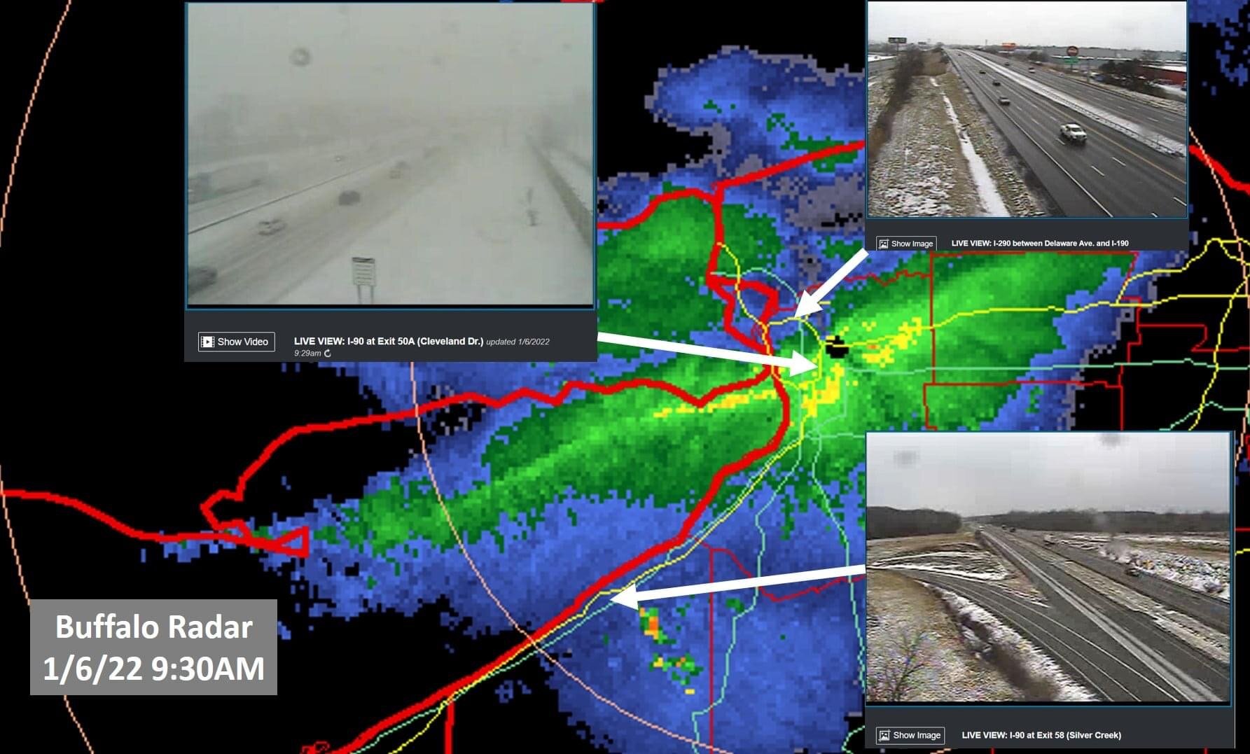
New SWS ...A LAKE EFFECT SNOW BAND WILL AFFECT PARTS OF GENESEE AND NORTHERN ERIE COUNTIES... HAZARDS...A lake effect snow band which can rapidly reduce visibility to less than a quarter of a mile. This lake effect snow band is producing extremely heavy snow at the rate of 2 to 3 inches per hour. LOCATION AND MOVEMENT...At 1001 AM EST, a lake effect snow band was over Buffalo extending northeast toward Pembroke in western Genesee county. The lake effect snow band was nearly stationary.
-
Smh
-
rotate that photo and send it into KBUF.
-
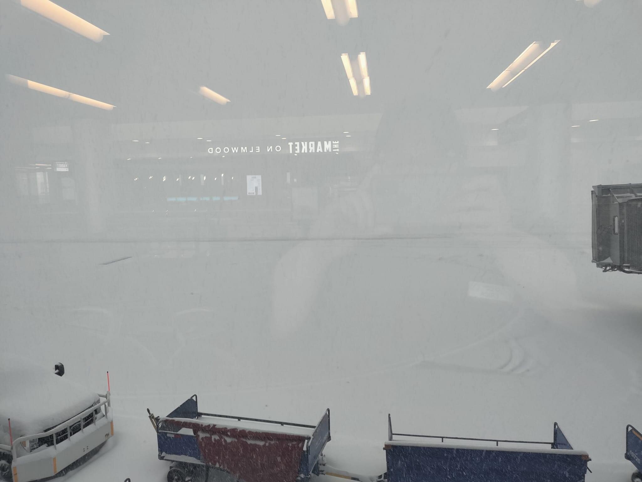
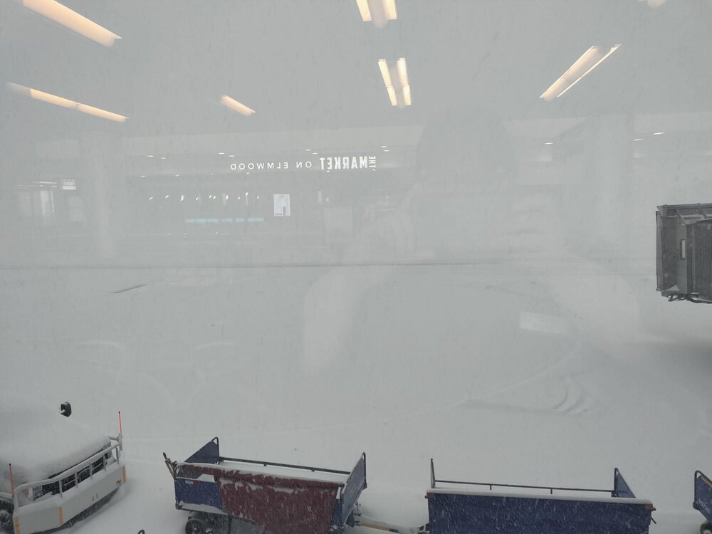
Airport
-
Looks like strongest returns are in the middle of the band instead of the northern fringes like last few major events.
-
Snow totals: Someone is getting 2 feet+ out of this. Kbuf is under heaviest returns right now, likely at double digits already. I don't think the bands moves much until later tonight. ...Erie County... Depew 9.0 in 0934 AM 01/06 42.91N/78.70W NWS Buffalo 6.5 in 0858 AM 01/06 42.95N/78.72W Buffalo 5.5 in 0926 AM 01/06 42.89N/78.86W Wales 2.2 in 0700 AM 01/06 42.74N/78.59W West Seneca 2.8 ENE 2.0 in 0700 AM 01/06 42.85N/78.70W Cheektowaga 2.7 NE 2.0 in 0700 AM 01/06 42.94N/78.72W East Concord 2.0 in 0821 AM 01/06 42.56N/78.64W Glenwood 1.0 SE 1.5 in 0700 AM 01/06 42.61N/78.65W Boston 2.5 NE 1.2 in 0700 AM 01/06 42.65N/78.70W Clarence Center 0.2 ESE 1.0 in 0645 AM 01/06 43.01N/78.63W Hamburg 0.4 WSW 0.5 in 0700 AM 01/06 42.72N/78.84W Hamburg 2.0 N 0.5 in 0708 AM 01/06 42.75N/78.83W Boston 1.5 NE 0.5 in 0730 AM 01/06 42.65N/78.72W Orchard Park 0.5 in 0808 AM 01/06 42.76N/78.75W Tonawanda 2.1 ESE 0.2 in 0700 AM 01/06 42.97N/78.84W
-
Sister coming in clutch. She’s a storm chaser at heart like me.
-
I'm at my office in Hamburg staring north. It's literally killing me being here right now. I'll be booking it north at 4 pm.
-
Heavy Snow Freezing Fog 23°F Humidity 88% Wind Speed SW 10 mph Barometer 29.88 in (1012.7 mb) Dewpoint 20°F (-7°C) Visibility 0.25 mi Wind Chill 13°F (-11°C) Last update 6 Jan 8:54 am EST
-
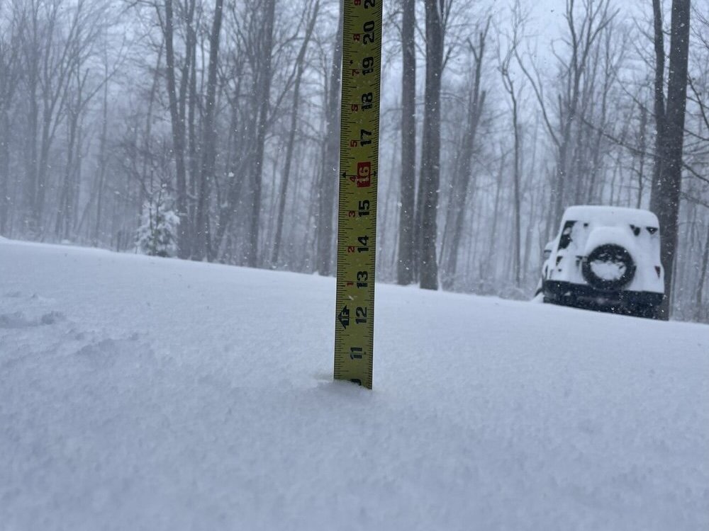
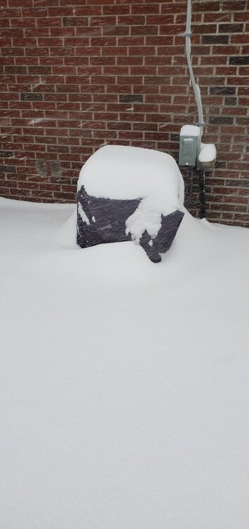
My sisters house
-
My sister is just south of airport and she says 7-8" there already.
-
As you'll be jackpot for first part of storm, send your snowfall totals into kbuf. Twitter/FB work for them.
-
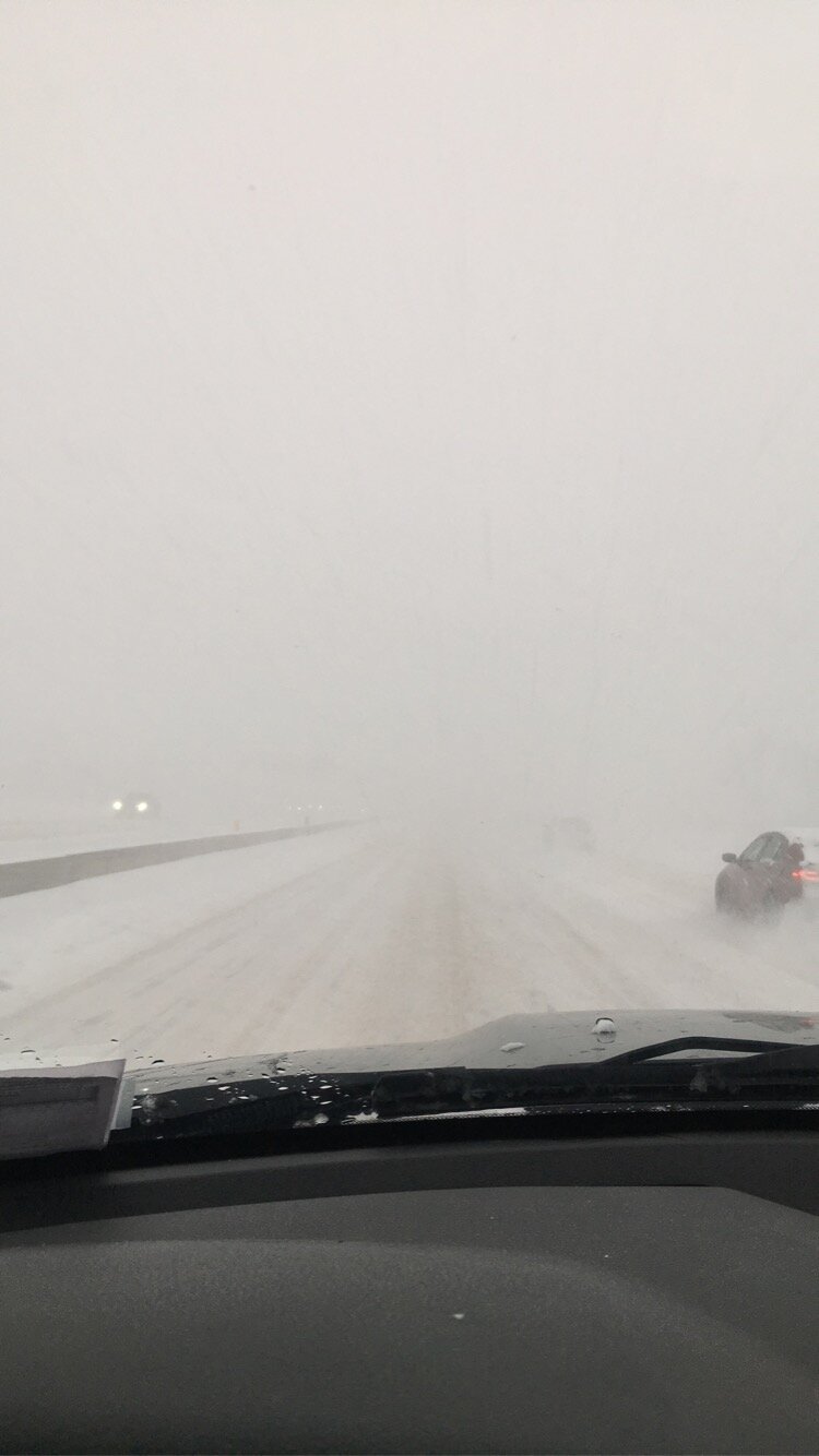
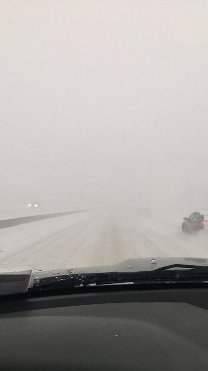
A guy I work with lives in north towns. His drive in.
-
I knew they were wrong when they said 1" max snowfall rates! Check latest SPS, it calls for lots of buns Special Weather Statement National Weather Service Buffalo NY 851 AM EST Thu Jan 6 2022 NYZ010-011-085-061500- Southern Erie NY-Genesee NY-Northern Erie NY- 851 AM EST Thu Jan 6 2022 ...A LAKE EFFECT SNOW BAND WILL AFFECT PARTS OF SOUTHERN ERIE... GENESEE...AND NORTHERN ERIE COUNTIES... HAZARDS...A lake effect snow band which can rapidly reduce visibility to less than a quarter of a mile. This lake effect snow band is producing extremely heavy snow at the rate of 2 to 3 inches per hour. LOCATION AND MOVEMENT...At 846 AM EST, a lake effect snow band was over Buffalo extending east to western Genesee county. The lake effect snow band was nearly stationary.
-
This is the one @WNashhas been hoping for the last few years.
-
Wb ayuud! You should get hit good with this one.