

SomeguyfromTakomaPark
-
Posts
5,449 -
Joined
-
Last visited
Content Type
Profiles
Blogs
Forums
American Weather
Media Demo
Store
Gallery
Posts posted by SomeguyfromTakomaPark
-
-
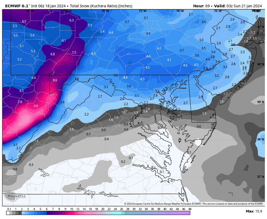
Can see some filling in now between culpepper and triangle.
-
6 minutes ago, Deck Pic said:
I think I have a chance at 4”. Another 0.10-0.15 liquid at 12/13:1 ratios.
Maybe even more if we can get under some good banding.
-
Shield is absolutely blossoming, looks anyone dc and north is gonna be in good shape.
-
 1
1
-
-
1 minute ago, aldie 22 said:
Very light at the moment can see the stuff forming to my west...fingers crossed
You can see it on the precipitation depiction RadarScope setting, right on schedule.
-
Wow, looks like about 2 inches already. Beautiful! Everything totally white including roads.
-
2 minutes ago, Terpeast said:
Bit slower, but also drier
QPF looks better than the 12z run on pivotal.
Edit: ends up about the same
-
1
-
-
2 minutes ago, yoda said:
DCA around 0.35" QPF
Wow! Keeps getting juicier, I am seeing DC under 0.3 on Pivotal though.
3k with a nice shift south too.
-
1
-
-
Looks like perhaps more interaction between the vorts early on the NAM run...maybe the trough a tad sharper too.
-
3 minutes ago, jgentworth said:
18z HRRR seems to be drier than the 12z NAM by a bit. But we're talking 15-20hrs on the HRRR which I think is probably out of its range a bit.
It was totally lost for the last storm, but the placement of the precip on it looks favorable for us, wouldn't sweat the QPF output.
-
13 minutes ago, Ravens94 said:
HRRR maxed out

Good look and a nice improvement over those turd runs from last night. Cranking by 10z. Should be pretty when we wake up.
-
It's much better than 0z, the max stripe is centered in our area instead of philly.
-
2
-
 1
1
-
-
2 minutes ago, NorthArlington101 said:

Even though the QPF isn't as good as other models I like the southerly move in the placement.
-
2
-
-
GFS gonna be south too
-
4
-
-
ICON is a very positive shift from 06z.
-
 3
3
-
-
NAM starting at 9z will get a solid base down before sun angle is a factor at all. Will be a relatively high impact event with cold road temps going in if the NAM is right.
-
1
-
-
Already 1-2 inches by down by 7am and still snowing.
-
2
-
-
5 minutes ago, Solution Man said:
Looks like vort souther on NAM @15
NAM looks much better at 9z tomorrow, low closer to the coast, better precip across the metro.
-
2
-
-
This event will be a dilemma for the districts around dc, light snow but right at the morning rush. Some districts like MCPS already had 2 snow days this week.
-
1 minute ago, packfan98 said:
Very nice, let’s keep juicing this thing up until game time.
-
2
-
-
3 minutes ago, nj2va said:
Looks like Deep creek/Canaan are the places to be this weekend. Wisp will probably be 100% open after this next storm and could top 60” on the year so far. Mountains have had a great January for the ski resorts.
I think I’m gonna ski white grass this Saturday.
-
4
-
-
Just now, Chris78 said:
The good news is the ground is frozen. Something were not used to in these parts lol.
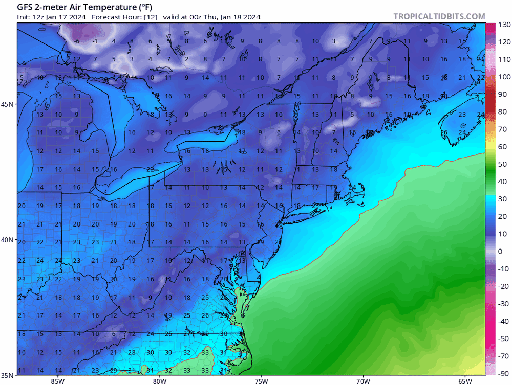
Also sun angle doesn't really kick in until about 10 or 11 am, if we get a few hours of snow before that it'll look and feel wintry again.
-
1
-
-
1 minute ago, Solution Man said:
When was this written ?
10:12 am is the timestamp on the discussion, but maybe that part is from last night.
-
 1
1
-
-
An upper level disturbance will push in behind a cold front
Thursday night into Friday and the two will bring a sufficient
opportunity for more accumulating snowfall later Thursday night
and into the early half of the day on Friday. Most of the snow
accumulation will take place Friday during the morning with
only the higher elevations seeing any accumulation before 12Z
Friday. All areas have an opportunity to see snow accumulation.
-
1
-
1
-
-
3 minutes ago, clskinsfan said:
I am with you. I have snowpack and sub 20 degree temps going on right now. I will be happy with some snow showers that drop an inch at this point.
This is correct.
-
3
-


Jan 19th Storm OBS Thread
in Mid Atlantic
Posted
I am intrigued at the period of snow after 1pm the HRRR is advertising