WeatherQ
-
Posts
168 -
Joined
-
Last visited
Content Type
Profiles
Blogs
Forums
American Weather
Media Demo
Store
Gallery
Everything posted by WeatherQ
-
Let’s go with powdered sugar!

-
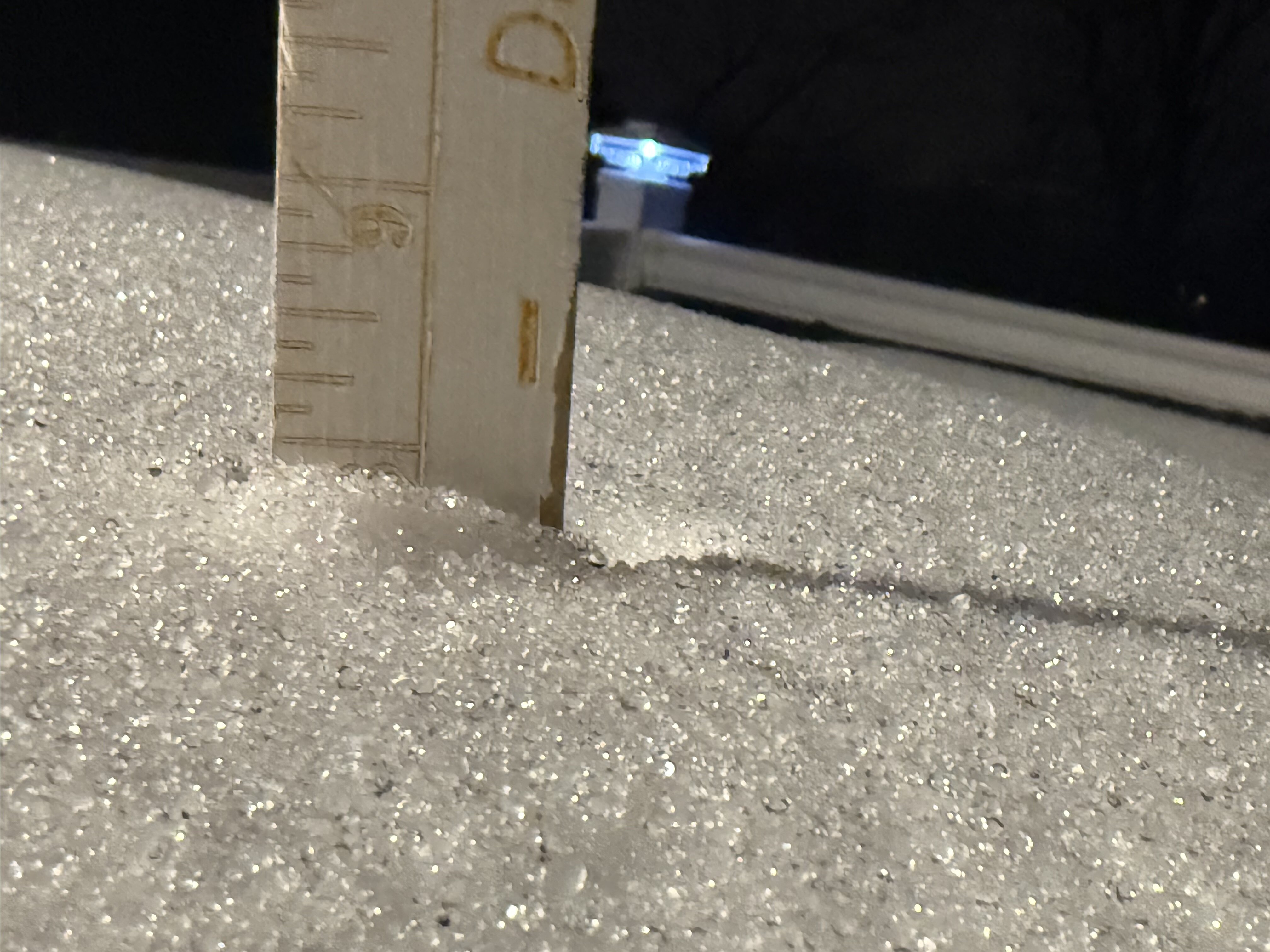
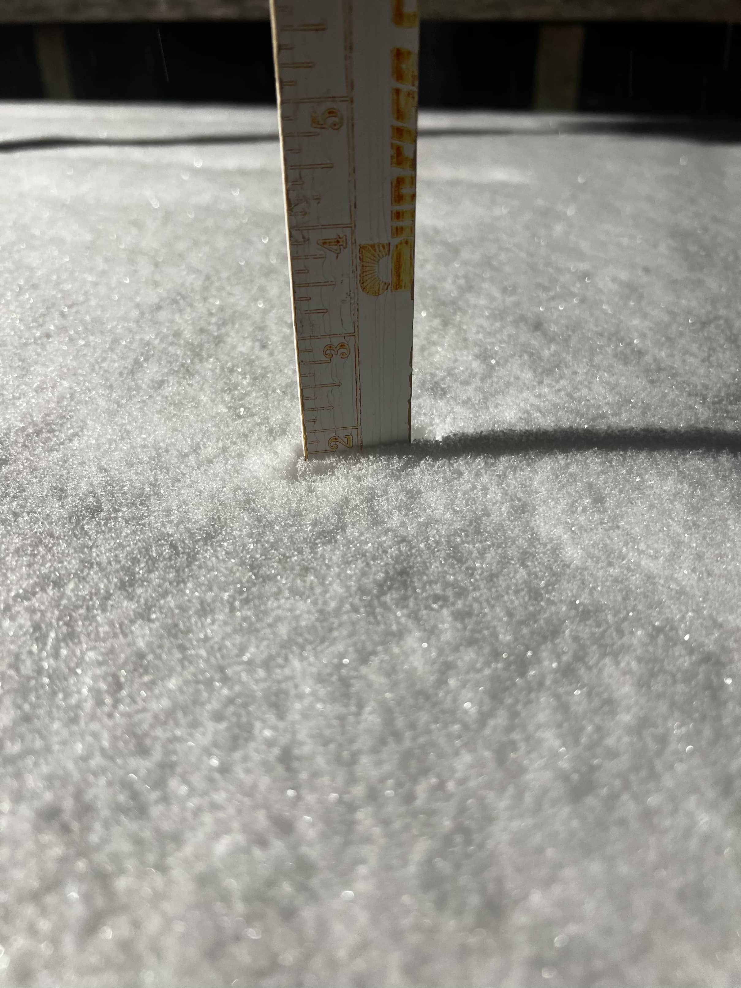
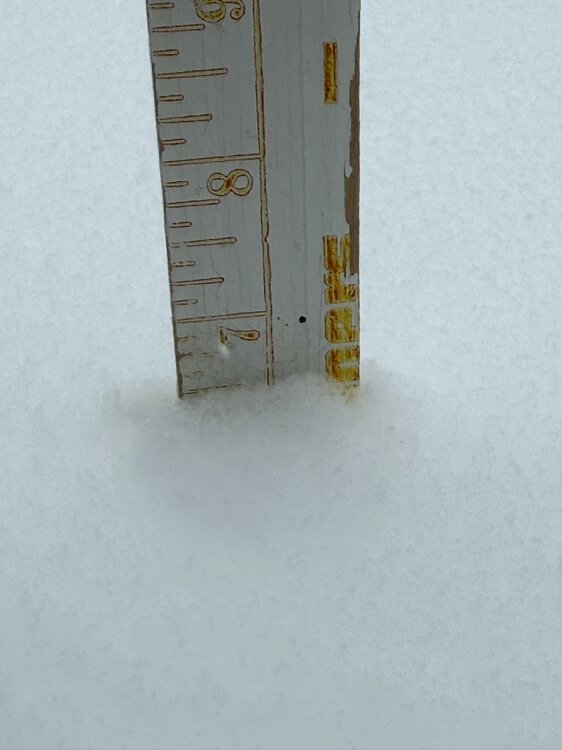
9 inches of sugar cookie! Extreme NE MD (Still use Old Bay at the headwaters of Big Elk Creek - Head of the Head of the Bay!)
-
Pouring Sleet … 7” snow now 3” sleet 18F/15F 29.85 in pressure Wind WNW at 8 mph RH 87% Extreme NE MD (the right “armpit” of MD
-
I think the SN accumulation is 7.5 with 1-2 inches IP and it’s just pouring sleet. 18F/14F 29.95 in (falling) 81% RH Winds W at 3 mph Vis 1 mile Extreme NE MD (I can see PA from my house) where the Peanutbutter Whiskey is flowing!
-
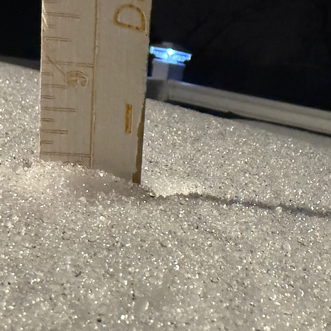
Pure Sneet (mainly heavy sleet) 7.5” starting to compact due to pingers 14F/10F 30.18 in (falling) 83% RH 1/3 mile visibility Wind - West 3 mph Extreme NE MD (I can spit and hit PA/DE)
-
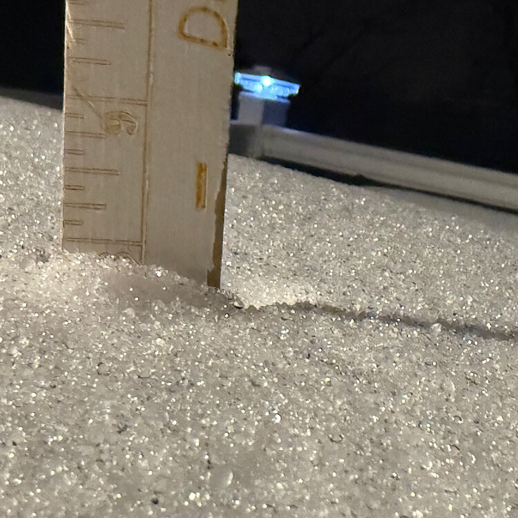
Morning friends! 6.5“ Heavy fluffy SN (no pingers) 17F/10F 87% RH 30.64 in Pressure 1/4 mi visibility Extreme NE MD (MD/PA/DE line)
-
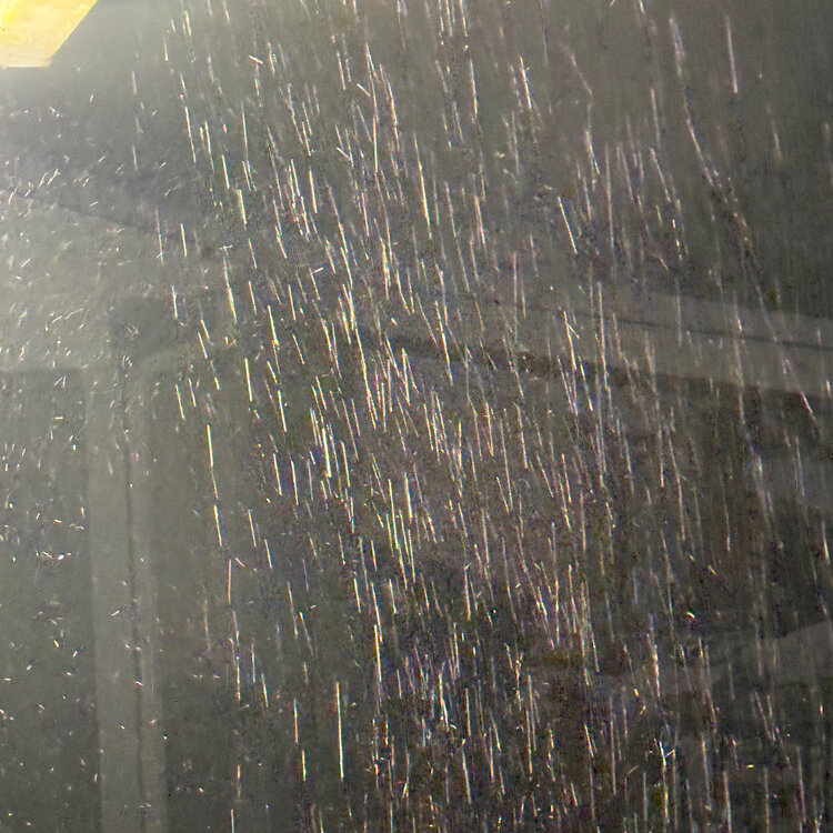
Absolutely massive amounts of clear frigid air falling from the sky rn. I don’t know if my powerful Ariens snowblower can handle this … 17F/-4F 30.65 in pressure RH 40% Virga on the doorstep extreme NE MD (MD/PA/DE line) one of MD’s famous snow anuses
-
Good evening all from the most NE MD part of our viewing area and still in the Sub. Several hundred yards from the Tri-State (DE/PA/MD) marker. Little Egypt Road, Elkton MD. May the Force Be With Us All! And the HRRR! 16F/-4F Absolute calm winds 30.65 in pressure
-
Looks like Millville, Ocean View, the DE/MD Beaches and the lower DelMarVa are gonna be the winners, eh?
-
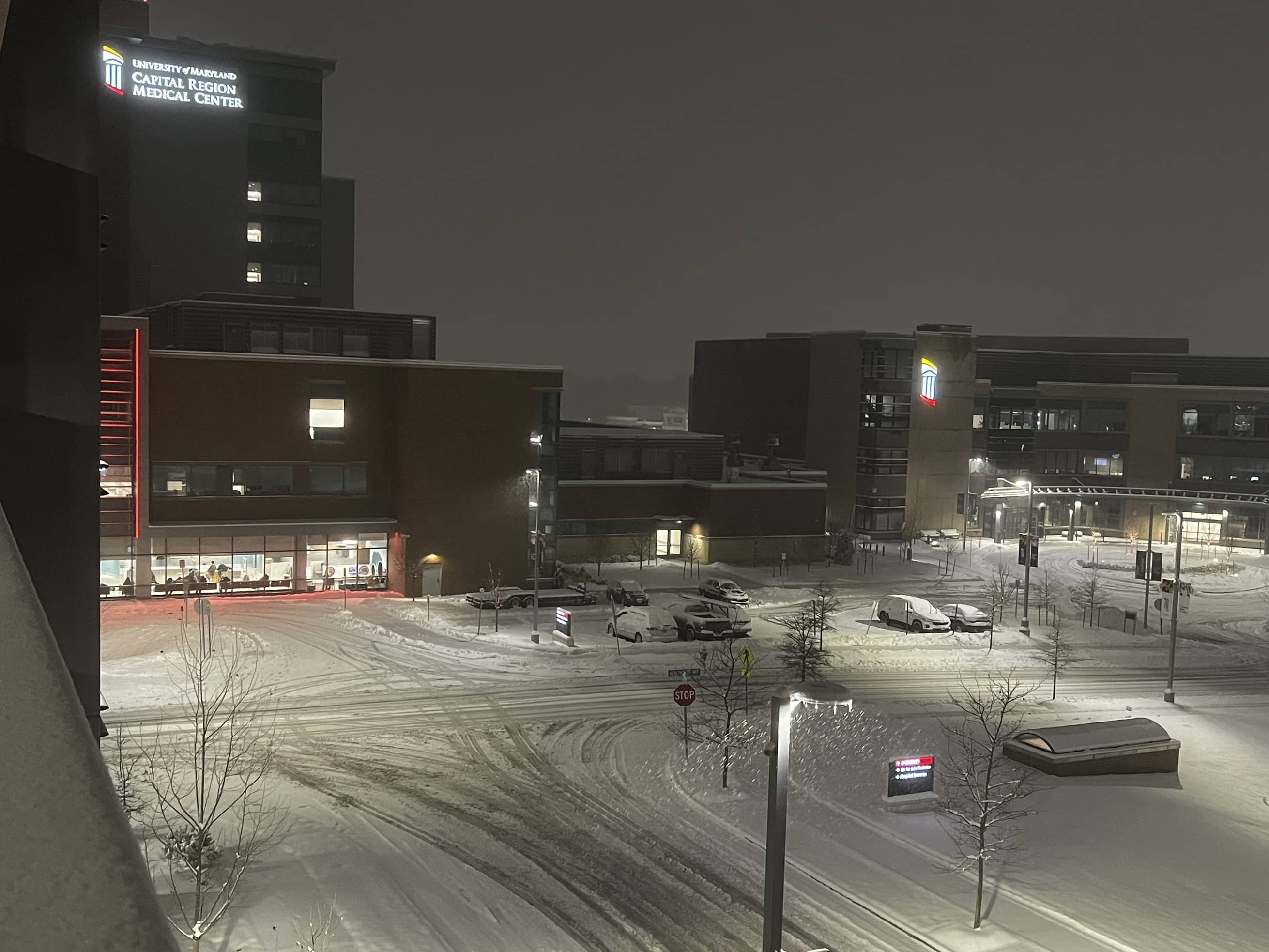
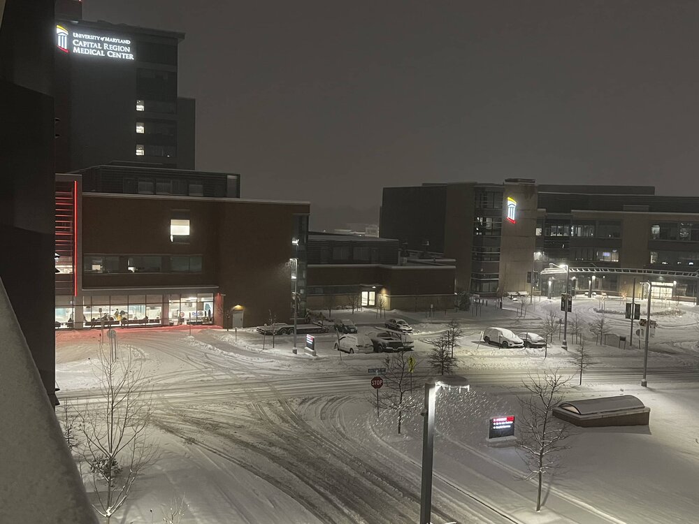
Leaving Cap Region Medical Center .. 29F .. about 4.7” on the ground
-
Cap Region MC, Largo, MD, 32F … snow OTG

-
Haven’t seen your name since NWS Philly on Arch Street back when I interned before the Mount Holly move when Chet and Dean were there! Hello Sir
-
Didn’t you call that just before the 12Z suite. Banging clairvoyance
-
Checking in from less than 1 Mi off the Tri State Marker (DE/MD/PA) in extreme NE MD (mail address Elkton MD/techncially Appleton MD) 30F/9F RH 40% hoping for 8” + happy with 6”
-
2024 Valentines Day Who the Hell Knows - Comeback Thread
WeatherQ replied to DDweatherman's topic in Mid Atlantic
Well .. New Castle Co DE Emergency Operations Division is getting very interested which bodes well for NE MD and the upper Eastern Shore… they titled this flash “Surprise Snow Storm”
-
2024 Valentines Day Who the Hell Knows - Comeback Thread
WeatherQ replied to DDweatherman's topic in Mid Atlantic
Ok MillvilleWx .. I need your no BS assessment … we have 2 globals and multiple regionals now with the NEMD crushed signal .. The RAP shows a perfect SLP pass off ORF … what’s the red tagger thought? -
University of MD Medical System Bel Air MD Warm and Dry feels like 87F Heat Index 105F oh … moderate snow outside ambulances getting covered

-
751 days without measurable snow … and now 2 storms in a week. El Niño … you rock! NE MD - New London Rd (Elkton) + Flakage 28F/77% RH BP 998 mb my BP 300/150 driving to hospital!

-
Jan 19th Snow on Snow: the this always works until it doesn't thread
WeatherQ replied to psuhoffman's topic in Mid Atlantic
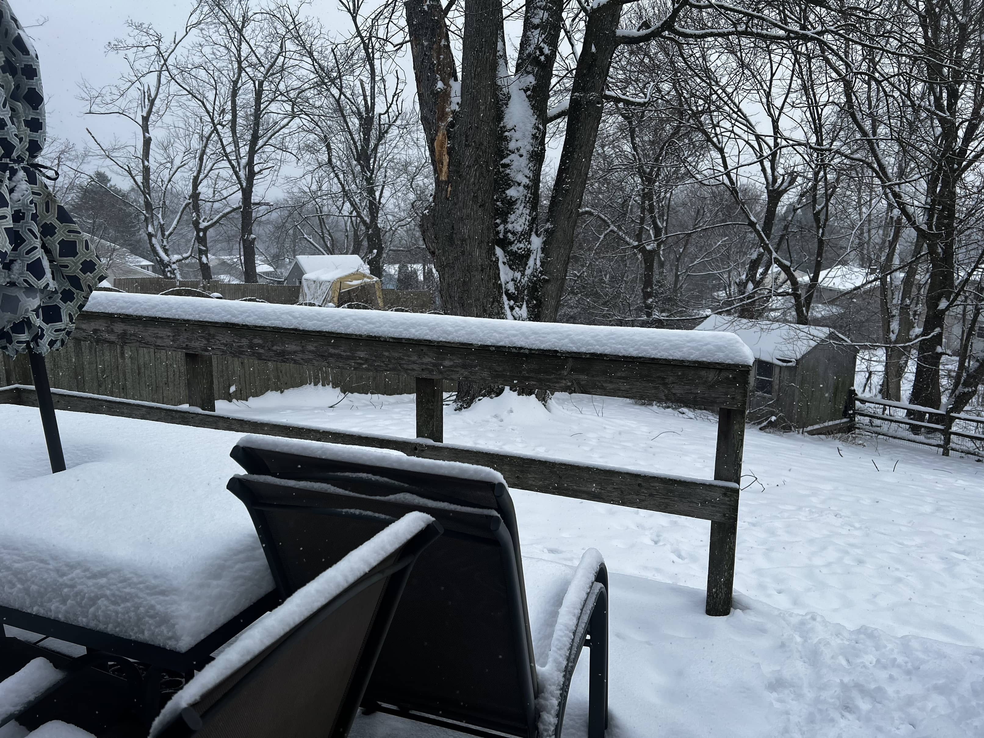
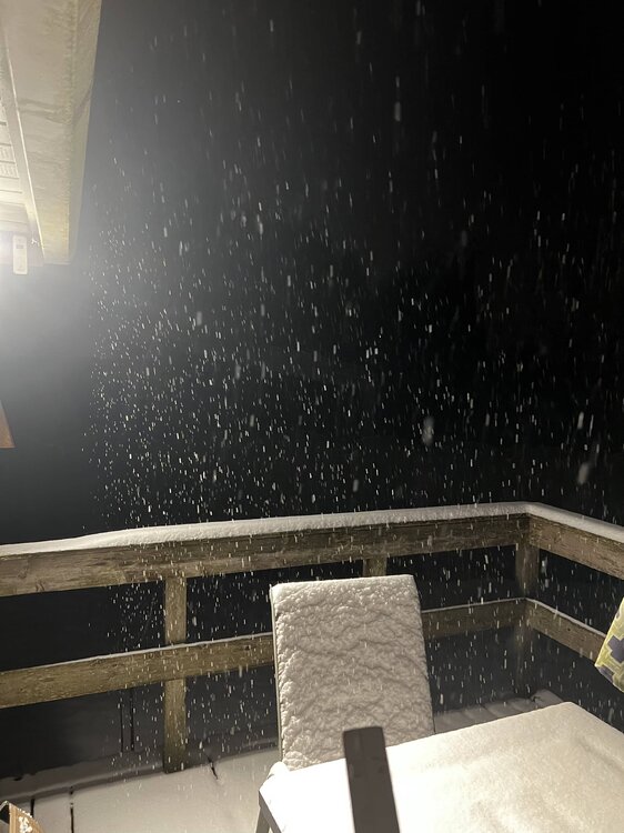
Emergency Room —- so I’ll be busy with falls, shoveling cardiacs, respiratory due to cold air and inevitable snowblower injuries and back pain … sorry Mods … banter .. but thx Deck Pic! Don’t come visit! Any of you! Stay safe! -
Jan 19th Snow on Snow: the this always works until it doesn't thread
WeatherQ replied to psuhoffman's topic in Mid Atlantic
Not likely … I’ll slug down 95 .. nice and slow and hopefully see some rakeage flakeage. Radar returns already starting to light up west of us … atmosphere must be pre-gaming -
Jan 19th Snow on Snow: the this always works until it doesn't thread
WeatherQ replied to psuhoffman's topic in Mid Atlantic
Actually posted WSW 5-6” for MD/DE line. Do I get my bingo piece for NE MD jackpot? Have to pull a shift in UMMS Hospital tmrw … should be an interesting commute -
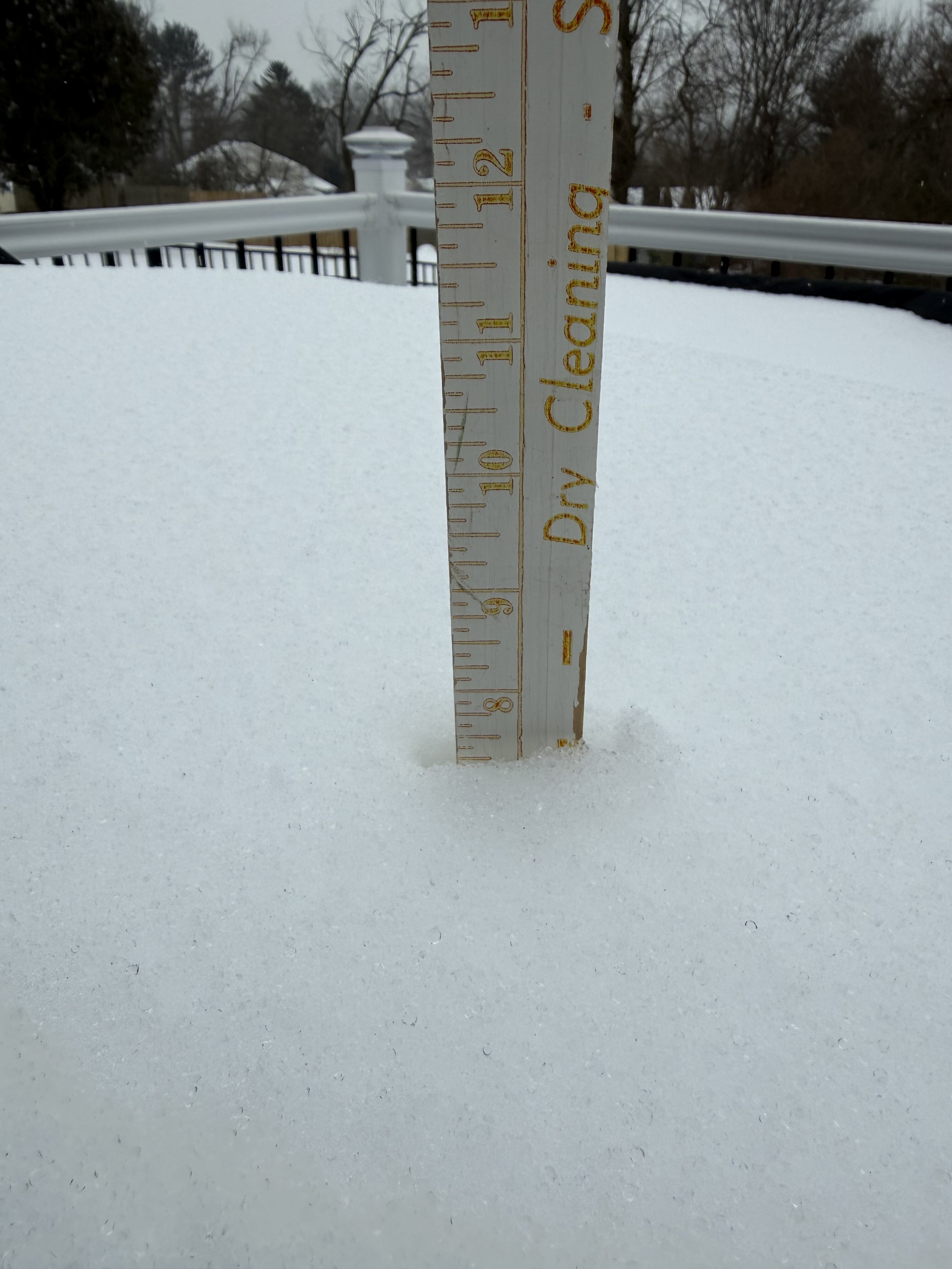
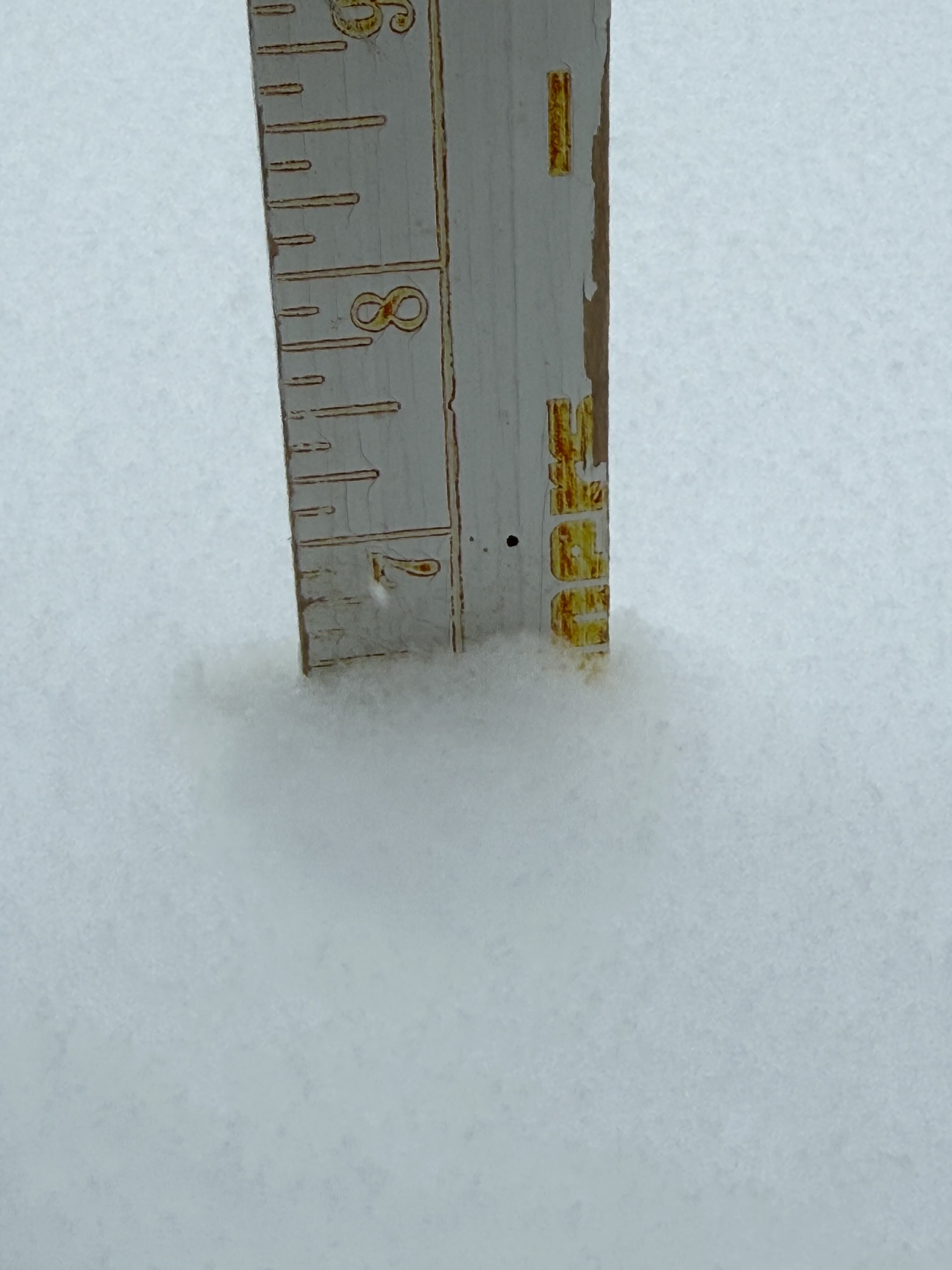
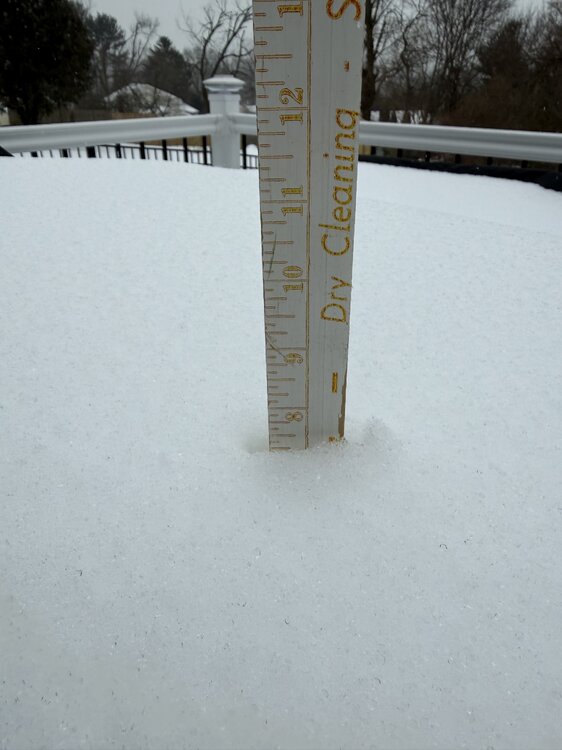
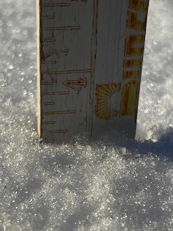
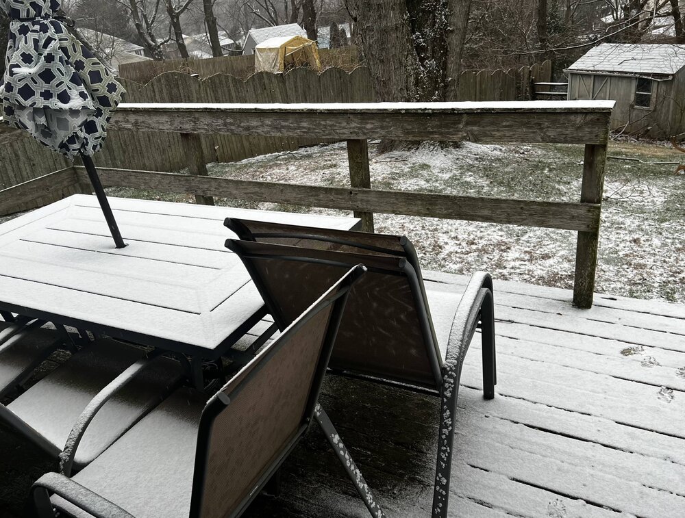
First light and my 6 yo rescued puppers isn’t quite sure what this POWDAH is ,… LOL. several 4” lollies at 3 separate places. The official deck is 3.85” with some sleet crunch compaction. Gorgeous view … missed it! 27F/77%RH 1001 mb pressure wind - calm loc: NE MD - extreme NE Cecil County -New London Road (border PA/MD/DE)

-
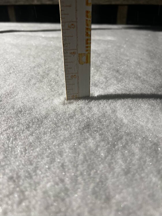
Really moderate fine powdah … 1.9 in 27F/68% RH BPress 1012 mb Locality: NE MD - NE of Elkton MD
-
Heavy clouds with Full on Snizzle … just E of the very NE tip of NE MD by the Tri State Marker (MD/PA/DE) convergence .. for those that know .. White Clay Creek State Park .. New London Road 27F/64%RH BP 1012 mb
-
Jan Medium/Long Range Disco: Winter is coming
WeatherQ replied to stormtracker's topic in Mid Atlantic
Does the Atlantic get more “blocky” if the Wstrn Canadian trough relaxes or does it just allow for more confluence towards the East Coast? I’m trying to picture the upper air physics in how you’ve described the WCand airmass