AstronomyEnjoyer
-
Posts
1,081 -
Joined
-
Last visited
Content Type
Profiles
Blogs
Forums
American Weather
Media Demo
Store
Gallery
Everything posted by AstronomyEnjoyer
-

Significant Miller B Nor'easter Apr 3rd-4th OBS
AstronomyEnjoyer replied to wxeyeNH's topic in New England
35.2F and mostly snow here at 890ft now. -
Significant Miller B Nor'easter Apr 3rd-4th OBS
AstronomyEnjoyer replied to wxeyeNH's topic in New England
You're right. I need to set out a decoy table. -
Significant Miller B Nor'easter Apr 3rd-4th OBS
AstronomyEnjoyer replied to wxeyeNH's topic in New England
Will the Lifetime table of science suffice? -
Significant Miller B Nor'easter Apr 3rd-4th OBS
AstronomyEnjoyer replied to wxeyeNH's topic in New England
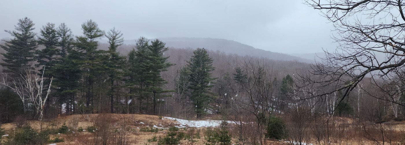
36.9° here with light rain and the occasional snowflake mixing in. Drove up the road to 1400ft and got into all snow. Here's looking towards Mt. Sunapee from the east.
-
Significant Miller B Nor'easter watch, Apr 3rd-4th
AstronomyEnjoyer replied to Typhoon Tip's topic in New England
18z compared to 00z HRRR (using its internal snowfall algorithm). Really developed a more coherent precip shield. -
Significant Miller B Nor'easter watch, Apr 3rd-4th
AstronomyEnjoyer replied to Typhoon Tip's topic in New England
18Z GFS Positive Depth Change looking really healthy IMBY. -
Significant Miller B Nor'easter watch, Apr 3rd-4th
AstronomyEnjoyer replied to Typhoon Tip's topic in New England
12Z GFS was run from my basement. -
Significant Miller B Nor'easter watch, Apr 3rd-4th
AstronomyEnjoyer replied to Typhoon Tip's topic in New England
Shit, I lost track, are you a military guy (or previous)? -
Significant Miller B Nor'easter watch, Apr 3rd-4th
AstronomyEnjoyer replied to Typhoon Tip's topic in New England
Y'all need to get one of those jobs where all you have to do is send emails to people requesting that they respond to your previous email. -
Significant Miller B Nor'easter watch, Apr 3rd-4th
AstronomyEnjoyer replied to Typhoon Tip's topic in New England
Barney in shambles. -
Significant Miller B Nor'easter watch, Apr 3rd-4th
AstronomyEnjoyer replied to Typhoon Tip's topic in New England
The weenie ones really. Within 48 hours the HRRR has been just about perfect in terms of forecasted snowfall over my head since the start of the year. It has been stable whereas the 3K NAM has spit out nonsense from run to run. -
Significant Miller B Nor'easter watch, Apr 3rd-4th
AstronomyEnjoyer replied to Typhoon Tip's topic in New England
Anecdotal (for my location), but he RAP and little RAP (HRRR) have absolutely wrecked the 12K and 3K NAM in terms of accuracy this winter. -
Significant Miller B Nor'easter watch, Apr 3rd-4th
AstronomyEnjoyer replied to Typhoon Tip's topic in New England
I've gone full turbo weenie. Give me the 3rd 30" plus storm IMBY in 5 years. -
New England 2024 Warm Season Banter
AstronomyEnjoyer replied to HoarfrostHubb's topic in New England
No, but I live in NH. Property taxes don't faze me. -
Significant Miller B Nor'easter watch, Apr 3rd-4th
AstronomyEnjoyer replied to Typhoon Tip's topic in New England
Let's do this, lol. -
Significant Miller B Nor'easter watch, Apr 3rd-4th
AstronomyEnjoyer replied to Typhoon Tip's topic in New England
Edit* More paltry higher res models as they come into range for the blend algorithm get weighed more heavily. (Source: complete speculation) -
Significant Miller B Nor'easter watch, Apr 3rd-4th
AstronomyEnjoyer replied to Typhoon Tip's topic in New England
Oh my word, this GFS run... -
New England 2024 Warm Season Banter
AstronomyEnjoyer replied to HoarfrostHubb's topic in New England
Oh I know - it's just there's not much available out that way. -
New England 2024 Warm Season Banter
AstronomyEnjoyer replied to HoarfrostHubb's topic in New England
I've got family in the Albany, NY area and there's been talk of purchasing land in southern VT to build a second home (to be roughly equidistant between us). Family likes the Manchester area, but I've been bombarding them with Dover listings. I haven't explained to them why they are all above 2200ft, but they haven't asked (or noticed). -
Significant Miller B Nor'easter watch, Apr 3rd-4th
AstronomyEnjoyer replied to Typhoon Tip's topic in New England
These are the kind of numbers you like to see on your point and click.
-
Significant Miller B Nor'easter watch, Apr 3rd-4th
AstronomyEnjoyer replied to Typhoon Tip's topic in New England
Uh, wow. Maybe I really will hit 100" on the season. -
Significant Miller B Nor'easter watch, Apr 3rd-4th
AstronomyEnjoyer replied to Typhoon Tip's topic in New England
00z GFS looks a tick south to me in the end. *Edit* compared to 18z, that is. Still north of other guidance. -
New England 2024 Warm Season Banter
AstronomyEnjoyer replied to HoarfrostHubb's topic in New England
I'm not a roofing expert, but the warped layer of singles does give me cause for concern. Do you know how far up the ice and water shield goes on your roof? -
Significant Miller B Nor'easter watch, Apr 3rd-4th
AstronomyEnjoyer replied to Typhoon Tip's topic in New England
Better for her, worse for you. Looks like noise to me. -
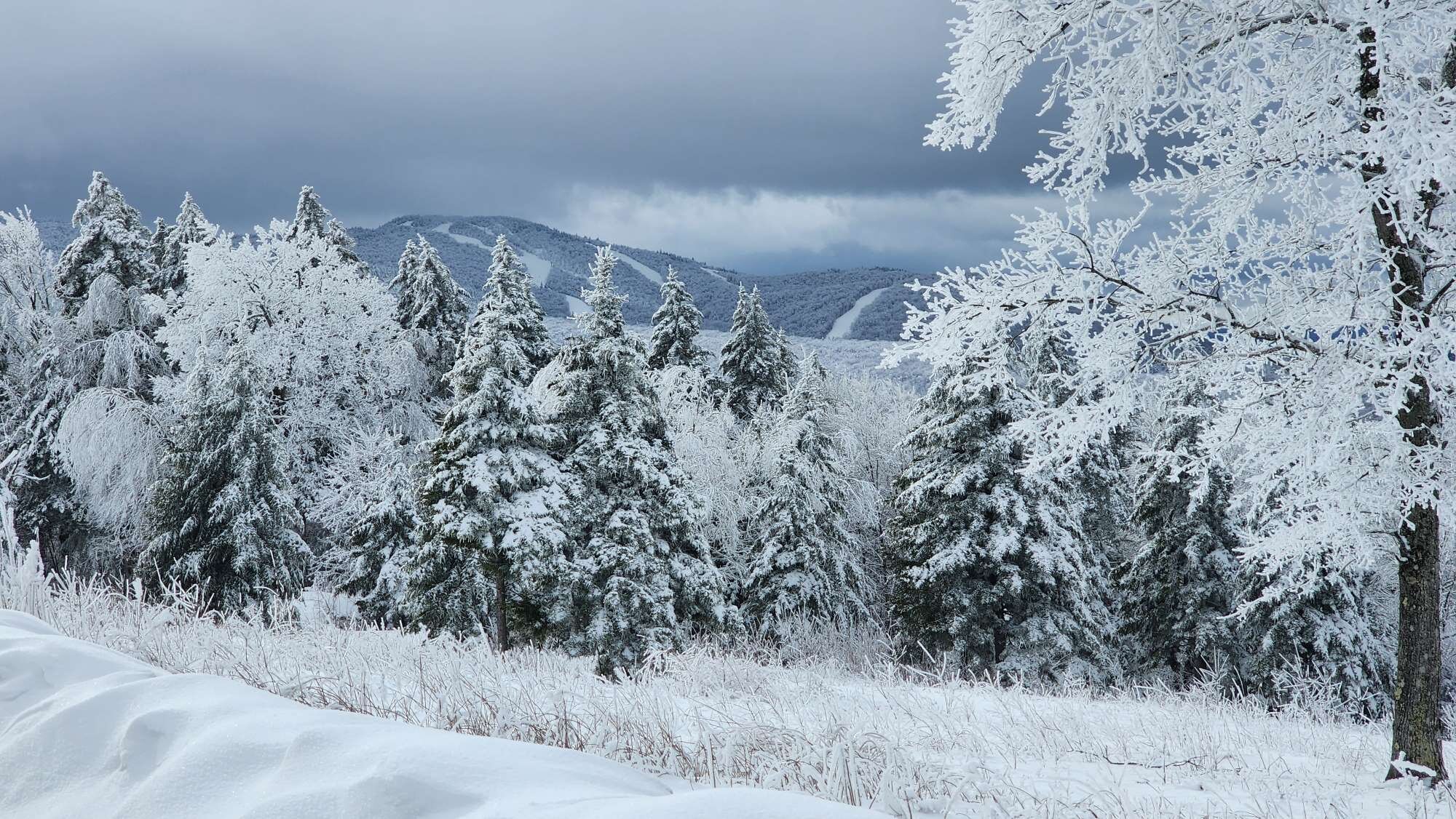
Lovely weather making swift work of the pack as March comes to a close. Have had continuous snow patches in the yard since Jan 7th and it looks like that will probably continue for just a little longer.