AstronomyEnjoyer
-
Posts
1,081 -
Joined
-
Last visited
Content Type
Profiles
Blogs
Forums
American Weather
Media Demo
Store
Gallery
Everything posted by AstronomyEnjoyer
-

Significant Miller B Nor'easter watch, Apr 3rd-4th
AstronomyEnjoyer replied to Typhoon Tip's topic in New England
One might even say a Montreal look, haha. -
Significant Miller B Nor'easter watch, Apr 3rd-4th
AstronomyEnjoyer replied to Typhoon Tip's topic in New England
18z ICON with the obligatory AstroEnjoyer jackpot run! -
Significant Miller B Nor'easter watch, Apr 3rd-4th
AstronomyEnjoyer replied to Typhoon Tip's topic in New England
Around 10 years ago my Dad was looking to buy a place in Randolph, NH. Awesome home, but too big and too remote. What a weenie spot. -
Significant Miller B Nor'easter watch, Apr 3rd-4th
AstronomyEnjoyer replied to Typhoon Tip's topic in New England
Ah, screw it, send in a Monads big dog. Let's get that season total over 100"! -
Significant Miller B Nor'easter watch, Apr 3rd-4th
AstronomyEnjoyer replied to Typhoon Tip's topic in New England
Didn't think I had a chance to reach average snowfall this season but it's looking like a real possibility now. -
UConn hater here. Go UMass.
-
Hey now, some people live up here. I even learned how to read so I could post here!
-
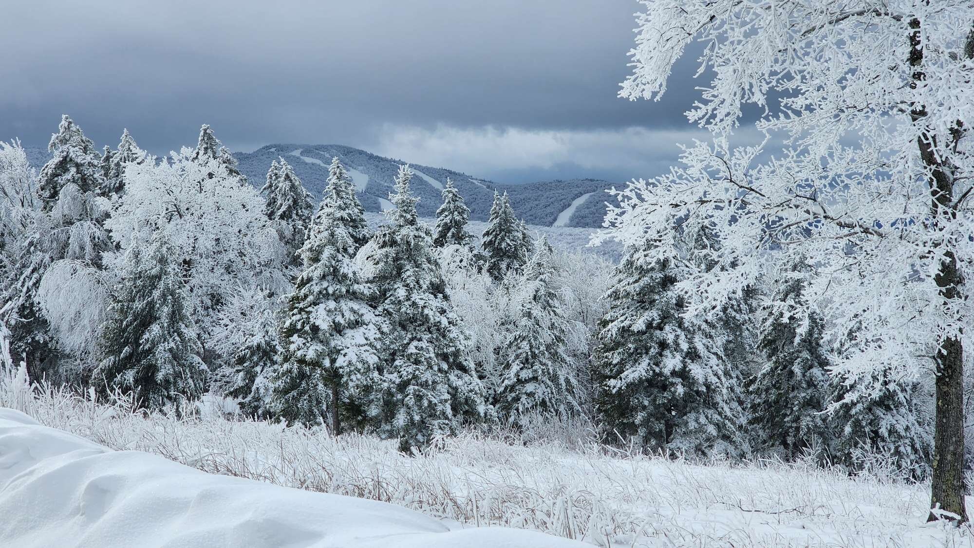
00z GFS clown is worthy of posting, haha. Through 240 hours.
-
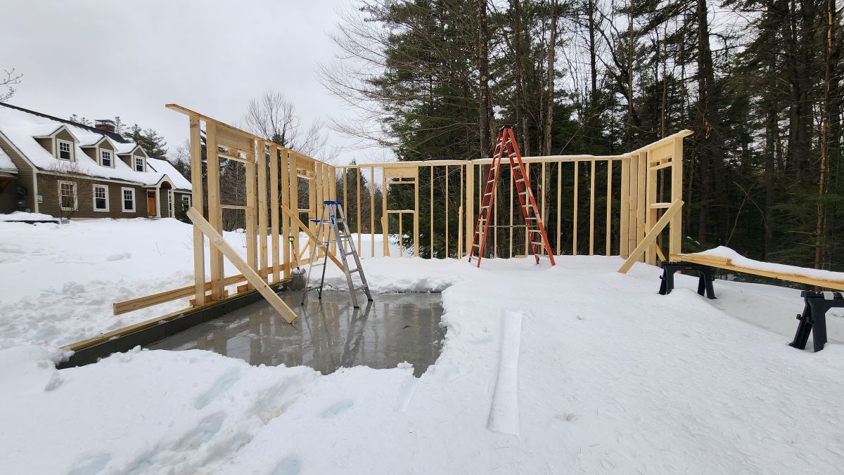
I'm trying to do construction over here! The snow had its chance, haha.
-
What a nasty day. Got a nice sweat going shoveling a foot of wet snow off the barn slab just to put up one little section of wall. Just soaked.

-
17.0" new, 69.5" season total. Outside shot of hitting average now.
-
The Congrats Dendrite Deck Destroyer 3/23-3/25 obs discussion
AstronomyEnjoyer replied to Ginx snewx's topic in New England
Here we go, lol.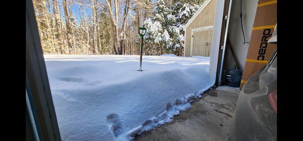
-
The Congrats Dendrite Deck Destroyer 3/23-3/25 obs discussion
AstronomyEnjoyer replied to Ginx snewx's topic in New England
Went out and measured 17.0" average on the ground. Now I'm annoyed I didn't set up a board so I could clear at the appropriate intervals - would've probably managed 20". Was mostly IP and/or ZR from 12pm to 6pm. Will measure SWE tomorrow morning.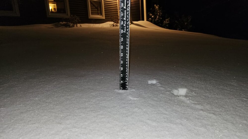
-
The Congrats Dendrite Deck Destroyer 3/23-3/25 obs discussion
AstronomyEnjoyer replied to Ginx snewx's topic in New England
8:25pm report of 18.5" here in Bradford, NH. I'll go grab a measurement of my own here in a bit but that seems accurate. Pretty amazing given there was a multiple hour switch to IP and ZR in the middle. -
The Congrats Dendrite Deck Destroyer 3/23-3/25 obs discussion
AstronomyEnjoyer replied to Ginx snewx's topic in New England
These hand rails only had about 0.2" of IP/ZR crud on them before it flipped back to snow and they're already past the point where they can't hold anymore. Edit: I only have a screengrab from a video of the railing after it already flipped back, but these were taken only 48 minutes apart. -
The Congrats Dendrite Deck Destroyer 3/23-3/25 obs discussion
AstronomyEnjoyer replied to Ginx snewx's topic in New England
Since flipping to snow about 40 minutes ago I've already picked up nearly 2" wow. Looks like someone fired a SAM into a flock of geese out there. -
The Congrats Dendrite Deck Destroyer 3/23-3/25 obs discussion
AstronomyEnjoyer replied to Ginx snewx's topic in New England
Back to snow now! -
The Congrats Dendrite Deck Destroyer 3/23-3/25 obs discussion
AstronomyEnjoyer replied to Ginx snewx's topic in New England
I'm getting flakes mixing in pretty good with the IP and ZR starting about 5 mins ago. -
The Congrats Dendrite Deck Destroyer 3/23-3/25 obs discussion
AstronomyEnjoyer replied to Ginx snewx's topic in New England
10.2" on the drive now. Actually back to mostly snow for the time being. -
The Congrats Dendrite Deck Destroyer 3/23-3/25 obs discussion
AstronomyEnjoyer replied to Ginx snewx's topic in New England
Big aggregates mixing back in with the sleet now. -
The Congrats Dendrite Deck Destroyer 3/23-3/25 obs discussion
AstronomyEnjoyer replied to Ginx snewx's topic in New England
28.6° and pretty much exclusively sleet here now. Curious to see if there's a flip back to snow as the storm pulls away. -
The Congrats Dendrite Deck Destroyer 3/23-3/25 obs discussion
AstronomyEnjoyer replied to Ginx snewx's topic in New England
28.6° and 10.0" on the driveway now. Big aggregates and sleet starting to ping! Lots of QPF to go still. -
The Congrats Dendrite Deck Destroyer 3/23-3/25 obs discussion
AstronomyEnjoyer replied to Ginx snewx's topic in New England
27.3° and 9.1" on the driveway now. -
The Congrats Dendrite Deck Destroyer 3/23-3/25 obs discussion
AstronomyEnjoyer replied to Ginx snewx's topic in New England
25.9° and 7" on the driveway so far. We'll see how long the mix line takes to get up here. -
The Congrats Dendrite Deck Destroyer 3/23-3/25 obs discussion
AstronomyEnjoyer replied to Ginx snewx's topic in New England
I really was too overconfident in its ability to stand up to snow and should have cleared it off more than the one time I did before going to bed. Thankfully there's nothing really delicate or important in there.