AstronomyEnjoyer
-
Posts
1,081 -
Joined
-
Last visited
Content Type
Profiles
Blogs
Forums
American Weather
Media Demo
Store
Gallery
Everything posted by AstronomyEnjoyer
-
29.7°/27.1°, light snow has commenced!
-
18z HRRR definitely an improvement for the marginal folks.
-
Yeah, I'd imagine you're in a good spot for this one. I'm on the wrong side of the hill for this kind of setup, but I still think I should be able to snag 3 or 4 inches.
-

New England Winter 2024-25 Bantering, Whining, and Sobbing Thread
AstronomyEnjoyer replied to klw's topic in New England
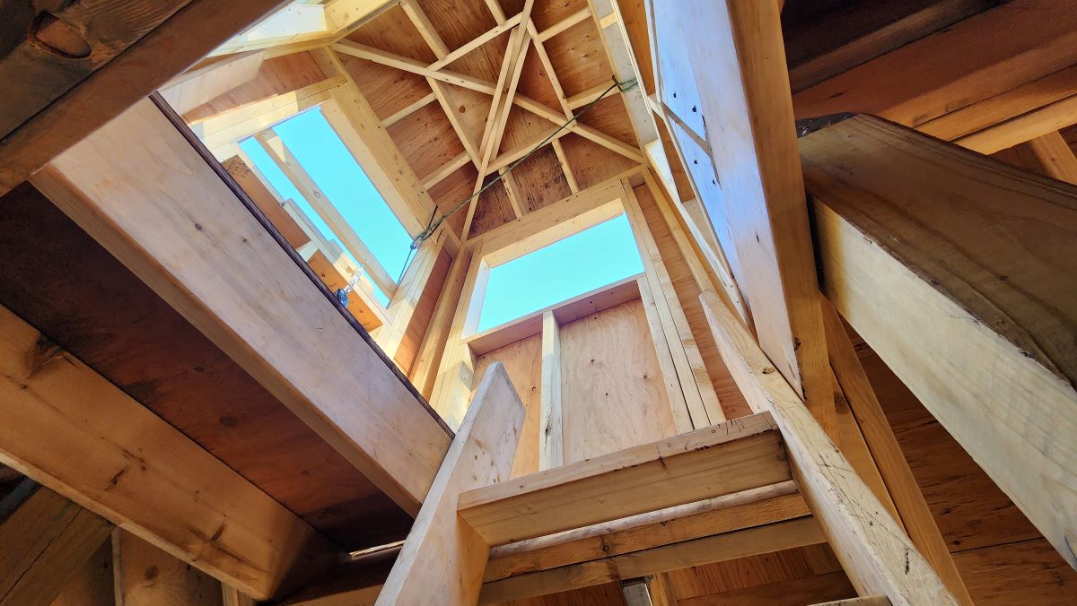
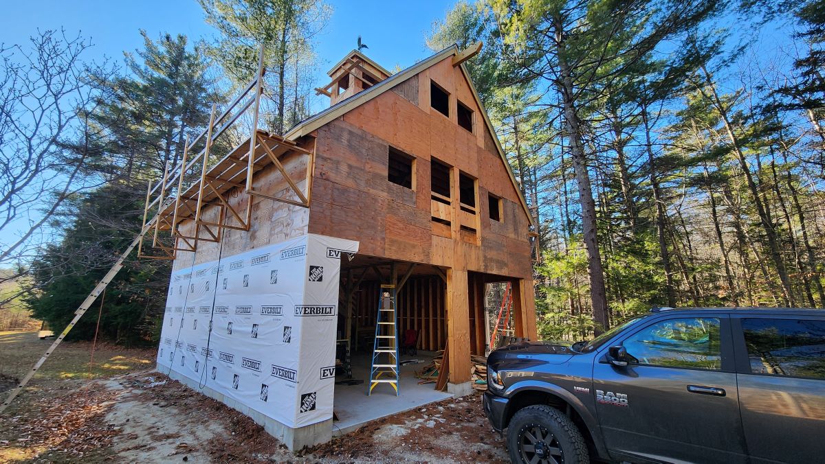
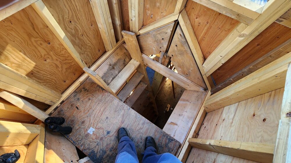
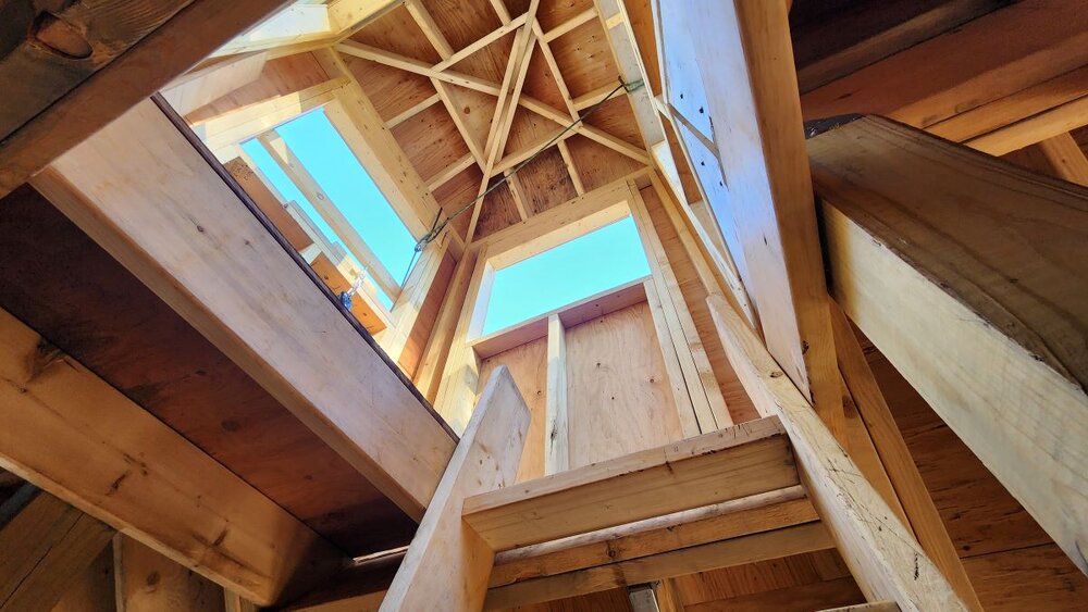
Been a while since I posted barn pics. Got the roof done in time for winter, was a massive PITA. 12/12 pitch so I had to do everything while in a harness. Need to get the rest of the house wrap up!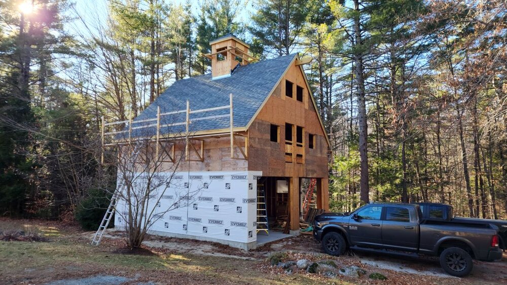

- 522 replies
-
- 12
-

-

-
19z NWS blend. Very usual suspects type stuff.
-
HRRR for the SNE weenies.
-
18z HRRR. Pretty solid for the hills.
-
Turkey Day Birch Bender Snow Storm/Observation Thread 11/28/-11/29
AstronomyEnjoyer replied to dryslot's topic in New England
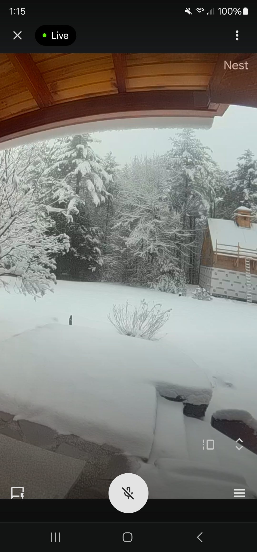
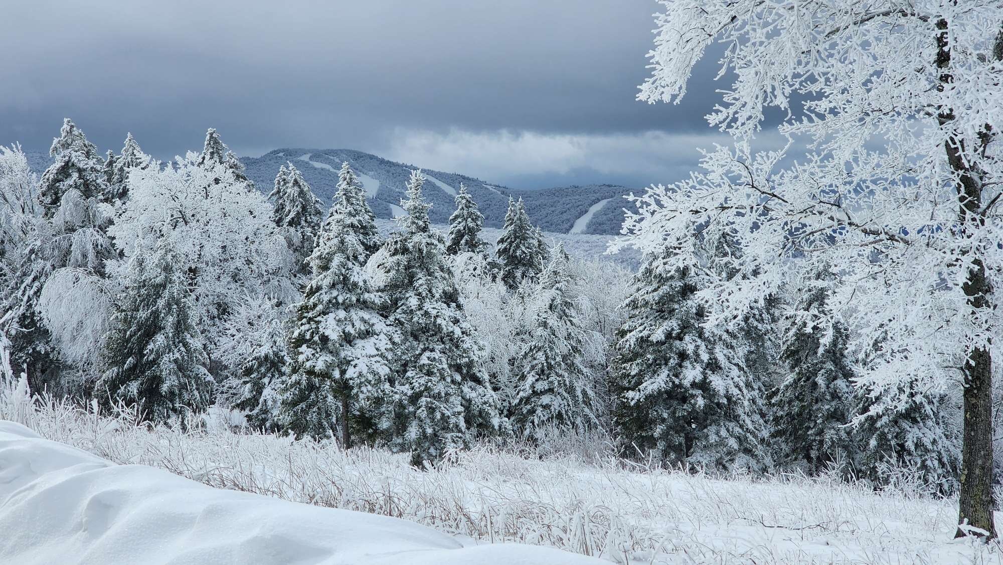
From what I can tell from the cameras, Bradford will end with around 8". Lost power there briefly. Hoping to clear the drive before it becomes a glacier.
-
Turkey Day Birch Bender Snow Storm/Observation Thread 11/28/-11/29
AstronomyEnjoyer replied to dryslot's topic in New England
Picking back up again - might have a shot at double digits. -
Turkey Day Birch Bender Snow Storm/Observation Thread 11/28/-11/29
AstronomyEnjoyer replied to dryslot's topic in New England
Around 6" based on visual estimation. 3k NAM says there's some juice left too. -
Turkey Day Birch Bender Snow Storm/Observation Thread 11/28/-11/29
AstronomyEnjoyer replied to dryslot's topic in New England
Whee, getting deeper!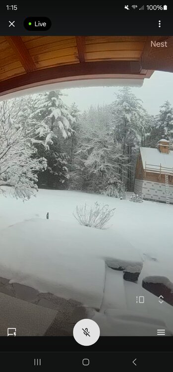
-
Turkey Day Birch Bender Snow Storm/Observation Thread 11/28/-11/29
AstronomyEnjoyer replied to dryslot's topic in New England
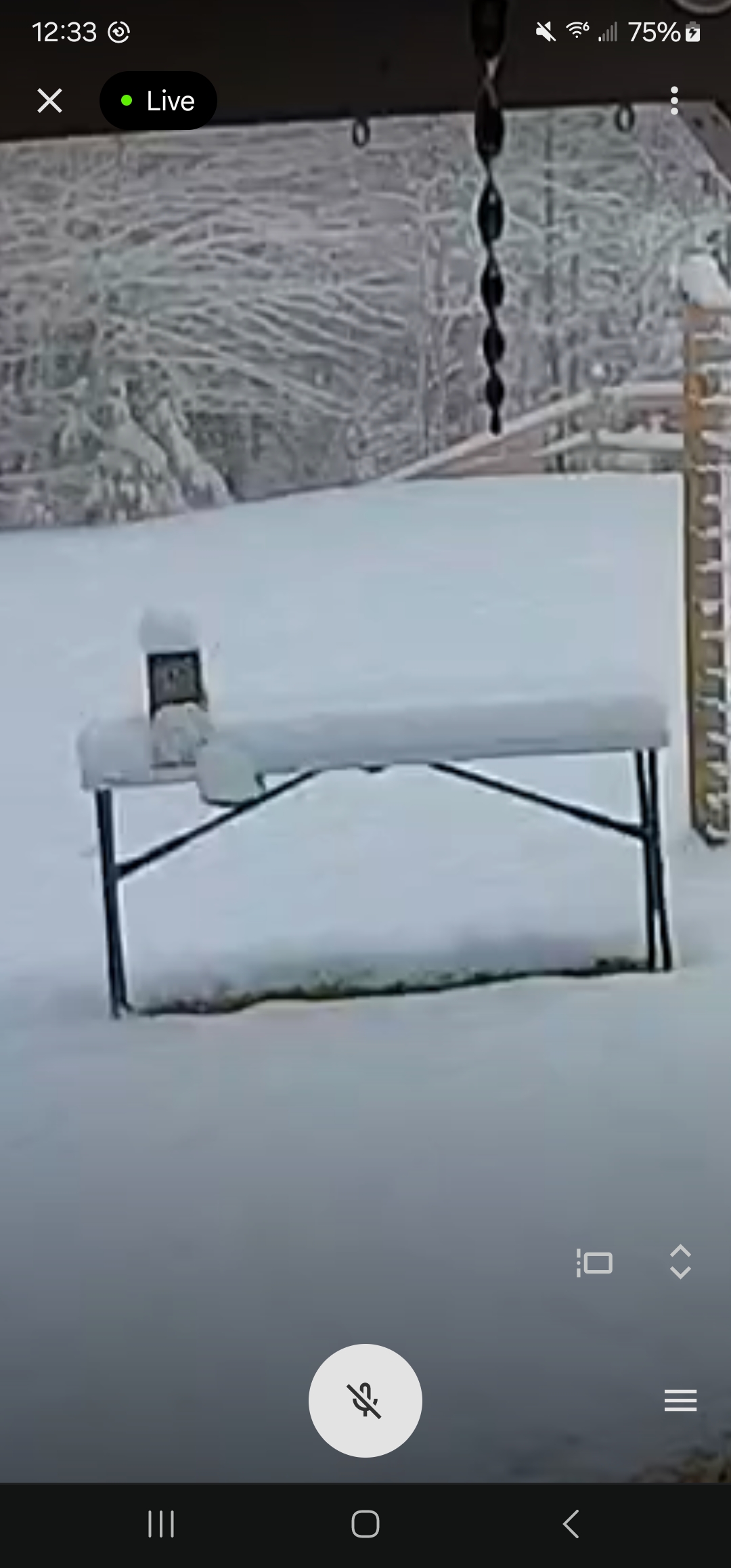
Zoomed in screenshot of my super scientific setup. Lifetime table of science with an 11 inch block of wood on top. So maybe like 4" so far?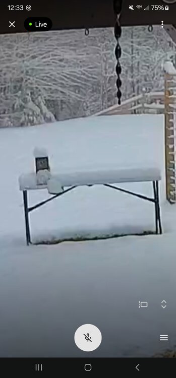
-
Turkey Day Birch Bender Snow Storm/Observation Thread 11/28/-11/29
AstronomyEnjoyer replied to dryslot's topic in New England
Flipped to snow here in Averill Park, NY at 1100ft. -
Turkey Day Birch Bender Snow Storm/Observation Thread 11/28/-11/29
AstronomyEnjoyer replied to dryslot's topic in New England
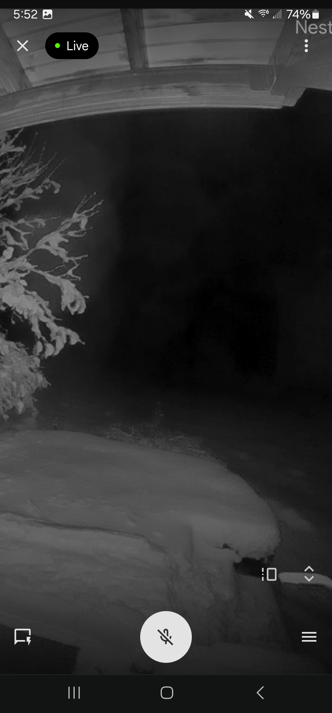
Really cranking now on the nest cams. -
Turkey Day Birch Bender Snow Storm/Observation Thread 11/28/-11/29
AstronomyEnjoyer replied to dryslot's topic in New England
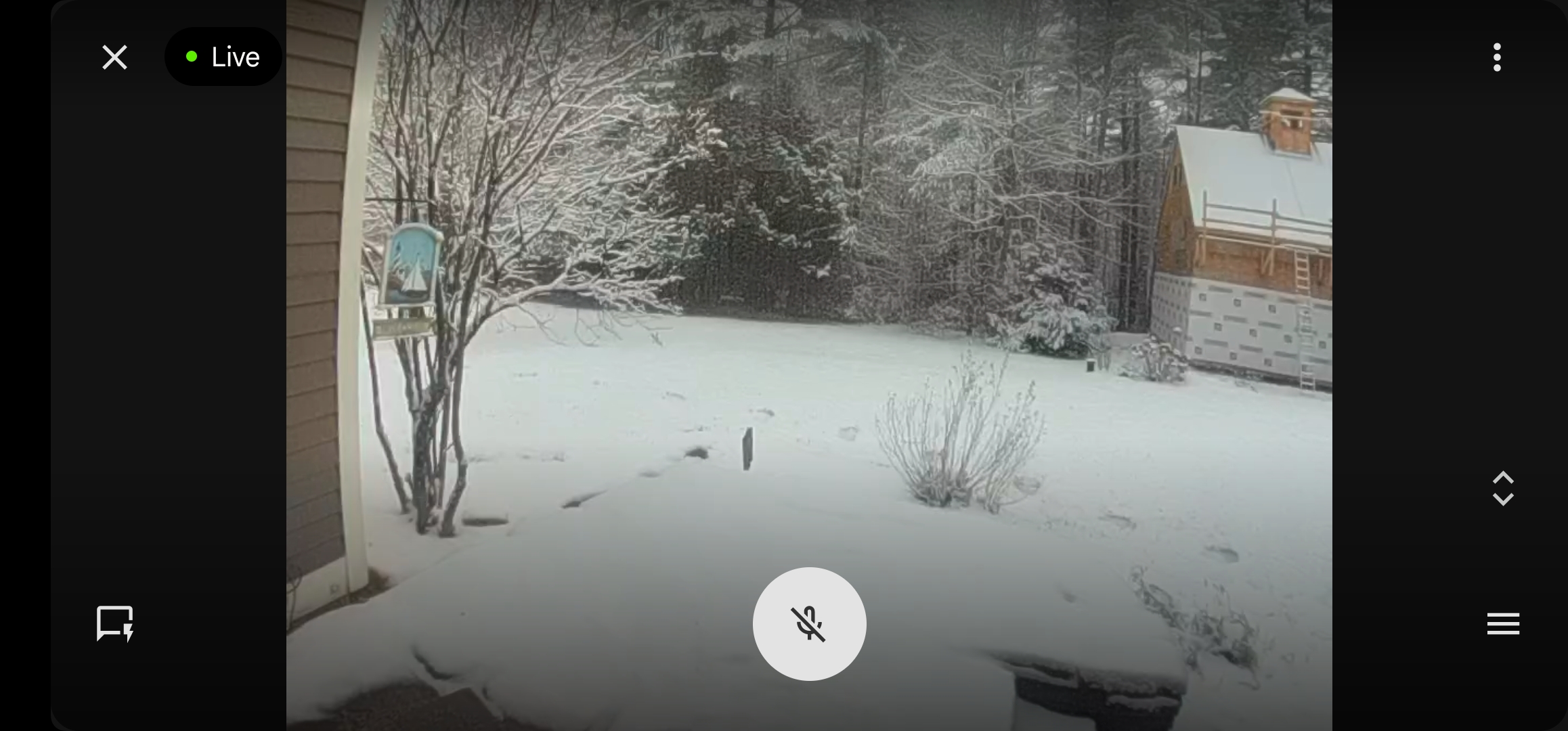
32.0°, still snow. Screenshot of the doorbell cam. Watching the live feed longingly, lol.
-
Turkey Day Birch Bender Snow Storm/Observation Thread 11/28/-11/29
AstronomyEnjoyer replied to dryslot's topic in New England
31.1°, and snow back in Bradford, per the nest cams, maybe 0.5" so far, but hard to tell. Dumping rain here outside the Albany area, (around 1100ft, about halfway to the Mass border), but can see the trees whitening on the 1400ft hill just across the road. Happy Thanksgiving! -
Turkey Day Birch Bender Snow Storm/Observation Thread 11/28/-11/29
AstronomyEnjoyer replied to dryslot's topic in New England
27.0° back in Bradford. Quality fake cold. -
Turkey Day Birch Bender Snow Storm/Observation Thread 11/28/-11/29
AstronomyEnjoyer replied to dryslot's topic in New England
It's just one of the HREF ensemble members, but this is quite the jump, ha. -
Turkey Day Birch Bender Snow Storm/Observation Thread 11/28/-11/29
AstronomyEnjoyer replied to dryslot's topic in New England
12Z HRRR, Internal snowfall algorithm. Pretty warm, gets the goodies further north. -
Blowvember - and not named for wind potential
AstronomyEnjoyer replied to Go Kart Mozart's topic in New England
From GYX, seems fairly bullish. -
Blowvember - and not named for wind potential
AstronomyEnjoyer replied to Go Kart Mozart's topic in New England
3km NAM would get the job done out this way. Nice n' pasty. -
Blowvember - and not named for wind potential
AstronomyEnjoyer replied to Go Kart Mozart's topic in New England
30.2° with a decent little burst of ZR this morning. Getting a glaze out on the deck. -
Blowvember - and not named for wind potential
AstronomyEnjoyer replied to Go Kart Mozart's topic in New England
First ballot I would hope... Nah, no chance I'm missing out on Thanksgiving. My nephew has just started talking and I need to ensure he says my name before he says my sister's. I'll be driving back Friday morning across southern Vermont anyway. That'll give me my snow fix assuming the event materializes. -
Blowvember - and not named for wind potential
AstronomyEnjoyer replied to Go Kart Mozart's topic in New England
Bah, this looks like it could be a decent event around these parts. Too bad I'll be in the Albany area on Thursday for Thanksgiving. Wonder if I ought to fake sickness. -
Blowvember - and not named for wind potential
AstronomyEnjoyer replied to Go Kart Mozart's topic in New England
Uh-oh, clowns are out and about. And so now is this clown.