Bob Chill
-
Posts
36,387 -
Joined
Content Type
Profiles
Blogs
Forums
American Weather
Media Demo
Store
Gallery
Everything posted by Bob Chill
-

January Medium/Long Range: A snowy January ahead?
Bob Chill replied to mappy's topic in Mid Atlantic
Outside of a nuke, best case scenario is to have the southern vort as juiced as possible when it turns north. Even modest NS interaction like a frontal boundary or ribbon of vorticity can keep things cohesive enough for a very nice event. Can't have a stream duel. They need to be nice to each other in some way. ICONs version can def work and improve without a bomb -
January Medium/Long Range: A snowy January ahead?
Bob Chill replied to mappy's topic in Mid Atlantic
Idk about that. Southern stream is ripping. To me it looks like the NS is messing it up more than assisting. But it's the Nam doing Nam things at a range it shouldn't be allowed to run lol -
January Medium/Long Range: A snowy January ahead?
Bob Chill replied to mappy's topic in Mid Atlantic
Upper levels lose lift and instability. Moisture is still there but the mechanism to wring it out gets pulled apart from messy interaction. Think of it like 3-4 way tug of war, very confusing and nobody usually wins. Doesn't mean that's locked in though. Just how it looks now. Northern stream is notorious for mid range surprises (in all directions). Difficult to model. @psuhoffmani agree 100%. We can have epic dry periods in any season but the last 4 years or so has taught me the same thing. When precip happens, a propensity to bust on the high side seems far more common than the other way around. If it pulls north all juiced up, my gut says it translates down stream no matter.... -
January Medium/Long Range: A snowy January ahead?
Bob Chill replied to mappy's topic in Mid Atlantic
Tough call. This current 2 week period could end up being the coldest/most active period of winter but I have my doubts for now. I'm expecting a -ao reload before any extended thaw. Otoh, winters don't behave the same as they used too so climo/history doesn't work as well as it used too. Right now the current AO dive still looks more like a classic 4+ week period versus a hit and run. Nothing surprises me anymore though -
January Medium/Long Range: A snowy January ahead?
Bob Chill replied to mappy's topic in Mid Atlantic
The current AO dive peaked at -4 and no signs of a legit flip yet. A relax is inevitable and ens guidance is honing in on it mid month but more importantly, what happens beyond will define a good chunk of Feb. My gut says another dive of lesser magnitude is the most likely. If that happens, front half of Feb will continue with a decent regime for winter wx. Even if/when things aren't lining up, winter will be lurking close by. Ens spread is wide. My money is on the big + flipper camp is wrong. Neutral waffle or elevator down is where my head is -
January Medium/Long Range: A snowy January ahead?
Bob Chill replied to mappy's topic in Mid Atlantic
It's never really looked good for a bomb. Don't get me wrong, I want a nuke but it's pretty messy in the upper levels as it lifts north. No classic banana high and no consolidated shortwave. Imo, the best ingredient in place is baroclinicity (odd word lol) and not much else for things going nuclear. That said, it's pretty juicy in the gulf so even if decaying or disorganized on the trip north, no reason to think we can't get a sheared but juicy overrunner. The once common widespread 2-4/3-6 has been on hiatus. This setup is a very common way to get that. Time will tell as always -
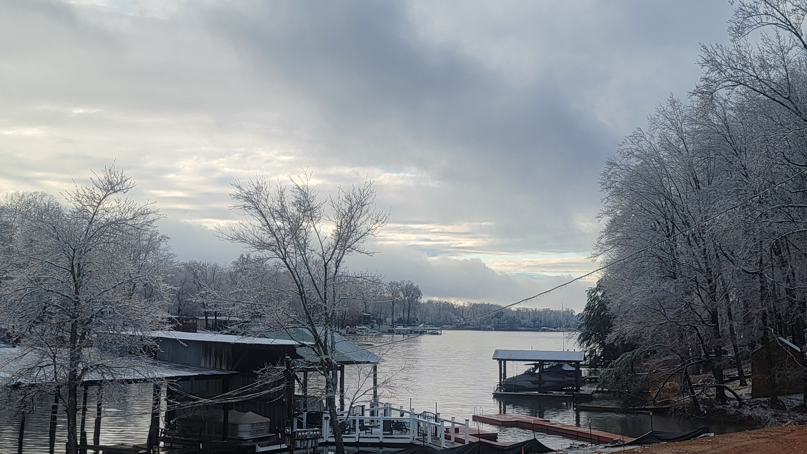
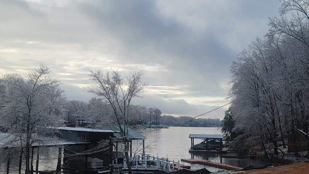
Pretty scenic for a messy storm down here. Lookin forward to my first non messy storm lol

-
January Medium/Long Range: A snowy January ahead?
Bob Chill replied to mappy's topic in Mid Atlantic
I'm not sure about this one. I do like my location this time. Overrunning precip zips north and I have room to spare in the mids/surface... for now... lol. Things are tricky as that slug comes up. I'd like to think I get a 2-4 deal before things fall apart if thats how it breaks. I prob won't get any extra effects from rapid deepening. That's likely well north of me. But I'm in an OK spot for a cohesive storm too. Short story is its becoming likely another winter wx make is coming for both our yards. Impacts TBD. I think I stand a better chance for accum snow than you guys with a weaker/messier upper level system. You guys would smoke me with a bomb but that's what I'm rooting for no matter what. 18z gefs likes the more bomby idea but the gefs is a cult of the op at this range lol -
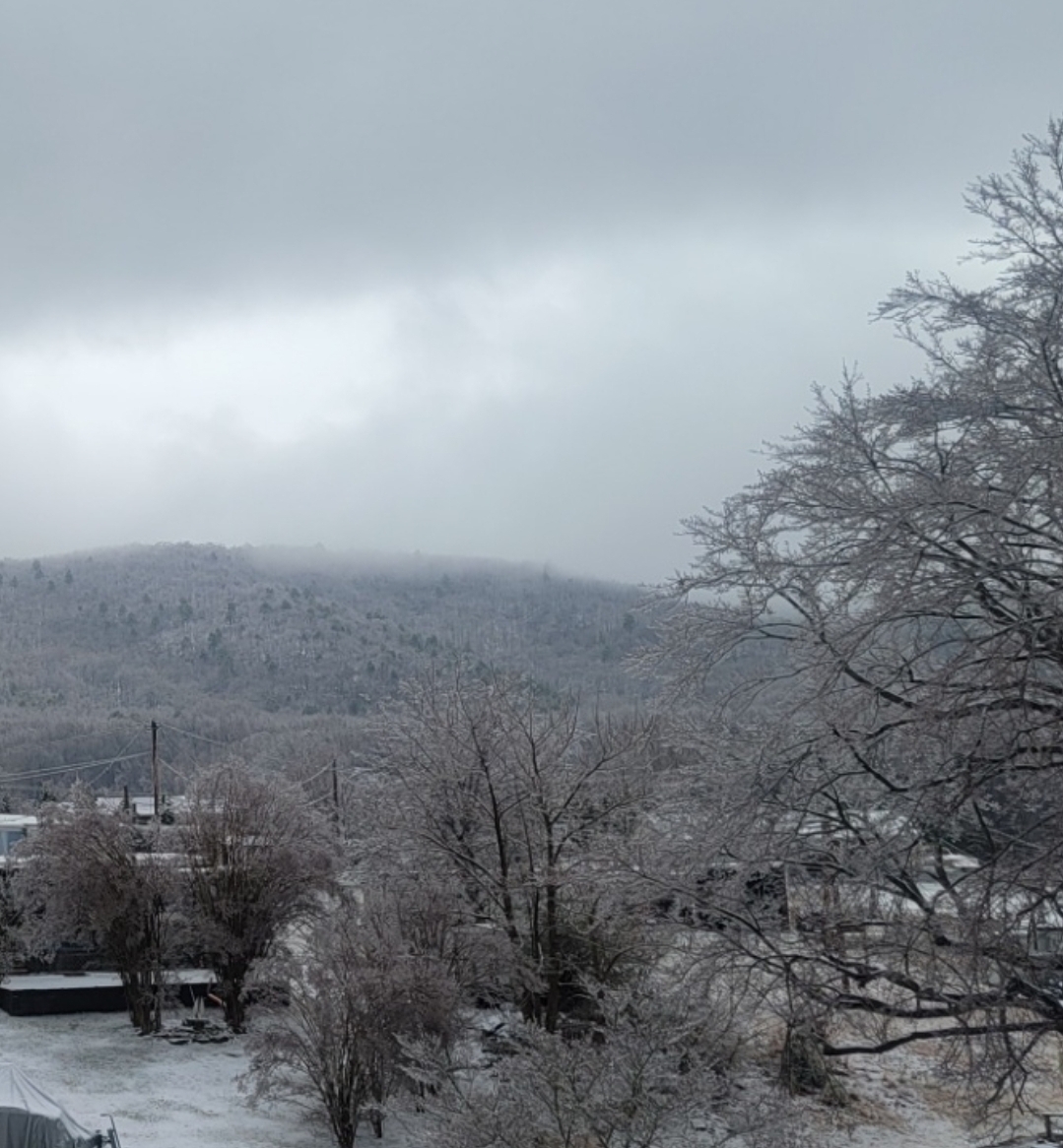
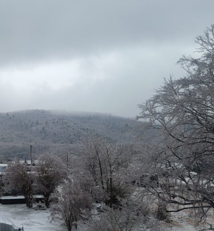
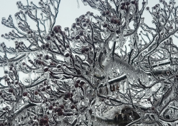
Ended with 1.5" of snow, .5" sleet, and at least .2 zr accretion. Power was out from 4am to just now lol. Exceeded expectations but it was a pretty messy storm here lol

-
January Medium/Long Range: A snowy January ahead?
Bob Chill replied to mappy's topic in Mid Atlantic
U ok bro? -
Pingin pretty good here to your east. It's going to be a crunchy night and AM lol
-
Solid 1.5" before a lull. Precip on the doorstep again but I doubt it will be snow. Temps bouncing between 29-30 so frozen will continue at least. Hope y'all get hammered and schools are out for a week. Good times
-
January Medium/Long Range: A snowy January ahead?
Bob Chill replied to mappy's topic in Mid Atlantic
Jan 2000 is on the d6-10 analog list. Extrapolate at your own risk -
You're prob in a much better spot than me overall. Especially west and north like forest and Elon area. I'm getting lucky right now. After this lets up my snow part is prob over then on to sleet and frozen pines lol
-
White asteroids. Usually means sleet nearby but you can hear them hitting the ground too lol
-
Penhook deathband incoming. Last hurrah for me probs but 1" on the ground and roads. Awesome day.
-
Dang it lol. I figured the warning was a tease and mirage but I'm lovin it no matter. Bottom of the hill is a little marina on the lake. I could sled 50mph right into the lake hahaha
-
NWS (blacksburg) upgraded to a warning with up to 4" of snow and sleet before zr lol. It's dumping. I'm under oranges. Let's fookin go!
-
Mod snow, big flakes, half mile viz, and sticking on everything. I'll post pics in a bit
-
Snowing in Penhook and Glade Hill. Temps hovering round 32-33 but ground is frozen. Radar looks better than I thought and it started 2 hours early. Extrapolate at your own risk
-
January Medium/Long Range: A snowy January ahead?
Bob Chill replied to mappy's topic in Mid Atlantic
Ummm.... this is the best d11+ analog set as a whole that I've seen in years. Jan 2004 was inch away from epic. Majority of these point towards our heaters and not single storms. I've become the most bullish on future prospects than I have in longer than i can remember. Some these analogs were just epic cold/stormy periods in general. Focusing on raw snowfall only misses the bigger picture here imo. -
January Medium/Long Range: A snowy January ahead?
Bob Chill replied to mappy's topic in Mid Atlantic
Starting to see the big bowl look on ens & now ops at times d10+. Big bowls are my personal faves. Long tracks with good trajectories. Won't be as cold as a big +pna but it will likely be active. All systems go if it sets up because even west tracks work with the big bowl. Highs to the north move laterally. Good for CAD. Last winter was blocky but ugly AF. Data shows a blocky winter either way. The year before that was crazy on the #s. This winter is trying pretty hard to go down as a blocky winter on the #s and maybe be snowy too. If the big weird multi decade AO/NAO cycle is real, which I think it is, this is probably the beginning of a 10 year stretch where blocking comes easy. Last one ended in 2011/12... -
January Medium/Long Range: A snowy January ahead?
Bob Chill replied to mappy's topic in Mid Atlantic
Yessir. Nearly all coastals are hybrids in the sense that slp jumps the coast/redevelops even with the majority of Miller As. Jan 2000 was a straight up coastal tracker but those are super rare. Otherwise, the handoff is present nearly all the time. In my simple mind, any storm that is juicy west of the MS River and tracks entirely south of us is a Miller A. No big lull or weird weaken b4 strengthen again stuff. Just a trackable blob of precip that consistently leaves bigger totals in its wake as it marches NE. Miller Bs comes in all shapes and sizes. Jan 2016 was a Miller B if you count where it comes from. It was a NS shortwave that hit the pac NW. Just took an insanely good track and never wobbled in strength much. I personally look at Jan 2016 more as a Miller A but it's debatable I no longer like the Miller A/B debate. We know what works and what doesn't and the lines between them are way too muddy to have 2 simple buckets -
January Medium/Long Range: A snowy January ahead?
Bob Chill replied to mappy's topic in Mid Atlantic
You know I believe train tracks and heaters are a legit phenomenon when it comes to EC snow in general. This period looked like a heater setup over 2 weeks ago. It's reasonable to have some blind optimism right now -
No doubt in my mind the UKIE is spot on. No bias here....