.jpg.93eb8afe5d1df4d67bc0eeb78d645380.jpg)
.jpg.7cbeb4b469bd18d447fac5868c43a091.jpg)
Yardstickgozinya
-
Posts
1,251 -
Joined
Content Type
Profiles
Blogs
Forums
American Weather
Media Demo
Store
Gallery
Everything posted by Yardstickgozinya
-
.thumb.jpg.6a4895b2a43f87359e4e7d04a6fa0d14.jpg)
Central PA Winter 25/26 Discussion and Obs
Yardstickgozinya replied to MAG5035's topic in Upstate New York/Pennsylvania
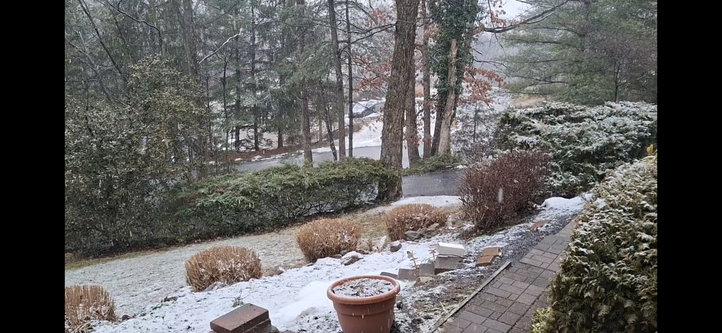
Snow recommenced here 5:15PM -
Central PA Winter 25/26 Discussion and Obs
Yardstickgozinya replied to MAG5035's topic in Upstate New York/Pennsylvania
Snow rain mix atm. -
Central PA Winter 25/26 Discussion and Obs
Yardstickgozinya replied to MAG5035's topic in Upstate New York/Pennsylvania
Good luck today fellows. Hopefully when I wake up your all out shoveling off your roofs. -
Central PA Winter 25/26 Discussion and Obs
Yardstickgozinya replied to MAG5035's topic in Upstate New York/Pennsylvania
Steady light snow would be a more accurate observation.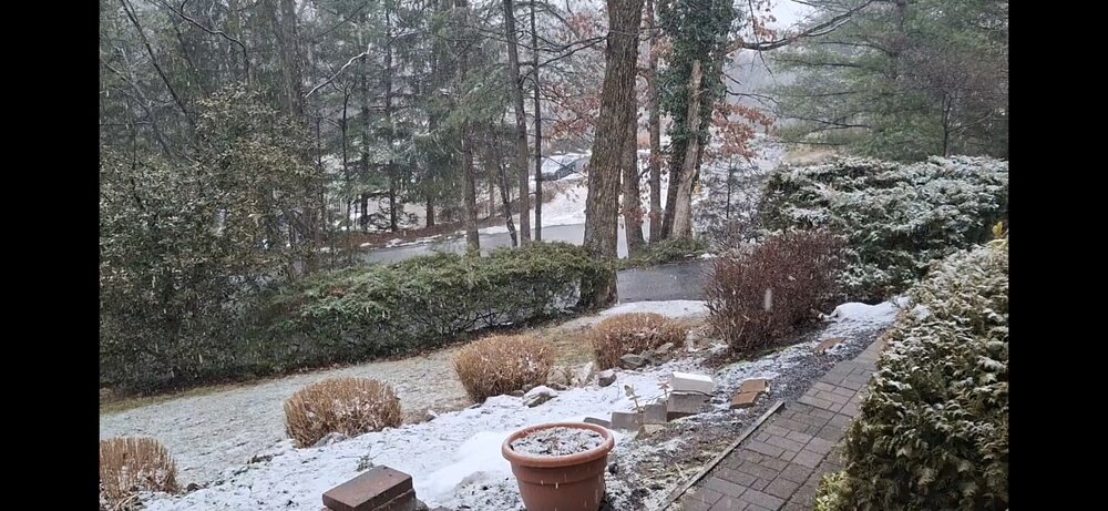
-
Central PA Winter 25/26 Discussion and Obs
Yardstickgozinya replied to MAG5035's topic in Upstate New York/Pennsylvania
Wow I'm really surprise that some north still haven't changed ever. It's not laying the best, but it's been steady snow for me for well over an hour now.
-
Central PA Winter 25/26 Discussion and Obs
Yardstickgozinya replied to MAG5035's topic in Upstate New York/Pennsylvania
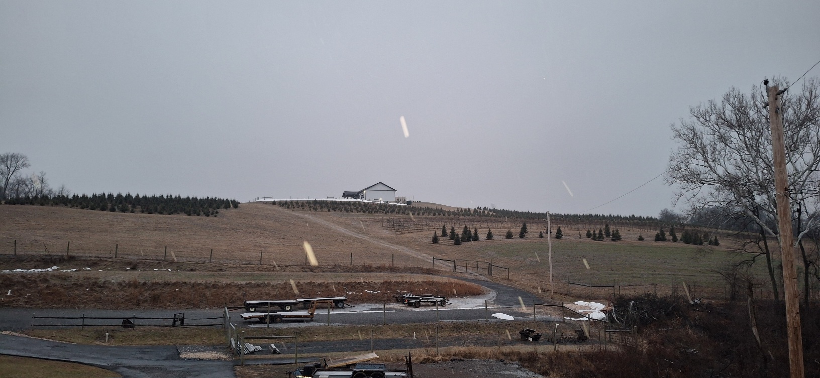
I just had a view back towards some higher elevation and I can definitely tell it's been snowing a little longer up there. It's been snowing rather light here for the last half hour b,ut we're still getting coverage without much of a problem. I know some of you fellows like your wine. This place is basically in my backyard.It's where my son and I cut down a lot of our christmas trees. Back in 09 when my son was still a child he got to experience cutting down a tree in an epic snow snow and drag it home on a sled with me. He's not as fond of snow as his old man, but it's definitely a fond memory of his.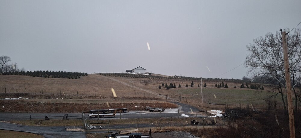
-
Central PA Winter 25/26 Discussion and Obs
Yardstickgozinya replied to MAG5035's topic in Upstate New York/Pennsylvania
You can actually see the snow starting to lay just a few hundred feet up. -
Central PA Winter 25/26 Discussion and Obs
Yardstickgozinya replied to MAG5035's topic in Upstate New York/Pennsylvania
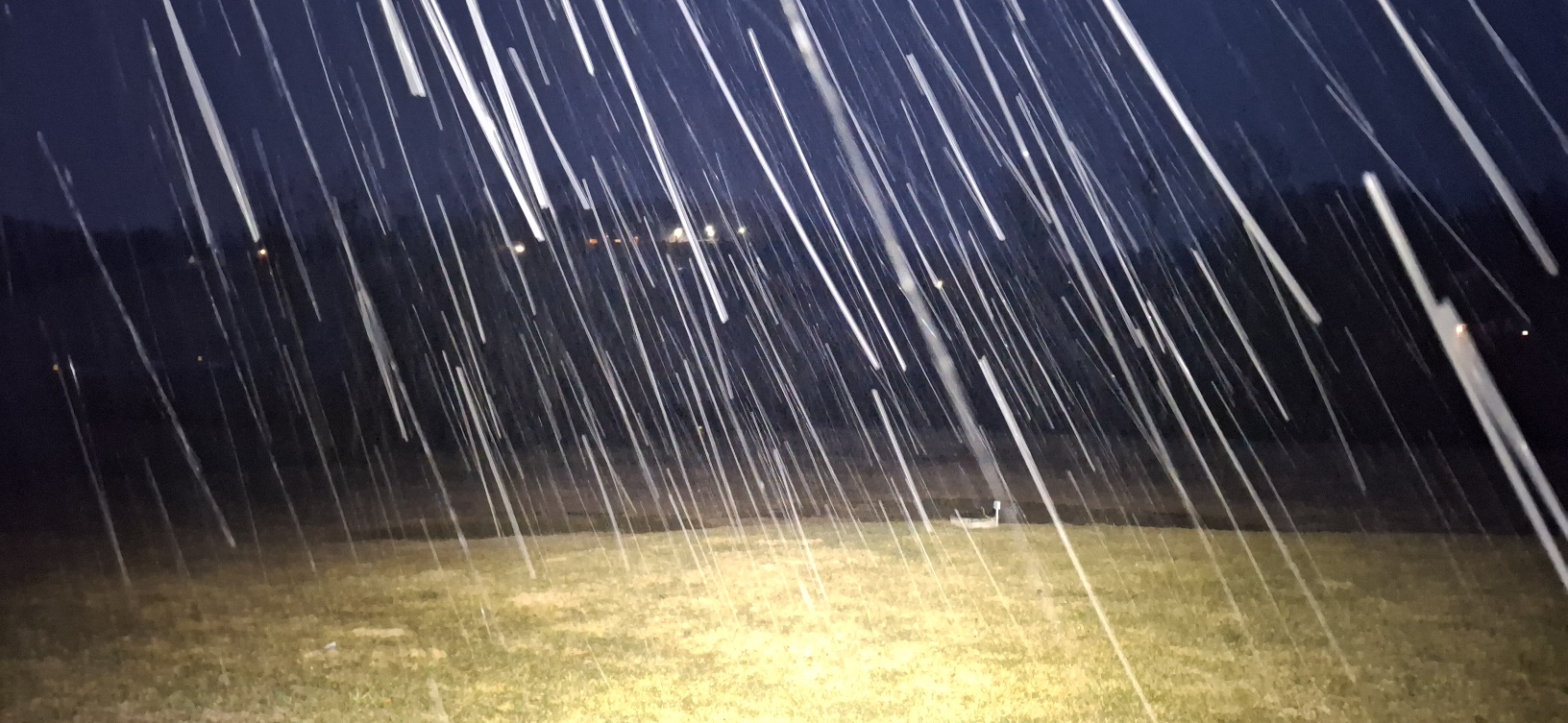
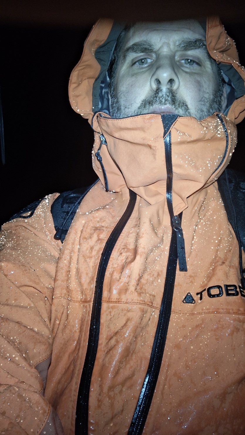
When I started my walk, it was drizzling., but it quickly started mixing with snow within the first five minutes, and it's been steady snow for about the last thirty minutes of my walk.. The smell of winter is in the air. What compelled me to take a break from my walk and post, was the sound of a distant locomotive air horn echoing throughout the valley. That sound is without a doubt, is my absolute favorite sound of of winter.. It's one of the most lonely an haunting sounds, but also quite majestic and beautiful at the same time. I find the locomotive horn to be a testament to some of the great generations that came before, and times when things just didn't move so damn fast. 30,000mm waterproofing doing its thing.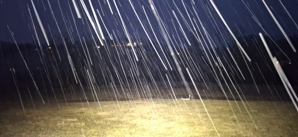

-
Central PA Winter 25/26 Discussion and Obs
Yardstickgozinya replied to MAG5035's topic in Upstate New York/Pennsylvania
A few wet flakes and grauple started hitting the ground here at 3:01 AM -
Central PA Winter 25/26 Discussion and Obs
Yardstickgozinya replied to MAG5035's topic in Upstate New York/Pennsylvania
I'm already enjoying the whole situation regardless. Everything's covered with frost and crispy out here at my buddies in Lisburn. The rocket stoves fired up and the soup's about to go on the barrel. I'm doing my couple mile walk home and possibly beyond tonight regardless of what might be coming from the sky. -
Central PA Winter 25/26 Discussion and Obs
Yardstickgozinya replied to MAG5035's topic in Upstate New York/Pennsylvania
First off, I wanna put in a little disclaimer and say that @mahantango#1 has absolutely nothing to do with my comments below I don't want readers to get the impression i'm directing my thoughts at him. At the end of the day it's pretty obvious to me that nobody knows exactly how this is going to play out. There's so much potential right now in either direction. It's situations like these that clearly exposures the forum's actual trolls. Now that said, i'm not saying that giving honest analysis the contradicts accumulating snowfall is trolling . It's obviously a lot more complex than that, but we have a whole bunch of guys here,taking advantage of that complexity, and it's situations like this that make those people stick out amongst the crowd. -
Central PA Winter 25/26 Discussion and Obs
Yardstickgozinya replied to MAG5035's topic in Upstate New York/Pennsylvania
Yeah, that's kinda strange. I believe your east of me and my p&c has 2 to 6 inches total . Nws has also been putting quite an emphasis on their lack of confidence and the possibility of extremely varying accumulations over short distance.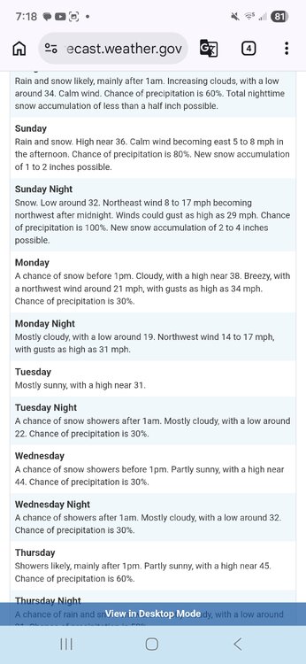
-
Central PA Winter 25/26 Discussion and Obs
Yardstickgozinya replied to MAG5035's topic in Upstate New York/Pennsylvania
Oh, man, that's because you skip step 3 through 9. Lol If you put the word weather on the end, the twitter feed should be the first thing to pops up. https://x.com/muweather -
Central PA Winter 25/26 Discussion and Obs
Yardstickgozinya replied to MAG5035's topic in Upstate New York/Pennsylvania
Step one.Try putting an m into your search bar. Step two. Put a u into the search bar. Steps 3 through 9 are basically the same as step one and two . You want to put your letters in the right order to spell out the word weather. if you make a mistake, don't worry, it just has to be close. Step ten is a the real doozy. Next, you wanna press the enter button, but be warned, you will be amazed. -
Central PA Winter 25/26 Discussion and Obs
Yardstickgozinya replied to MAG5035's topic in Upstate New York/Pennsylvania
That ain't breaking my heart either.Just get it west, I ain't choosy. -
Central PA Winter 25/26 Discussion and Obs
Yardstickgozinya replied to MAG5035's topic in Upstate New York/Pennsylvania
I'm actually fine with where the storm's at. I would find it much more exciting to watch a tick west on radar real time. Even if we don't get many ticks west on on paper , from this point moving forward, let's not forget the storm itself can tick west, whether the models give it permission or not. That's exactly what 2016 did. -
Central PA Winter 25/26 Discussion and Obs
Yardstickgozinya replied to MAG5035's topic in Upstate New York/Pennsylvania
I saw you pull that comment @pasnownut. I was going to cheer you on. I believe in you ! i'm here to help you overachieve. -
Central PA Winter 25/26 Discussion and Obs
Yardstickgozinya replied to MAG5035's topic in Upstate New York/Pennsylvania
Likely a blend. -
Central PA Winter 25/26 Discussion and Obs
Yardstickgozinya replied to MAG5035's topic in Upstate New York/Pennsylvania
Foxyynew just gave me a solid, 1 to 3 .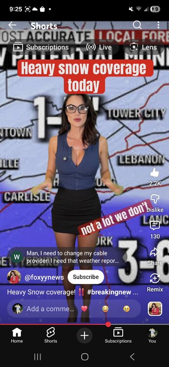
-
Central PA Winter 25/26 Discussion and Obs
Yardstickgozinya replied to MAG5035's topic in Upstate New York/Pennsylvania
Aye aye, Matey" She aint a Marlin, she aint a tuna. This bohemoth monster of of the sea thinks she'll make way of the fishes. This beast never seen the likes of such snow famished scurvy dogs . "Arr" drags pined down deeper than Captain Nemo and the Nautilus themselves.. Don't worry landlubbers , your favorite skally wag, is bringing her ashore
-
Central PA Winter 25/26 Discussion and Obs
Yardstickgozinya replied to MAG5035's topic in Upstate New York/Pennsylvania
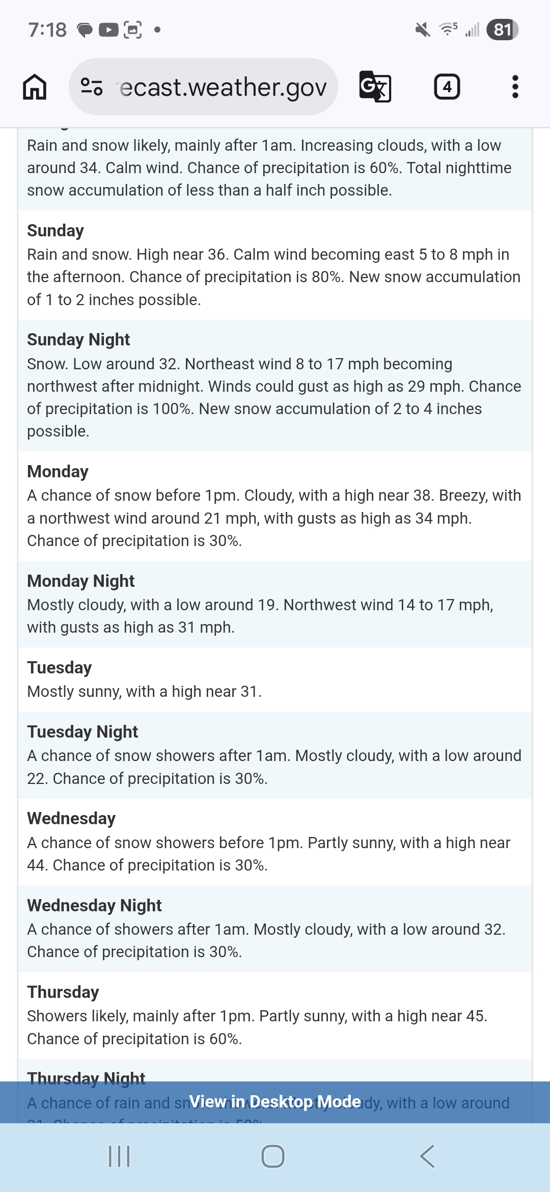
This mornings write up from Nws forcast discussion on this weekend’s winter potential. KEY MESSAGE 3: Reminder that it`s still winter with potential for accumulating snow Sunday followed by a brief cold spell with brisk winds Monday and Tuesday. Main chance for snow on Sunday would be more from the inverted trough, still a ways out to pinpoint location and amts of snow with such a feature. Upper level low dynamics might be the key for our area as well. Earlier discussion below. There remains a strong potential for a low pressure system off the Mid-Atlantic coast Sunday intensifying into a nor`easter by Monday. However, the track of the low remains uncertain with plenty of variability in the model guidance. The ECMWF and the UKMET remain farther south and offshore as it exits the coast, whereas the GFS is closest and has the greatest impacts to the Mid-Atlantic region. This is a low confidence forecast at this time with northern and southern stream phasing differences still to be resolved. It seems that even with a more suppressed and eastward track, the associated upper trough and inverted trough axis may be able to provide sufficient forcing/lift to produce a broad area of accumulating snow. Confidence in accumulating snowfall continues to increase, but significant details remain TBD as it relates to the potential for significant snowfall. Confidence is much higher in a reality check back to winter temperatures as a brisk northerly wind behind the departing nor`reaster directs a much colder Canadian airmass back into the region. Max temps on Monday and Tuesday will be 5 to 15 degrees below the historical average. The cold spell won`t last long with a moderating trend commencing through midweek as low level winds turn more southwesterly. Todays full discussion below https://forecast.weather.gov/product.php?site=CTP&issuedby=CTP&product=AFD&format=CI&version=1&glossary=1&highlight=off -
Central PA Winter 25/26 Discussion and Obs
Yardstickgozinya replied to MAG5035's topic in Upstate New York/Pennsylvania
@Jns2183 Yardstick short range regime sequencing . Thanks for that too by the way, It was a good listen. -
Central PA Winter 25/26 Discussion and Obs
Yardstickgozinya replied to MAG5035's topic in Upstate New York/Pennsylvania
I love seeing the volatility in the atmosphere in Pa. the last two nights. Makes me more hopeful maybe we can bust big . -
Central PA Winter 25/26 Discussion and Obs
Yardstickgozinya replied to MAG5035's topic in Upstate New York/Pennsylvania
Heavy rain here flash of lightning. -
Central PA Winter 25/26 Discussion and Obs
Yardstickgozinya replied to MAG5035's topic in Upstate New York/Pennsylvania
I could have the wrong person here, but I believe it was @anotherman that brought up the Megalopolitan Blizzard of 1983 last week. I'm certainly not saying that it will, but given what the gfs has shown at times and the slightly cooler column ,I feel that this one has more of a legitimate chance, then last week, to bust towards something like that. I could definitely live with that .