MDScienceTeacher
-
Posts
332 -
Joined
-
Last visited
Content Type
Profiles
Blogs
Forums
American Weather
Media Demo
Store
Gallery
Everything posted by MDScienceTeacher
-
Jan Medium/Long Range Disco: Winter is coming
MDScienceTeacher replied to stormtracker's topic in Mid Atlantic
That’s the ensemble too. That is a huge signal if I ever seen one. Just wow. -
Jan Medium/Long Range Disco: Winter is coming
MDScienceTeacher replied to stormtracker's topic in Mid Atlantic
Right I was gonna say the same thing. We are in the 5 day range. -
Jan Medium/Long Range Disco: Winter is coming
MDScienceTeacher replied to stormtracker's topic in Mid Atlantic
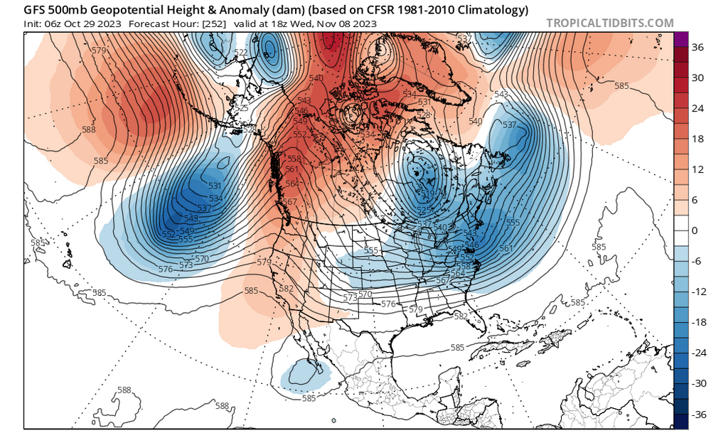
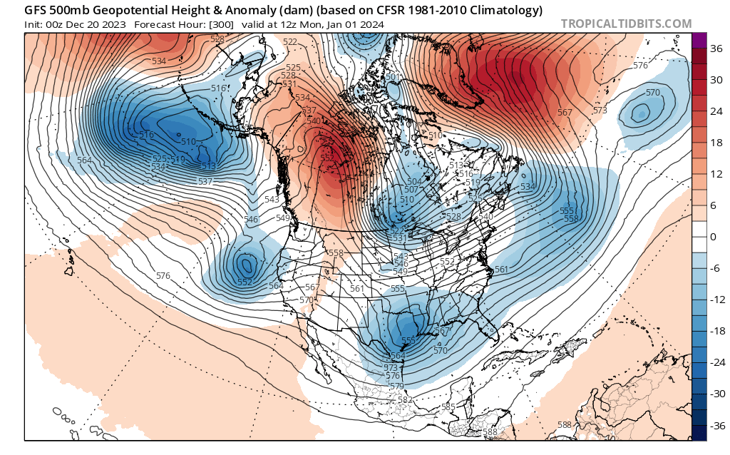
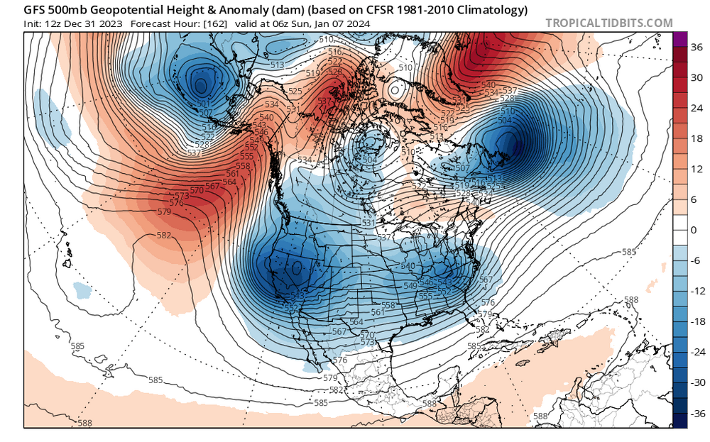
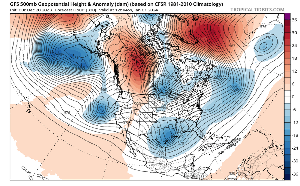
The differences in the 500 MB Height Anomaly North and East of us btw this mornings 6z run (where we get a nice snow storm) and yesterday's 12Z run (which shows a cutter) are significant. Notice how the low heights extend all the way in to the Hudson Bay on the 6z. My guess is this acts to strengthen the block, locking in HP to our north causing a tighter pressure gradient and keeping the upper level low from tracking too far north before spawning the surface coastal low. Quite different than the 12Z yesterday where you can see a upper level low pressure extending up in to Chicago (way too far north). 6Z today: 12Z yesterday:
-
Jan Medium/Long Range Disco: Winter is coming
MDScienceTeacher replied to stormtracker's topic in Mid Atlantic
The EPS looks to have more certainty in the storm track for this storm (members are more clustered together): GEFS: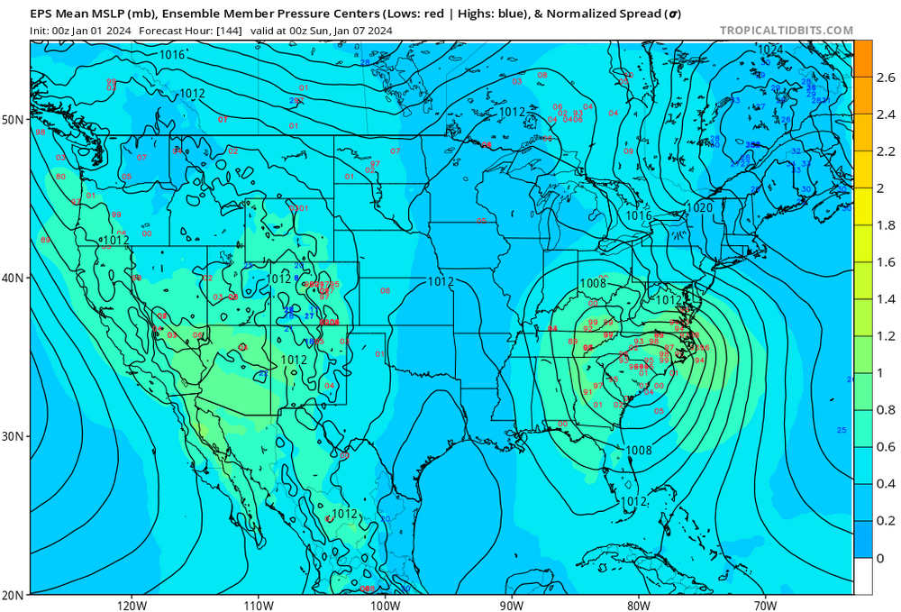
-
Jan Medium/Long Range Disco: Winter is coming
MDScienceTeacher replied to stormtracker's topic in Mid Atlantic
I just learned that "NWS takes observations at 92 stations; 69 in the conterminous United States, 13 in Alaska, 9 in the Pacific, and 1 in Puerto Rico. " What other sources of data does NOAA feed in to the GFS? Especially on the west coast where there are only 9 stations in the pacific. -
Jan Medium/Long Range Disco: Winter is coming
MDScienceTeacher replied to stormtracker's topic in Mid Atlantic
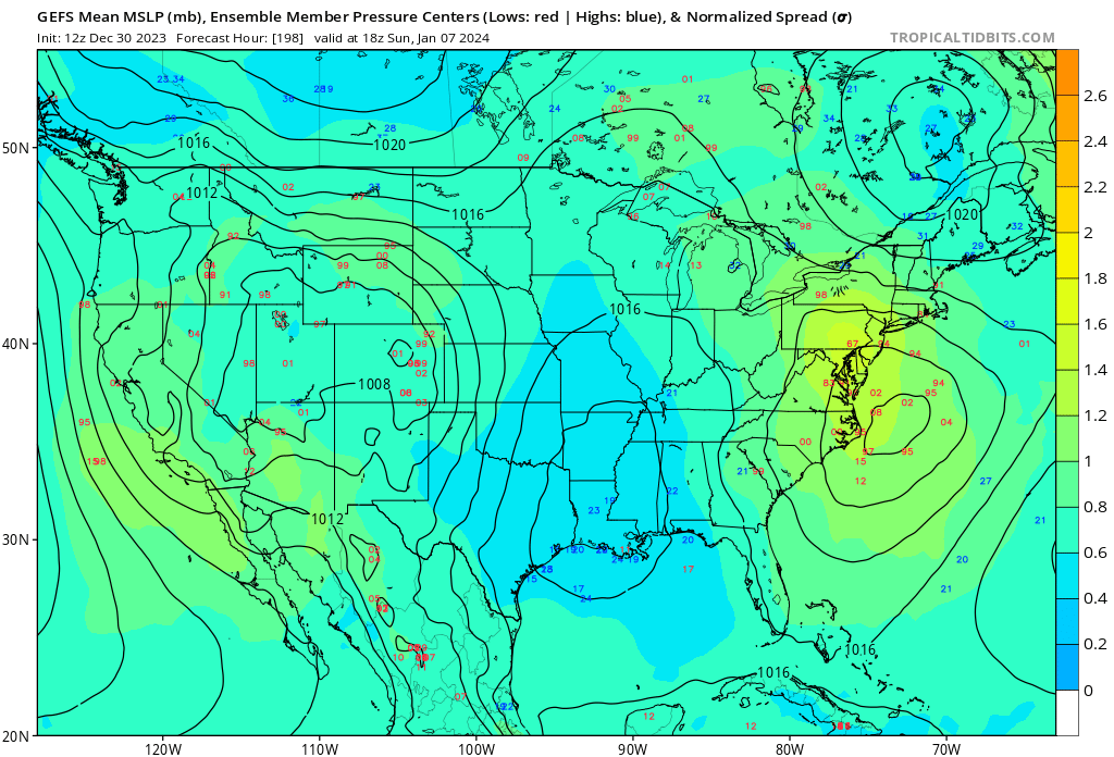
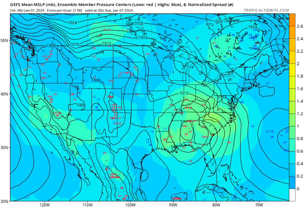
In addition, the cluster of lows on the individual members lot shifted south and west by about 75 miles: 12Z 18Z -
Jan Medium/Long Range Disco: Winter is coming
MDScienceTeacher replied to stormtracker's topic in Mid Atlantic
Right. And on the gefs as a result the low pressure tracks over Georgia and out over benchmark. Based on the overall run to run consistency of the blocking to our north and northeast I don’t expect much to change over the next several days. It’s gonna come down to how the minute details play out like how strong the hp is to our north and the timing of when and where the low bombs out to our south.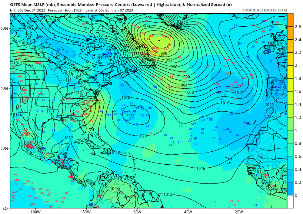
-
Jan Medium/Long Range Disco: Winter is coming
MDScienceTeacher replied to stormtracker's topic in Mid Atlantic
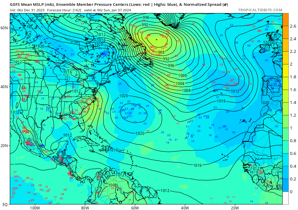
Per the op, sub 990 low going over Central VA under an air mass that has been historically warm means temp issues. Not saying it couldnt happen, we have the 50-50 low so that should help to fight the warm air, I am just saying dont invest too much in to this storm until we get closer. One silver lining is that the GEFS shows a much different track, with the low pressure bombing out after it exits the coast: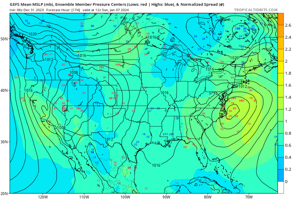
-
Jan Medium/Long Range Disco: Winter is coming
MDScienceTeacher replied to stormtracker's topic in Mid Atlantic
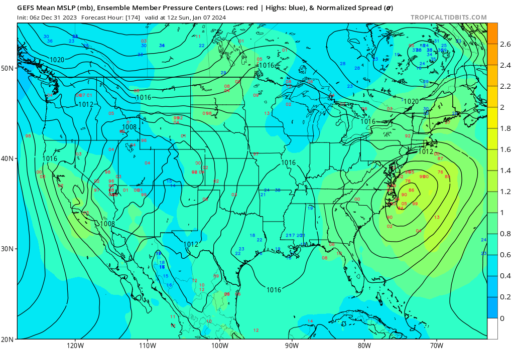
Here are the individual Ensemble Members for the 7th. This is noticeably north of the previous three runs. Good Cluster of lows. Not sure if it will be cold enough.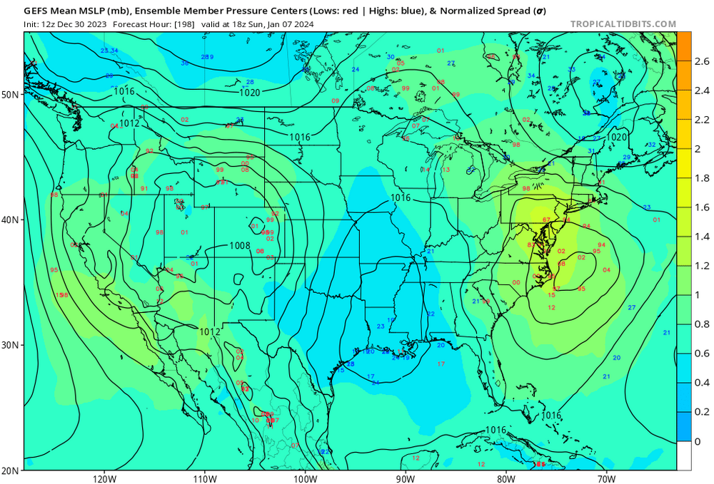
-
Yes. Volcanic activity (large and small scale) can lead to significant exothermic processes. Definitely enough to have an impact on world wide climate. I dont think people realize just how much energy it takes to skew the earths natural Glacial-Interglacial Cycles, things like volcanic activity, sun spots and astroid strikes are all capable of changing the earths weather patterns. But honestly, we are probably just in a slump and we will wind up getting a 50 inch season sometime very soon.
-
Right.. I dont know if anyone remembers this but the weather channel used to have a segment called "A look ahead" where they would show the jet stream pattern up to 7-10 days in the future. It was a great segment and they used it to warn people ahead of time for snow storm potential. That was probably my earliest memories of following weather models.
-
That storm would have been rain during peak climb.. even in to Vermont and New Hampshire. There wasn’t an antecedent cold air mass anywhere on the eastern seaboard. With the same set up you would get the same outcome. Maybe elevation would do a little better but I don’t think people realize how much warm air was pulled in from the that storm.
-
Also I don’t understand why someone has any more confidence in a 264 hour h5 map then they do a surface map at the same tome period. I get it, models are more skilled with longer waves but fantasy is fantasy and anything over 192 hours is fantasyland
-
When you say "We don't have profiles like New York" does this mean that New York Meso station obs have vertical sampling? And how do they achieve that? Balloons? Just curious.
-
surface only?
-
Is this what you are talking about?
-
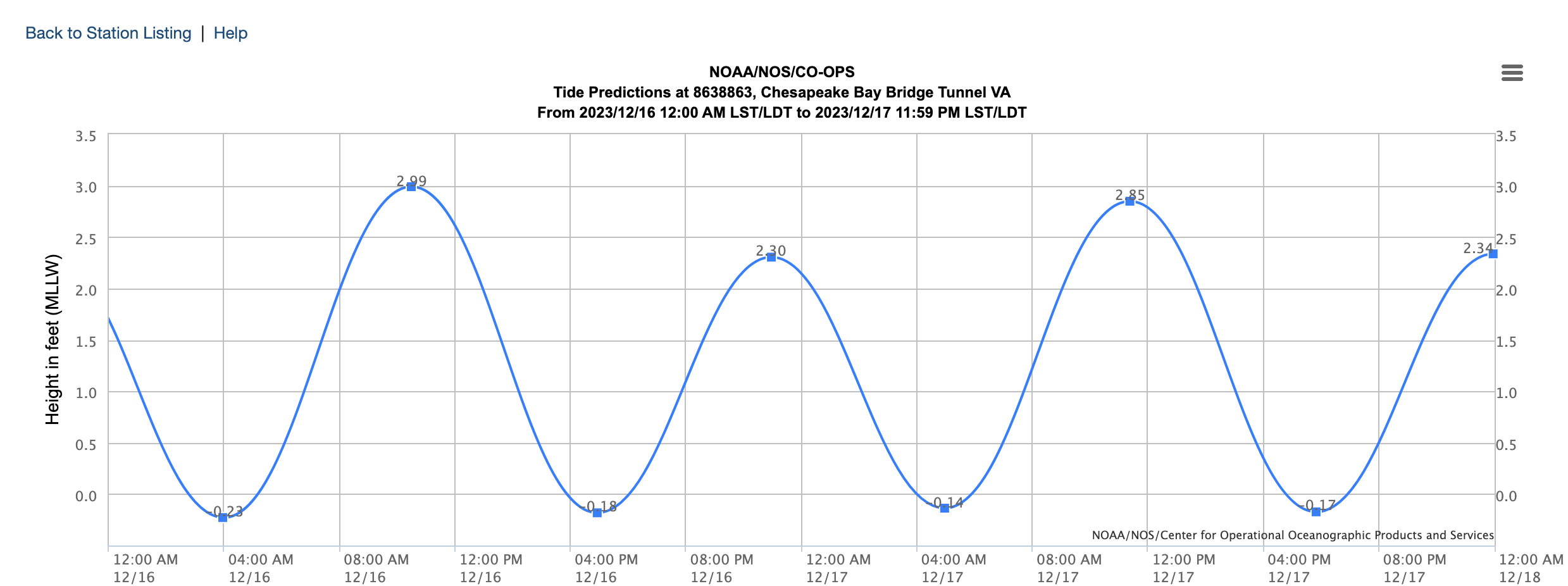
12/17/18 Disco/Obs - Rain/Wind Event
MDScienceTeacher replied to Weather Will's topic in Mid Atlantic
High tide is Midnight Sunday night in to Monday. This coincides with the highest winds. Could be a moderate storm surge event for the lower western shore.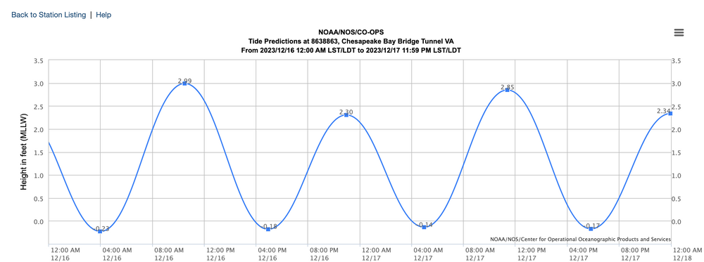
-
Are you actually tracking this? I mean its neat to look at and it is cool to get a real deal southern stream system to move through.. but this has been a rain storm ever since it showed up on the models like 7 days ago.
-
Threading the needle implies that there is some level of cold air in place. This is just not that case with the current pattern.
-
LOL.. 2 meter temp change run to run. They know who their users are.
-
12/10-11 Disco / Obs - Rain/Snow/Wind Event
MDScienceTeacher replied to nj2va's topic in Mid Atlantic
What did January 2011 look like a a few days before? Didnt that one sneak up on us too? -
12/10-11 Disco / Obs - Rain/Snow/Wind Event
MDScienceTeacher replied to nj2va's topic in Mid Atlantic
@Ji is this one exciting enough for you? -
The 384 hour GFS is never correct. It can get lucky but never correct. I would recommend picking a time where you can legitimately start taking model out put seriously (like <168 hours ) and dont look at anything after that .
-
Yikes. I know you didn’t see hardly any measurable snow last year and this was far and away the lowest snowfall totals in since records were kept in northern md. The last 20 months have been tough. I think we will be fine though. I would be shocked if our area doesn’t bounce back to the historical average with a season or two producing above average snowfall.
- 1,295 replies
-
- 2
-

-
- wishcasting
- almost winter
- (and 1 more)
-
let’s do this! Btw Isn’t this a legitimate look? Red over Greenland and blue in the Atlantic?