

DarkSharkWX
-
Posts
667 -
Joined
-
Last visited
Content Type
Profiles
Blogs
Forums
American Weather
Media Demo
Store
Gallery
Posts posted by DarkSharkWX
-
-
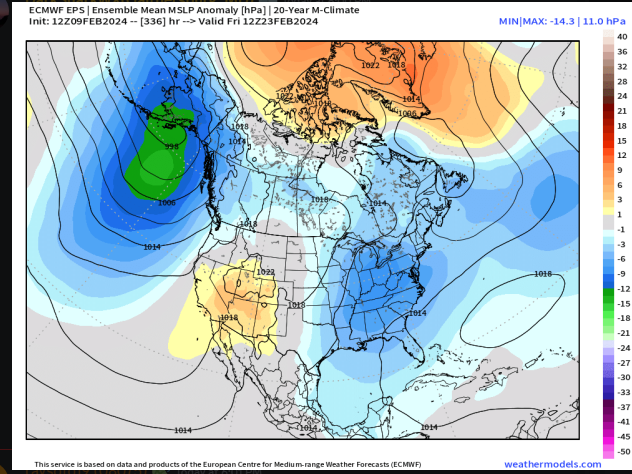
goa low on EPS for the 24th signal, jet is extended right amount and in good spot(this usually js comes with +EPO), pacific troughing/goa low is correlated to snow for us bc it implies enhanced STJ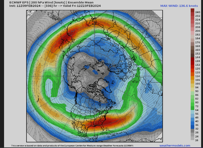
as others have said it looks good for 24th-
 3
3
-
-
5 minutes ago, nj2va said:
Looks great!

i mean it did its js a weak ass strung out wave
-
Just now, stormtracker said:
Here's the takeway...the GFS isn't going down without a fight. Most of us thought it would fold by now
CMC further S too
-
1
-
-
-
-
4 minutes ago, Stormchaserchuck1 said:
I personally don't mind having a ridge over Alaska..
yeah all that matters that the jet is extended the right amount which we have here, that js usually comes with +EPO/alaskan trough
epo isnt js alaska -
6 minutes ago, Maestrobjwa said:
Since we're between model cycles, the part of my brain that, for whatever reason attaches meaning to dates and such just can't get past this list...Top 25 and not a one the last week of Feb...Even 2010 missed! Don't trust it
Side note: All the ones I marked happened on PD weekend thar year...just sayin'
")
.jpg.1e2b359142f38fd0d6c0be9b4082c01c.jpg)
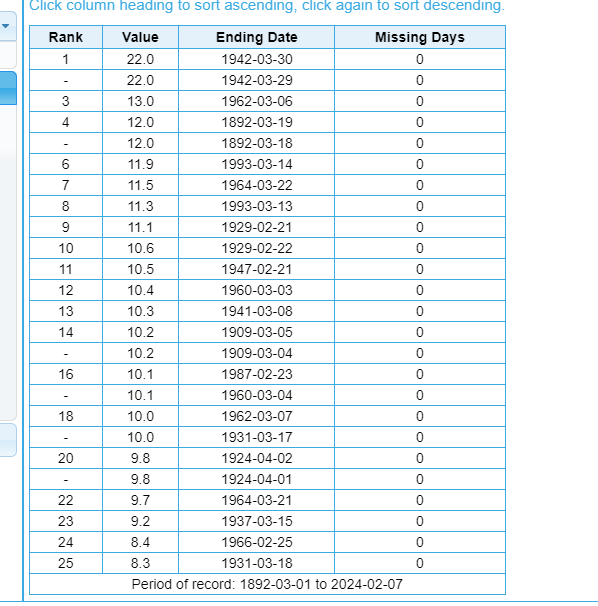
since feb 20(some duplicates)
also climo is barely different from feb 18 and 3-5 days later, no reason to think that w a pattern like this we cant get a big snowstorm -
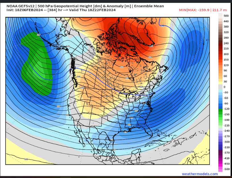
GEFS looked amazing for the end of run, aleutian low redeveloping with rockies ridging with very favorable atlantic
would fit in nicely for the 22nd-24th timeframe-
10
-
-
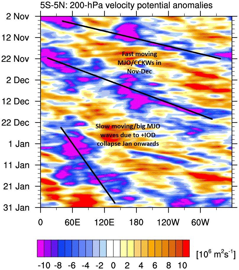
the quick transition from fast MJO waves to slow moving ones due to +IOD collapse is crazy lmao, should work out for us once we make it into 8/1/2
-
4 minutes ago, stormtracker said:
Snow map from SV...yes @NorthArlington101, I know other maps are gonna be like 75% less snowier probably. I'm just snowing the maps before you post WW map tht shows 2"

-
1
-
-
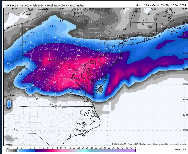
kuchera is 6-8" on pivotal
-
3
-
-
12 minutes ago, CAPE said:
With the advertised upper air pattern, this period could feature a shot of legit Arctic air, possibly coming in behind a winter storm. Maybe some (late) deep winter with snow otg.

i think there probably will be at least one big cold shot once the block does retrograde, which wont be picked up by guidance at this lead time
-
10 minutes ago, Maestrobjwa said:
To climo? While I guess that would be something at least...I don't see how we get to the 30 inch forecasts of some playing that game. That's gonna require one of those shots to be a MECS. No way the cities get above climo without that (unless we get like 3 moderate events).
Would've felt more comfortable if this changed happened 1-2 weeks earlier, but you never know. While I still feel like we're kinda flirting with the last part of our usual window...thankfully it's still early...so we'll just have to patient until we get closer.
dca is 5.9" from climo iirc, and i'm about 8-10" from climo here
-
1
-
-
8 minutes ago, frd said:
I was not aware how dramatic the North America snow cover has declined. Pretty remarkable.
Interesting post by @bluewave below.
<
The record low snow cover may be part of the reason the surface temperatures days 11-15 will be significantly warmer than the 850mb temperatures.


>
the snowcover should recover
-
-
-
9 minutes ago, Stormchaserchuck1 said:
We're going to go into Feb 13/14 with no snow. Global models had us below average temps/above normal precip for Jan and February, almost every run going back to September.
what?? did you forget about the 6-12" we got 2 weeks ago
we are average to date right now lmao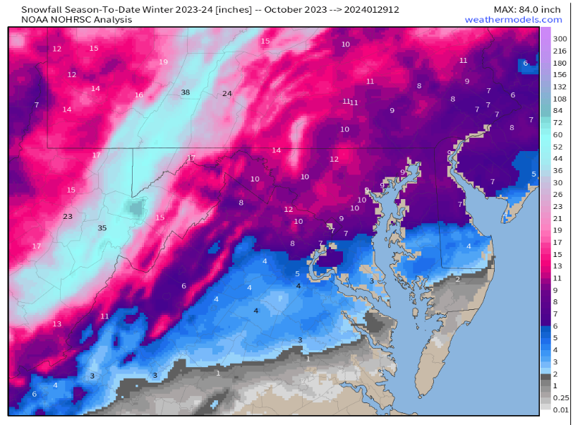
-
3
-
 2
2
-
-
7 minutes ago, NorthArlington101 said:
Unironically it’s where we want it at this range. I’d even take it there 5 days to go.
Problem I think is temps. Not sure they are workableits a long shot but we'll need the TPV to be just in the right spot and strong enough to where it can provide cold air but not also interfere with our storm
or we get a 12z cmc(yesterday) type solution where the backside of it phases, we'll see what happens since tpv features are modeled horribly with long lead times-
1
-
-
-
8 minutes ago, Allsnow said:
Weeklies stay the course today


looks pretty nice

-
11
-
2
-
-
 nice recovery
-
11
-
-
once the jet retracts we probs see the most favorable pattern of this winter yet
-
11
-
-
12/11: 2.1"
1/14: 0.2"
1/15-1/16: 5.8"
1/19: 6.4"
Total so far: 14.5"-
1
-
-
1 minute ago, RandyHolt said:
I didn't clear a spot to measure proper but I am in Rockville and it sure seems like more than 6" but I hadn't seen anyone else report over 6" until your post. I am going 6.4" but think its still snowing here.
ik someone in germantown who has 7-8" bc of the constant banding the entire event over there, seems like 270 was the cutoff for that last band that just moved through
-
2
-

 woah
woah


Mid/Late February will be rocking. (This year we mean it!) February long range discussion.
in Mid Atlantic
Posted