Wow
-
Posts
8,072 -
Joined
-
Last visited
Content Type
Profiles
Blogs
Forums
American Weather
Media Demo
Store
Gallery
Everything posted by Wow
-
stop looking at the little red L's !!!
-
further east.. not really north
-
Yes there's a bend in the isobars and wind barbs per the maps the indicative there's something there to push in enough WAA. But this is big step though.
-
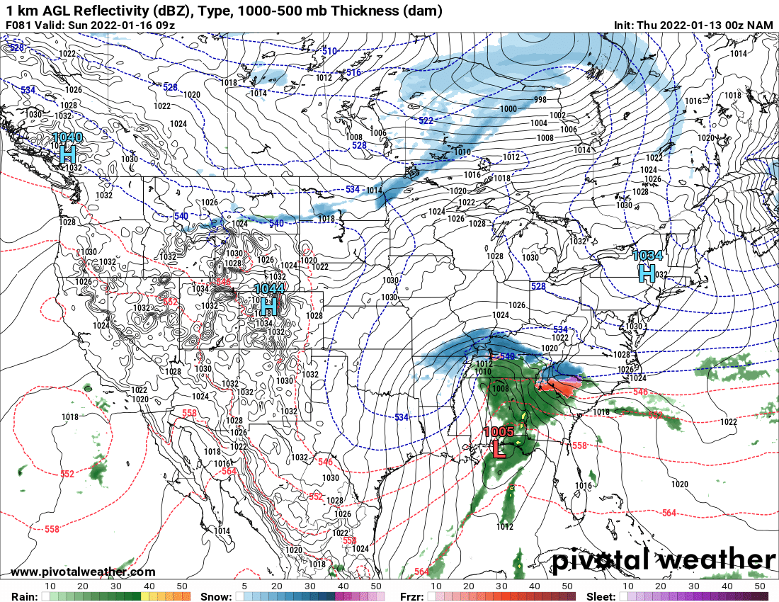
If the low tracks from FL panhandle to Charleston as shown, you are not going to have that much ice. It's a mostly snow/rain event. Climatology rules.
-
ULL really digging south. FIngers crossed... This will significantly reduce the ice threat with a Miller A track. Ignore the precip maps showing ice everywhere.
-
Wow the NAM just went Miller A .. looks like the model outputs from Monday/Tuesday. That would be huge to see the rest of the models move back to this!
-
Weaker and faster is the ideal solution.. Once it's rolls east of the Mississippi.. let 'er rip
-
NAM made a big move east and weaker with the s/w. That's going to tame the primary low. Maybe a Miller A isn't off the table quite yet...
-
Better but matter how far south that surface low goes it's still a Miller B and there's gonna be a changeover to sleet and ice unless the ULL digs far enough south.
-
GEFS following the same trend
-
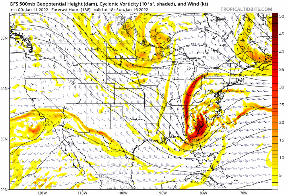
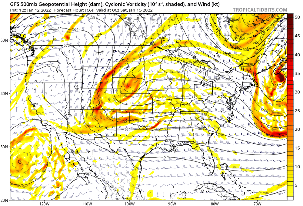
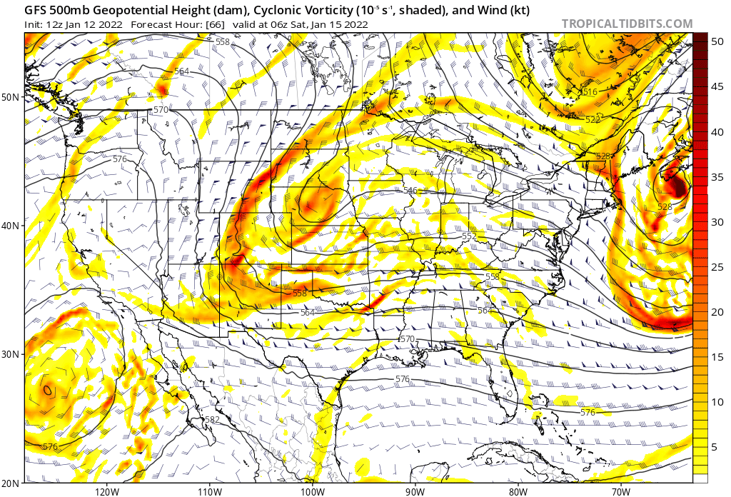
Here's a nice loop of 500mb GFS from 0z Jan 11 when the NW trend started and then starting to reverse itself in today's runs
-
Surface reflection is still a mess but the trend is clear
-
Out to 60... the ULL is just about where it was at yesterday's 12z run
-
GFS continuing the trend
-
Trend loop of the RGEM showing the trend west then trending back east over the past 36 hrs
-
ICON trend FWIW
-
NAM in the Euro camp keeping the track south
.thumb.png.fbf1edd940a32e55cfe50272383ab67f.png)
-
@78 the SLP is over Mobile AL ...
-
Oh yes the 18z Euro is chef's kiss right there. No primary low pushing up the TN Valley and the 50/50 doing its job locking in the HP and keeping this one low and slow.
-
A couple more movements like this and would get a lot more folks back in the game.
-
Big improvement with the gfs .. less amped with the primary low . The hope is we can erase this trend over the past 24 hrs.
-
Gfs finally trended more east/faster with the wave. Need more of this!
-
Don't look at the surface maps
-
Want to see it faster or weaker.. too much separation will let the low pull up too early


.png.3c4bf390d5530ef9a4a262053967e14a.png)