

RU848789
-
Posts
4,002 -
Joined
-
Last visited
Content Type
Profiles
Blogs
Forums
American Weather
Media Demo
Store
Gallery
Everything posted by RU848789
-
December 2020 General Discussions & Observations Thread
RU848789 replied to bluewave's topic in New York City Metro
I know it's just one model run and it's 8 days out, but there's at least hope - I could live with this in CNJ (GFS/CMC show snow N of 84). -
Interesting to see the moderate weakening observed by the hurricane hunters this evening with winds now down to 130 mph (just barely Cat 4). However, in the last hour or so, there have been indications of an eye trying to form, which is often a sign of intensification. The Yucatan could use a break, although 130 mph is still a big deal. Beyond there, no real change as the forecast is still for a Cat 3 hurricane to strike the central LA coast Friday night (120-125 mph) - the center of the track has landfall near Marsh Island, just south of Lafeyette and about 100 miles west of New Orleans and 90 miles east of Lake Charles. Let's see if tonight's models make any big moves on track or intensity.
-
that time of year kids...
-
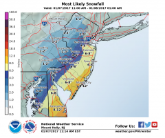
Hey Philly folks - is there anywhere to get archived forecasts (and snowmaps) from the various Philly TV stations for this past storm? Were they predicting 6-8" for Philly? I know the NWS was estimating 4-6" for Philly, so just curious. Thanks.
-
-
bump again - not sure why not pinned...
-
Vendor, Blog and TV Channel Forecasts Thread Part 2
RU848789 replied to Rjay's topic in New York City Metro
Agree with the LOL. I once spent about 15 minutes talking meteorology with him and it was clear that, while he has a met degree (from Kean), his depth of knowledge of complex meteorological science is limited, as he admitted when I asked him some probing technical questions (I wasn't trying to trip him up - was hoping he could give me some insight into the Arrhenius relationship between atmospheric temperature, energy and moisture content and he said he's not really a "science" guy, but was more interested in forecasting). Nice guy, but no Walt Drag. -
Thanks, wasn't familiar with that mode - maybe they should note it's in that mode on the radar page. Also, I understand the concept of scanning more slowly to better detect very light precip, but I still don't understand why they'd show "negative" dBZ returns - for Mt. Holly right now, there are what appear to be thin brown bands of "non-precip" (several of which are nowhere near Hillsborough, so it's not that). http://www.theweatherprediction.com/habyhints/239/ Yes, I know and appreciate that - is there any downside to permanently pinning? There have been multiple times there were storms in other regions and many of the graphics in this thread pertain to much larger areas than NYC Metro, so I find it annoying to have to hunt a few pages for this thread. Just wondering...
-
Maybe a dumb question, but on this radar and the standard NWS radar sites, all of a sudden I'm seeing "non-precip" shown, whatever that is (negative dBZ's in brown/grey mostly), which makes it hard to see the actual blues and greens (and more) denoting actual precip. Anyone know why that is the case? http://radar.weather.gov/radar.php?rid=dix&product=N0R&overlay=11101111&loop=no Also, IMO this thread out to be pinned in perpetuity and not allowed to slide off the first page, as it's a great thread regardless of whether or not we have an active storm.
-
I usually just rely on y'all for posting model graphics, since I'm not that well versed in searching through e-wall and getting the info on my own, plus I hate wasting my time if someone else has done something (thanks!). However, occasionally, I like to look at a model ru nor two on my own and right now, if I go to the e-wall and go to the 0000UTC Models area (0Z) and then click on, say, the NAM at 06 hours, the time stamp appears to be for last night's (1/21) 0Z NAM (not the current one or 1/22), whereas if I click on the 18Z NAM that ran earlier today, the time stamp (1/21 intializing at 1800) appears correct. Am I doing something wrong? Is there a better source than the PSU e-wall? Gracias...
-
Islip hit by the meteorological hat trick in the last half-year
RU848789 replied to tmagan's topic in New York City Metro
Thanks, I found the radar loops (linked), but am now wondering if there is any way to control the speed/timing of them or to pause them and capture screen shots and the like. It appears as if all one can see is a very fast 24 hour loop that can't be stopped. http://www.wunderground.com/radar/radblast.asp?ID=EWR&lat=0&lon=0&label=you&type=TR0&zoommode=pan&map.x=400&map.y=240¢erx=400¢ery=240&prevzoom=zoom&num=1&delay=100&scale=1&showlabels=1&smooth=0&noclutter=0&showstorms=0&rainsnow=0&lightning=0 -
Islip hit by the meteorological hat trick in the last half-year
RU848789 replied to tmagan's topic in New York City Metro
Just curious - anyone know where I could find a radar loop of the heavy rainfall period from Mt. Holly and/or Upton? I've seen the radar totals, but not any loops. Thanks. -
Question: I always thought these were the times the model output started coming out, not when they started running. I always thought the 0Z suite, for example, all started running with 0Z, or 7 pm EST, data inputs and that the models took varying times to run, hence producing different output times. Can anyone confirm whether that's right or wrong? If it's wrong, then why call them all the 0Z suite, then?
-
Pinnage please! (then delete this post to unclutter the thread)...
