
blackngoldrules
-
Posts
1,859 -
Joined
-
Last visited
Content Type
Profiles
Blogs
Forums
American Weather
Media Demo
Store
Gallery
Everything posted by blackngoldrules
-

Pittsburgh/Western PA WINTER ‘25/‘26
blackngoldrules replied to Burghblizz's topic in Upstate New York/Pennsylvania
Glad to see some of us are up. Who needs sleep when this is going on! Lol -
Pittsburgh/Western PA WINTER ‘25/‘26
blackngoldrules replied to Burghblizz's topic in Upstate New York/Pennsylvania
It sure is. I don't think I've seen snow this heavy in a long time. It's mesmerizing to watch. -
Pittsburgh/Western PA WINTER ‘25/‘26
blackngoldrules replied to Burghblizz's topic in Upstate New York/Pennsylvania
This week has been a much needed distraction for me. It's been fun tracking this with you guys. Now, we get to finally enjoy what we've been tracking. -
Pittsburgh/Western PA WINTER ‘25/‘26
blackngoldrules replied to Burghblizz's topic in Upstate New York/Pennsylvania
I stopped sweating this stuff years ago. I've been through too much personally that's way worse than busting on a snowstorm. Lol I'm just going to enjoy the ride and whatever happens happens. It's been fun to track all week and now it's finally almost here. -
Pittsburgh/Western PA WINTER ‘25/‘26
blackngoldrules replied to Burghblizz's topic in Upstate New York/Pennsylvania
Oh I know. My forecast has been consistent with 2am. -
Pittsburgh/Western PA WINTER ‘25/‘26
blackngoldrules replied to Burghblizz's topic in Upstate New York/Pennsylvania
A few here seemed bothered by the virga, so figured I'd share a local met's explanation. I think he explained it pretty well. Lol -
Pittsburgh/Western PA WINTER ‘25/‘26
blackngoldrules replied to Burghblizz's topic in Upstate New York/Pennsylvania
Damn donut hole! Lol -
Pittsburgh/Western PA WINTER ‘25/‘26
blackngoldrules replied to Burghblizz's topic in Upstate New York/Pennsylvania
Well, I mentioned the snow mixed with sleet possibility a couple days ago in the forecast, especially city and south, and that's exactly what my forecast is now. Lol I wasn't trying to be a downer, but I've just seen this too many times. I just hope it doesn't last long and doesn't cut the totals down too much. Sent from my SM-S931U using Tapatalk -
Pittsburgh/Western PA WINTER ‘25/‘26
blackngoldrules replied to Burghblizz's topic in Upstate New York/Pennsylvania
Years ago, before I met my late wife and moved to South Park, and later Bethel Park, I grew up and lived in Westmoreland County. If you know where New Stanton is, about 5 or 10 minutes from there. Usually when a big storm like this would hit the area, I would almost always get more snow, and usually quite a bit more, than Pittsburgh and Allegheny County. After moving to the South Hills, and storms hit, my parents would always tell me they got more than me. Looks like here is one rare instance where I may get more than them for a change IF that warmer air gets to them and cuts their totals down some. Sent from my SM-S931U using Tapatalk -
Pittsburgh/Western PA WINTER ‘25/‘26
blackngoldrules replied to Burghblizz's topic in Upstate New York/Pennsylvania
I'm up. Haven't slept much this week anyway. -
Pittsburgh/Western PA WINTER ‘25/‘26
blackngoldrules replied to Burghblizz's topic in Upstate New York/Pennsylvania
GFS holding steady which is good to see obviously. If the Euro can also at least hold steady, then maybe we can feel good about that WTOD staying south of the border. As many times as that WTOD has snuck up here and bit us, there have been storms where we got lucky and it stayed just south. I hope this is one of them. Sent from my SM-S931U using Tapatalk -
Pittsburgh/Western PA WINTER ‘25/‘26
blackngoldrules replied to Burghblizz's topic in Upstate New York/Pennsylvania
Did you see my comment a bit earlier. Lol I unfortunately know all too well how it goes living in the south South Hills. Lol It sure likes to creep up here with storms like this. All we can do now is wait. Whatever happens happens. Sent from my SM-S931U using Tapatalk -
Pittsburgh/Western PA WINTER ‘25/‘26
blackngoldrules replied to Burghblizz's topic in Upstate New York/Pennsylvania
People in Morgantown are really all over the place right now. They have models giving them 18 inches and models giving them 5 inches. That damn WTOD gets to them first and screws them. Sent from my SM-S931U using Tapatalk -
Pittsburgh/Western PA WINTER ‘25/‘26
blackngoldrules replied to Burghblizz's topic in Upstate New York/Pennsylvania
Dude, I've had a "Debbie Downer" kind of a week, so give me a break. Lol But, I wasn't trying to be that at all. Just talking about the possibility of it happening like it has in the past for discussion purposes. I mean, if it gives us 12" instead of 15", if that happens, who really cares. It's a lot no matter what. Just bringing up the possibility. All I was doing. Sent from my SM-S931U using Tapatalk -
Pittsburgh/Western PA WINTER ‘25/‘26
blackngoldrules replied to Burghblizz's topic in Upstate New York/Pennsylvania
I get the feeling that the sleet is going to sneak it's way up here at some point. We all know about that WTOD and how the models tend to underestimate it and some of the models are already showing it creep it's way toward us. Doesnt mean we still aren't going to get a lot of snow. But the sleet may cut it down some. Wouldn't surprise me if the NWS eventually changes their forecast from "Snow" to "Snow possibly mixed with sleet". Especially Pittsburgh and south. At least for Sunday or Sunday night. The North Hills and north seem to escape it more often. Hope I'm wrong. Just going by past history here. Sent from my SM-S931U using Tapatalk -
Pittsburgh/Western PA WINTER ‘25/‘26
blackngoldrules replied to Burghblizz's topic in Upstate New York/Pennsylvania
06z GFS. Yikes. Not sure what Euro is showing when ratios are added as I don't have the paid version. Almost 10 inches 10:1 ratio. Sent from my SM-S931U using Tapatalk -
Pittsburgh/Western PA WINTER ‘25/‘26
blackngoldrules replied to Burghblizz's topic in Upstate New York/Pennsylvania
Winter Storm Watch URGENT - WINTER WEATHER MESSAGE National Weather Service Pittsburgh PA 204 AM EST Thu Jan 22 2026 OHZ039>041-048>050-057>059-068-069-PAZ013-014-020>022-029-031-073- 075-WVZ001>004-012-021-509>511-513-221515- /O.NEW.KPBZ.WS.A.0001.260125T0000Z-260126T1800Z/ Tuscarawas-Carroll-Columbiana-Coshocton-Harrison-Jefferson OH- Muskingum-Guernsey-Belmont-Noble-Monroe-Lawrence-Butler-Beaver- Allegheny-Armstrong-Washington-Greene-Westmoreland-Fayette-Hancock- Brooke-Ohio-Marshall-Wetzel-Marion-Monongalia- Ridges of Eastern Monongalia and Northwestern Preston-Preston- Western Tucker- Including the cities of Malvern, Greensburg, New Philadelphia, Monessen, Wheeling, Cambridge, Weirton, Zanesville, Parsons, Ambridge, Canonsburg, Coshocton, Dover, Uniontown, Cadiz, Fairmont, Follansbee, Salem, New Martinsville, Kittanning, Martins Ferry, Saint George, New Castle, Washington, East Liverpool, St. Clairsville, Butler, Bruceton Mills, Monaca, Caldwell, Kingwood, New Kensington, Beaver Falls, Wellsburg, Woodsfield, Aliquippa, Morgantown, Moundsville, Latrobe, Columbiana, Steubenville, Ellwood City, Murrysville, Waynesburg, Lower Burrell, Pittsburgh Metro Area, Hendricks, Coopers Rock, Ford City, and Carrollton 204 AM EST Thu Jan 22 2026 ...WINTER STORM WATCH IN EFFECT FROM SATURDAY EVENING THROUGH MONDAY AFTERNOON... * WHAT...Moderate to major impacts to the region are possible later this weekend with periods of moderate to heavy snow. * WHERE...Portions of east central Ohio, southwest and western Pennsylvania, and northern and the northern panhandle of West Virginia. * WHEN...From Saturday evening through Monday afternoon. * IMPACTS...Travel could be very difficult to impossible later this weekend and Monday morning. PRECAUTIONARY/PREPAREDNESS ACTIONS... Monitor the latest forecasts for updates on this situation. -
Pittsburgh/Western PA WINTER ‘25/‘26
blackngoldrules replied to Burghblizz's topic in Upstate New York/Pennsylvania
EURO is starting up now on the Pivotal site. Sent from my SM-S931U using Tapatalk -
Pittsburgh/Western PA WINTER ‘25/‘26
blackngoldrules replied to Burghblizz's topic in Upstate New York/Pennsylvania
I'm really sorry for your loss as well. In times like this, it's definitely good to have a hobby as a distraction. Fun to at least track no matter what happens. But here's to this one paying off. And no sleet or drizzle! Lol Sent from my SM-S931U using Tapatalk -
Pittsburgh/Western PA WINTER ‘25/‘26
blackngoldrules replied to Burghblizz's topic in Upstate New York/Pennsylvania
Not to be morbid on a weather thread, but my dear mother in law just passed away Sunday night. I was there with her until the end. Just like we both were with my wife 6 years ago. She was like a second Mom to me. I can remember in 2010 during that storm, getting stuck heading home to my wife from work. She was a big snow lover like us. So was her Mom. They're all up in heaven now. It would figure that we would finally get pummeled with a big one with them gone and I can't enjoy it with them. I can remember looking at the models prior to the 2010 storm and my wife constantly asking me what I was seeing on them as we were getting excited for the possibility of a big snowstorm. I'd like to think they are up there now and they will in some way influence this and give me that next big one. [emoji6] I'm hurting all over again and I could definitely use something to get excited about as I grieve all over again. Thanks for reading this guys. Sorry to interrupt with something completely different but important for me to share. I've known you guys a long time. Thank you. Sent from my SM-S931U using Tapatalk -
Pittsburgh/Western PA WINTER ‘25/‘26
blackngoldrules replied to Burghblizz's topic in Upstate New York/Pennsylvania
Moderate to heavy snow right now. Radar filled in nicely for us. Sent from my SM-S931U using Tapatalk -
Pittsburgh/Western PA WINTER ‘25/‘26
blackngoldrules replied to Burghblizz's topic in Upstate New York/Pennsylvania
That's the funniest model run I have ever seen. Lol Sent from my SM-S931U using Tapatalk -
Pittsburgh/Western PA WINTER ‘25/‘26
blackngoldrules replied to Burghblizz's topic in Upstate New York/Pennsylvania
On our doorstep now...... Sent from my SM-S931U using Tapatalk -
Pittsburgh/Western PA WINTER ‘25/‘26
blackngoldrules replied to Burghblizz's topic in Upstate New York/Pennsylvania
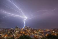
Squall is moving through the county now. Any thunder at all? -
Pittsburgh/Western PA WINTER ‘25/‘26
blackngoldrules replied to Burghblizz's topic in Upstate New York/Pennsylvania
We really do live close to each other! I could probably walk to your house. Lol Sent from my SM-S931U using Tapatalk


