vortmax
-
Posts
4,642 -
Joined
-
Last visited
Content Type
Profiles
Blogs
Forums
American Weather
Media Demo
Store
Gallery
Everything posted by vortmax
-
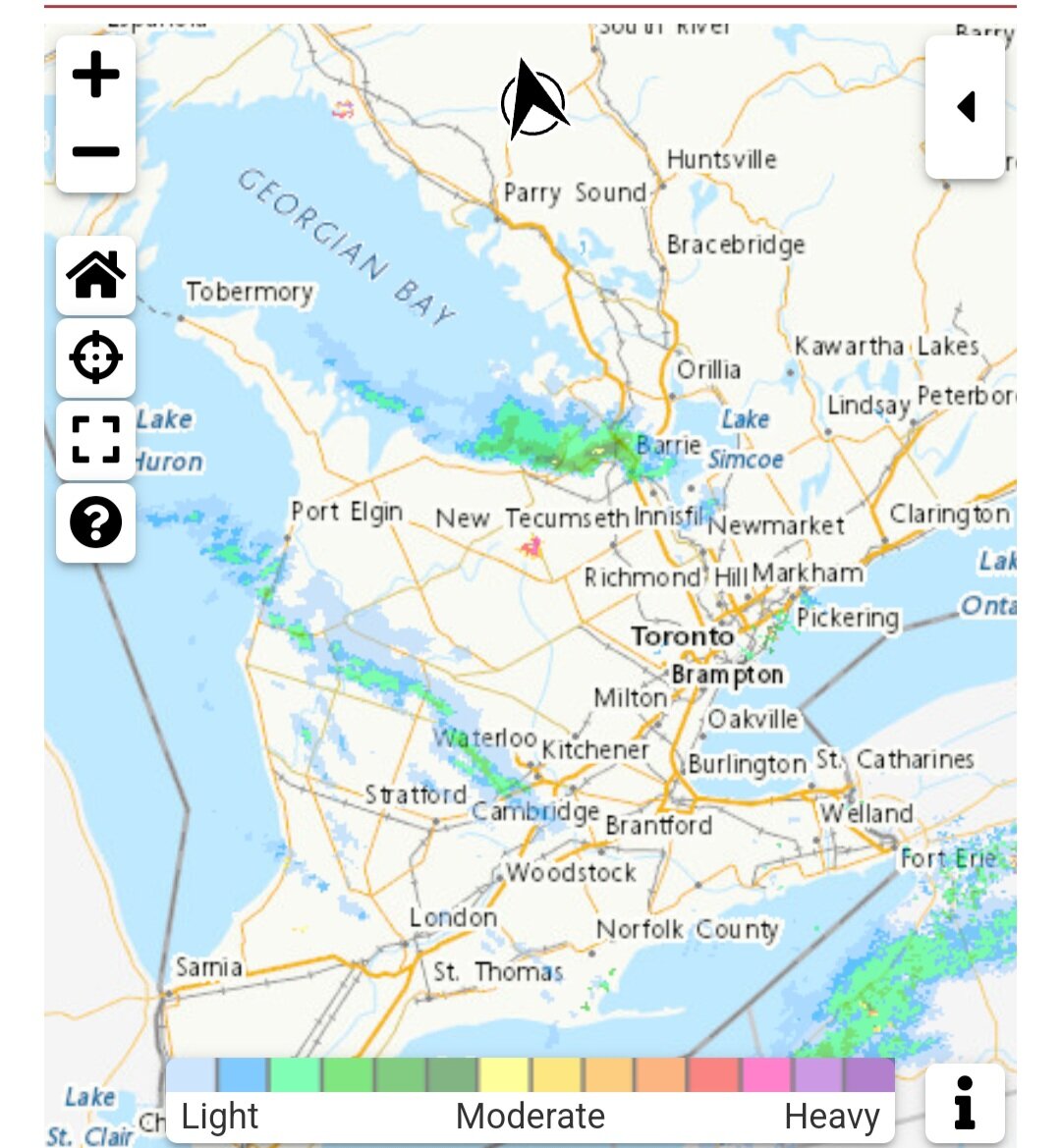
 Looks like some seeding from GB
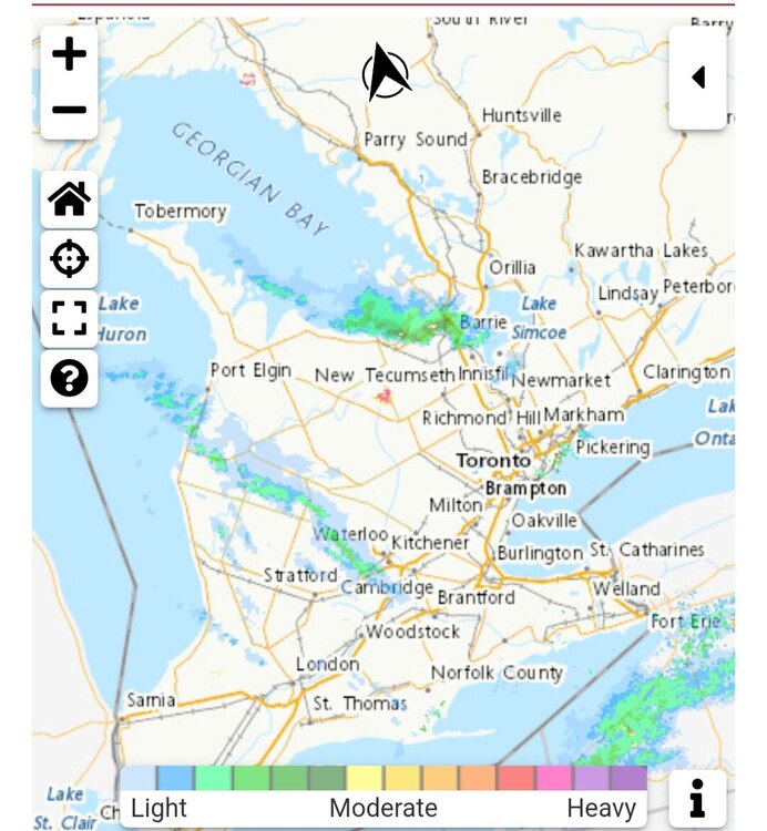
-
Yea, right over Oswego. Nice! Actually just south of the campus.
-
Just noticed that meso. Impressive. Also just noticed the WWA for Wayne cty. I'm assuming it'll be a Sodus Bay east special, but you never know.
-
If we can't have it, no one can!
-
GEM not showing on Pivotal.
-
As of 12Z model guidances, the nor`easter remains to track far enough east keep the majority of the snow out of the forecast area, however a shift westward can change this. So you're saying there's a chance?
-
Question is why it shifted west already (guessing something over the pacific?) and if there's room for more based on the upper levels.
-
I know this is a different setup than the Jan 16th storm, but the 500 setup looks similar. Some of the differences of this setup I see are: 1) The ridge axis seems about 200 miles east. 2) Northern energy phases earlier it seems. 3) Not as negatively tilted as early (yet). 4) H500 trough position is similar, but the surface forms significantly further east. I could be off here, anyone want to chime in? I have a good feeling about this one, though.
-
The wind would be brutal if you went this weekend!
-
I'm liking the westward drift. Let's see if the other globals follow suit.
-
I'd take that, but seems like quite the angle for a band.
-
Upstate NY Banter and General Discussion..
vortmax replied to wolfie09's topic in Upstate New York/Pennsylvania
The defense clearly lost the game. Tons of missed tackles. They were out on the field way too much in the 2nd half and plain old tired at the end. The coin toss determined the winner. -
Upstate NY Banter and General Discussion..
vortmax replied to wolfie09's topic in Upstate New York/Pennsylvania
Sure was. Come on. Lost the coin toss. -
Upstate NY Banter and General Discussion..
vortmax replied to wolfie09's topic in Upstate New York/Pennsylvania
A 2nd heart attack?? -
Upstate NY Banter and General Discussion..
vortmax replied to wolfie09's topic in Upstate New York/Pennsylvania
You got to be kidding me!!! -
Upstate NY Banter and General Discussion..
vortmax replied to wolfie09's topic in Upstate New York/Pennsylvania
Nope -
Upstate NY Banter and General Discussion..
vortmax replied to wolfie09's topic in Upstate New York/Pennsylvania
Wow AND the conversion,!! -
Upstate NY Banter and General Discussion..
vortmax replied to wolfie09's topic in Upstate New York/Pennsylvania
4th and 14. This will be legendary if completed. -
Upstate NY Banter and General Discussion..
vortmax replied to wolfie09's topic in Upstate New York/Pennsylvania
Big play D. -
Upstate NY Banter and General Discussion..
vortmax replied to wolfie09's topic in Upstate New York/Pennsylvania
Let's go #1 D! -
Upstate NY Banter and General Discussion..
vortmax replied to wolfie09's topic in Upstate New York/Pennsylvania
Those 4 missed points are gonna haunt KC. -
Upstate NY Banter and General Discussion..
vortmax replied to wolfie09's topic in Upstate New York/Pennsylvania
Bam! -
And 4" in Ontario.
-
3-4" here as well. Surprised.
-
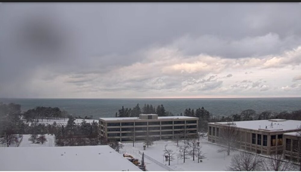
Band ashore here. Fluffy 1.5"/hr rates. Thankful for Lake Ontario.