SnoSki14
-
Posts
16,063 -
Joined
-
Last visited
Content Type
Profiles
Blogs
Forums
American Weather
Media Demo
Store
Gallery
Everything posted by SnoSki14
-
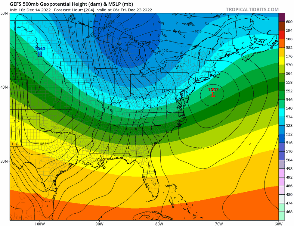
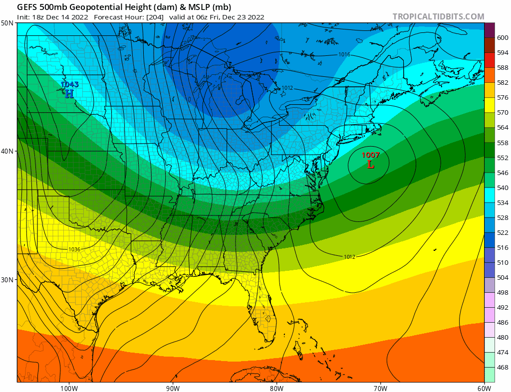
CMC has the strongest arctic front we've seen in years. From 60+ to single digits in 12-18hrs along with 50-60+ gusts
-
A little early. Christmas Eve & Christmas will be very cold regardless
-
Very dramatic changes. I think we need to see a few more runs before saying it's done.
-
It doesn't always happen right away. Sometimes it can take over a month and December hasn't been kind to us. But it is what it is. Also not every strong -AO has led to a snowy outcome especially in a Nina
-
Yeah models runs suck today. PNA gets going too late. It showed this a couple days ago. We'll see if it reverts or stays this way.
-
The CMC is just an arctic front
-
Euro tends to overamplify systems in the LR, which is why its latest run makes me skeptical. Not saying it won't be a hugger but I'd be surprised if the Euro's evolution played out.
-
Idk what everyone's complaining about. I wouldn't want a perfect hit this far out on the models
-
I hope you realize how rare 4"+ snows are in December for your area. Hell NYC struggles to hit freezing until mid-late Dec
-
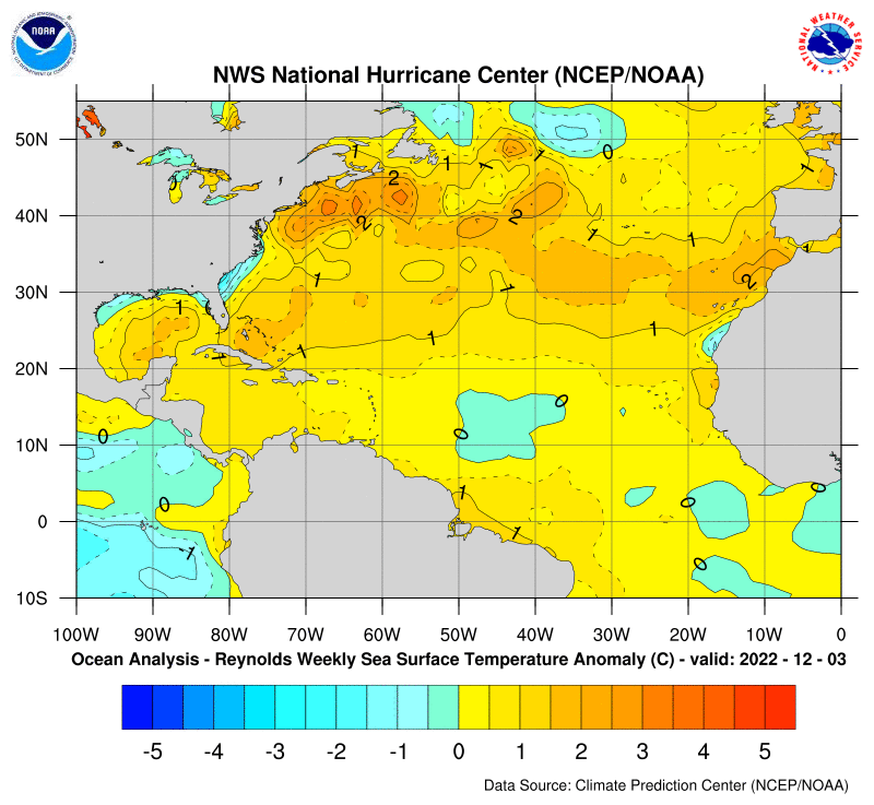
Sounds like you think it'll track inland. Certainly not discounting that given Atlantic warm pool. It's likely why we've had to wait til Jan/Feb to get a significant snow event at the coast lately
-
GFS went east this morning. Euro is over amplifying as usual. I think we're in a good spot
-
Euro over amplification bias in play. Latest GFS is more east. I like where we're at right now
-
That little leading shortwave could act like a 50/50 and prevent a CMC inland track
-
I love Miller As They're loaded with potential. Boxing day was my top 3 favorite storm
-
2-3' or bust
-
Starting to wonder if eastern areas could turn to rain if there's a full capture. Like that one storm that gave us snow and skunked central & eastern SNE
-
This doesn't hurt either. A lot of fuel out there
-
Yeah I think the timing of the capture will be what models waver on for the next several days. Interestingly enough they both (Euro & GFS) have the PNA recycling which means another storm is possible after this one. If so that'd be very reminiscent of 2010
-
Does anyone want a flawless run right now I'm just happy models are in good agreement already. Usually a good sign of something big
-
We're only getting a coastal hugger today because the primary is in the lakes. Actually if it weren't for the block we'd probably be in the 60s today with a wound up cutter.
-
Good enough at this timeframe
-
A little disjointed with the double low but I'll take it at this range
-
Imo that's more significant than an op run Op runs will waver a lot. We want ensembles to stay the course
-
Lots of potential in that time frame. Big PNA spike and west based NAO along with another big -AO dip
-
GEFS show multiple threats