Hurricane Agnes
-
Posts
9,264 -
Joined
Content Type
Profiles
Blogs
Forums
American Weather
Media Demo
Store
Gallery
Everything posted by Hurricane Agnes
-
E PA/NJ/DE Summer 2022 OBS Thread
Hurricane Agnes replied to Maxwell03's topic in Philadelphia Region
I didn't even see any Brood X here last year either - and the last time I believe that brood was out was around a year after one of my sisters had moved into her Montco house. She had a couple stragglers crawling up her shed near the creek at the bottom of her backyard, and that was the first time I had ever seen a "red-eyed" cicada. -
E PA/NJ/DE Summer 2022 OBS Thread
Hurricane Agnes replied to Maxwell03's topic in Philadelphia Region
Gave it a shot about 10 minutes after sunset - no crickets, no cicadas, no katydids. Just bizarre! It's currently 85 with dp that has now crept up to 70. -
E PA/NJ/DE Summer 2022 OBS Thread
Hurricane Agnes replied to Maxwell03's topic in Philadelphia Region
97 was my high today and it was the hottest temp recorded on my main PWS (which I bought back in late July 2020 to replace my old 2015 one that is on its last legs). It's currently 90 with the sun peeping through some high clouds as we head towards sunset in about 50 minutes, and have a dp of 68. -
E PA/NJ/DE Summer 2022 OBS Thread
Hurricane Agnes replied to Maxwell03's topic in Philadelphia Region
I'm gonna have to make it point to pop out there in the evening to check for those. I have been cat sitting the past couple weeks - gave one sister's kitty back last Tuesday and just got my other sister's cat yesterday (and neither can be let out here or manage to dart out an open door or I'll never see them again... lol). So I have limited the outside watering and nature checks to the mornings after they are fed and napping. -
E PA/NJ/DE Summer 2022 OBS Thread
Hurricane Agnes replied to Maxwell03's topic in Philadelphia Region
I've seen the lightning bugs but have had no cicadas or katydids yet... When it's hot out there like this, they usually get going in the morning and go all the way to dusk. Just popped out back for 5 minutes and nothing. Just the drone of central air conditioners. I managed to touch 97 just before 2:30 before it dropped back to the current 96 (dp 69). -
E PA/NJ/DE Summer 2022 OBS Thread
Hurricane Agnes replied to Maxwell03's topic in Philadelphia Region
Hit 96 a few times around 1:30 pm and it's currently sunny and 96 with some scattered small cumulus clouds, and dp is 68. Edit to add - when I was out this morning watering, I heard NOT a SINGLE cicada whatsoever, Nada. It's pretty unprecedented in my lifetime at this point. I don't know what happened. Maybe they got caught in lanternfly sticky traps on trees and couldn't molt, but this is just bizarre. -
E PA/NJ/DE Summer 2022 OBS Thread
Hurricane Agnes replied to Maxwell03's topic in Philadelphia Region
At 9:38 am, it hit 90 here (#11 in July & #16 since May), with dp 69. Low this morning did manage to get doown to 76. Just got done soaking some plants. Currently sunny and 89 with dp 69 and some scattered cirrus here and there. -
E PA/NJ/DE Summer 2022 OBS Thread
Hurricane Agnes replied to Maxwell03's topic in Philadelphia Region
Just after 8:30 pm and it's 84 with dp 68. Since it is pretty much cloudless, will see how much radiates before morning. -
E PA/NJ/DE Summer 2022 OBS Thread
Hurricane Agnes replied to Maxwell03's topic in Philadelphia Region
So far have had a high of 96 today and it's currently sunny and 95 with dp 62. Mt. Holly has the immediate Philly metro area in an Excessive Heat Warning through Sunday - -
E PA/NJ/DE Summer 2022 OBS Thread
Hurricane Agnes replied to Maxwell03's topic in Philadelphia Region
Have now hit another 90+ temp as #10 (for July) & #15 (since May) just after 10 am. It's currently a cloudless 91, with dp 66. -
E PA/NJ/DE Summer 2022 OBS Thread
Hurricane Agnes replied to Maxwell03's topic in Philadelphia Region
Bottomed out at 76 just after 3 am this morning and it has been on the way up since. Currently sunny and 81, with the dp finally below 70, and reading 68. -
E PA/NJ/DE Summer 2022 OBS Thread
Hurricane Agnes replied to Maxwell03's topic in Philadelphia Region
I saw that line of convection parallel to the Delaware river (and my lightning detector has been picking it up) and wondered if it was near you. I think I may have hit my high of 96 for the day and it's currently 93 with dp finally staying in the lower 70s and is 72. -
E PA/NJ/DE Summer 2022 OBS Thread
Hurricane Agnes replied to Maxwell03's topic in Philadelphia Region
Now sitting at 96 and something blew through within the past 30 minutes as the winds briefly got gusty and the dp had dropped down from the upper 70s to the low/mid-70s (bopping between 73/74). Once the breeze died down, the dp is creeping back up and is at 75/76. The cirrus has also been replaced with clusters of cumulus. -
E PA/NJ/DE Summer 2022 OBS Thread
Hurricane Agnes replied to Maxwell03's topic in Philadelphia Region
Well I officially hit 90 (#9 in July & #14 since May) just touched @ 10:16 am. Dewpoint has been sitting at 77. -
E PA/NJ/DE Summer 2022 OBS Thread
Hurricane Agnes replied to Maxwell03's topic in Philadelphia Region
I had a "low" of 77 this morning and am now off to the races with the temp 87 and sunny with a bunch of cirrus clouds, and a dp of 77. It's also totally unprecedented for me to NOT have heard a single cicada here yet this summer. I know there were a bunch of cicada killers out front but most of these cicada guys hang out in the woods a couple hundred feet away. I don't know what happened but maybe a pile were emerging early and then got hit with one of the May frosts and/or whatever hadn't emerged after that, got stuck in dry soil. I was out for almost 45 minutes watering yesterday and heard not a one and even in the mornings, at least one or two are up and buzzing to herald the coming heat. Was just out there about 10 minutes ago and stood waiting and still nada. -
E PA/NJ/DE Summer 2022 OBS Thread
Hurricane Agnes replied to Maxwell03's topic in Philadelphia Region
Well I banged 96 just after 3 pm today (90+ day #8 for July and #13 since May). And yup, was out with the hose this morning giving the plants a good long repeated soaking. It's currently mostly sunny and 93 with dp 71. -
E PA/NJ/DE Summer 2022 OBS Thread
Hurricane Agnes replied to Maxwell03's topic in Philadelphia Region
Have so far hit a high of 95 today and am currently at 95 with dp 72. LOL I wonder if they even sell cars with those retractable antennas anymore. -
E PA/NJ/DE Summer 2022 OBS Thread
Hurricane Agnes replied to Maxwell03's topic in Philadelphia Region
If your PWS has the capability, you could get a NIST-certified thermometer positioned at the location and then verify (and confirm if it's a siting thing) and if needed, calibrate the PWS to match. So far my "low" has been 74 this morning but has crept up to 76. Will see if that trend continues since it's still about 30 minutes from sunrise. -
E PA/NJ/DE Summer 2022 OBS Thread
Hurricane Agnes replied to Maxwell03's topic in Philadelphia Region
Ended up hitting 92 as a high (#7 for July and #12 total since May) after a low of 73. It was progged that the cold front would help to mix out those awful dps from yesterday and for the most part it did - by about 10 degrees. It's currently mostly sunny and 89 with dp 67 and the heatwave has been engaged for the rest of the week! There was a climo section added in the AFD that suggested a record high min for Thursday this week - -
E PA/NJ/DE Summer 2022 OBS Thread
Hurricane Agnes replied to Maxwell03's topic in Philadelphia Region
Got one more hundred of an inch splatter for 0.03" so far today. Temp is 75 with dp 73. -
E PA/NJ/DE Summer 2022 OBS Thread
Hurricane Agnes replied to Maxwell03's topic in Philadelphia Region
I am *finally* getting enough to tip the bucket. The splats on the kitchen window are new. Currently have 0.02" to wet the leaves so I guess I shouldn't be choosy. That will probably be it since it looks like a precip. hole has opened up. Currently 77 with dp 73.
-
E PA/NJ/DE Summer 2022 OBS Thread
Hurricane Agnes replied to Maxwell03's topic in Philadelphia Region
Literally zippo so far today and I won't even bother hoping for that latest batch on the radar. The sun came out bright and strong before sunset. Have a whopping total of 0.47" for the month of July so far and that was from scattered sprinkles each totaling less than 1/4". Currently mostly cloudy again, with a few breaks that I can see, and 79 with dp 74.
-
E PA/NJ/DE Summer 2022 OBS Thread
Hurricane Agnes replied to Maxwell03's topic in Philadelphia Region
Dammit. Am even picking up convection all around (and had a clap of thunder a couple minutes ago) and the cell is literally like a couple miles to my NW. Sun is trying to break out to the west and south and still haven't tipped the bucket. Temp is "down to" 82 but dp is still 77.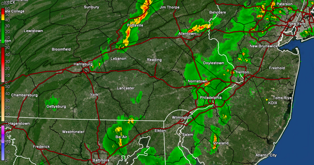
-
E PA/NJ/DE Summer 2022 OBS Thread
Hurricane Agnes replied to Maxwell03's topic in Philadelphia Region
My walk is finally "wettish" but it's STILL not enough to tip the bucket. Temp is 83 with dp 77. There's a little cell to the SW where it would be nice if it did a little dump but I know it will either side-swipe me or fizzle.
-
E PA/NJ/DE Summer 2022 OBS Thread
Hurricane Agnes replied to Maxwell03's topic in Philadelphia Region
I have a cousin who lives in W. Orange, NJ who texted that they were getting torrential downpours, followed by sun, followed by more torrential downpours. Wash. Rinse. Repeat. Meanwhile I am watching the radar just evaporate as it passes over northern Delco and bypasses NW Philly. It's currently 87 with dp 75, an a sky filled with useless clouds (although they are keeping the temps out of the 90s now).