

Hurricane Agnes
-
Posts
9,263 -
Joined
Content Type
Profiles
Blogs
Forums
American Weather
Media Demo
Store
Gallery
Everything posted by Hurricane Agnes
-
E PA/NJ/DE Spring 2023 OBS Thread
Hurricane Agnes replied to Hurricane Agnes's topic in Philadelphia Region
Now up to 1.04" for the event so far IMBY today with a steady moderate rain and breezy in a typical nor'easter way. Plants getting a good soaking and it has helped get my monthly total to a more normal value (am now at 4.14" for the month so far). Temp is 48 with dp 48. -
E PA/NJ/DE Spring 2023 OBS Thread
Hurricane Agnes replied to Hurricane Agnes's topic in Philadelphia Region
Getting some light, so far non-measurable rain - enough to wet the sidewalk. Currently 53 with dp 46. Looks like a heavier blob is over lower south Jersey. -
E PA/NJ/DE Spring 2023 OBS Thread
Hurricane Agnes replied to Hurricane Agnes's topic in Philadelphia Region
Bottomed out at 49 this morning and am currently at 52 with dp 48 and overcast. SPC SW DY1 has us penciled in for some possible thundershowers - Mt. Holly estimates for round 1 - -
E PA/NJ/DE Spring 2023 OBS Thread
Hurricane Agnes replied to Hurricane Agnes's topic in Philadelphia Region
Picked up 0.28" of rain yesterday and 0.30" this morning for a 2-day event total of 0.58". Had a low of 46 this morning and am currently at my high so far today with an overcast 57 and dp 50. -
E PA/NJ/DE Spring 2023 OBS Thread
Hurricane Agnes replied to Hurricane Agnes's topic in Philadelphia Region
I noticed yesterday that KDIX came back at some point and has been running okay today. I know that in general, "maintenance windows" are set to cover contingencies in case something takes longer than expected, and I know it was expected to be out until tomorrow, but it's back! Ended up with a low of 39 this morning and a high of 63 before the front came through just before 6 pm and crashed me down to my current 49 with dp 47. Had a brief sprinkle earlier this afternoon that was enough to wet the walk (non-measurable), but got a heavier shower, depositing 0.12" in the bucket so far, and am getting light rain now. -
E PA/NJ/DE Spring 2023 OBS Thread
Hurricane Agnes replied to Hurricane Agnes's topic in Philadelphia Region
Ended up bottoming out at 40 yesterday and had a high of 59. Had clouds that rolled in and out during the day although it remained party sunny. Currently 41 with dp 33. Heard on the radio that an EF1 touched down in Womelsdorf in Berks County this past weekend - Had to do a quick search to see where that is and it's a bit NW of Reading. -
E PA/NJ/DE Spring 2023 OBS Thread
Hurricane Agnes replied to Hurricane Agnes's topic in Philadelphia Region
Bottomed out at 41 here this morning and the dp has definitely tanked since the weekend. I had popped out before 5 am this morning and you could see the stars pretty clearly. However you could also see a very high hazy deck of cirrus as well so don't know how much if any of an aurora might have been viewable down this far. Currently a mostly sunny 58, with a few scattered cumulus, and a dp of 35. -
E PA/NJ/DE Spring 2023 OBS Thread
Hurricane Agnes replied to Hurricane Agnes's topic in Philadelphia Region
Wow - I saw an article earlier about it and it was originally expected for the usual places viewable when there is a geomagnetic storm - Canada and far northern U.S. There has been some CAA clouds drifting in and out so it wouldn't surprise me if some layer of "blocking clouds" ends up killing that idea down this way. And even then, we would be at the southern fringe so need some dark sky location. SWPC link for this - https://www.swpc.noaa.gov/news/g1-g2-minor-moderate-geomagnetic-storm-watches-23-24-april-2023 -
E PA/NJ/DE Spring 2023 OBS Thread
Hurricane Agnes replied to Hurricane Agnes's topic in Philadelphia Region
Ended up with 0.62" of rain yesterday and then another 0.27" (so far) this morning for a 0.89" 2-day event total. Plants are happy. That has brought my monthly total up to 2.53" to date, which is below normal, but then this is that odd transitional time of year where anything goes. It's also only about 1/3rd of what I got when compared to the month of April in 2022 (which yielded 7.33" of rain), where on April 7, 2022, I had a single day monthly rain event of 2.55". Currently an overcast and misty 54 with dp 53. -
E PA/NJ/DE Spring 2023 OBS Thread
Hurricane Agnes replied to Hurricane Agnes's topic in Philadelphia Region
Round 1 gave me 0.20" of rain. Wish it were a bit more but am glad for that and am hoping the rest of the system can give me some steady returns for the next couple hours as it heads east. It's currently a misty 59 with dp 58. -
E PA/NJ/DE Spring 2023 OBS Thread
Hurricane Agnes replied to Hurricane Agnes's topic in Philadelphia Region
My Wyndmoor sis is up your way going to a bday party (am guessing one of her friends) and she texted about 15 minutes ago that she had just gotten off 309 when she ran into the rain. -
E PA/NJ/DE Spring 2023 OBS Thread
Hurricane Agnes replied to Hurricane Agnes's topic in Philadelphia Region
Now down over 10 degrees and finally getting some bucket tips. Am at 0.12" so far with 3/4"/hr gully washer. Also hearing some thunder.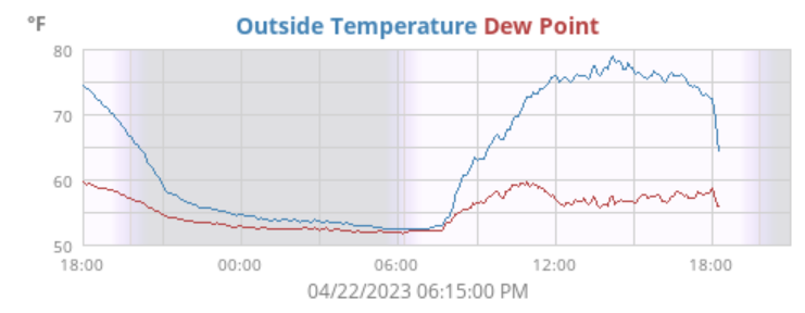
-
E PA/NJ/DE Spring 2023 OBS Thread
Hurricane Agnes replied to Hurricane Agnes's topic in Philadelphia Region
Finally starting to get some rain here. Temp has dropped 8 degrees and is down to 64. Also getting convection although haven't heard any thunder. -
E PA/NJ/DE Spring 2023 OBS Thread
Hurricane Agnes replied to Hurricane Agnes's topic in Philadelphia Region
Have been getting the winds and those winds are oddly cool although the general air temp is 72 (dp 59). Rain is on my doorstep and hopefully I get some 'cause the plants are thirsty! ETA and just like that - the temp dropped 5 degrees and it's down to 67 and falling. -
E PA/NJ/DE Spring 2023 OBS Thread
Hurricane Agnes replied to Hurricane Agnes's topic in Philadelphia Region
I read the AFD about an hour ago and they mentioned that there would be some storms ahead of the front so there is more behind what dry-slotted you. It's literally pushing up from due south and being shoved to the east. -
E PA/NJ/DE Spring 2023 OBS Thread
Hurricane Agnes replied to Hurricane Agnes's topic in Philadelphia Region
And here comes Norman. DE & MD were under a Watch earlier - -
E PA/NJ/DE Spring 2023 OBS Thread
Hurricane Agnes replied to Hurricane Agnes's topic in Philadelphia Region
Yeah and it's a shame that KDIX is off this week for routine maintenance. Mt. Holly has been using KDOX and I have switched to that too for now. Had bottomed out at 52 this morning and so far got as high as 77 today although it's down to 76 (dp 57) with the sun in and out. Just pulled up an old outdoor patio rug to toss to be replaced with a new one as soon as I go get one (was gonna do it yesterday but was getting the car inspected and it needed some suspension work and replacement rotors that took longer than expected because they were waiting on a guy to bring the parts). -
E PA/NJ/DE Spring 2023 OBS Thread
Hurricane Agnes replied to Hurricane Agnes's topic in Philadelphia Region
My low ended up being 50 this morning and it begrudgingly made it to an oddly pleasant 82 as a high, despite a dp at or near 60. There was also a thin haze of high clouds visible through the otherwise blue sky. Currently 66 with dp 57. -
E PA/NJ/DE Spring 2023 OBS Thread
Hurricane Agnes replied to Hurricane Agnes's topic in Philadelphia Region
SPC SW DY2 has much of the CWA in Marginal Risk for the weekend - After a low of 47 yesterday morning, I eventually made it up to 75 late in the afternoon. Currently 50 with dp 48 and some low stratus. -
E PA/NJ/DE Spring 2023 OBS Thread
Hurricane Agnes replied to Hurricane Agnes's topic in Philadelphia Region
Winds went calm overnight and the radiational cooling took over IMBY. Bottomed out at 36 here (with a dp as low a 29) this morning although temps are on the upswing. Currently mostly sunny and 46 with dp 34. -
E PA/NJ/DE Spring 2023 OBS Thread
Hurricane Agnes replied to Hurricane Agnes's topic in Philadelphia Region
Made it up to 60 for a high today after a 49 low. Dews were definitely down today compared to yesterday and the breezes that had kicked in yesterday evening, continued much of today. Currently partly sunny and 56 with dp 36. -
E PA/NJ/DE Spring 2023 OBS Thread
Hurricane Agnes replied to Hurricane Agnes's topic in Philadelphia Region
Ended up with a couple hundreds more rain this morning for a grand total of 0.11". Bottomed out at 55 and hit 67 for a high so far today once the sun came out. It's currently mostly sunny, with a few clouds here and there, and 66, with a dp 42. -
E PA/NJ/DE Spring 2023 OBS Thread
Hurricane Agnes replied to Hurricane Agnes's topic in Philadelphia Region
He sent a follow-up email to report he had at least 6" of snow and I told him that it had to be that wet heavy stuff since the temps were marginal. Got some moisture here starting after about 1 am and have registered 0.09" of it so that's more than Sunday's bust. Currently overcast, misty, and 58 with dp 57. -
E PA/NJ/DE Spring 2023 OBS Thread
Hurricane Agnes replied to Hurricane Agnes's topic in Philadelphia Region
Wow. You can't catch a break. Maybe the fish will be bountiful! this year! -
E PA/NJ/DE Spring 2023 OBS Thread
Hurricane Agnes replied to Hurricane Agnes's topic in Philadelphia Region
My uncle who lives in a 'burb outside of St. Paul, MN emailed this morning that they broke a record last week of 85 and this morning, he has a couple inches of snow. lol Wiggum Rule on steroids. Currently overcast here and 66 with dp 61.
