Hurricane Agnes
-
Posts
9,263 -
Joined
Content Type
Profiles
Blogs
Forums
American Weather
Media Demo
Store
Gallery
Everything posted by Hurricane Agnes
-
E PA/NJ/DE Fall 2023 OBS/Discussion Thread
Hurricane Agnes replied to Rtd208's topic in Philadelphia Region
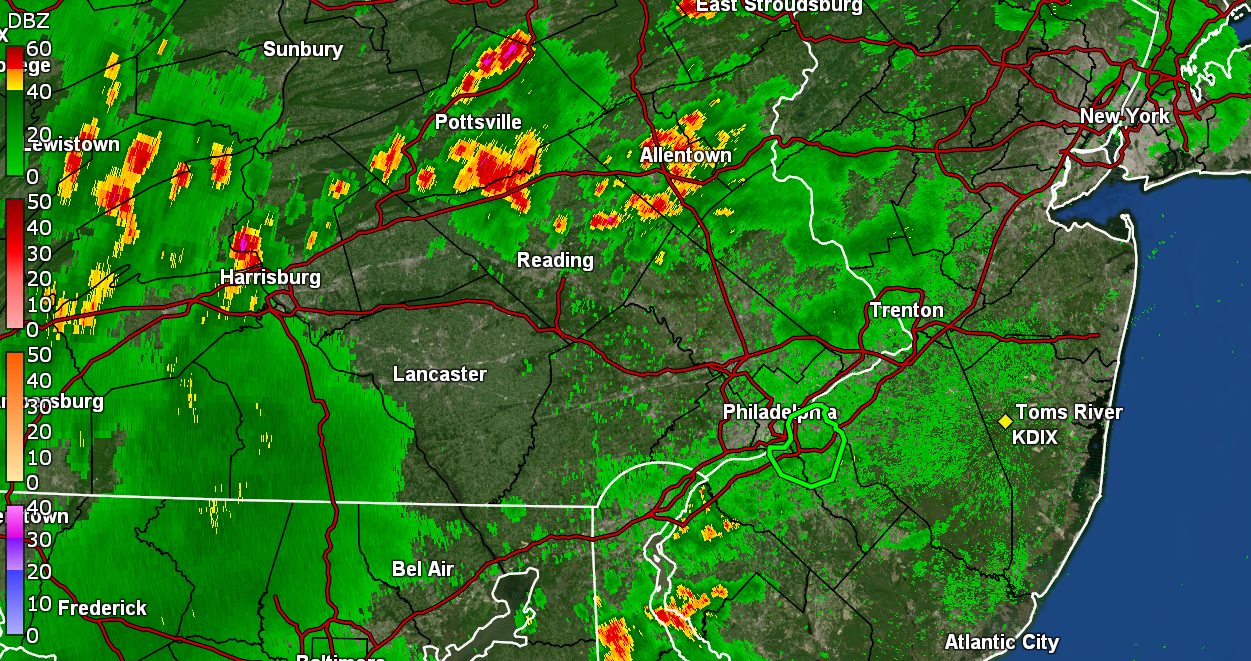
Ended up with an additional 0.12" from that round and now stand at 0.30" for the day (so far) and 1.37" for an actual 3-day total (since Friday). Currently an overcast and misty 72 with dp 70. -
E PA/NJ/DE Fall 2023 OBS/Discussion Thread
Hurricane Agnes replied to Rtd208's topic in Philadelphia Region
Oh I know it's close to you but meant it was "30 miles away" from "the perimeter" around Chadds Ford that had been widely reported by the local LEO that they were "certain" he was "within". Aside from obviously being a "survivalist"-by-experience, could be he is getting some "help". Am still getting light stuff, which is probably best for "soaking in" and not gully-washer runoff, and am up to 0.18" as of post time (1.25" 2-day total). Temp is 69 with dp 69, with occasional steamy windows. -
E PA/NJ/DE Fall 2023 OBS/Discussion Thread
Hurricane Agnes replied to Rtd208's topic in Philadelphia Region
I had KYW on when the "breaking" news came in this morning. Talk about busting through a "perimeter". That's almost 30 miles away. This cluster of showers have me now up to 0.14" at post time. Low earlier was 67 and am currently 69 with light rain and dp 69. -
E PA/NJ/DE Fall 2023 OBS/Discussion Thread
Hurricane Agnes replied to Rtd208's topic in Philadelphia Region
Interesting how that evolved. Sortof tentacles to my east and west. ETA am getting some light stuff now - so far at 0.03" in the bucket from it!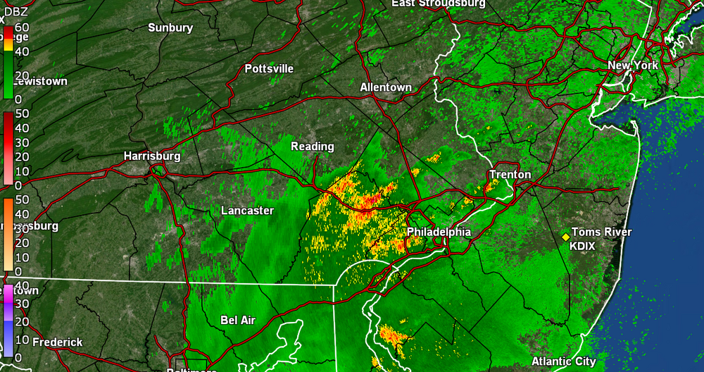
-
E PA/NJ/DE Fall 2023 OBS/Discussion Thread
Hurricane Agnes replied to Rtd208's topic in Philadelphia Region
Picked up another 0.30" from that little pop-up to give me 0.70" for the day and 1.07" for a 2-day total! Currently misty and 70 with dp 70. -
E PA/NJ/DE Fall 2023 OBS/Discussion Thread
Hurricane Agnes replied to Rtd208's topic in Philadelphia Region
Getting another pop up! Woot! just over 1"/hr. This one is heavier than the last round. Currently up to 0.62" for the day at post time with temp 70 and dp 70. -
E PA/NJ/DE Fall 2023 OBS/Discussion Thread
Hurricane Agnes replied to Rtd208's topic in Philadelphia Region
Somebody put a pan of jiffy pop on the stove out west and it's starting to pop. Berks and Lehigh Counties have really been cashing in with this pattern. Will have to see if our Reading folks get any...
-
E PA/NJ/DE Fall 2023 OBS/Discussion Thread
Hurricane Agnes replied to Rtd208's topic in Philadelphia Region
Amen! And something just wrong a towel out over me and I got another 0.01". Temp creeping back up and at 71 with dp 71. -
E PA/NJ/DE Fall 2023 OBS/Discussion Thread
Hurricane Agnes replied to Rtd208's topic in Philadelphia Region
Picked up 0.39" from that round to add to the 0.01" that fell around 2am, for a 2-day total so far of 0.77". Yay! Sun is tentatively out trying to shine through the overcast and temp is 70 with dp 69. -
E PA/NJ/DE Fall 2023 OBS/Discussion Thread
Hurricane Agnes replied to Rtd208's topic in Philadelphia Region
Those clusters threw a couple outflow boundaries that spread out from east to west. Took my temp down to 69 and dp to 68, while the sun is trying to come out but then there is that stuff out west. -
E PA/NJ/DE Fall 2023 OBS/Discussion Thread
Hurricane Agnes replied to Rtd208's topic in Philadelphia Region
That red blob was sitting over me. It's moving fast though and the heaviest has moved to the north. Still getting some moderate rain and have 0.36" in the bucket.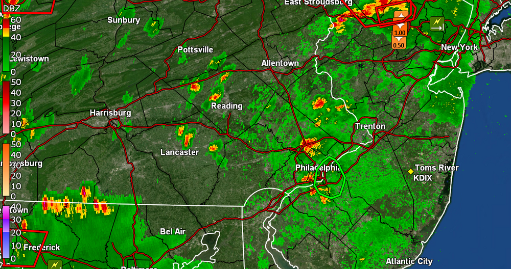
-
E PA/NJ/DE Fall 2023 OBS/Discussion Thread
Hurricane Agnes replied to Rtd208's topic in Philadelphia Region
Have been watching it back in across Jersey and into E. PA and blow up. Edit - am getting almost 1.5"/hr rates at the moment. Yay. -
E PA/NJ/DE Fall 2023 OBS/Discussion Thread
Hurricane Agnes replied to Rtd208's topic in Philadelphia Region
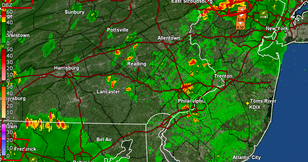
Delayed but not denied. Stuff. Getting lots of convection with the thunderstorm with moderate rain and so far have 0.09 (total) in the bucket (had 0.01" earlier this morning to add to the overnight stuff). Low was 68 and high was 86. Currently a thundershower and 74 with dp 70.
-
E PA/NJ/DE Fall 2023 OBS/Discussion Thread
Hurricane Agnes replied to Rtd208's topic in Philadelphia Region
Had the warning overnight and took a screenshot of that incoming convective cluster before it finally hit. Got lots of thunder and lightning out of it but only netted 0.37" of rain (although since the last rain that I had IMBY was 8/30, I'll take it). Currently a steamy-window 68 with dp 68, and low stratus.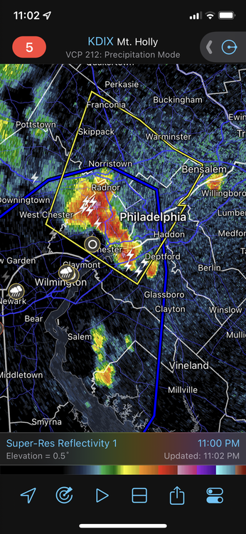
-
E PA/NJ/DE Fall 2023 OBS/Discussion Thread
Hurricane Agnes replied to Rtd208's topic in Philadelphia Region
Got a whopping 0.01" and the sun is out. Temp 78 with dp 71. I guess I shouldn't complain. -
E PA/NJ/DE Fall 2023 OBS/Discussion Thread
Hurricane Agnes replied to Rtd208's topic in Philadelphia Region
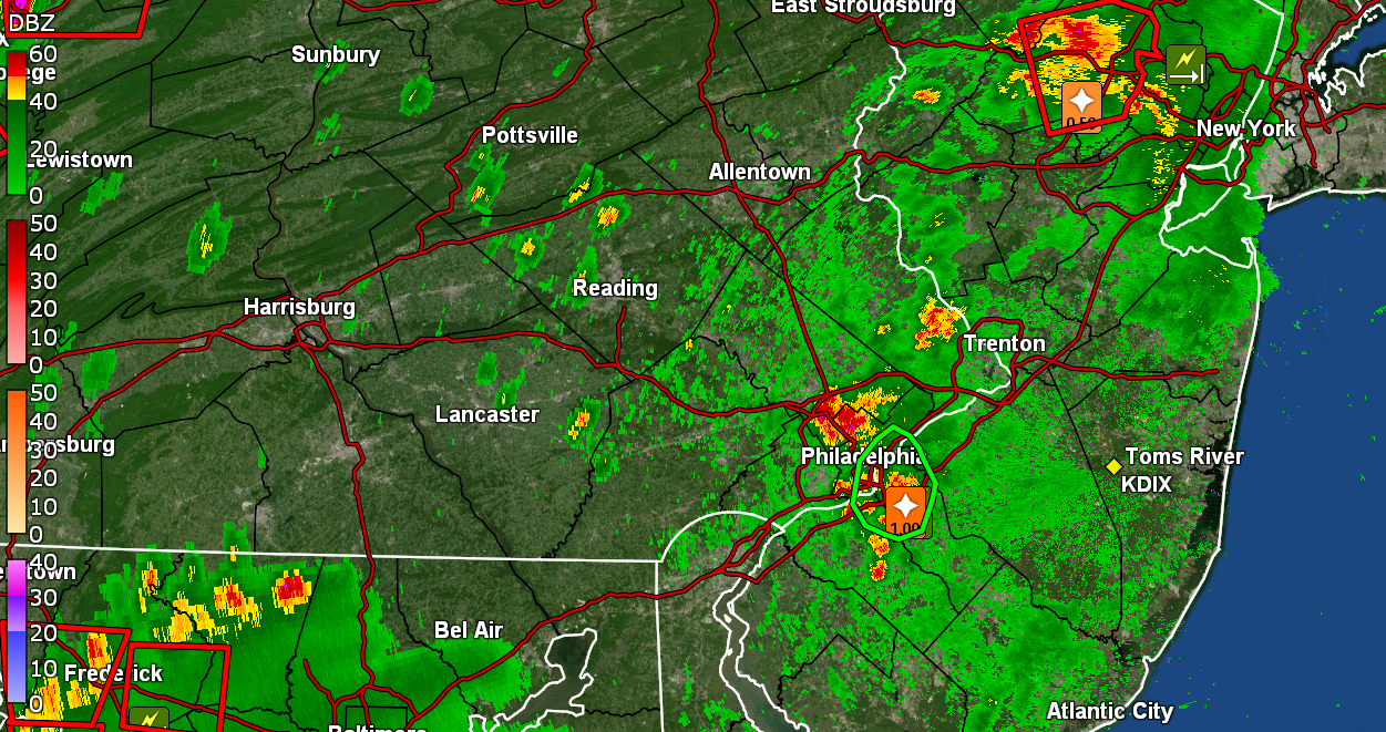
Still have tons of convection and now getting thunder. Have a little bit of rain to wet the walk but nothing measurable. There's a little pop-up nearby that will be just my luck to fizzle but we will see. Temp is down to 79 with dp 72. -
E PA/NJ/DE Fall 2023 OBS/Discussion Thread
Hurricane Agnes replied to Rtd208's topic in Philadelphia Region
You (Landsdale) just got mentioned in the ongoing NOAA radio alert. -
E PA/NJ/DE Fall 2023 OBS/Discussion Thread
Hurricane Agnes replied to Rtd208's topic in Philadelphia Region
Am picking up convection all around but zilch for rain. Little pop-ups form and then dissipate. It has clouded up and dropped the temp to 89 but 93 remains the high for today at this point. Dp is 72. -
E PA/NJ/DE Fall 2023 OBS/Discussion Thread
Hurricane Agnes replied to Rtd208's topic in Philadelphia Region
Here we go - Currently 93 (still my high) with dp 74. -
E PA/NJ/DE Fall 2023 OBS/Discussion Thread
Hurricane Agnes replied to Rtd208's topic in Philadelphia Region
Am officially at day 6 of this heatwave, the longest string of consecutive 90s this year. This is also 90+ #19 since June. It's currently 93 (my high so far) with lots of haze and cumulus, and with a dp that is in the ugh range again at 75. Some RERs yesterday (3 record highs and 1 record high min) - -
E PA/NJ/DE Fall 2023 OBS/Discussion Thread
Hurricane Agnes replied to Rtd208's topic in Philadelphia Region
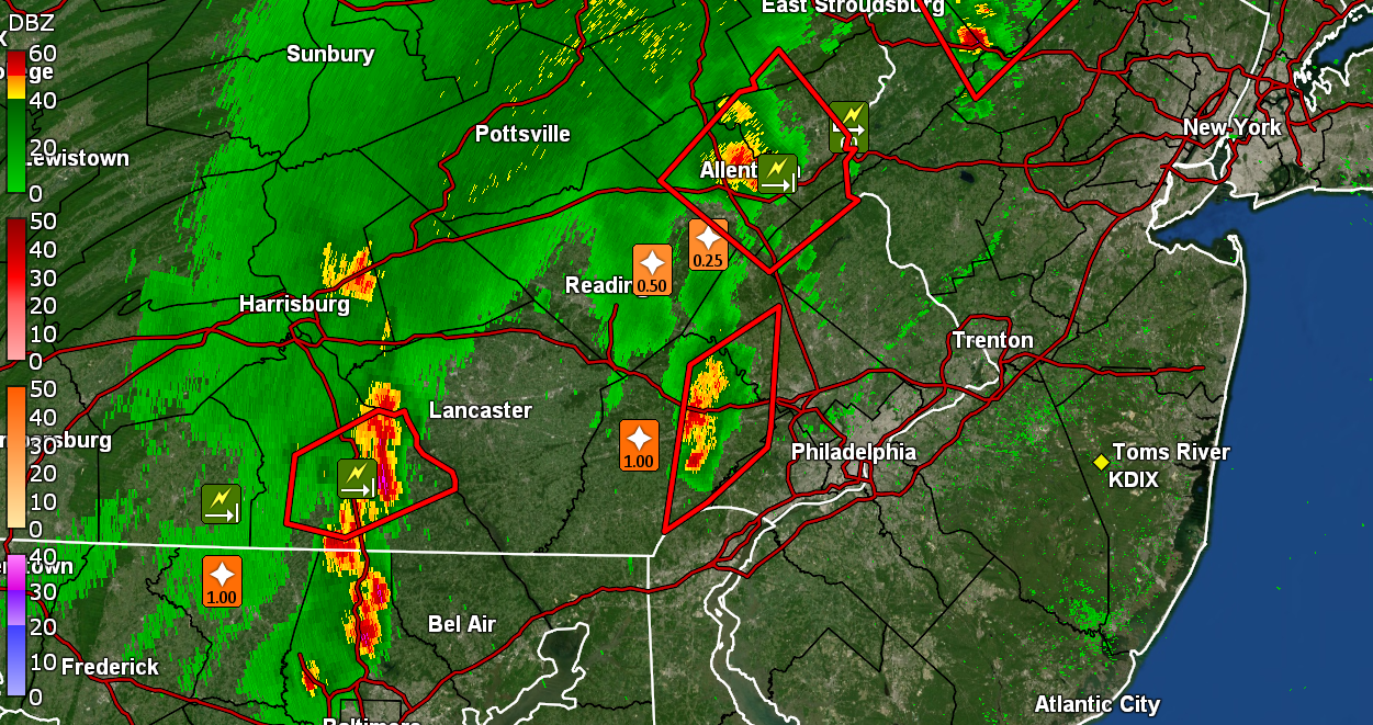
LOL I have had my shopping cart full of groceries do that in the parking lot of a supermarket. Had to run like a crazy woman to grab it before it slammed into someone's car. And yeah - I remember when my Wyndmoor sis had neglected to put her umbrella down and with it being on a south-facing backyard deck with a relatively unobstructed west side of the property, it managed to not only get lofted, but blown along the side of the house to the front, and then out into the street where it tumbled further down the street propelled by the west to east gusts. My niece had to race to chase it down. My lightning detector picked up convection between midnight and 2 am, although it wasn't as nuts as I have seen it in the past but was still frequent indicating nearby cells (it has a range of about a 20 mile radius). Still.. there was ZILCH in the rain department. Anyway, so far my low this morning has been 71 and it's currently a cloudy 73 with dp 67. -
E PA/NJ/DE Fall 2023 OBS/Discussion Thread
Hurricane Agnes replied to Rtd208's topic in Philadelphia Region
I KNEW something from those clusters of cells had to have bullseyed you. -
E PA/NJ/DE Fall 2023 OBS/Discussion Thread
Hurricane Agnes replied to Rtd208's topic in Philadelphia Region
Round 1 completely evaporated before getting here and round 2 fizzled. The umbrella jinx continues. Currently 77 with dp 67 with some lightning off in the distance. -
E PA/NJ/DE Fall 2023 OBS/Discussion Thread
Hurricane Agnes replied to Rtd208's topic in Philadelphia Region
I finally broke down and decided to go put my patio umbrella down and was treated to an outflow boundary breeze. It has been knocking the temp down, which is currently down to 84. But the biggest difference is the dewpoint which is now down to 67.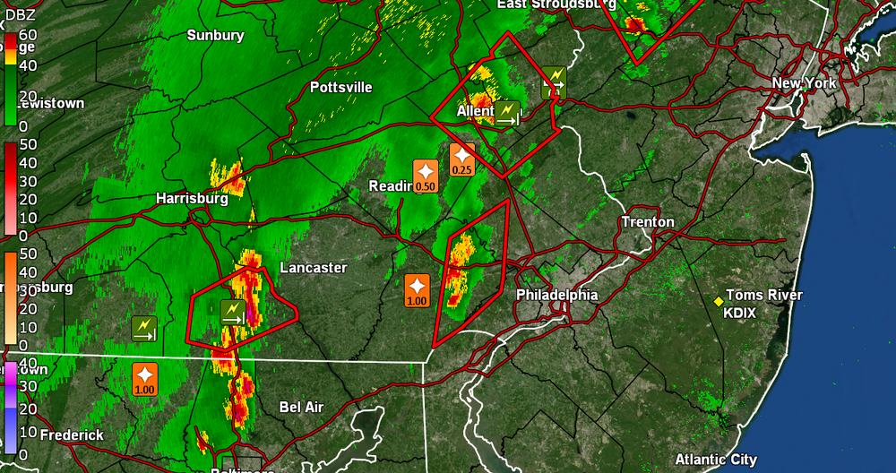
-
E PA/NJ/DE Fall 2023 OBS/Discussion Thread
Hurricane Agnes replied to Rtd208's topic in Philadelphia Region
I'm going to probably have to put my umbrella down so it doesn't do a Mary Poppins. It's just that many times when I preemptively do that, I never get the rain! Warnings have been lofted N/W.