Hurricane Agnes
-
Posts
9,355 -
Joined
Content Type
Profiles
Blogs
Forums
American Weather
Media Demo
Store
Gallery
Everything posted by Hurricane Agnes
-
Got up to 87 as a high today and although the dp stayed mostly in the low 60s, it has now started creeping up. Currently a hazy (wildfire smoke?) 80, with dp 68. I know there is an Air Quality Alert up for the area for tomorrow.
-
My low this morning managed to get to 70, but at some point with a dp of 62. Big difference from dps in the upper 70s. Currently 76 and sunny with some scattered clouds, and a dp of 64. Really nice out for a late July summer day.
-
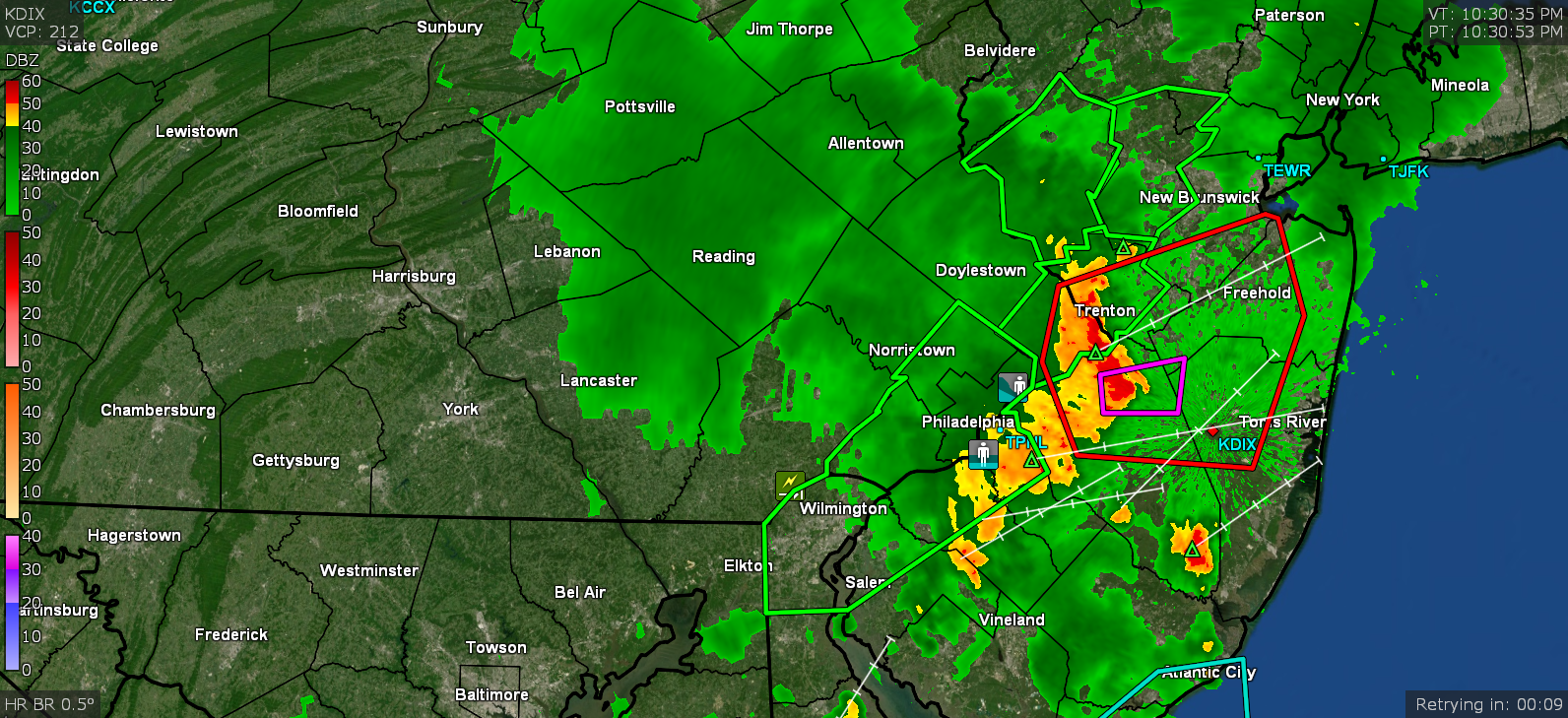
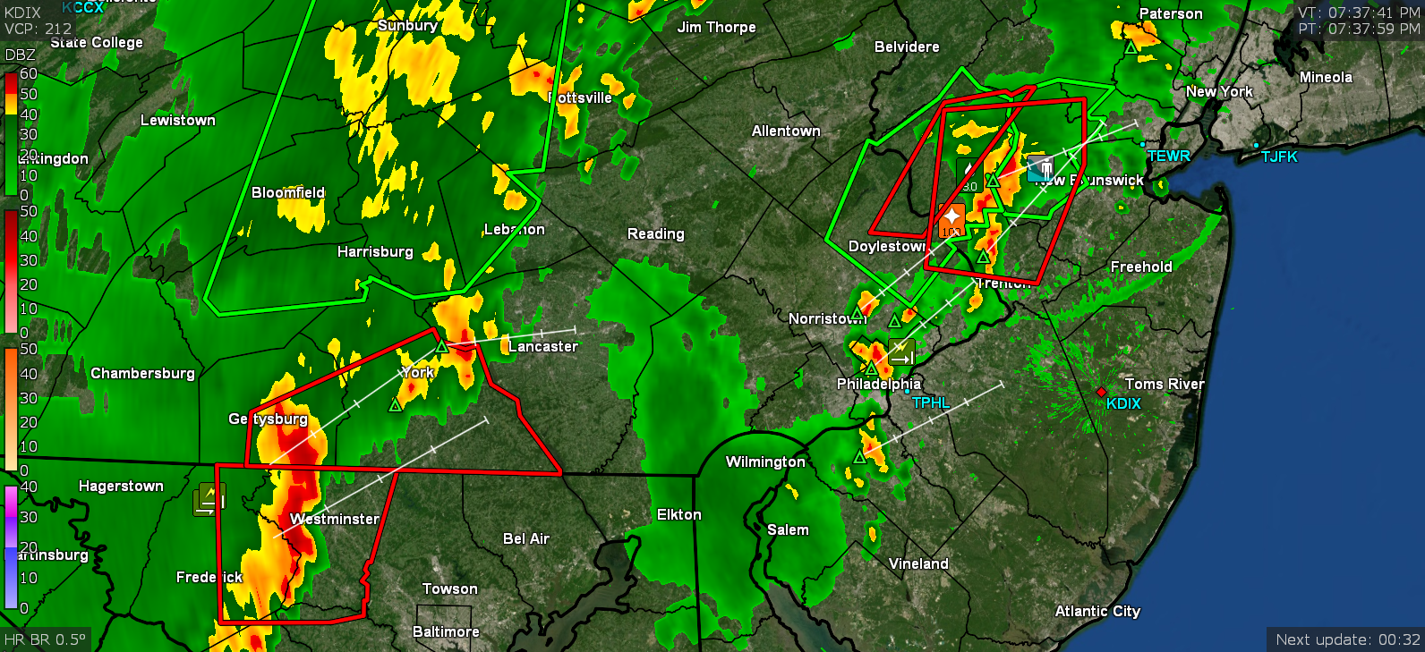
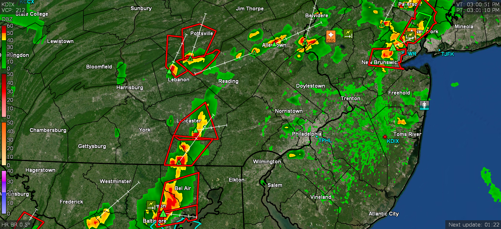
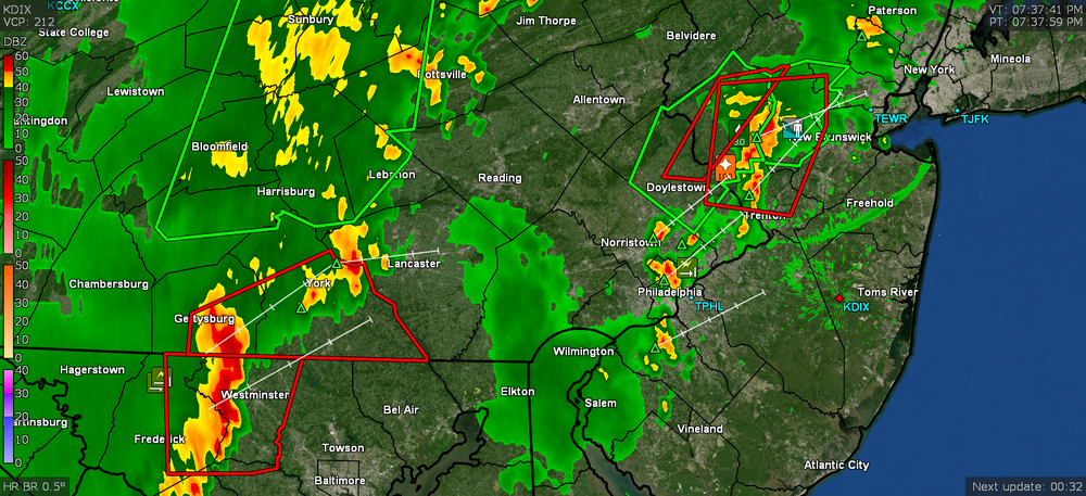
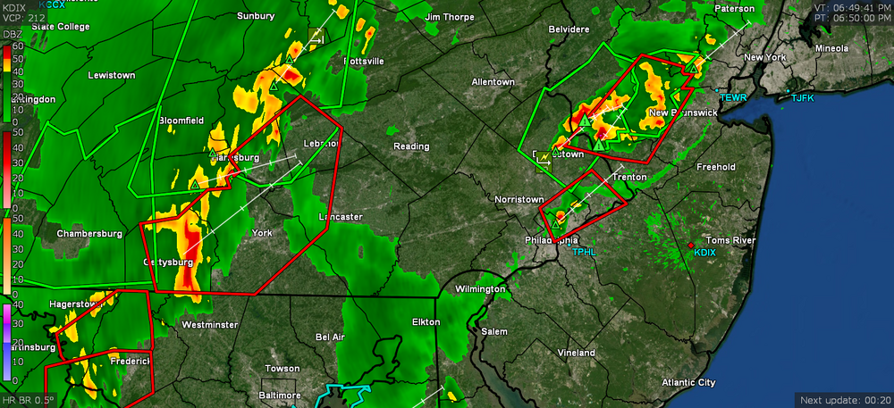
I saw Mt. Holly confirmed an EF1 around the Columbus/Johnston area of Jersey north of Ft. Dix. That was as that last line was moving through and I did catch a screenshot of the TORW around 10:30 pm last night.

-
Although I can still feel the residual heat radiating from the brick of the house, today is like day and night compared to the last couple days. Temp has yet to reach 80 here and dp finally dropped below 70 this morning. The atmosphere is still unsettled so despite some early sun, the clouds have rolled in and it's generally been overcast since (although that is probably keeping the temp down too). Currently 77 and overcast with dp 67.
-
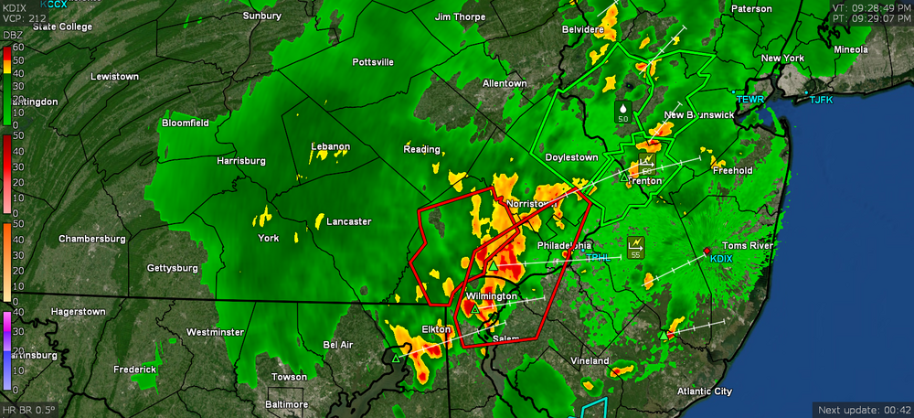
That whole complex of convection eventually formed a line as it barreled through the city, and was just loaded with lightning. The only saving grace was that once it formed the line, it was moving quickly instead of stalling out and just puking rain like what happened last Monday.
-
There was a TOR up around your area sometime between 5 and 5:30 pm. I think there was a report of a funnel by a spotter. Looks like my low was 72 this morning and the sun is trying to peak out between the debris clouds. Current temp is 75 with dp 73.
-
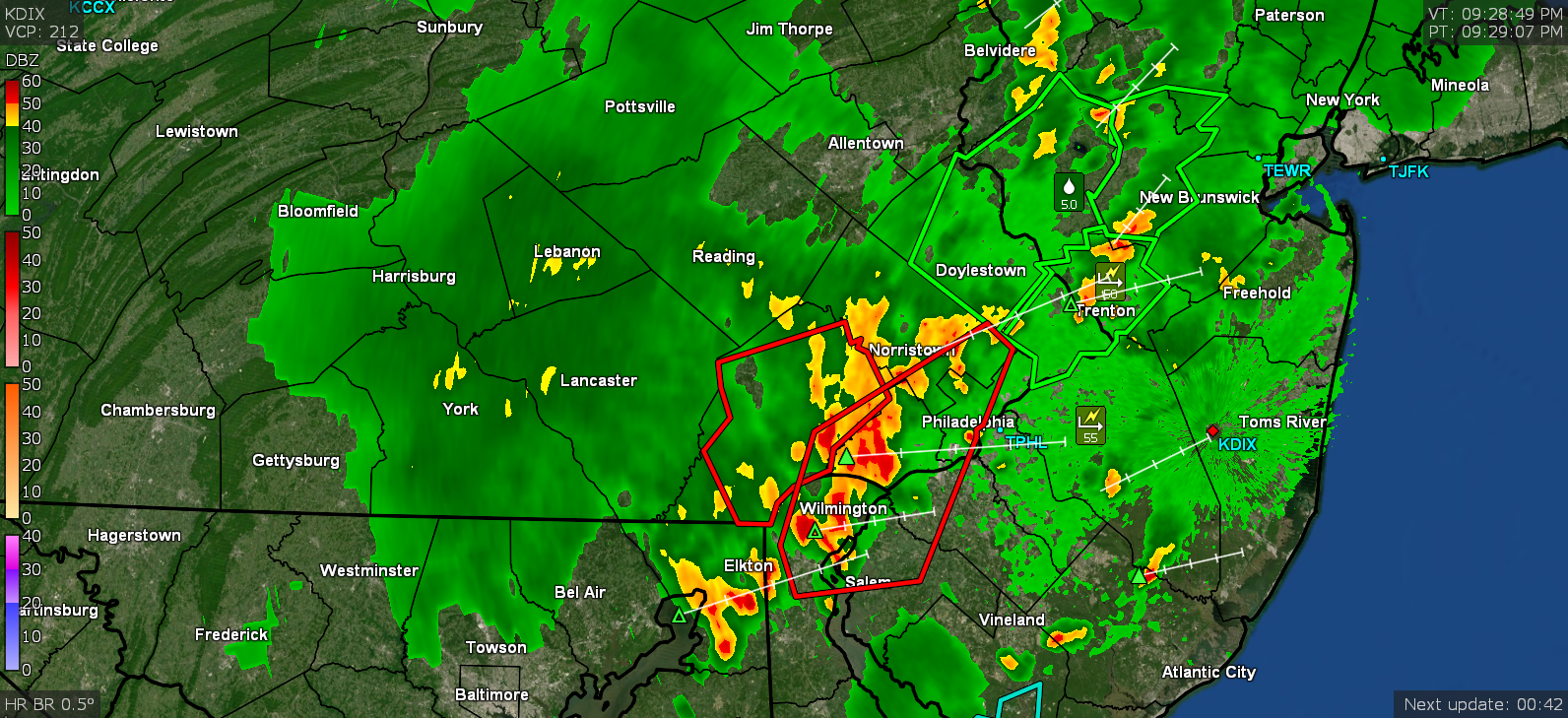
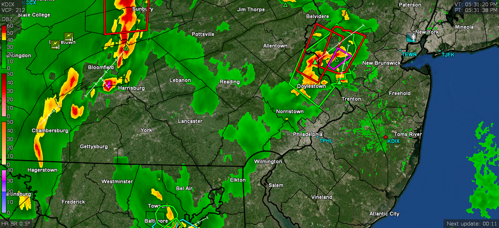
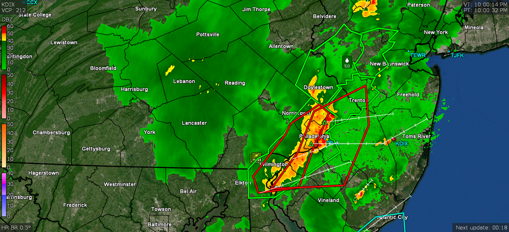
I'm pretty much done. Any residual will probably be unmeasurable. Still seeing lightning flashes off to the north and east but not hearing any thunder. Finished up with 1.19" for the day in 2 rounds. Temp is currently 72 with dp 71. I saw the reports of a water rescue in Bensalem and noting the Frankford and Pennypack Creeks are out of their banks, so some of the places that got hit Monday, got hit again. There's flooding on the Schuylkill Expressway between Montgomery and City Ave. going westbound in the SE Montco area.
-
The front end of it is on Trenton's doorstep. I'm down to light but still productive rain and am up to 1.17" in the bucket. Grateful I won't have to water for a few days! TOR just got lofted in Wrightstown south of you.
-
The heaviest rains have moved on east and I'm getting light to moderate but still quite a bit of rocking and rolling. Currently up to 1.13" in the bucket with about a 1/2" per hour rate. Temp is 72 with dp 71.
-
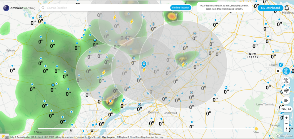
Jackpotted. Rates variable but around 2.75"/hr and am up to 0.96" at post time.
-
Fireworks in progress. Getting rainfall rates of ~2.4"/hr and am up to 0.85" for the event so far and rising rapidly. Temp at 73 with dp 73.
-
Anything that Edward G. Robinson appears in only illustrates how comfortable he is just playing any kind of role. I am getting walloped. Warnings flying. Getting 1.4"/hr rate at the moment and am up to 0.42" so far. Temp is 75.
-
Lauren Bacall is da bomb! As much as people love Casablanca, I prefer Bogart in Key Largo (probably my favorite movie with him). Am on the precipice of some incoming cells... That line has taken its sweet time moving east but seems to have accelerated its forward motion now. Am currently at 78 with dp 75 so still a bit juicy here and not really stabilized. And as I'm typing this, up goes a Thunderstorm Warning. ETA - game on! Rain has commenced!
-
Hopefully not too much after what happened to you guys this past Monday! Made the national news alongside Germany & Belgium.
-
Was gonna post that it looks like the big dry slot over your area is slowly starting to fill in. Meanwhile I could use a little more. It's down to 75 with dp down a bit to 72 but that means a steamy window alert.
-
That little cell was moving fast and only deposited 0.14" but I'll take. Temp is down to 77 with dp 75.
-
RAIN!!! Thunderstorm. THANK GOODNESS!!!!! Up to 0.04" but a blob just expanded and is moving north over me.
-
That complex up in North Jersey has a well-defined outflow boundary that has been moving to the SE. Am back down to 86 with dp 77 and still waiting for some blip to at least give me 1/4" for the effort. The firehose flow that is starting to produce some stuff through the city is still generally to my east although it looks like it starting to backbuild a bit to the west.
-
They just threw up a Warning on this but it is to my east. Am hearing thunder from it. Temp is 87 with dp 75. It's like dry begets dry.
-
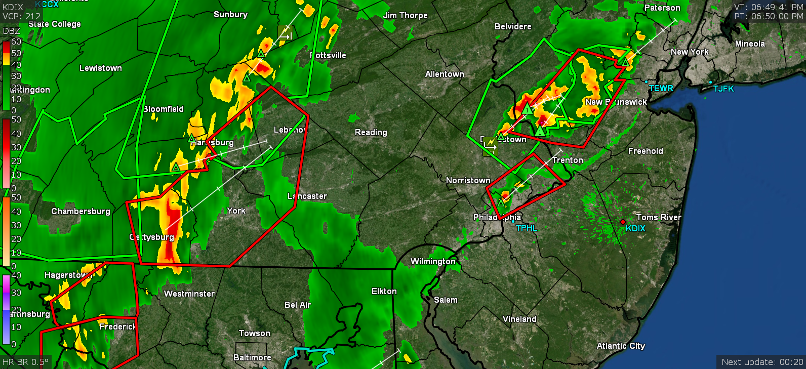
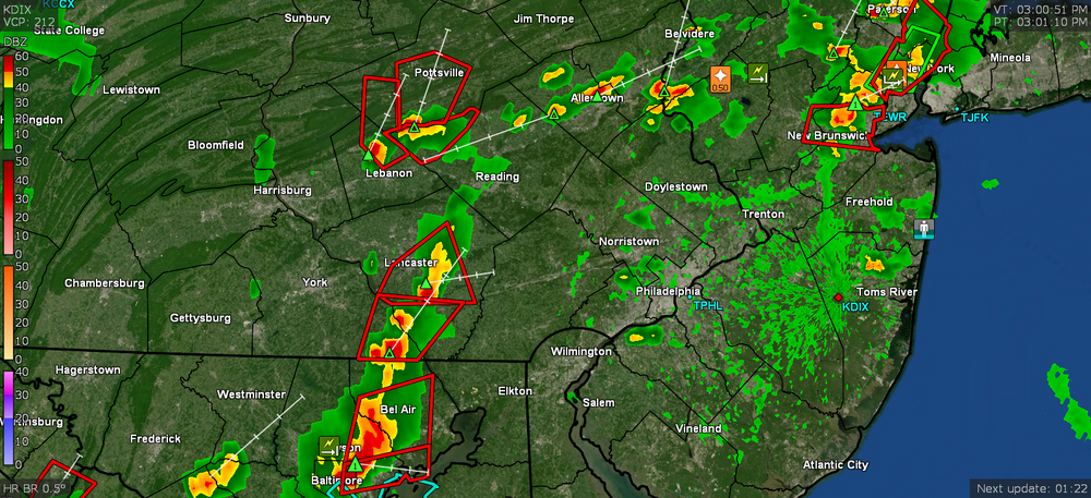
There's a TOR up for the Flemington area. I know an earlier warning had a spotter see a funnel. Still nothing measurable here and temp down to 86 with dp 77.
-
Getting some light rain, enough to start wetting the sidewalk but not measurable yet. Temp is down to 87 but dp is 77, so still juicy.
-
Hearing thunder and the lightning sensors all around are lighting up!
-
It's clouded over here but the rain has been missing me entirely. The clouds did drop my temp down to 90, but the dp is still up there at 75.
-
Getting some big raindrops as I get fringed by some small popups coming in from the SW of me. Temp dropped a few degrees to 92 with dp 76.
-
I can't believe I that I ended up looking that up and then watching Youtube reviews of it. If it can nail lanternflies then it would be worth it! You might still get sideswiped by the connecting stuff between those split cells. Am watching some little blips trying to bubble up in central Delco and southern Montco to see if I can get something. Poor plants are frying. Sun has been in and out and am currently bopping between 94 and 95 (am at 95 at post time) with 76 dp.